Special | A | B | C | D | E | F | G | H | I | J | K | L | M | N | O | P | Q | R | S | T | U | V | W | X | Y | Z | ALL
G |
|---|
GOOS. GOOS is a permanent global system for observations, modelling, and analysis of marine and ocean variables to support operational ocean services worldwide. The GOOS Project aims to provide accurate descriptions of the present state of the oceans, including living resources; continuous forecasts of the future conditions of the sea for as far ahead as possible; and the basis for forecasts of climate change. The GOOS Project Office, located at the IOC headquarters in Paris since 1992, provides assistance in the implementation of GOOS. | |
GPS wave gaugeA surface buoy with a Global Positioning System (GPS) antenna moored about 20 km from coast to monitor sea level changes using real time kinematic (RTK) GPS technique with a land-based station. The GPS buoy is used as a wave gauge to detect tsunami before its arrival to the coast. In Japan, the system has been in operation since 2008, and in 2012, 15 GPS buoys were in operation by Ports and Harbours Bureau, Ministry of Land, Infrastructure, Transport and Tourism (MLIT). GPS data are transmitted to land, processed in real time by PARI (Port and Airport Research Institute), and then sent to JMA who is responsible for tsunami monitoring and warnings. During the 2011 Tohoku tsunami, the JMA detected the tsunami offshore and upgraded its tsunami warning for Japan.  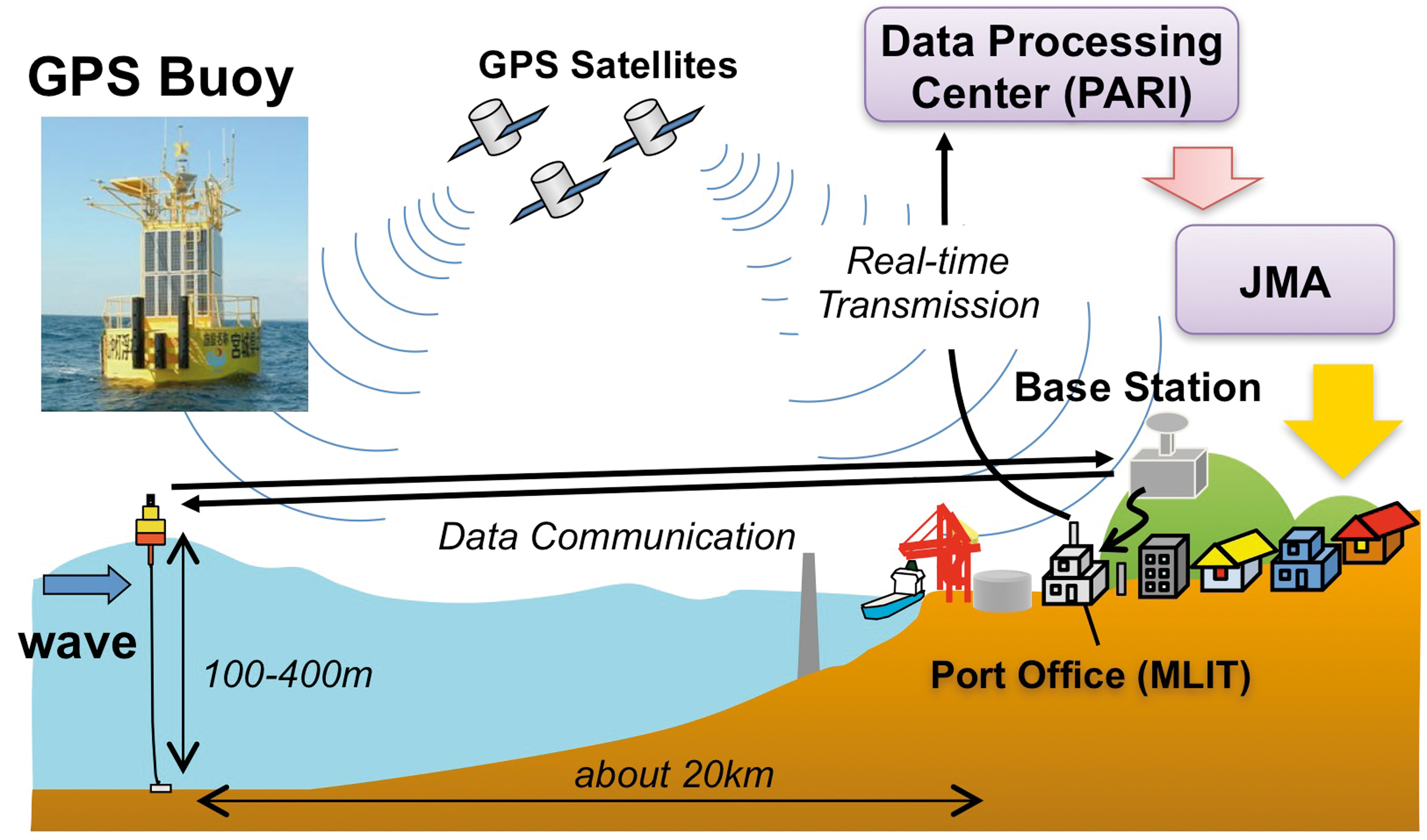 GPS buoy system was introduced at 15
sites around Japan by MLIT for wave monitoring.  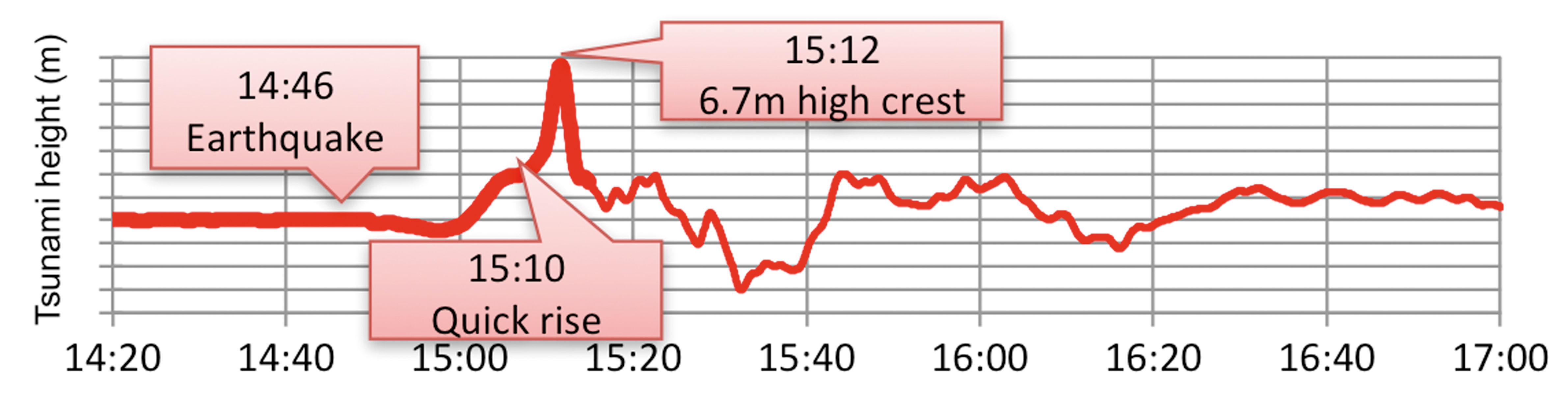 | |
GTSworldwide. The GTS is widely used for the near real-time transmission of sea level data for tsunami monitoring. The GTS and other robust communications methods are used for the transmission of tsunami warnings. | |