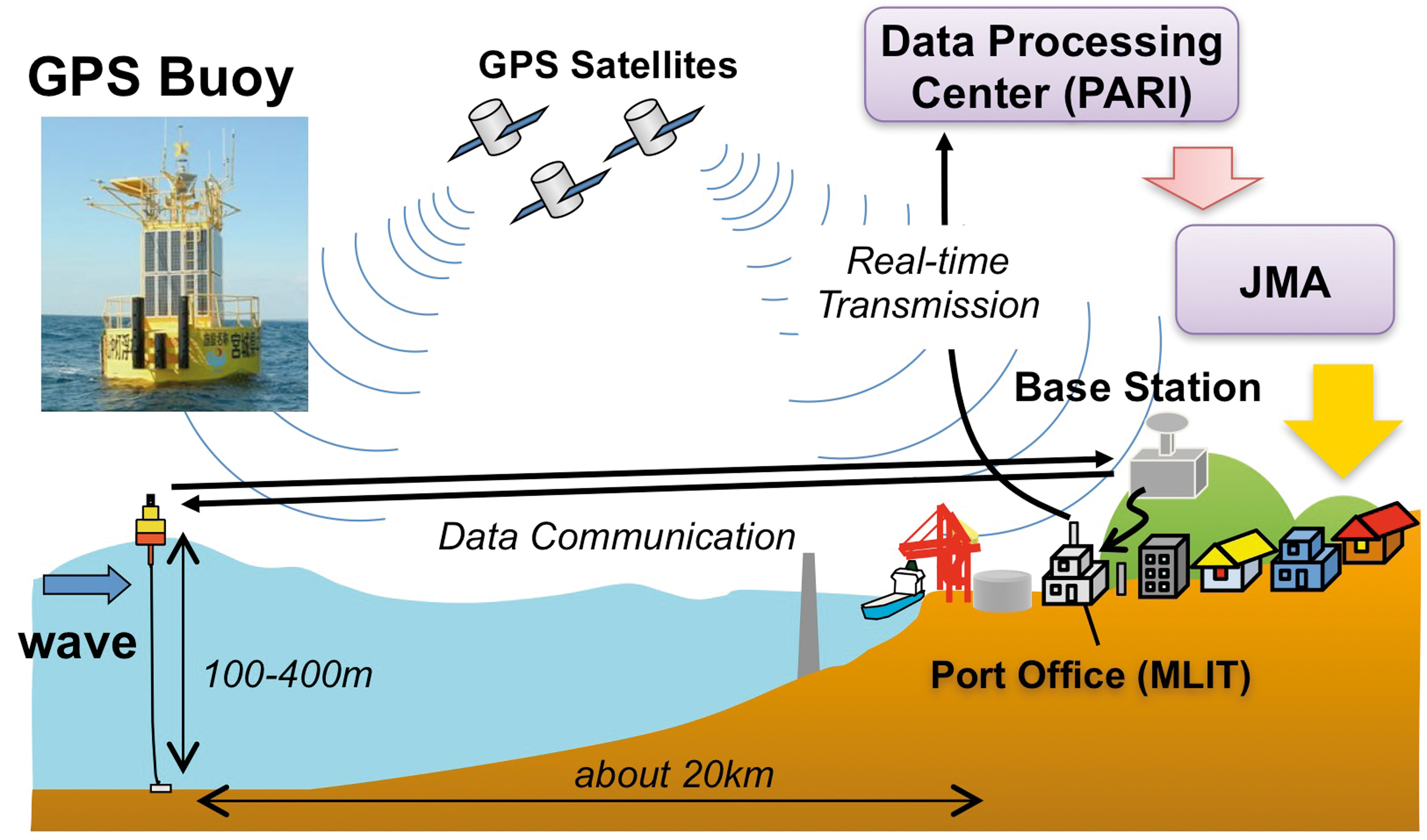
A surface buoy
with a Global Positioning System
(GPS) antenna moored about 20 km from coast to monitor sea
level changes using real time kinematic (RTK) GPS
technique with a land-based station.
The GPS buoy is used as
a wave gauge to detect
tsunami before its arrival to the
coast.
In Japan, the system has been in operation since 2008, and in 2012,
15 GPS buoys
were in operation by Ports and Harbours
Bureau, Ministry of Land, Infrastructure, Transport and Tourism (MLIT).
GPS data are transmitted
to land,
processed in real
time by PARI (Port and Airport Research Institute), and then sent
to JMA who is responsible for tsunami
monitoring and warnings.
During the 2011 Tohoku tsunami,
the JMA detected the tsunami offshore and upgraded its tsunami warning
for Japan.
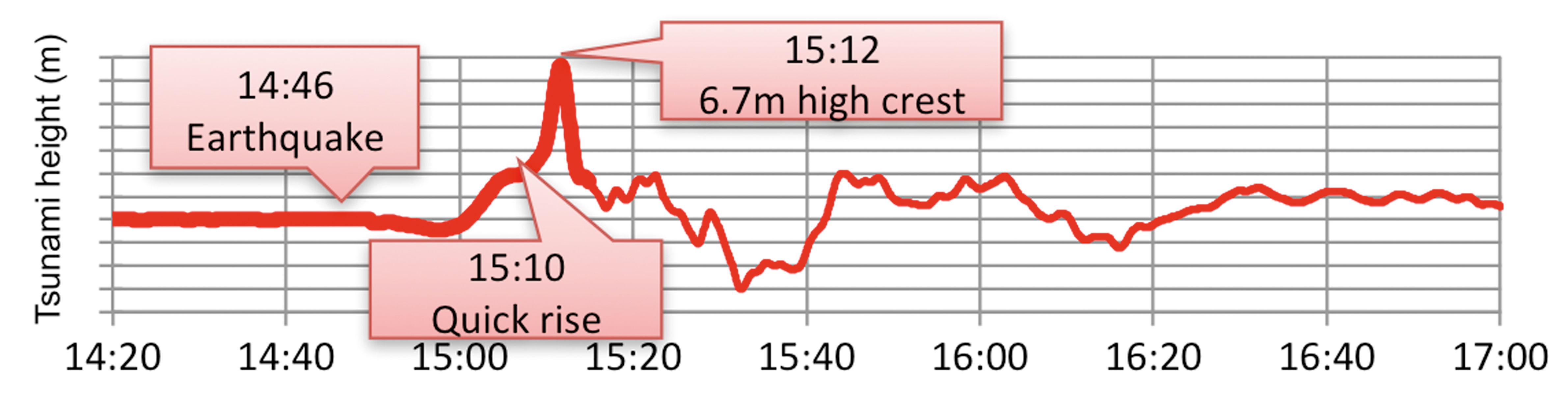
GPS buoy system was introduced at 15
sites around Japan by MLIT for wave monitoring.
The
GPS buoy at 204 m in water
depth off Kamaishi Port, Japan, recorded the first wave
crest exceeded 6 m in the 2011
Tohoku- oki earthquake tsunami event. Profile acquired by Ports and
Harbours Bureau, Ministry of Land, Infrastructure, Transport and Tourism (MLIT), Japan and processed
by PARI.