Satellite altimeters monitor
Sea Surface Height
(SSH), and can
record a snapshot
of the propagating tsunami if the
satellite orbit is located
above the tsunami.
During the 2004 Indian Ocean tsunami
and 2011 Tohoku
tsunami, several satellites
captured the tsunami
as it propagated across the Indian and Pacific
Ocean, respectively.
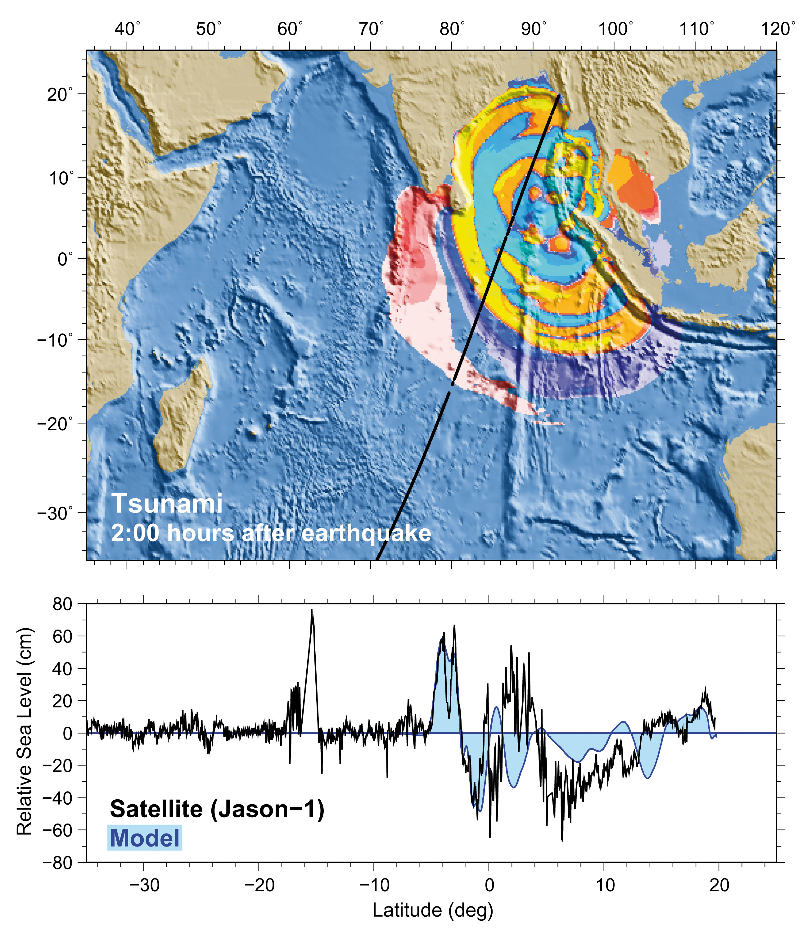
Radar altimeters aboard the Jason-1
satellite recorded the 26 December 2004 Indian
Ocean tsunami in a snapshot
taken two hours after the earthquake. Bottom
profile superimposing MOST model calculations on the satellite data shows a maximum wave amplitude of about
60 cm. Image
courtesy of NOAA.