A system consisting
of a device such as a tide gauge for measuring the height of sea level,
a data collection platform (DCP)
for acquiring, digitizing, and archiving the sea level information digitally, and often a transmission
system for delivering the data
from the field
station to a central data collection centre.
The specific requirements of data sampling
and data transmission are dependent on the application. The GLOSS programme maintains a core network of sea level stations.
For local tsunami
monitoring, one-second sampled
data streams available in real time are
required. For distant
tsunamis, warning centres
may be able to provide adequate warnings using data acquired
in near-real time (one-minute sampled
data transmitted every
15 minutes or better). Sea level stations
are also used for monitoring long-term sea level
change and climate change studies, where
an important requirement is for the very accurate location of the station as acquired
through surveying techniques.
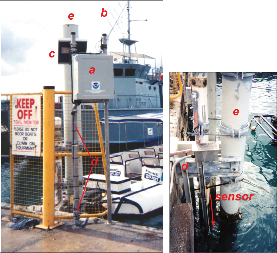
The fiberglass
electronics package (a), antenna (b), solar panel (c) were installed on a pier. Conduit (d) containing cables connecting the sensor, located at a
depth of five feet below low-tide water level,
to the data collection platform
containing the electronics above,
was externally attached to the tube containing the sensor (e). Courtesy of University of Hawaii Sea Level Center.
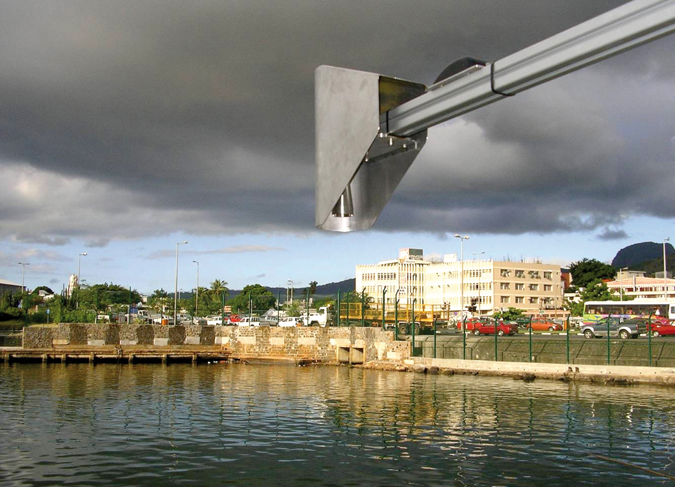
GLOSS sea level stations
employ a number
of instruments to measure sea level, including
down-looking radars to measure sea level. Port Louis, Mauritius. Photo courtesy of University of Hawaii Sea Level Center.