
Résultats de la recherche: 86

RDM2017
OTGA/KMFRI Research Data Management
The course will provide comprehensive training in research data management in order to lay the foundations for a common approach for research data management amongst researchers, repositories and facilities (including libraries) that manage marine data, thereby helping to ensure that the data is accessible, standardized and maintained over time.
MEDIN_Cefas2022
An introduction to MEDIN and marine data management for Cefas (Nov 2022)
This free training course is suitable for anyone responsible for collecting or managing marine environmental data within Cefas. Familiarity with different marine data types, and how data is acquired and used, would be helpful but not essential. Prior knowledge or practical experience of data management is not required.
SP_BDM_2024
Biological Data Management
This course will provide a comprehensive introduction for the management and archive of marine biological data, including the guiding principles of biological data management and typical responsibilities for data managers. Several types of biological data will be tackled, including observational data, image-derived data and omics data and how these data can be formatted, standardized and quality controlled before being submitted to wider regional, national and international initiatives. Watch the video below for a brief overview and introduction.
Find all the information on how to enroll in this course on OceanExpert: https://oceanexpert.org/event/4213
SP_BDM_2025
Biological Data Management 2025
This course will provide a comprehensive introduction for the management and archive of marine biological data, including the guiding principles of biological data management and typical responsibilities for data managers. Several types of biological data will be tackled, including observational data, image-derived data and omics data and how these data can be formatted, standardized and quality controlled before being submitted to wider regional, national and international initiatives. Watch the video below for a brief overview and introduction.
Find all the information on how to enroll in this course on OceanExpert:
SP_BDM_2025-2
Biological Data Management 2025 (2nd cohort)
This course will provide a comprehensive introduction for the management and archive of marine biological data, including the guiding principles of biological data management and typical responsibilities for data managers. Several types of biological data will be tackled, including observational data, image-derived data and omics data and how these data can be formatted, standardized and quality controlled before being submitted to wider regional, national and international initiatives. Watch the video below for a brief overview and introduction.
Find all the information on how to enroll in this course on OceanExpert: https://oceanexpert.org/event/4846
As a follow-up of the bi-annually opened Ocean Data Management Training course, this course provides a comprehensive introduction for the management and archive of marine biological data, including the guiding principles of biological data management and typical responsibilities for data manager. Several types of biological data will be tackled, including observational data, image-derived data and omics data and how these data can be formatted, standardized and quality controlled before being submitted to wider regional, national and international initiatives.
By the end of this course, participants will be able to describe the core tasks required for the processing and distributing of biological marine data, explain the importance of following standards, both for the data and the metadata and identify possible data flow mechanisms and pathways to ensure their data are shared as widely as possible, thereby stimulating re-use.
Learning outcomes
Upon successful completion of this training, learners will be able to:
- Describe the core tasks required for the processing and distributing of biological marine data
- Explain the importance of following standards, both for the data and the metadata
- Identify possible data flow mechanisms and pathways to ensure their data are shared as widely as possible, thereby stimulating re-use
Course contents
Topics will include: Guiding principles in data management, Data formats, metadata, quality control, data policy, data sharing and publishing, and a main focus on data management of various types of biological data. It is organized in the following modules:
- Module 1. Guiding principles in data management
- Module 2. Fundamentals of marine biological data management and the Research Data Life Cycle
- Module 3. Best practices for data capture
- Module 4. Transferring your (meta)data to Darwin Core
- Module 5. Common issues with data format and quality
- Module 6. Preservation & publication of marine biological data
- Module 7. Imagery data
- Module 8. DNA-derived data
- Module 9. Data archaeology & rescuing historical data
Target audience
- Marine data managers
- NODC and/or ADU staff
- Data stewards and researchers
- Early career researchers
Language and computer skills required
- a good working knowledge of English
- basic computer skills
- the ability to find resources through search engines
- the ability to be self-directed in learning new technology skills (e.g. following a step-by-step tutorial, online video help, or access to support to learn necessary skills)
Instructors/Organisers
This course is organised by the OceanTeacher Global Academy with the assistance of the Flanders Marine Institute:
- Leen Vandepitte (general coordination) – Flanders Marine Institute (VLIZ)
- Laura Marquez
- Lynn Delgat
- Charlotte Dhondt
- Patricia Cabrera
- Carolien Knockaert
- Ruben Perez
- Salvador Fernandez
- Stefanie Dekeyzer
- Wim Decock
- Cyril Radermecker
Course duration and format:
The course will be delivered online between 3 September 2025 and 30 November 2025. The estimated time to complete the self-paced course is approximately 35 hours.
Learner Assessment:
This is a self-taught course that includes quizzes designed to help learners assess their own learning at regular intervals. In order to successfully complete the course and award a Certificate at the end, the following is mandatory:
-
- Complete all lessons in each Module of the course
- Complete all quizzes with 70% minimum score. For each quiz you are allowed 2 attempts and the highest grade is recorded
- Complete pre and post tests
Note: submitting the course feedback survey is mandatory to obtain the course certificate.
Technology requirements
To complete this course, participants should have access to:
- Computer with Windows or Mac operating system
- Latest version of either Chrome, Edge, Firefox, or Safari web browsers
How to enrol
Please register on the OceanExpert website (www.oceanexpert.org). Once your OceanExpert account is approved (this is not done immediately), you can self-enrol in the course. If you already have an OceanExpert account, you can self-enrol in the course using your OceanExpert username and password. Enrolment is available until 15 July 2025.
First log-in OceanTeacher, then access the course page and click on self-enrollment.
The enrolment key is BDM**2025-c2
For any questions please contact the OTGA Secretariat (ioc.training@unesco.org) always using the name of the course as email subject.
There are no tuition fees.
UNESCO is committed to promote equal access principles. Applications from minority or underrepresented groups are strongly encouraged.
Feedback survey
At the end of the course, you will be asked to fill out a feedback survey. This information will be used to improve future courses.
Cancellation policy
In the event of cancellation of the course by the OTGA or its affiliates, we will provide notification of cancellation at least 7 days prior to the course date. In the event of cancellation by the attendee, we should receive notification of cancellation at least 7 days prior to the course date.
SP_BDM_2026
Biological Data Management 2026
This course will provide a comprehensive introduction for the management and archive of marine biological data, including the guiding principles of biological data management and typical responsibilities for data managers. Several types of biological data will be tackled, including observational data, image-derived data and omics data and how these data can be formatted, standardized and quality controlled before being submitted to wider regional, national and international initiatives. Watch the video below for a brief overview and introduction.
Find all the information on how to enroll in this course on:
https://oceanexpert.org/event/5000
As a follow-up of the bi-annually opened Ocean Data Management Training course, this course provides a comprehensive introduction for the management and archive of marine biological data, including the guiding principles of biological data management and typical responsibilities for data manager. Several types of biological data will be tackled, including observational data, image-derived data and omics data and how these data can be formatted, standardized and quality controlled before being submitted to wider regional, national and international initiatives.
By the end of this course, participants will be able to describe the core tasks required for the processing and distributing of biological marine data, explain the importance of following standards, both for the data and the metadata and identify possible data flow mechanisms and pathways to ensure their data are shared as widely as possible, thereby stimulating re-use.
Learning outcomes
Upon successful completion of this training, learners will be able to:
- Describe the core tasks required for the processing and distributing of biological marine data
- Explain the importance of following standards, both for the data and the metadata
- Identify possible data flow mechanisms and pathways to ensure their data are shared as widely as possible, thereby stimulating re-use
Course contents
Topics will include: Guiding principles in data management, Data formats, metadata, quality control, data policy, data sharing and publishing, and a main focus on data management of various types of biological data. It is organized in the following modules:
- Module 1. Guiding principles in data management
- Module 2. Fundamentals of marine biological data management and the Research Data Life Cycle
- Module 3. Best practices for data capture
- Module 4. Transferring your (meta)data to Darwin Core
- Module 5. Common issues with data format and quality
- Module 6. Preservation & publication of marine biological data
- Module 7. Imagery data
- Module 8. DNA-derived data
- Module 9. Data archaeology & rescuing historical data
Target audience
- Marine data managers
- NODC and/or ADU staff
- Data stewards and researchers
- Early career researchers
Language and computer skills required
- a good working knowledge of English
- basic computer skills
- the ability to find resources through search engines
- the ability to be self-directed in learning new technology skills (e.g. following a step-by-step tutorial, online video help, or access to support to learn necessary skills)
Instructors/Organisers
This course is organised by the OceanTeacher Global Academy with the assistance of the Flanders Marine Institute:
- Leen Vandepitte (general coordination) – Flanders Marine Institute (VLIZ)
- Laura Marquez
- Lynn Delgat
- Charlotte Dhondt
- Patricia Cabrera
- Carolien Knockaert
- Ruben Perez
- Salvador Fernandez
- Stefanie Dekeyzer
- Wim Decock
- Cyril Radermecker
Course duration and format:
The course will be delivered online between April and December 2026. The estimated time to complete the self-paced course is approximately 35 hours.
Learner Assessment:
This is a self-taught course that includes quizzes designed to help learners assess their own learning at regular intervals. In order to successfully complete the course and award a Certificate at the end, the following is mandatory:
-
- Complete all lessons in each Module of the course
- Complete all quizzes with 70% minimum score. For each quiz you are allowed 2 attempts and the highest grade is recorded
- Complete pre and post tests
Note: submitting the course feedback survey is mandatory to obtain the course certificate.
Technology requirements
To complete this course, participants should have access to:
- Computer with Windows or Mac operating system
- Latest version of either Chrome, Edge, Firefox, or Safari web browsers
How to enrol
Please register on the OceanExpert website (www.oceanexpert.org). Once your OceanExpert account is approved (this is not done immediately), you can self-enrol in the course. If you already have an OceanExpert account, you can self-enrol in the course using your OceanExpert username and password. Enrolment is available until 15 December 2026 and the course closes 31 December 2026
First log-in OceanTeacher, then access the course page and click on self-enrollment.
The enrolment key is BDM**2026
For any questions please contact the OTGA Secretariat (ioc.training@unesco.org) always using the name of the course as email subject.
There are no tuition fees.
UNESCO is committed to promote equal access principles. Applications from minority or underrepresented groups are strongly encouraged.
Feedback survey
At the end of the course, you will be asked to fill out a feedback survey. This information will be used to improve future courses.
Cancellation policy
In the event of cancellation of the course by the OTGA or its affiliates, we will provide notification of cancellation at least 7 days prior to the course date. In the event of cancellation by the attendee, we should receive notification of cancellation at least 7 days prior to the course date.
![Building Capacity on Biodiversity-Inclusive and Climate-Smart MSP and Area-Based Management for ABNJ [onsite training]](https://classroom.oceanteacher.org/pluginfile.php/129899/course/overviewfiles/eventImage.png)
MSP-BBNJ Korea 2026
Building Capacity on Biodiversity-Inclusive and Climate-Smart MSP and Area-Based Management for ABNJ [onsite training]
This in-person training is a joint initiative aiming to enhance national and regional capacity for marine spatial planning (MSP) with tools applied to areas within and beyond national jurisdiction, including ecosystem-based and climate-resilient approaches, and area-based management methodologies and processes.
The training includes two parts:
Part 1 - Regional training on Biodiversity Inclusive and Climate Smart Marine Spatial Planning for Asia and Pacific
A 2-day course aiming to strengthen the capacity of MSP practitioners and decision-makers to integrate biodiversity conservation, climate adaptation and mitigation, and inclusive governance into planning processes. Building on the MSPglobal International Guide and its complementary volumes on Biodiversity-Inclusive and Climate-Smart MSP , the course combines conceptual alignment with hands-on application. Participants will develop a shared understanding of ecosystem-based and climate-resilient planning principles, explore the implications of biodiversity loss and climate change for marine management, and examine policy alignment and inclusive governance approaches. Through interactive exercises and a simulated MSP process, they will learn how to apply these principles across all phases of the MSP cycle from scoping and assessment to plan development, implementation, monitoring, and adaptive management.
Part 2 - Applying Marine Spatial Planning Tools to Area-Based Management in Areas Beyond National Jurisdiction (ABNJ) for Asia and Pacific
This 3-day training equips practitioners working in MSP or MPA management, ocean governance, conservation, management, and related fields with the frameworks and practical knowledge needed to design Area-Based Management Tool (ABMT) proposals in Areas Beyond National Jurisdiction (ABNJ) under the BBNJ Agreement. Building on the MSPglobal International Guide on Marine Spatial Planning, the course bridges established MSP methodologies with the scientific and technical requirements of BBNJ governance and operationalization, exploring how biodiversity, climate, and equity — including the integration of traditional knowledge of Indigenous Peoples and Local Communities (IPLCs) — apply in ABNJ contexts.
Format and Duration
All sessions will happen synchronously ONSITE. The agenda of the sessions will be shared once confirmed.
This course has an estimated time duration of:
-
16 hours (Part 1), from 13 to 14 July 2026
-
24 hours (Part 2), from 15 to 17 July 2026
*Note that participants may choose or be selected to participate in only one or both parts of the training.
Venue:
South Korea, Busan; Hotel Conference Room
Language of instruction: English
Learning outcomes
Part 1 - Regional training on Biodiversity Inclusive and Climate Smart Marine Spatial Planning for Asia and Pacific
By the successful completion of the first part of the training, participants will be able to:
-
-
Apply biodiversity-inclusive and climate-smart principles across the different phases of the MSP process;
-
-
-
Identify entry points for integrating biodiversity, climate, and equity considerations throughout the MSP cycle;
-
-
-
Design and facilitate stakeholder engagement processes that support inclusive and equitable marine governance;
-
-
-
Communicate MSP strategies effectively to diverse audiences and stakeholders;
-
-
-
Engage in and contribute to regional and global communities of practice on biodiversity-inclusive and climate-smart MSP.
-
Part 2 - Applying Marine Spatial Planning Tools to Area-Based Management in Areas Beyond National Jurisdiction (ABNJ) for Asia and Pacific
Upon successful completion of this second course, participants will be able to:
-
-
Detail the scientific and technical requirements for ABMT proposals under the BBNJ Agreement, including supporting methodologies.
-
-
-
Distinguish components of biodiversity-inclusive and climate-smart spatial planning applied to ABNJ governance.
-
-
-
Understand the use of MSP-based analysis in ABMT proposals for ABNJ, including integration of global spatial datasets on biodiversity, human activities, and climate to identify areas of significance.
-
-
-
Discuss the implications of data gaps for spatial decision-making and ABMT design and implementation.
-
-
-
Assess the transferability of MSP spatial analysis approaches demonstrated in the case studies to their own national or regional ABNJ contexts, identifying relevant data sources, governance actors (including the role of Indigenous Populations and Local Communities’ knowledge), and potential constraints.
-
Course content
Part 1 - Regional training on Biodiversity Inclusive and Climate Smart Marine Spatial Planning for Asia and Pacific
Day 1 (From Concepts to Planning Foundations) focuses on establishing a common interpretation of what biodiversity-inclusive and climate-smart MSP means in operational terms, including implications of biodiversity loss, climate change, and sustainability for MSP decisions. Through facilitated discussions and applied exercises, participants will examine marine ecosystem functioning, climate pressures, nature-based solutions, ecosystem-based planning principles, policy alignment, and inclusive governance, developing a shared conceptual language that distinguishes biodiversity-inclusive and climate-smart MSP from conventional planning approaches. This training day will include the following sessions:
Session 1.1 —Why Biodiversity-Inclusive and Climate-Smart MSP?
Session 1.2 — Marine Ecosystems, Climate Change and Nature-Based Solutions
Session 1.3 — Ecosystem-Based Approach as the Operational Backbone of MSP
Session 1.4 — Aligning MSP with Biodiversity and Climate Policy Frameworks
Session 1.5 — Inclusion, Rights and Knowledge in Marine Planning
Day 2 (Applying Biodiversity-Inclusive and Climate-Smart MSP Across the Planning Cycle) is fully application-oriented and structured around a simulated MSP process. Working in multidisciplinary teams, participants will apply biodiversity-inclusive and climate-smart principles across the full MSP cycle, from framing the planning context and objectives to assessment, plan development, implementation, monitoring, and adaptive management. Using simplified spatial data and planning scenarios, participants will explore ecological sensitivities, climate risks, cumulative impacts, trade-offs, and governance options, and translate plans into implementable strategies and communication messages. The training concludes with reflection on leadership, communication, and stakeholder engagement, reinforcing the role of MSP as a strategic, adaptive, and inclusive governance tool in the face of biodiversity and climate challenges. This training day will include the following sessions:
Session 1.6 — Framing the Planning Context and Designing a Biodiversity Inclusive Climate-Smart MSP Process
Session 1.7 — Assessing Ecosystems, Climate Risks and Spatial Pressures
Session 1.8 — Developing Biodiversity-Inclusive and Climate-Smart Spatial Strategies
Session 1.9 — From Plan to Action: Implementation, Monitoring and Adaptive Management
Session 1.10 — Communicating MSP and Building Long-Term Support
Part 2 - Applying Marine Spatial Planning Tools to Area-Based Management in Areas Beyond National Jurisdiction (ABNJ) for Asia and Pacific
Days 3 to 5 focus on applying biodiversity-inclusive and climate-smart planning within the framework of the BBNJ Agreement, with an emphasis on how the process feeds into developing Area-Based Management Tool (ABMT) proposals. These sessions guide participants from understanding proposal requirements and design options, building on scientific and spatial evidence to applying these elements through demonstration of practical case studies.
Day 3 (Understanding ABMT and the development of proposals in the context of the BBNJ Agreement). Participants will work through the sequence from identifying a relevant candidate site in Areas Beyond National Jurisdiction, and examining the Annex I biodiversity criteria, including how each can be demonstrated through spatial and scientific evidence. The sessions will also introduce ABMT design approaches and relevant legal instruments, frameworks, and bodies , and, discuss how national MSP experience can inform ABMT design in areas beyond national jurisdiction, including how IPLC knowledge and rights can be reflected in proposals.
Day 4 (Building the evidence base required for ABMT proposals). Participants will explore ecosystem-based management and conservation tools such as key biodiversity areas (KBAs) and ecosystem and biologically significant areas (EBSAs), and related approaches, in support of Annex I criteria. The sessions will also cover the role of Environmental Impact Assessments (EIA) and Strategic Environmental Assessments (SEA) under the BBNJ framework, including the data required to perform these evaluations and develop proposals.
Day 5 (Applying ABMT in single and multi-sector case studies and various data contexts. Participants will examine, through case scenarios, how biodiversity evidence, impact assessment, and governance arrangements inform ABMT proposals, including the coordination and cooperation across existing sectoral bodies to support decision-making. The training sessions conclude with reflection on lessons learned, common gaps, and the steps needed to advance ABMT development in participants’ own contexts.
Target audience
This training is designed for practitioners working in marine spatial planning (MSP), ocean governance, or related fields — particularly those involved in MSP processes or BBNJ implementation at national or regional levels, including the design and application of area-based management tools (ABMTs) in ABNJ. It aims to strengthen participants’ capacity to integrate biodiversity and climate considerations across the MSP cycle, while also developing practical insights into the design and implementation of ABMT proposals in Areas Beyond National Jurisdiction (ABNJ) inspired by MSP principles, tools and experience. Typical participants include government officials, staff of regional organizations (e.g. RFMOs and Regional Seas Programmes), and technical operators from NGOs engaged in MSP or ABNJ-related work.
Organizers
This training course is jointly organized by the IOC (in support of the MSPglobal, Ocean Decade Capacity Development Facility, OceanTeacher Global Academy, and IOC Sub-Commission for the Western Pacific (WESTPAC) activities) in collaboration with the Korea Institute of Ocean Science and Technology (KIOST), and the Irish Marine Institute.
Part 1 of the training is developed under the MSPglobal initiative with the support of co-funding from the European Union. Part 2 of the training is developed under CDF/OTGA with funding with the support of co-funding from KIOST and Irish Marine Institute (Our Shared Oceans).
Facilitators
The training sessions will be delivered with the support of experts from IOC (including, Catarina Fonseca, Niccolo Bassan, NaYeon Kim, and Ana Carolina Mazzuco, others to be confirmed), the Korea Institute of Ocean Science and Technology (names to be confirmed); and the Irish Marine Institute (names to be confirmed).
Registration, costs, and technological requirements
Candidates should meet at least one of the following criteria:
-
Currently working in an operational MSP or BBNJ-related role (e.g., MSP or BBNJ focal point, or equivalent)
-
Employed by a government agency, regional organization (RFMO, Regional Seas Programme), or NGO with an active mandate in marine spatial planning or ocean governance
-
Formally nominated or endorsed by their organization or government, confirming institutional support for participation
List of eligible countries for the open call for participation: Cook Islands, Fiji, Kiribati, Maldives, Marshall Islands, Micronesia (Federated States of), Nauru, Niue, Palau, Papua New Guinea, Samoa, Solomon Islands, Timor-Leste, Torkelau, Tonga, Tuvalu, and Vanuatu.
*Note remaining part of the available places will be dedicated to direct contact invitations issued by IOC WESTPAC to its Members.
Application and selection:
- Individuals wishing to participate in the open call shall submit their information in this APPLICATION FORM, open from 10 to 30 April 2026. A limited number of seats will be available for this category of participation.
- Invited participants will receive a direct email communication from IOC, and including additional guidance and instructions.
Costs:
This course has no tuition fees.
Lunch and dinner will be provided on-site to all selected participants.
For the open call for participation, travel support will be provided to a limited number of participants (approximately 12), including accommodation and flight tickets.
Additional travel support may be available to a very restricted number of participants of the invited poll (WESTPAC). Details to be shared with selected invitees and adapted to the participation modality in reference of part 1 and 2.
-
Access to a computer or mobile device with Windows, Android, or Mac OS.
-
Latest version of either Chrome, Edge, Firefox or Safari web browsers, with JavaScript and cookies enabled
-
Broadband internet access (minimum bandwidth of 0.5 Mbps (Receive and Send)
-
Audio speakers or headphones
-
Basic computer skills, such as finding resources through search engines and the ability to be self-directed in learning new technology skills (e.g. following a step-by-step tutorial, online video help, or access to support to learn necessary skills)
Additional requisites:
All participants are strongly encouraged to complete the following online courses prior to attending the training:
-
MSPglobal course on Biodiversity-Inclusive and Climate-Smart MSP (20h, OTGA) — strongly recommended for Part 1
-
Using Science, Knowledge & Tools to Operationalise the BBNJ Agreement (35h, OTGA) required for Part 2, as the in-person sessions build directly on this content
Assessment & Certificate
This training will include pre-and-post self-assessments, and a final assignment report.
*Note that the preparation online courses suggested in the pre-requisites have a different assessment rationale, and certificate of completion.
To receive a Certificate of Completion, for each part of the training course, participants shall:
-
Fully attend to the in-person sessions
-
Engage and complete every proposed training activity
-
Successfully complete the report assignment
-
Complete the mandatory pre- and post-assessment.
Submit the required feedback form is mandatory.
Contacts
For course organization, please contact: TO BE ADDED
For additional questions, please contact OTGA Secretariat (ioc.training@unesco.org) always using the name of the course as e-mail subject.
Cancellation policy
In the event of cancellation of the course by the OTGA or its affiliates, we will provide notification of cancellation at least 7 days prior to the course date. In the event of cancellation by the attendee, we should receive notification of cancellation at least 7 days prior to the course date.

Building Skills for Coastal Restoration with Nature and People
Course description
By the end of the course you:
Pierre Strosser
Assessment
Variety of quizzes receiving an minimum grade of 70 % for each quiz
Certificate
to obtain a certificate you need to complete all the modules, complete all the quizzes and obtain a minimum grade of 70 % for each quiz - complete the feedback survey.
Technical requirements
Learning Management System (Moodle)
- Computer with Windows or Mac OS
- Latest version of either Chrome, Edge, Firefox, or Safari web browsers
- JavaScript and cookies enabled
- Broadband internet access (minimum bandwidth of 0.5 Mbps - Receive and Send)
- Speakers or headphones
Device Compatibility
- Access to a computer, laptop, or tablet with reliable internet connectivity.
- Capability to stream video content, as the course includes recorded video sessions.
- A stable and reasonably fast internet connection to ensure seamless access to course materials, videos, and interactive platforms.
- Basic software for document creation and reading, like Microsoft Word or Google Docs, for assignments and PDF reader for course readings.
Computer skills required
You should be proficient in the following:
- Basic Computer Literacy - General familiarity with operating a computer or a similar device.
- Ability to navigate the web, such as accessing websites and using search engines.
- Communication Skills - Basic email skills for communication with trainers or peers, if required.
- Document Creation and Management - Skills for creating, editing, and sharing documents and assignments, if required. Ability to download, open, and read PDF files and other standard document formats.
- Multimedia Interaction - Basic skills to play, pause, and interact with online video content. Optionally, if there are interactive multimedia elements or assignments, the ability to engage with these tools would be beneficial.
No prior knowledge required
Self enrolment process: this course will open 22 May till 31 December 2026.
Please register on the OceanExpert website (www.oceanexpert.org). Once your OceanExpert account is approved (this is not done immediately), you can self-enrol in the course. If you already have an OceanExpert account, you can self-enrol in the course using your OceanExpert username and password.
First log-in OceanTeacher, then access the course page and click on self-enrolment. The enrolment key for all courses in 2026 is Coast#2026
For any questions please contact the OTGA Secretariat (ioc.training@unesco.org) always using the name of the course as email subject.
this course is free of charge
Cancellation policy
In the event of cancellation of the course by the OTGA or its affiliates, we will provide notification of cancellation at least 7 days prior to the course date. In the event of cancellation by the attendee, we should receive notification of cancellation at least 7 days prior to the course date.

COES-WIO2025
Coastal Ocean Environment School in Western Indian Ocean (COES-WIO) on Coastal and Oceanographic Processes, Marine Pollution, Fisheries and Data Management
The Coastal Ocean Environment School in Western Indian Ocean (COES-WIO) in Kenya is thrilled to open applications for its inaugural program. Modelled after the successful Coastal Ocean Environment Summer School in Nigeria and Ghana (COESSING; https://coessing.org/), which has fostered oceanography skills and capacity across West Africa since 2015, COES-WIO offers a transformative learning experience in ocean science.
The program includes an immersive, in-person week from 21st to 27th September 2025 in Mombasa, Kenya, where participants will engage in hands-on activities, including fieldwork, laboratory analysis, data interpretation, and presentations. This experience is designed to enhance practical skills, connect with experts, and build networks that support continued growth and international collaboration in ocean sciences. Participants will have the opportunity to learn advanced ocean-related practices and global frameworks, important tools to advance capacity in research, management, and services.
The training is developed as a pre-activity of the 13th Western Indian Ocean Marine Science Association Symposium, and is organized in the context of the United Nations Decade of Ocean Science for Sustainable Development (2021-2030). The school will gather 75 international young professionals from the WIO region.
Venue: Mombasa, Kenya
The training will take place at the Technical University of Mombasa (TUM) with some sessions hosted at Pwani University and Kenya Marine and Fisheries Research Institute (KMFRI).
Learning outcomes
By the end of the course, the learners are expected to:
- Be familiar with field surveys and experimental techniques within the different project tracks.
- Understand how to use different equipment for physical and biological data collection within the different project tracks.
- Be familiar with processes involved in the different project tracks including fish handling, postharvest processes, marine plastics and laboratory sample processes.
- Develop reports to communicate the scientific concepts learnt in the various project tracks.
Course contents
- Small Scale Fisheries & Postharvest losses, Mariculture potential in the WIO
- Climate change - Beach Erosion & Coastal Processes
- Physical and Chemical Oceanography
- Marine Plastics & Pollution
- Ecological Survey Techniques and Data Management
Target audience
Students (Bachelors, masters, PhD), early-career researchers, and professionals in marine science and oceanography-related fields, including sectoral stakeholders from the WIO region.
Language of instruction: English
Moderators and Instructors
- Cosmas Munga, TUM
- Ali Maarifa, PU
- Brian Arbic, U-Michigan
- Janae' Collier, U-Michigan
- Eben Nyadjro, Mississippi State University
- Richmond Q., Plastic Punch, Ghana
- John Walter, UNILAG
- Audrey Delpech, CNRS France
- Chenzhu (William) Xu, Oregon State University
- Peter Knoop, U-Michigan
- Tracey Schafer, U-Michigan
- Gabriel Akoko Juma, Alfred Wegener Institute
- Joseph Tunje, PU
- Francis Mutuku, TUM
- Saeed Mwaguni, TUM
- David Mirera, KMFRI
- John Mbugani, UDOM
- Clara Rivers, U-Copenhagen
- Anthony Nzioka, KMFRI
- Peter Odote, KMFRI-Associate
- Frank Mirobo, UDOM
- Nimit Kumar
- Ritabrata Thakur, IIT New Delhi
Organizers
The training is organized by the University of Michigan (UoM), USA in collaboration with Technical University of Mombasa (TUM), Pwani University (PU), and Kenya Marine and Fisheries Research Institute (KMFRI).
Activities were made possible with additional support of the Western Indian Ocean Marine Science Association, BlueCaD Project – Early Career Ocean Professionals Programme, Western Indian Ocean Early Career Scientists Network (WIO-ECSN), and UNESCO IOC OceanTeacher Global Academy and Ocean Decade Capacity Development Facility.
Course duration and format:
In-person course, with a total of 42 hours of training time involving on-site activities.
Please note that some project tracks might have about 4 hours of synchronous (online) sessions to prepare the students for on-site activities. These sessions will be communicated to the respective learners after selection. The online sessions will take place from 17:00 HRS to 19:00 HRS, Nairobi time to allow for participation of teachers and students from a wide range of time zones.
Each project track will have 15 selected based on preference, during application.
A detailed timetable will be shared with the students 3 weeks prior to the course.
Learner Assessment and Certificate
The certificate will be issued after the completion and full attendance of the activities in the respective project tracks, including successfully completing the group presentations.
Note: submitting the course feedback survey is mandatory to obtain the course certificate.
Pre-requisites and requirements
To complete this course, you should have access to:
- A laptop from which the students can perform tasks and join the synchronous sessions (you will be required to carry your laptop to the training site).
- Latest version of either Chrome, Edge, Firefox, or Safari web browsers
- Linux (preferably Ubuntu 16.04 or above)
- Access to the Internet for online sessions
- Availability to travel and take part in the 1-week onsite course in Malta
Prior to the course, the learners will be required to:
- Register and familiarize yourself with the OTGA platform.
- Download and install R and other software that will be communicated.
- Download the datasets that will be uploaded on the OTGA platform
- Do a self-introduction on the OTGA platform and highlight their expectations
- Read the course materials notes that will be prepared by the lecturers.
- Confirm their availability for the in-person training in Malta
How to apply
This course has a limited number of participants.
Please complete the online application form available on this LINK. The applications start on 2 July 2025 and the deadline to submit is 15 July 2025 (23:59 CEST: Central European Summer Time).UNESCO is committed to promoting equal access principles. Applications from minority or underrepresented groups are strongly encouraged.
Selection criteria
The application and selection process will be coordinated by the organizers. Participants will be selected according to the following criteria:
Gender balance
Nationalities of or studying in WIO countries, that is; from Somalia, Kenya, Tanzania, Mozambique, South Africa, Comoros, Madagascar, Seychelles, Mauritius and Reunion.
Geographical representation
Age range: up to 35 years old
Background: all the sectors are encouraged to apply. We will pay attention to create an interdisciplinary group, and distribute learners in the different project tracks based on preference.
Contacts
- Course Coordinators: Gabriel Juma gabriel.akoko.juma@awi.de and Cosmas Munga ckamunga2014@tum.ac.ke
- OTGA Secretariat: ioc.training@unesco.org
Costs
This training has no tuition fees.
15 grants are available to cover the travel costs (for non-Kenyan participants). Accommodation for the whole week is provided to all the participants; breakfasts, lunches and dinners are included. Other participants will have to cover the costs of travel.
Feedback survey:
At the end of the course, you will be asked to fill out a feedback survey. This information will be used to improve future courses.
Cancellation policy
In the event of cancellation of the course by the OTGA or its affiliates, we will provide notification of cancellation at least 7 days prior to the course date. In the event of cancellation by the attendee, we should receive notification of cancellation at least 7 days prior to the course date.
OceanExpert Announcement: https://oceanexpert.org/event/4820
CRSLR_2025
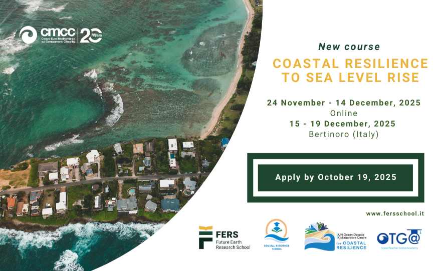
Coastal Resilience to Sea Level Rise
course summary
rise is one of the most pressing challenges facing coastal communities, ecosystems, and infrastructure around the world. Understanding the risks, causes, and impacts of rising sea levels and the consequences on coastal regions is pivotal to design effective adaptation strategies and policies to enhance climate resilience.
the driving physical processes—such as ocean thermal expansion, polar ice melt, glacial retreat, and atmospheric dynamics—as well as the human and ecological impacts – such as increased coastal flooding, saltwater intrusion, habitat loss, and displacement of communities.
tools like flood modelling and vulnerability mapping.
Understand of the physical processes driving SLR risks
Asses regional vulnerabilities and coastal risks
(provide EXAMPLES) for planning and decision-making
, industry and high level education institutions
COMPASS-Philippines2025
COMPASS Philippines - Coastal Observing and Modeling for Prediction and Assessment to Support resilient Systems
This training course is part of CoastPredict UN Ocean Decade GOOS Programme’s capacity-building efforts and is a collaboration with the SUSTAIN project (UN endorsed project affiliated to CoastPredict). The training focuses on advancing skills in coastal ocean, wave, and biogeochemical modeling, and introduces innovations in observation and remote sensing, to strengthen coastal resilience in the Philippines. The course is organized by CoastPredict in collaboration with the Decade Collaborative Centre for Coastal Resilience (DCC-CR) ‘Coastal Resilience School’ and CMCC Foundation - Euro-Mediterranean Center on Climate Change, Italy, with the support of OceanTeacher Global Academy (OTGA).
Details: https://oceanexpert.org/event/4643
Course objective
The course is designed to provide participants with a comprehensive understanding of numerical ocean modeling, machine learning techniques, and remote sensing applications to simulate and analyze the dynamic and biodiverse marine environments of the Philippines.
A key feature of the course is hands-on training using the SURF ocean modeling platform, enabling participants to simulate real-world scenarios through detailed tutorials and case studies centered on the Philippine coastal region. The program emphasizes integrating physical, biological, and chemical processes in marine systems to support the protection and sustainable management of natural resources. Through this initiative, the course aims to enhance capacity for implementing data-driven solutions and strategies for resilience that can serve as a replicable model for other regions facing similar challenges.
Venue
The course will be subdivided into two phases:
An online phase will take place through OTGA e-learning platform.
An in-person phase which will be held in Quezon City, Philippines, at the University of Philippines.
Learning outcomes
By the end of the course the participants should be able to:
- Understand the fundamentals of ocean circulation, wave dynamics, and biogeochemical modeling.
- Set up and execute downscaling experiments using the SURF platform.
- Apply advanced AI modeling techniques to predict and analyze coastal chlorophyll concentrations.
- Understand key concepts in satellite data processing and remote sensing for oceanographic monitoring
- Understand how decision-support systems can assist in marine hazard management, oil spill forecasting, and ship route optimization
- Gain practical knowledge of coastal observations and hands-on experience in implementing and operating low-cost sea-level monitoring systems.
Target audience
The course is targeted particularly towards mid-career scientists and professionals from environmental protection agencies, governmental officers and postgraduate students (with basic knowledge of oceanography and modeling).
Technological requirements/computer skills
- Python, Jupyter notebook
Course content and agenda
- Module 1 Lessons (online through BigBlueButton on OTGA platform)
24 Feb 2025: 8.00 CET / 15:00 GMT+8 (3 hours)
- Lesson 1: Overview of the Relocatable Ocean Modeling platform SURF
- Lesson 2: Overview of coastal wave modelling
- Lesson 3: Introduction to biogeochemical 1-D modelling
- Lesson 4: Introduction to Cineca’s cloud computing system
- Lesson 5: Practical application of SURF
- Assignment of exercises: Instructions and overview (for downscaling and wave modeling).
- Q&A Live session- 1 hour - 26 Feb 2025: 8.00 CET/15:00 GMT+8 - (BigBlueButton on OTGA platform)
3 March 2025 - 9:00 - 16:00 (GMT +8)
- Welcome and recap of preparatory sessions
- Regional physical oceanography
- Remote sensing applications in the Philippines
- Observation and modeling in the Philippines
- Applications of SURF ocean model in the Philippines
- Numerical modeling of marine ecosystems
4 March 2025 - 9:00 - 16:00 (GMT +8)
- Numerical ocean circulation, dynamical downscaling, and the NEMO model: Advanced techniques and applications
- Practical session 1: Review of exercises completed after online lectures, and case study simulations - instructions on what is needed at the end of week for evaluated presentations.
- Practical session 2: Downscaling experiment using the SURF platform
- Decision support system applications for Oil spills
- Ship voyage optimisation with VISIR-2
5 March 2025 - 9:00 - 16:30 (GMT +8)
- Practical session 3: Wave modelling
- Practical session 4: Biogeochemical models - 1D
- Machine-learning model for chlorophyll
- Practical session 5: Machine learning model implementation
6 March 2025 - 9:00 - 16:00 (GMT +8)
- Coastal observations and citizen science
- Practical Session 6: Finalizing the case study simulation
- Presentation preparations
7 March 2025 - 9:00 - 12:30 (GMT +8)
- Final Presentations and Applications
- Group Presentations
- Discussion and Q&A
- Closing Remarks and Certificates
8 March 2025 - 9:00 - 12:00 (GMT +8)
- Field Trip - installation of low-cost sea level sensors
Language of instruction: English
Course instructors
- Aiko Love B. del Rosario - Marine Science Institute - University of the Philippines
- Aletta T. Yñiguez - Marine Science Institute - University of the Philippines Diliman
- Cesar L. Villanoy - Marine Science Institute - University of the Philippines
- Federica Benassi - CMCC Foundation - Euro-Mediterranean Center on Climate Change, Italy
- Francesco Trotta - CMCC Foundation - Euro-Mediterranean Center on Climate Change, Italy
- Gianandrea Mannarini - CMCC Foundation - Euro-Mediterranean Center on Climate Change, Italy
- Igor Atake - CMCC Foundation - Euro-Mediterranean Center on Climate Change, Italy
- Laura T. David - Marine Science Institute - University of the Philippines
- Lorenzo Mentaschi - University of Bologna
- Luca Giunti - CMCC Foundation - Euro-Mediterranean Center on Climate Change, Italy
- Marco Zavatarelli - University of Bologna
- Samantha Siedlecki - Department of Marine Sciences - University of Connecticut
- Viviana Piermattei - CMCC Foundation - Euro-Mediterranean Center on Climate Change, Italy
Organizers
- Marine Science Institute, University of the Philippines Diliman (Philippines)
- CMCC Foundation - Euro-Mediterranean Center on Climate Change, Italy.
- CoastPredict
- University of Bologna
- Coastal Resilience School - DCC-CR - Decade Collaborative Centre for Coastal Resilience
- Department of Science and Technology Philippine Council for Agriculture, Aquatic and Natural Resources Research and Development DOST PCAARRD
Course Duration
The course has a total of approx 46.5 hours, according to the following structure:
- 24 Feb - 8:00 CET/15:00 Philippines time (GMT+8) - 3.5 hours (synchronous, online)
- 26 Feb - 8:00 CET/15:.00 Philippines time (GMT+8) 1 hour (synchronous, online)
- Assignments ~ 8 hours (asynchronous, online)
- 5 days (3-7 March)- 9:00-16:00 (GMT+8) ~ 6 hours /day ( ~ 30 hours) (synchronous, face-to-face)
Certificate
OTGA Certificate will be awarded to the participants upon successful completion of assignments online and delivery of a group presentation according to the course planning.
Notes
Application process
This course is by invitation only, with a limited number of seats (10-15) participants.
Selection criteria
UNESCO is committed to promoting equal access principles. Applications from minority or underrepresented groups are strongly encouraged.
A minimum of a Master's degree in relevant fields such as environmental science, marine science, meteorology, fisheries, coastal engineering, or urban planning, or with equivalent relevant experience, from the Philippines and surrounding regions.
Costs
Free of charge. There are no tuition fees.
The course is offered free of charge to the participants. The participants would have to cover their own costs of their travel and stay in Quezon city. Instructors are self-funded.
Contacts
For any questions, please contact OTGA Secretariat (ioc.training@unesco.org), always using the name of the course as e-mail subject.
Cancellation policy
In the event of cancellation of the course by the OTGA or its affiliates, we will provide notification of cancellation at least 7 days prior to the course date. In the event of cancellation by the attendee, we should receive notification of cancellation at least 7 days prior to the course date.
OBIS2026EN
Contributing and publishing datasets to OBIS (self-paced)
The Ocean Biodiversity Information System (OBIS) is the most comprehensive gateway to the world’s ocean biodiversity and biogeographic data and information. OBIS provides open access to this quality-controlled data that adhere to biodiversity standards (Darwin Core, EML). This course is a continuation of the Contributing and publishing datasets to OBIS (self-paced), which remained open only for staff and collaborators of OBIS Nodes (under invitation of OBIS Secretariat).
The aim of this course is to teach the step-by-step basics for how to format and publish datasets according to these standards to contribute to OBIS, and adopt best practices in the management of marine life data. This training course is self-guided and designed to teach learners how to structure datasets to contribute to OBIS. The course will guide users step-by-step through the OBIS data life cycle, including: identifying an appropriate data structure, applying Darwin Core Archive formatting, conducting quality control steps, publishing data, and accessing data from OBIS.
This course is an updated version - 2025/2026.
Participation in this course is restricted to staff and collaborators in OBIS Nodes, invited by OBIS Secretariat, open initially from 15 December 2025 to 15 December 2026.
https://oceanexpert.org/event/4930
Watch the video below for a brief overview and introduction by the course instructor, Elizabeth Lawrence.
Learning goals
- Describe the OBIS data life cycle
- Restructure a flat dataset into a Darwin Core-Archive format, following OBIS best practices
- Identify appropriate Biodiversity Information Standards (TDWG) vocabulary for your dataset
- Interpret and resolve quality control flags
- Publish data and metadata on an IPT
- Obtain OBIS data from the Mapper tool, R, API
Target audience
Participation in this course is restricted to staff and collaborators in OBIS Nodes, invited by OBIS Secretariat, open initially from 15 December 2025 to 15 December 2026.
Course content
The course is divided into the following Modules:
Module 1. Introduction to data publishing and Darwin Core
Module 2. Introduction to data formatting
Module 3. Formatting data tables
Module 4. DNA Derived Data
Module 5. Controlled Vocabulary
Module 6. Conducting Quality Control
Module 7. Publishing your Data
Module 8. Accessing Data from OBIS
These modules will cover:
- Darwin Core standards (Relational databases, Core and Extension tables)
- Formatting data to publish in OBIS (Creating Event, Occurrence, and ExtendedMeasurementOrFact tables; Mapping standardized vocabulary; Using World Register of Marine Species (WoRMS) Taxon Match tool; Understand how to compile genetic, acoustic, habitat, imaging, and/or tracking data for OBIS)
- Conducting quality control (Dealing with uncertain data fields e.g. temporal, spatial, taxonomic; Troubleshooting difficult data types or missing data)
- Publishing data (Filling metadata; Using, publishing, and updating datasets on IPT)
- Accessing and downloading data from OBIS (Full data exports, R, API; Using Mapper tool to subset data)
Duration
This is a 32-hour self-paced online course (asynchronously), open continuously from 15 December 2025 to 31 December 2026.
Lead Instructor
- Dr. Elizabeth Lawrence (OBIS training officer)
Other course contributors
- Carolina Peralta Brichtova
- Ruben Perez Perez
- Pieter Provoost
- Saara Suominen
- Leen Vandepitte
- Marcos Zárate
- Mr. Ward Appeltans (OBIS project manager)
Language
English
Learner assessment
This is a self-taught course that includes quizzes designed to help learners assess their own learning at regular intervals. In order to successfully complete the course and be awarded a Certificate at the end, the following is mandatory:
- complete all lessons in each Module of the course;
- complete all quizzes (80% minimum score);
- submit the assignments and receive a minimum grade of 80% or 'satisfactory' according to the exercise type.
Note: Filling in the course feedback survey is mandatory to obtain the course certificate, as well as a pre and post assessment.
Pre-requisites:
- be a staff or collaborator in an OBIS Node
- a working knowledge of English
- background knowledge in biological and marine sciences
- basic computer skills (either Windows or Mac systems)
- the ability to be self-directed in learning new technology skills (e.g. following a step-by-step tutorial, online video help, or access to support to learn necessary skills)
Technology requirements
To complete this course, participants should have access to:
- Latest version of either Chrome, Edge, Firefox, or Safari web browsers
- JavaScript and cookies enabled
- Broadband internet access (minimum bandwidth of 0.5 Mbps (Receive and Send)
- Speakers or headphones, Microphone
How to enrol
If you are a member of an OBIS node, please contact OBIS secretariat (helpdesk@obis.org) for instructions on how to enroll.
For any questions please contact the OTGA Secretariat (ioc.training@unesco.org) or the OBIS secretariat (helpdesk@obis.org) always using the name of the course as email subject.
UNESCO is committed to promote equal access principles. Participation from minority or underrepresented groups are strongly encouraged.
Costs
There are no tuition fees.
This training course has been developed with financial support from NORAD and LifeWatch ERIC.
Feedback survey
At the end of the course, you will be asked to fill out a feedback survey. This information will be used to improve future courses.
Cancellation policy:
In the event of cancellation of the course by the OTGA or its affiliates, we will provide notification of cancellation at least 7 days prior to the course date.
In the event of cancellation by the attendee, we should receive notification of cancellation at least 7 days prior to the course date.
Python2024-LAC
Data Analysis with Python Programming for Early Career Ocean Professionals (ECOPs)
Given the development of new tools in studying the ocean in more detail and on larger scales, early-career ocean professionals, students and other oceanographers need programming skills for effective data management and analysis. This course serves as an introduction to the Python programming language and software environment, enabling participants to process, analyze and visualize data more robustly. It is specially designed for early career ocean professionals who are beginners in Python programming, and who aim to explore different ocean datasets in their research. The training will utilize relevant oceanographic datasets, including physical, chemical and biological data, as well as fisheries datasets. This approach makes it easier to relate to, understand and apply concepts covered in the course.
Details: https://oceanexpert.org/event/4054

DCO-QA/QC
Data quality assurance (QA) and quality control (QC) in the Ocean Decade
Summary
Be able to describe QA and QC processes their ocean data have been through in metadata shared with global data ocean data systems
Understand issues in QC of ocean data from a range of thematic areas and be able to perform basic QC of these data
Actions
advised
Learning will be measured through short assessments and quizzes
Evaluation/Certificate:
Certificate will be issued, the criteria is to complete all lessons in each Module of the course and complete all quizzes (70% minimum score for each quiz)
Complete final course feedback survey
Technology requirements:
● Computer with Windows or Mac operating system
Pre-requisites: advisable: take the Ocean Data Management course (see www.oceanteacher.org) - available till 31st October 2025
Application process:
Please apply through this LINK. Apply before 15 September 2025 (23:59 CEST)
number of participants admitted: 40 people
costs: no cost
For any questions please contact the OTGA Secretariat (ioc.training@unesco.org) always using the name of the course as email subject.
There are no tuition fees.
UNESCO is committed to promote equal access principles. Applications from minority or underrepresented groups are strongly encouraged.
Feedback survey
At the end of the course, you will be asked to fill out a feedback survey. This information will be used to improve future courses.
FishMan_2022
Earth Observation data and techniques for fisheries management
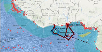
Fishing vessel traffic data derived from Automatic Identification System (AIS) has become an essential component for building fisheries intelligence. Enforce and related fisheries management strategies rely on such information to curb illegal fishing, plan and implement policies for the sustainability of marine living resources.
Fisheries managers and enforcers require specialized skills to processes the large volume of positional, navigational and voyage related information embedded in AIS data. Open-source programming software such as Python has lots of third-party modules for building packages and functions. This makes Python an asset for the creation of customized data processing, analyses and visualization to support in making informed decisions in the management of natural resources.
This training course will provide participants an understanding of the movement of fishing vessels and skills in processing AIS data.
EOFish-2025
Earth Observation for Enhanced Fisheries Monitoring, Control, and Surveillance
: Data manipulation and analysis
- Overview of the Automatic Identification System (AIS)
- Key attributes of AIS data
- Importance of AIS data for monitoring, control, and surveillance
- Sources of AIS data and formats
- Reading AIS data files using Pandas
- Cleaning and preparing AIS data for analysis
- Handling missing or erroneous data in AIS datasets
- Visualising vessel tracks using Python libraries
- Calculating vessel speeds and identifying anomalies
- Detecting potential IUU fishing activities based on AIS patterns
- Integrating AIS data into fisheries management systems
- Case studies: Detecting transshipment using AIS data
Target audience and prerequisites
This course is designed for researchers, fisheries officers, students, and Early Career Ocean Professionals (ECOPs) actively engaged in fisheries management, maritime security, and coastal conservation in Africa.
Language: English
Instructors
Dr. Kwame Adu Agyekum (Department of Marine and Fisheries Sciences, University of Ghana)
Mr. Ignatius Kweku Williams (GMES and Africa project, University of Ghana)
Mr. Daniel Quarshie (GMES and Africa project, University of Ghana)
Course format and duration
This course will be held online and includes synchronous sessions, for which attendance is mandatory. These sessions are scheduled for: 9 – 13 July 2025 11:00 -13:00 UTC / GMT Daily.
The estimated duration of this course is 20 hours (10 hours of synchronous classes and 10 hours of asynchronous activities).
Organizers
RTC Ghana
MarCNoWA: GMES & Africa Project
IOCAFRICA - Intergovernmental Oceanographic Commission of UNESCO Sub-Commission for Africa and the Adjacent Island States
Learner assessment
Assignments (e.g, written and data exercises) and multiple-choice quizzes.
Certificate
OTGA Certificate will be awarded to the participants upon completion of assignments (pass mark: 70%) and 60% attendance at the synchronous sessions.
Technology requirements, computer skills, and pre-requisites
- Computer with Windows or Mac OS
- Latest version of either Chrome, Edge, Firefox or Safari web browsers
- JavaScript and cookies enabled
- Broadband internet access (minimum bandwidth of 0.5 Mbps (Receive and Send)
- Speakers or headphones, and microphone
You should be proficient in the following:
- basic computer skills
- finding resources through search engines
- the ability to be self-directed in learning new technology skills (e.g. following a step-by-step tutorial, online video help, or access to support to learn necessary skills).
Application and selection of participants.
A limited number of seats (approximately 25) are available. Please fill out the online application form available in this LINK:
The applications start on 10 June 2025. The deadline to submit the application is 25 June 2025 (23:59 CET: Central European Time).
Participants will be selected based on the fit to the target audience, motivation statement, and professional background/qualification.
Costs: This is an online course with no tuition fees.
Contacts
For any questions, please contact OTGA Secretariat (ioc.training@unesco.org) or the course coordinator Ignatius Kweku Williams (kwilliams@ugedugh.onmicrosoft.com) always using the name of the course as e-mail subject.
Feedback survey
At the end of the course, you will be asked to fill out a feedback survey. This information will be used to improve future courses.
Cancellation policy
In the event of cancellation of the course by the OTGA or its affiliates, we will provide notification of cancellation at least 7 days prior to the course date. In the event of cancellation by the attendee, we should receive notification of cancellation at least 7 days prior to the course date.
eDNA_Africa_2025
Environmental DNA (eDNA) Training for Africa and the Adjacent Island States
Environmental DNA (eDNA) sampling and analysis have become an increasingly popular tool for studying biodiversity and monitoring ecosystems. It provides a relatively easy, non-invasive method to scan environments; estimate number of species, assess biodiversity, and monitor changes in a community without having to collect organism samples. Additionally, eDNA has the potential to inform on the movements and habitat associations of endangered/rare species, migratory species, water quality, detecting and tracking invasive species, harmful algal blooms, pathogens, and parasites. eDNA uses traces of genetic materials that organisms leave behind in water, soil, or air. Regardless of its wide application, knowledge of this technique is still underused in several parts of the world, such as in Africa. Marine ecosystems of Africa and the adjacent island states are teeming with biodiversity, including 439 key marine biodiversity areas. These ecosystems are facing significant threats from climate change, overexploitation, invasive species, urbanization, and other factors, as such, impact on biodiversity. Therefore, there is an urgent need to accelerate the understanding of African biodiversity patterns and monitor ecosystems more efficiently. Implementing eDNA techniques in biodiversity assessment in African countries is a promising opportunity to maximize the conservation and management of marine life.
In this context, this blended training aims to provide participants with a comprehensive theoretical understanding of environmental DNA (eDNA) and its applications in environmental sciences. It will cover all relevant aspects from eDNA sampling, laboratory and bioinformatic analysis, data analysis of results and possible application. The participants will learn about the origins of eDNA, how it enters the environment, and its significance in measuring biodiversity. The training will give an overview of eDNA, including its definition and different ecosystems where it can be studied with a specific focus on marine ecosystems.
Venue
University of Ghana
General Learning Goals
By the end of the course, the participants are expected to have:
- Increased understanding of the eDNA technology and its practical application.
- Enhanced skills in the collection and preservation of eDNA samples.
- Practical knowledge and skills in the extraction of eDNA samples.
- Insights on the analysis of eDNA data, and use of bioinformatics tools.
- Knowledge of utilization of eDNA technique in assessing marine biodiversity and monitoring ecosystems.
This course includes an online preparation component where participants will learn how to:
- Explain what eDNA is, its sources, and its ecological significance.
- Describe workflows for eDNA sampling, preservation, laboratory analysis, and bioinformatics.
- Identify key challenges, limitations, and good practices in eDNA studies.
- Understand quality control (QC), data stewardship, and ethical considerations in eDNA research.
- Recognise how eDNA data can inform policy, conservation, and ecosystem monitoring in Africa’s marine environments.
Target audience
The training is focused on ocean practitioners from West and North African countries, including Early Ocean Career Professionals (ECOPs) and mid-career ocean scientists interested in and needing to use eDNA in their scientific or technical work.
Pre-requisites
Participants must:
-
Have prior knowledge of marine biodiversity sampling and monitoring.
-
Bring their laptop.
-
A working knowledge of English.
-
Applicants must be from West or North Africa.
Course content
Module 1: Foundations of Environmental DNA (eDNA) Science
Module 2: eDNA-Omics and Their Applications
Module 3: eDNA Workflows and Practical Considerations
Module 4: eDNA Bioinformatics Analysis
Module 5: Data Interpretation, Bias, and Policy Relevance
All these theoretical modules will be complemented by targeted hands-on activities for 1 week, face-to-face training in Ghana.
Language of instruction: English
Course Duration, Synchronous Sessions, and Format
The course will take place face-to-face between 3 to 7 November, 2025, with a duration of approximately 40 hours.
The course has an online learning component to be completed before the onsite classes of approximately 12h.
Participants will be required to:
- Complete online self-paced learning activities before the onsite classes.
- Familiarize themselves with the documentation and methods shared by the group previously.
Instructors
Organizers
Application process and selection criteria
OTGA online application form. Before starting the online application process, applicants must: (a) create a profile in OceanExpert (www.oceanexpert.org); (b) prepare a Curriculum Vitae; and (c) prepare a motivational statement highlighting the relevance of this course for the candidate's career (maximum 300 words).
A limited number of seats are available (20 seats). Please complete the online application form available on this LINK [https://otga.wufoo.com/forms/m164fy0026gyzv/]. The applications start on 5 August 2025. The deadline to submit the application is Sunday 24 August 2025.
UNESCO is committed to promoting equal access principles. Applications from minority or underrepresented groups are strongly encouraged.
Assessment & Certificate
Participants will be required to complete a preparation phase online before the course, attend all sessions of the face-to-face training in Ghana, and successfully complete the course activities and assessments. A certificate of completion will be issued for those who complete these requisites.
Contacts
- Course Coordinators: Ibukun Adewumi i.adewumi@unesco.org; Edwin Mwashinga e.mwashinga@unesco.org;
- RTC Ghana Coordinator: Benjamin Botwe
- OTGA Secretariat: ioc.training@unesco.org
Costs
Free of charge. There are no tuition fees.
For the selected participants, course organizers will cover the costs of travel, accommodation, local transport, and food. Eligibility for support requires meeting the pre-requisites and target audience.
The instructors will give the course voluntarily.
Cancellation policy
In the event of cancellation of the course by the OTGA or its affiliates, we will provide notification of cancellation at least 7 days prior to the course date. In the event of cancellation by the attendee, we should receive notification of cancellation at least 7 days prior to the course date.
eDNA_Africa_2026
Environmental DNA (eDNA) Training for Africa and the Adjacent Island States 2026
Environmental DNA (eDNA) sampling and analysis have become an increasingly popular tool for studying biodiversity and monitoring ecosystems. It provides a relatively easy, non-invasive method to scan environments; estimate number of species, assess biodiversity, and monitor changes in a community without having to collect organism samples. Monitoring of endangered species, invasive species, pathogens, and harmful algal bloom Additionally, eDNA has the potential to inform on the movements and habitat associations of endangered/rare species, migratory species, water quality, detecting and tracking invasive species, harmful algal blooms, pathogens, and parasites. eDNA uses traces of genetic materials that organisms leave behind in water, soil, or air. Regardless of its wide application, knowledge of this technique is still underused in several parts of the world, such as in Africa.
Marine ecosystems of Africa and the adjacent island states are teeming with biodiversity, including 439 key marine biodiversity areas. These ecosystems are facing significant threats from climate change, overexploitation, invasive species, urbanization, and other factors, as such, impact on biodiversity. Therefore, there is an urgent need to accelerate the understanding of African biodiversity patterns and monitor ecosystems more efficiently. Implementing eDNA techniques in biodiversity assessment in African countries is a promising opportunity to maximize the conservation and management of marine life.
In this context, this blended training aims to provide participants with a comprehensive theoretical understanding of environmental DNA (eDNA) and its applications in environmental sciences. It will cover all relevant aspects from eDNA sampling, laboratory and bioinformatic analysis, data analysis of results and possible application. The participants will learn about the origins of eDNA, how it enters the environment, and its significance in measuring biodiversity. The training will give an overview of eDNA, including its definition and different ecosystems where it can be studied with a specific focus on marine ecosystems.
Venue
Pwani University, Kenya
General Learning Goals
By the end of the course, the participants are expected to have:
- Increased understanding of the eDNA technology and its practical application.
- Enhanced skills in the collection and preservation of eDNA samples.
- Practical knowledge and skills in the extraction of eDNA samples.
- Insights on the analysis of eDNA data, and use of bioinformatics tools.
- Knowledge of utilization of eDNA technique in assessing marine biodiversity and monitoring ecosystems.
This course includes an online preparation component where participants will learn how to:
- Explain what eDNA is, its sources, and its ecological significance.
- Describe workflows for eDNA sampling, preservation, laboratory analysis, and bioinformatics.
- Identify key challenges, limitations, and good practices in eDNA studies.
- Understand quality control (QC), data stewardship, and ethical considerations in eDNA research.
- Recognise how eDNA data can inform policy, conservation, and ecosystem monitoring in Africa’s marine environments.
Target audience
The training is focused on ocean practitioners from Eastern and Southern Africa countries, including Early Ocean Career Professionals (ECOPs) and mid-career ocean scientists interested in and needing to use eDNA in their scientific or technical work.
Pre-requisites
Participants must:
-
Have prior knowledge of marine biodiversity sampling and monitoring.
-
Bring their laptop.
-
A working knowledge of English.
-
Applicants must be from Eastern or Southern Africa.
Course content
Module 1: Foundations of Environmental DNA (eDNA) Science
Module 2: eDNA-Omics and Their Applications
Module 3: eDNA Workflows and Practical Considerations
Module 4: eDNA Bioinformatics Analysis
Module 5: Data Interpretation, Bias, and Policy Relevance
All these theoretical modules will be complemented by targeted hands-on activities for 1 week, face-to face training at the Pwani University, Kenya.
Language of instruction: English
Course Duration, Synchronous Sessions, and Format
The course will take place face-to-face between 27 July and 2 August, 2026, with a duration of approximately 40 hours.
The course has an online learning component to be completed before the onsite classes of approximately 12h.
Participants will be required to:
- Complete online self-paced learning activities before the onsite classes.
- Familiarize themselves with the documentation and methods shared by the group previously.
Instructors
Organizers
Application process and selection criteria
OTGA online application form. Before starting the online application process, applicants must: (a) create a profile in OceanExpert (www.oceanexpert.org); (b) prepare a Curriculum Vitae; and (c) prepare a motivational statement highlighting the relevance of this course for the candidate's career (maximum 300 words).
A limited number of seats are available (20 seats). Please complete the online application form available on this LINK [https://otga.wufoo.com/forms/mfp4obc0qqy8qa/]. The applications start on 30 April 2026. The deadline to submit the application is 15 May 2026.
UNESCO is committed to promoting equal access principles. Applications from minority or underrepresented groups are strongly encouraged.
Assessment & Certificate
Participants will be required to complete a preparation phase online before the course, attend all sessions of the face-to-face training in Kenya, and successfully complete the course activities and assessments. A certificate of completion will be issued for those who complete these requisites.
Contacts
- Course Coordinators: Ibukun Adewumi i.adewumi@unesco.org; Edwin Mwashinga e.mwashinga@unesco.org;
- OTGA Secretariat: ioc.training@unesco.org
Costs
Free of charge. There are no tuition fees.
For the selected participants, course organizers will cover the costs of travel, accommodation, local transport, and food. Eligibility for support requires meeting the pre-requisites and target audience. The instructors will give the course voluntarily.
Costs of this training are co-sponsored by the Ocean Decade Capacity Development Facility and the UNESCO IOC Project Office for IODE.
Cancellation policy
In the event of cancellation of the course by the OTGA or its affiliates, we will provide notification of cancellation at least 7 days prior to the course date. In the event of cancellation by the attendee, we should receive notification of cancellation at least 7 days prior to the course date.
Event details: https://www.oceanexpert.org/event/5013
ERASMUSMARIS-26
Erasmus Maris 2026: Monitoring microplastic pollution in coastal waters: From sampling and analysis to data
Collaboration and teamwork are central, and the training concludes with a certificate ceremony recognizing participants' achievements.
Who is it for?
The course is designed for approximately 60 upper secondary students and 14 science teachers from participating European Schools. The teachers will follow the trainer pathway, enabling them to implement Erasmus Maris activities with their students after the course. Two facilitators from Wings of the Ocean will also follow the trainer pathway to support future implementation in France.
Venue
Microplastic sampling with a manta net.
This includes:
Approximately 20 hours of synchronous practical training distributed across 14–18 September 2026;
approximately 12 hours of online/asynchronous learning, including lessons and quizzes.
The practical training includes laboratory analysis, field sampling, introduction to the MARIS database, and supervised data-entry activities. The online component includes theoretical lessons and quizzes
Language of Instruction
Spanish.
The online lessons and quizzes are currently in English. If translation is completed before the course, the online materials may also be made available in Spanish.
Instructors
- Kamel Labibes: Chair- Ayam Sailing Europe,ASE)
- Carlos Sanz Lázaro: Professor, Department of Ecology, Faculty of Sciences, University of Alicante; Ramón Margalef Multidisciplinary Institute for Environmental Studies (IMEM), University of Alicante
Internal process. Each of the schools participating in the Erasmus Maris program, spread across EU different countries, have chosen six students to participate in the program. Applicants have expressed a genuine interest in environmental issues. presentation, and performance at school were also taken into account.
UNESCO is committed to promoting equal access principles. Applications from minority or underrepresented groups are strongly encouraged. For any questions please contact the OTGA Secretariat (ioc.training@unesco.org) always using the name of the course as the email subject.
Contacts
- Dr Kamel Labibes: coordination@ayamsailing.eu
- OTGA Secretariat: ioc.training@unesco.org
In case of need for further clarifications please use the contacts above, always using as email subject.
Feedback survey
At the end of the course, you will be asked to fill out a feedback survey. This information will be used to improve future courses.
Cancellation policy
In the event of cancellation of the course by the OTGA or its affiliates, we will provide notification of cancellation at least 7 days prior to the course date. In the event of cancellation by the attendee, we should receive notification of cancellation at least 7 days prior to the course date.
MDExc-2025EN
From Observation to Action: Empowering communities towards excellence in marine data
This course aims to equip ocean data leaders in regions across the globe with the knowledge and tools to grow their own communities of practice, thereby developing professional expertise and data literacy for ocean data producers, curators, and users as identified in the Ocean Decade’s Data Strategy Implementation Plan.
General learning outcomes
Upon successful completion of this training, participants will be able to:
- Support community buy-in and develop learning opportunities to train others within their own countries and regions about ocean data
- Seed and lead their own local or regional ocean data Communities of Practice
- Play leading roles in the Decade Coordination Office for Ocean Data Sharing’s global Community of Practice
- Lead cross-border cooperation on specific data sharing topics of interest
Course content & planning
Four modules of three topics delivered on-online with targeted, in-person follow-up.
Each topic will consist of:
- One one-hour lecture - pre-recorded to allow learners to watch at their own pace
- Follow-up discussion time - online, in groups
- Activities to re-inforce the learning
Module 1 (November 2025)
1.1 Setting the scene: Why ocean data management, incentives to sharing data, and the global ocean data landscape
-
- Aim: To provide an introduction and overview to the course; to describe some of the impacts, benefits and motivations in sharing well-managed ocean data; to give an overview of the global and regional ocean data sharing networks and initiatives.
- Outcome: Learners will be able to explain to others why it is important to manage and share ocean data and what options are available to make this happen at a global scale
1.2 Understanding roles: The IODE Quality Framework, Steps, Roles of Individuals
-
- Aim: To give an introduction to the Quality Framework that IODE uses to manage and share ocean data across its network; to outline the various roles that exist within the framework and how these relate to an ocean data community of practice
- Outcome: Learners will be able to describe the key roles that are needed in an ocean data community of practice and the quality framework that activity sits within
1.3 Identifying your ocean data community: Who will you engage with, support, and train?
-
- Aim: To help learners consider who their ocean data community is and what the focus of learning/training needs in that community is
- Outcome: Learners will be able to identify the purpose of their community of practice, and to identify and invite potential members
Module 2 (December 2025)
2.1 Planning: making your marine projects and programmes “data first”
-
- Aim: To explain to learners the Data Management Planning process and how it helps in making a project or programme “data first’
- Outcome: Learners will be able to lead in Data Management Planning in their organisation or community of practice
2.2 Quality data matters
-
- Aim: To introduce learners to a range of thematic data quality issues, which may be beyond their normal area of expertise and to the impacts of data quality on the re-use of data in a range of ocean applications
- Outcome: Learners will have an overview of the importance of ocean data quality which they can bring to their communities of practice and be informed of key resources which they can point their communities of practice
2.3 Building your ocean data community:
-
- Aim: To equip learners with skills in building a community of practice in ocean data management and sharing
- Outcome: Learners will be confident in their ability to grow a community of practice from the potential members identified in Block 1.
Module 3 (January 2025)
3.1 Putting data to work - sharing ocean data to enable insight and action
-
- Aim: To enable communities of practice to understand how to prepare data for sharing, where to share and some tools that can be used to share data which can then be used in creating insights
- Outcome: Learners will be able to encourage data sharing in their communities of practice, and advise on best practices, technology choices, etc
3.2 How do I get credit for sharing my data? Moving from data sharing to data publication
-
- Aim: To help learners to understand the difference between sharing data and formal data publication, the benefits of data publication, how to get started, and how to use digital object identifiers for datasets
- Outcome: Learners will be able to describe data publication to their communities of practice and be aware of options to allow for formal citation of datasets created by their communities of practice
3.3 Creating learning spaces in your ocean data community
-
- Aim: A key activity of communities of practice is sharing knowledge and helping members to learn from each other. This session will focus on the key aspects of a healthy peer-based learning environment, and will be followed in block 4 by a session on designing effective learning sessions
- Outcome: Learners will be able to foster healthy environments in their communities of practice to allow the growth and development of members
Module 4 (February 2026)
4.1 What is the IODE network and who is involved
-
- Aim: The IODE network is the key ocean data sharing network globally and consists of a number of components. This session will introduce learners to the makeup of IODE’s network and its scope of work
- Outcome: Learners will be able to introduce the IODE network to their communities of practice and to align activities of the community to IODE activity, including working alongside National Oceanographic Data Centres and Associated Data Units
4.2 Getting organisational support and buy-in
-
- Aim: As data communities of practice are often engaged in organisational change, getting buy-in or support for their activities is key. This session will equip learners with tools to help with raising the profile of and engagement with their communities of practice leading to greater impact.
- Outcome: Learners will be equipped with skills and knowledge to effectively communicate the work of their communities of practice to a range of stakeholders and to get buy-in from decision makers
4.3 Designing learning
-
- Aim: Communities of Practice support their members by giving them focussed learning opportunities. This session will introduce the concepts in designing effective learning opportunities
- Outcomes: Learners will be able to plan effective and targeted training sessions to develop skills within their communities of practice
In-person Follow-up (2026)
- Aims: To provide in-person spaces to follow-up on the train-the-trainer course content and to develop individual roadmaps to action, implementation of which will be followed up online
- Outcomes: Learners will have developed personal action plans to put into practice the skills they have acquired throughout the course and have organised the first follow-up session with the course leaders
Information about these sessions will be updated [HERE] once confirmed.
Target audience & pre-requisites
This course was prepared for ocean practitioners and institutions interested in becoming focal points to collaborate with the Decade Coordination Office for Ocean Data Sharing in building a network of recommended practices around good data management and sharing.
Participation will require:
- Good working knowledge of English (*the course will be delivered in multiple languages, but external resources may be in English)
- Basic computer skills
- Knowledge of ocean data management is advised (completed the OTGA course)
- Knowledge of ocean data
Language of instruction
English and Spanish
Instructors and Organizers
Content for this course was provided by:
- Adam Leadbetter
- Rob Thomas
- Jan-Bart Calewaert
- Ana Carolina Mazzuco
- Taco de Bruin
- Peter Burger
- Margarita López-Velosa
- Other instructors from each region (to be confirmed)
This training is organized by the Decade Coordination Office for Ocean Data Sharing in collaboration with the the Ocean Decade Coordination Unit and the UNESCO IOC OceanTeacher Global Academy (Programme Component of IODE).
Assessments and Certificate
This course contain a set of online multiple-question automated assessments to evaluate your learning, and a final action plan to be developed and implemented individually. Participants will be required to complete a pre and post self-assessment related to the course content, and be requested to fill out a feedback survey at the end of the course to reflect on your learning experience and identify areas for improvement. This will also provide valuable feedback for course teachers and organisers to enhance future training sessions.
To receive a Certificate of Completion, learners must:
- Achieve a minimum score of 80% on all quizzes;
- Complete every lesson, activity, and assessment;
- Complete the mandatory pre-test and post-test;
- Develop and implement an action plan;
- Participate in online live sessions (75% attendance);
- Submit the required feedback form, which is mandatory for all OTGA courses.
After completion of the course, participants will be invited to join follow ups and monthly meetings with the DCO for Ocean Data Sharing to continue the network building and future training of other participants.
Technology requirements
To complete this course, participants should have access to:
- Computer with a modern operating system (Windows, macOS, or Linux)
- Latest version of either Chrome, Edge, Firefox or Safari web browsers
- JavaScript and cookies enabled
- Broadband internet access (minimum bandwidth of 0.5 Mbps (Receive and Send)
- Speakers or headphones, Microphone
Course duration and format
This course will be conducted in a blended format, through a combination of online self-paced activities, instructor led sessions and assessments, and hands-on work. The duration of the course (Blocks 1, 2, 3, and 4 and related activities) is a total of 25 hours.
Live sessions schedule:
18 November 2025
16 December 2025
5 February 2026
5 March 2026
Note that the training course may be complemented by face-to-face in-person follow-up module - to be scheduled in 2026 - dates and venue to be confirmed by region.
Cost: This course has no tuition fees.
How to participate
Participation in this training is invitation only, coordinated in collaboration with the National Committees, Coordination Offices and Centres of the Ocean Decade.
Contacts
- DCO Ocean Data Sharing: oceandatasharing@unesco.org
- OTGA Secretariat: ioc.training@unesco.org
For any questions please contact the OTGA Secretariat always using the name of the course as the email subject.
Cancellation policy
In the event of cancellation of the course by the OTGA or its affiliates, we will provide notification of cancellation at least 7 days prior to the course date. In the event of cancellation by the attendee, we should receive notification of cancellation at least 7 days prior to the course date.
OceanExpert announcement: https://oceanexpert.org/event/4867
BC-VLab3*2025
How to use a Virtual Laboratory on Carbon Plankton Dynamics
This 4-hour course is designed to empower ocean scientists by providing a comprehensive understanding and practical skills in using a Carbon Plankton Dynamics Virtual Laboratory (VLab), running in Blue-Cloud Virtual Research Environment (VRE). Participants will learn how to explore carbon plankton data, patterns, and processes relevant to marine ecology using a virtual environment. Knowing that the carbon pump in marine ecosystems operates as a key mechanism for carbon dynamics, learning how to use a virtual carbon plankton model can provide support to enhance knowledge in marine life dynamics, as well as perform science-based decision-making. This course uses datasets and scenarios of the Belgian Part of the North Sea and the Gulf of Trieste to demonstrate the capabilities of the models, which can be applied and adapted for other regions and conditions.
The course aims to empower ocean scientists with a comprehensive understanding and practical skills in using a Virtual Laboratory (Vlab) on Carbon Plankton Dynamics within the Blue-Cloud VRE. By accessing various digital tools, you will be able to utilize models to study carbon plankton and apply them to make decisions related to the carbon pump mechanism based on data products and modelling outputs.
Learning outcomes
Upon successful completion of this training, participants will be able to:
- Identify key data collection processes and partners involved in research within the Belgian Part of the North Sea and the Gulf of Trieste and the development of the Carbon Plankton Dynamics Virtual Laboratory.
- Explain the importance of carbon plankton dynamics for scientific research, modeling, and oceanography.
- Define the purpose and functionalities, and the services provided by the Virtual Laboratory.
- Identify and utilize near-real-time data within the Virtual Laboratory for use in Nutrient–Phytoplankton–Zooplankton–Detritus (NPZD)-type models.
- Access relevant data from Blue-Cloud Data Discovery and Access service (DD&AS)
- Format data files for use in the Virtual Laboratory
- Operate the Virtual Laboratory (VLab) on Carbon Plankton Dynamics to simulate and analyze phytoplankton dynamics in the specified regions.
- Analyze model results related to the contributions of bottom-up and top-down drivers by the RShiny App within the Virtual Laboratory.
- Quantify the relative contributions of bottom-up and top-down drivers in phytoplankton dynamics using the NPZD-type model within the Virtual Laboratory.
- Interpret marine ecosystem management decisions based on model outputs from the Virtual Laboratory (VLab).
Course content
-
Module 1: Introduction to the Virtual Laboratory - This module introduces the Virtual Laboratory on Carbon Plankton Dynamics, its services, the relevance of carbon plankton dynamics, and key partners, focusing on their roles in data collection and modeling within the Belgian Part of the North Sea and Gulf of Trieste as a use case.
-
Module 2: Data Collection - This module guides on the types of data needed for the Virtual Laboratory on Carbon Plankton Dynamics, methods to access data (DD&AS), and the process of building and formatting data files, focusing on data from the Belgian Part of the North Sea and Gulf of Trieste.
-
Module 3: Discovering the Model - This module provides hands-on experience in operating the Virtual Laboratory on Carbon Plankton Dynamics using the handbook, focusing on how to use near-real-time data to run an NPZD-type model.
-
Module 4: RShiny App - This module teaches participants how to use the RShiny App in the Virtual Laboratory on Carbon Plankton Dynamics, focusing on visualizing and interpreting data related to phytoplankton dynamics in the Belgian Part of the North Sea and Gulf of Trieste.
Target audience
- Graduate students and postdoctoral researchers in marine and environmental sciences;
- IT professionals supporting research activities in scientific institutions; and
- Project managers and coordinators involved in research projects that utilise Virtual Research Environments (VREs).
Proficient in the following is required:
- The ability to be self-directed in learning new technology skills (e.g. following a step-by-step tutorial, online video help, or access to support to learn necessary skills)
- Basic computer skills
- Finding resources through search engines
Language of instruction
English
Instructors and Organizers
Content for this course was provided by:
This training is organized by the EU BlueCloud2026 project in collaboration with the UNESCO IOC OceanTeacher Global Academy, RTC Belgium, and contributions from project partners' experts (Flanders Marine Institute VLIZ, National Institute of Oceanography and Applied Geophysics (OGS) of Italy).
Blue-Cloud 2026 aims at a further evolution of this pilot ecosystem into a Federated European Ecosystem to deliver FAIR & Open data and analytical services, instrumental for deepening research of oceans, EU seas, coastal & inland waters. It develops a thematic marine extension to EOSC for open web-based science, serving the needs of the EU Blue Economy, Marine Environment and Marine Knowledge agendas.
Assessments and Certificate
This course contain a set of multiple-question automated assessments to evaluate your learning. Participants will be required to complete a pre and post self-assessment related to the course content, and be requested to fill out a feedback survey at the end of the course to reflect on your learning experience and identify areas for improvement. This will also provide valuable feedback for course teachers and organisers to enhance future training sessions.
To receive a Certificate of Completion, learners must:
- Achieve a minimum score of 70% on all quizzes.
- Complete every lesson, activity, and assessment.
- Complete the mandatory pre-test and post-test.
- Submit the required feedback form, which is mandatory for all OTGA courses.
Technology requirements
To complete this course, participants should have access to:
- Computer with a modern operating system (Windows, macOS, or Linux)
- Latest version of either Chrome, Edge, Firefox or Safari web browsers
- JavaScript and cookies enabled
- Broadband internet access (minimum bandwidth of 0.5 Mbps (Receive and Send)
- Speakers or headphones, Microphone
Course duration and format
For this first round, the course will be available online between 17 September 2025 and 31 July 2026. The estimated time to complete the self-paced course is approximately 4 hours.
Cost: This course has no tuition fees.
The training course is Funded by the European Union, with additional support from UNESCO IOC.
How to enrol
Please register on the OceanExpert website (www.oceanexpert.org). Once your OceanExpert account is approved (this is not done immediately), you can self-enrol in the course. If you already have an OceanExpert account, you can self-enrol in the course using your OceanExpert username and password.
First log-in OceanTeacher, then access the course page and click on self-enrolment. The enrolment key for all courses is VLab3*2025EN1
Contacts
- OTGA Secretariat: ioc.training@unesco.org
For any questions please contact the OTGA Secretariat always using the name of the course as the email subject.
Cancellation policy
In the event of cancellation of the course by the OTGA or its affiliates, we will provide notification of cancellation at least 7 days prior to the course date. In the event of cancellation by the attendee, we should receive notification of cancellation at least 7 days prior to the course date.
OceanExpert announcement: https://oceanexpert.org/event/4858
BC-VLab4
How to use a Virtual Laboratory on Marine Environmental Indicators
Summary
This 8-hour course is designed to empower ocean scientists by providing comprehensive understanding and practical skills in using the Marine Environmental Indicators Virtual Laboratory running in Blue-Cloud Virtual Research Environments (VREs). Evaluating environmental conditions of marine areas is crucial to provide data-based support for decision-making in ocean management. In this course, the participants will learn about important and widely used marine environmental indicators: 1) Marine Heatwave (MHW), 2) Ocean Heat Content (OHC), 3) Trophic Index (TRIX), and 4) Storm Severity Index (SSI).
The general goal is to equip ocean scientists with the knowledge and skills to effectively navigate, utilize, and customize the Marine Environmental Indicators Virtual Lab for assessing marine environmental conditions and supporting ocean management decisions.
This course is organized by CMCC, INGV, OGS, KNMI, and VLIZ, with the support of the UNESCO IOC OceanTeacher Global Academy (OTGA).
Format and Duration
This is a fully online, self-paced course with no synchronous sessions. The estimated time required to complete the course is approximately 4 hours of asynchronous activities, including video lectures, readings, quizzes, and practical exercises.
Venue
Online
Language of Instruction: English
Learning Outcomes
Upon successful completion of this training, learners will be able to:
- Use the Virtual Laboratory within a Virtual Research Environment
- Explain the relevance of marine environmental indicators
- Calculate the Marine Heatwave (MHW) indicator
- Interpret spatial trends of the Marine Heatwave (MHW) indicator
- Explain the Ocean Heat Content (OHC) indicator
- Analyze spatial trends of the Ocean Heat Content (OHC) indicator
- Identify potential eutrophication hotspots using the Trophic Index (TRIX)
- Understand and compute the Storm Severity Index (SSI), interpret its spatial and temporal patterns, and analyze storm impacts using Jupyter Notebooks and cloud-based tools within the Virtual Research Environment
- Use the MEI Web Application to generate environmental indicators
Course Content
The course is composed of six online modules:
- Module 1: Introduction This module provides a comprehensive overview of marine environmental indicators, delving into their significance in assessing ocean health and their application in informed decision-making. Participants will learn about the crucial role these indicators play in evaluating marine ecosystems and gain an understanding of the BlueCloud VLab and its partners involved in this initiative.
- Module 2: Marine Heatwave (MHW) This module explores the computation of the Marine Heatwave indicator, providing insights into its relevance for understanding climate change effects on sea surface temperature. Participants will gain a clear understanding of the data sources used to calculate this indicator, and learn to navigate and utilize the provided notebook for practical analysis and visualization.
- Module 3: Ocean Heat Content (OHC) This module provides a thorough exploration of the Ocean Heat Content indicator, offering a comprehensive understanding of its significance as a key metric in assessing global climate change and its impact on ocean dynamics. Participants will delve into the various data sources that inform this indicator, and acquire practical skills in utilizing the provided notebook for in-depth analysis and interpretation of OHC data.
- Module 4: Trophic Index (TRIX) This module examines the impact and application of the Trophic Index, focusing on its utility as a key indicator of eutrophication and overall water quality in marine environments. Participants will be introduced to the relevant data sources that are used to calculate the Trophic Index, and will gain hands-on experience using the provided notebook for data analysis and informed interpretation of Trophic Index values.
- Module 5: Storm Severity Index (SSI) This module delves into the impact of the Storm Severity Index, investigating its role as a crucial measure of coastal vulnerability and its implications for risk assessment and management. Participants will explore the data sources used in calculating the SSI and gain the expertise needed to apply the provided notebook for practical calculations and informed interpretation of storm-related impacts. In addition users will be taught how to run the Storm Severity Index on the Cloud Computing Platform.
- Module 6: Using the MEI Web Application This module provides a practical introduction to the MEI Web Application, which allows users to compute and explore all Marine Environmental Indicators through an intuitive graphical interface. This module focuses on how to use the web app to run the same analyses covered in the previous modules using Jupyter Notebookin, in a simpler, code-free environment. Participants will learn how to navigate the web interface, select indicators, configure parameters, and interpret the generated outputs.
Target Audience
This course was prepared for researchers, data scientists, and academic professionals involved in ocean science and related fields who are interested in enhancing research capabilities through advanced digital tools and collaborative platforms. It is also suitable for:
- Graduate students and postdoctoral researchers in marine and environmental sciences
- IT professionals supporting research activities in scientific institutions
- Project managers and coordinators involved in research projects that utilize Virtual Research Environments (VREs)
Prior experience with D4Science or Virtual Research Environments and scientific programming may be required.
Organizers
- CMCC https://www.cmcc.it, https://oceanexpert.org/institution/15381
- INGV https://www.ingv.it, https://oceanexpert.org/institution/6939
- OGS https://www.ogs.it/en, https://oceanexpert.org/institution/6941
- KNMI https://www.knmi.nl/home, https://oceanexpert.org/institution/12233
- VLIZ https://vliz.be/nl, https://oceanexpert.org/institution/6223
Facilitators
- Francesco Palermo: CMCC (https://oceanexpert.org/expert/77906)
- Rafael De Menezes: CMCC (https://oceanexpert.org/expert/30900)
- Simona Simoncelli: INGV (https://oceanexpert.org/expert/22199)
- Enrico Baglione: INGV (https://oceanexpert.org/expert/56170)
- Nydia Catalina Reyes Suarez: OGS (https://oceanexpert.org/expert/37482)
- Jan Willem Noteboom: KNMI (https://orcid.org/0000-0002-4909-7865)
- Marco Lettere: Nubisware
Registration, Costs, and Technological Requirements
This course has no tuition fee and is open to everyone. No application is required, self-enrolment with open registrations.
To follow this course, participants need access to:
- A computer with a modern operating system (Windows, macOS, or Linux)
- Latest version of Chrome, Edge, Firefox, or Safari
- JavaScript and cookies enable
- dBroadband internet access (minimum 0.5 Mbps)
- Speakers or headphones, microphone
Prior experience with D4Science or Virtual Research Environments and scientific programming may be required for some activities. Additional resources can be found at: https://blue-cloud.org/
UNESCO is committed to promoting equal access principles. Registration from minority or underrepresented groups is strongly encouraged.
How to enrol
Please register on the OceanExpert website (www.oceanexpert.org). Once your OceanExpert account is approved (this is not done immediately), you can self-enrol in the course. If you already have an OceanExpert account, you can self-enrol in the course using your OceanExpert username and password.
First log-in OceanTeacher, then access the course page and click on self-enrolment. The enrolment key for all courses is VLab4*2026EN1
Assessment & Certificate
This course contains a set of multiple-question automated assessments to evaluate your learning. You will be required to complete a pre and post self-assessment related to the course content, and be requested to fill out a feedback survey at the end of the course to reflect on your learning experience and identify areas for improvement. This will also provide valuable feedback for course teachers and organisers to enhance future training sessions.
Note: All quizzes are graded automatically, and the grades are returned to you immediately.
A certificate will be awarded to all participants that successfully completed all the lessons, activities and assessments. The passmark is 80%. Responding to the feedback survey is a requirement for certificates to be awarded in all OTGA courses.
Contacts
For course organisation, please contact: Cyrielle Delvenne; cyrielle.delvenne@vliz.be
For additional questions, please contact the OTGA Secretariat (ioc.training@unesco.org), always using the name of the course as email subject.
Cancellation Policy
In the event of cancellation of the course by the OTGA or its affiliates, we will provide notification of cancellation at least 7 days prior to the course date. In the event of cancellation by the attendee, we should receive notification of cancellation at least 7 days prior to the course date.

ECOPOceanTech-2024
Introduction to Oceanographic Survey Techniques and Data Management
Summary
Global change requires studying the ocean in more detail and at longer and larger scales. Capacity development and training on standard survey techniques and the use of simple sensors has been identified as a tool to enhance ocean observation. This course serves as an introduction to oceanographic survey techniques and data processing. It is designed for Early Career Ocean Professionals (ECOPs), students, and other oceanographers who intend to pursue oceanography and marine sciences. Relevant oceanographic (physical, chemical, and biological) datasets will collected and used during the training, making it easy to relate, understand, and apply the course concept.
Venue: AquaBioTech Group, Mosta, Malta
Learning outcomes
By the end of the course, the learners are expected to:
- Be familiar with oceanographic survey techniques.
- Understand how to use simple data collection tools and sensors.
- Be familiar with measurement of temperature, salinity, turbidity, depth oxygen and chlorophyll.
- Produce meaningful descriptive statistics and informative graphs from raw data.
- Results interpretation and discussion for scientific communication and writing.
Course contents
The course will be divided into 4 modules:
Module 1: Field sampling techniques for basic coastal oceanographic parameters
- Introduction to oceanographic parameters temperature, salinity, turbidity, depth oxygen and chlorophyll.
- Preparing a field work checklist,
- Safety measures during field work
- Calibration, and deploying of sensors and equipment
- Field surveys
Module 2: Data visualization and management
- Data retrieval
- Data entry
- Data visualization in R software using ggplot package
- Simple analysis using R
- Data management: storage, sharing and repository
Module 3: Basics of scientific writing
- Language and structure
- Graphics and visuals
- Citation and referencing
- Plagiarism
Module 4: Basics of science communication and outreach
- Language and sentence structure in science communication
- PowerPoint Presentation
- Visuals for infographics
- Policy briefs
Target audience
ECOPs who are enrolled in a Bachelor’s or Master’s degree, or have completed their Masters Degree and intend to use this knowledge in their academic or research related work. No prior R knowledge will be required, but knowledge on basics of oceanography is desired. The current course is specifically targeting ECOPs from and/or based in the Mediterranean region (from Southern Europe, Northern Africa and Western Middle East).
Language of instruction: English
Moderators and Instructors
Ines Boujmil – Aqua Biotech Group
Dr. Anabel von Jackwoski - Stockholm University
Mr. Gabriel Akoko Juma – Alfred Wegener Institute, Germany
Organizers
This course is being organized with the support of the Early Career Ocean Professionals Programme, Alfred Wegener Institute, Helmholtz Centre for Polar and Marine Research, Stockholm University, Aqua Biotech Group, International Ocean Institute, Jean Monnet Centre of Excellence on Sustainable Blue Economy and UNESCO-IOC Ocean Teacher Global Academy.
Details: https://oceanexpert.org/event/4367
GLOSS Sealevel
IOC of UNESCO GLOSS Sea-level Training for North Africa
Course description:
The IOC of UNESCO GLOSS Sea Level Training for North Africa is a five-day technical capacity development course designed to strengthen national and regional capabilities in sea-level observation, data management, and applied sea-level science within the North-Eastern Atlantic and Mediterranean region, with a particular focus on North African Member States. The course aims to provide participants with practical and theoretical knowledge required to operate, maintain, and sustain tide gauge stations contributing to the Global Sea Level Observing System (GLOSS).
Core content include:
-
Sea-level measurement technologies, station installation, maintenance, and troubleshooting
-
Data telemetry and operational data exchange with the IOC Sea Level Station Monitoring Facility (SLSMF) and other international data centres
-
Sea-level data processing, quality control (including automated QC using the IOC SLSMF API), and interpretation
-
Fundamental sea-level science, including tides, surges, seiches, tsunamis, sea-level rise, and vertical land motion
-
Practical field exercises, including site visits to operational tide gauge stations and basic surveying and levelling techniques (optical and GNSS).
Audience:
The training is intended for professionals from IOC Member States in North Africa and the NEAM region who are currently involved, or expected to be involved, in sea-level observation and data management activities.
Specifically, the target audience includes:
-
Technicians responsible for the operation and maintenance of tide gauge stations
-
Hydrographers and surveyors working with coastal and water level measurements
-
Data analysts involved in processing and quality control of sea-level data
-
Early-career or entry-level oceanographers engaged in sea-level or coastal observation programmes
Participants are typically affiliated with national oceanographic, hydrographic, or maritime institutions contributing, or planning to contribute, sea-level data to IOC systems such as GLOSS and the IOC Sea Level Station Monitoring Facility (SLSMF).
Learning outcomes:
Upon successful completion of the IOC of UNESCO GLOSS Sea Level Training for North Africa, participants will be able to:
-
Identify and describe the main sea-level measurement technologies used in GLOSS tide gauge stations and explain their operational strengths and limitations.
-
Configure and manage data telemetry systems to enable timely transmission of sea-level data from national stations to the IOC Sea Level Station Monitoring Facility (SLSMF) and other relevant international data centres.
-
Apply standard sea-level data processing and quality control procedures, including the use of automated quality control tools and the IOC SLSMF API.
-
Interpret sea-level time series (mareograms) to identify and distinguish physical phenomena such as tides, seiches, storm surges, tsunamis, and longer-term sea-level variability.
-
Perform basic tidal analysis and explain the concept and use of tidal datums in hydrographic, oceanographic, and maritime applications.
-
Explain the role of vertical land motion and site stability in sea-level observations and integrate levelling and GNSS information into station assessments.
-
Demonstrate practical field skills through site visits and hands-on exercises, including basic surveying and inspection of operational tide gauge infrastructure.
Course content:
The training combines theoretical lectures, practical exercises, system demonstrations, and a field visit to ensure participants gain applied operational skills in sea-level observation and data management.
1. Introduction and Regional Context
-
Overview of the GLOSS and its role within IOC programmes
-
Network reports and experience-sharing by participating Member States
-
Regional sea-level monitoring challenges and priorities in North Africa and the NEAM region
2. Sea-Level Measurement Technologies
-
Overview of sea-level measurement principles
-
Types of tide gauges and sensors used in GLOSS stations
-
Strengths, limitations, and suitability of different technologies for operational monitoring
3. Tide Gauge Installation, Operation, and Maintenance
-
Anatomy and components of a tide gauge station
-
Installation requirements and best practices
-
Routine maintenance procedures and operational checks
-
Troubleshooting common technical problems affecting station performance
4. Data Telemetry and International Data Exchange
-
Data transmission systems and telemetry options
-
Establishing and maintaining data delivery links with the IOC Sea Level Station Monitoring Facility (SLSMF)
-
Overview of other international and GLOSS sea-level data centres
-
Practical troubleshooting session to establish or improve data links
5. Sea-Level Data Processing and Quality Control
-
Introduction to sea-level data formats and processing workflows
-
Manual and automated quality control procedures
-
Use of the IOC SLSMF API for automated quality control
-
Practical exercises using real sea-level datasets
6. Sea-Level Science and Data Interpretation
-
Interpretation of mareograms and sea-level records
-
Identification of physical processes affecting sea level, including: Tides/Seiches/ Storm/surges/Tsunamis/ Sea-level rise and variability / Overview of tidal analysis methods and tidal datums
7. Vertical Land Motion and Site Stability
-
Concepts of vertical land motion (VLM) and its impact on sea-level observations
-
Theory of levelling methods (optical levelling and GNSS)
-
Integration of GNSS and levelling data with sea-level observations
-
Overview of GNSS and VLM data centres supporting sea-level monitoring
8. Practical Field Activities
-
Site visit to an operational tide gauge station
-
Hands-on inspection of station components and surroundings
-
Basic surveying and levelling exercises in the field
-
Application of learned concepts in a real operational environment
Prerequisites:
-
No prior specialised knowledge of tides or advanced sea-level science is required
-
Basic understanding of oceanographic or tidal concepts is desirable
-
Basic computer skills are required, including the ability to work with digital data and software tools
-
Some familiarity with water level data processing requirements or operational measurement environments is expected
-
Willingness and ability to participate in hands-on fieldwork, including a site visit to a tide gauge station and basic survey exercises
Language of instruction: English
Instructors:
Technology requirements:
Participants should be able to:
-
Use a personal computer confidently, including basic operating system functions (file management, installing or running software, connecting to networks)
-
Work with digital datasets, including opening, viewing, and managing sea-level or time‑series data files
-
Use common productivity software, such as spreadsheets and document viewers, to review, organize, and inspect data outputs
-
Access and use web-based platforms and online tools, including browser-based data portals and APIs demonstrated during the training (e.g. IOC Sea Level Station Monitoring Facility tools)
Technical Skills:
-
Basic knowledge of water level data processing requirements, sufficient to follow instruction on data quality control and analysis workflows
-
Familiarity with digital communication and data transmission concepts, supporting understanding of telemetry and data exchange with international data centres
-
Willingness and ability to engage in hands-on technical sessions, including practical exercises using IOC tools, APIs, and real sea-level datasets
re-requisites: not applicable
Selection criteria:
-
Professional relevance
Candidates must be currently involved, or expected to be involved, in sea‑level observation, tide gauge operation, or water‑level data analysis within a national oceanographic, hydrographic, or maritime institution
-
Institutional role and applicability
Priority is given to nominees whose responsibilities allow them to directly apply the training outcomes to the operation, maintenance, or data management of tide gauge stations contributing to GLOSS and IOC systems
-
Regional eligibility
Applicants must be nominated by eligible IOC Member States from North Africa and the NEAM region, as specified in the call (Algeria, Cabo Verde, Cyprus, Egypt, Israel, Jordan, Libya, Mauritania, Morocco, and Tunisia)
-
Basic computer skills
-
Some familiarity with water‑level data processing or measurement environments
-
An ability to participate fully in hands‑on technical and field activities
-
Sufficient working knowledge of English, as the training will be conducted entirely in English
-
Commitment to full participation
-
Availability to attend the entire onsite training period (18–22 May 2026), including practical sessions and the site visit
-
Gender and geographic balance (where applicable)
-
Selection may take into account equitable geographic representation and gender balance, in line with IOC capacity development principles
Learner assessment:
Written and oral assessments throughout the training course.
Duration: 37 hours
Certificate:
A certificate will be issued at the end of the training course - details to be defined
Venue:
Innovocean campus- Unesco/IOC Project office for IODE - Jacobsenstraat 1, 8400 Oostende- Belgium.
Organizers:
-
Intergovernmental Oceanographic Commission of UNESCO (UNESCO‑IOC)
-
Ex-employees of the National Oceanography Centre (NOC), United Kingdom
-
Flanders Marine Institute (VLIZ)
-
UNESCO‑IOC Project Office for IODE (Ostend, Belgium)
-
CoastWAVE 2.0 Project (DG ECHO, co‑funding)
Contacts:
For course organization, please contact: [TO BE UPDATED]
For additional questions, please contact OTGA Secretariat (ioc.training@unesco.org) always using the name of the course as e-mail subject.
Cancellation policy:
In the event of cancellation of the course by the OTGA or its affiliates, we will provide notification of cancellation at least 7 days prior to the course date. In the event of cancellation by the attendee, we should receive notification of cancellation at least 7 days prior to the course date.
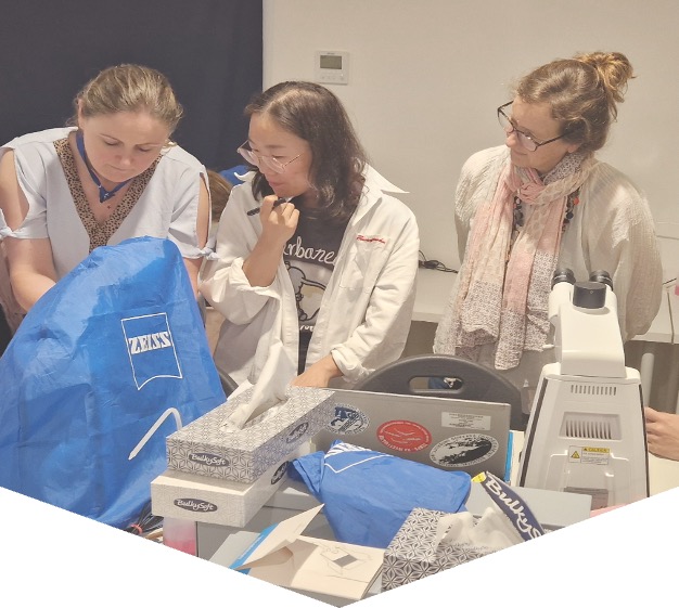
IOC Training Course and Identification Qualification in Harmful Marine Microalgae 2026
Since 1993 the IOC has conducted training courses on harmful microalgae. The purpose has been to improve the taxonomic and identification skills of the participants for research purposes and for practical monitoring of harmful algal blooms.
From 2006 the IOC training in HAB identification has been offered within a new framework which gives accreditation. The present course includes now a practical exam at the end of the course with an IOC Certificate of Proficiency in Identification of Harmful Algae issued to participants who pass the exam. We know by experience that many of the more than 500 trainees we have had over the years have wished the courses to give accreditation, and in some countries, the IOC courses have become a reference for laboratories to be approved for carrying out regulatory monitoring for harmful microalgae.
The IOC Science and Communication Centre on Harmful Algae, University of Copenhagen, Denmark is organizing the course.
IOC Training Course and Identification Qualification in Harmful Marine Microalgae 2026
Course description: The course includes 100 hours of teaching and is divided into two parts. 1) The first part of the course is organised online using the elearning platform of IOC/IODE/OceanTeacher Global Academy, giving general introductions to the various groups of harmful algae; this part is mainly for self-study and estimated to 40 hours of reading. 2) The second part is a practical course in species identification (see tentative programme below). Part 2 includes 60 hours of teaching and a microscope will be available to each participant during the entire period, see also link below.
Participants: The course is aimed at participants who have some years of practical experience in identification of microalgae. The number of participants is limited to 16. If there are more applicants than available seats, priority will be given to applicants who have direct research or management responsibilities with regard to the occurrence of harmful algae.
Dates: Part 1 will be offred through the eLearning platform of OTGA’ from October onwards; part 2 takes place onsite from 12-24 October 2026.
Venue on site: IOC Science and Communication Centre on Harmful Algae, Department of Biology, University of Copenhagen, Denmark.
Language: English.
Course lecturers: Dr. Santiago Fraga, Dr. Jacob Larsen, Dr. Nina Lundholm, Professor Øjvind Moestrup.
Enquiries may be sent to Jacob Larsen, jacobl@bio.ku.dk
Costs: The course is organized on a cost-recovery basis. The price of the course is 4500 EUR and it is a package deal, which covers all expenses during the course period, see also link below; thus
- Accommodation, arriving to the course venue on 12 October, check-in from 16.00, and check-out on 24 October at 10.00
- All meals during the course, starting with an evening meal upon arrival on 12 Oct. and finishing with breakfast on 24 Oct.
- Access to the distant learning programme on Ocean Teacher which will be available two- months prior to the practical course
- Teaching material including hard copies or pdf-versions of the following books which will be distributed during the practical part of the course:
- Lassus, P., Chomérat, N., Hess, P. & Nézan, E. 2016. Toxic and Harmful Microalgae of the World Ocean. – Denmark. International Society for the Study of Harmful Algae / Intergovernmental Oceanographic Commission of Unesco. IOC Manuals and Guides 68, 523 pp. (pdf-version)
- Hoppenrath, M., Chomérat, N., Horiguchi, T., Murray, S.A. & Rhodes, L. 2023. Marine benthic dinoflagellates – their relevance for science and society (2nd, revised edition). - Senckenberg Gesellschaft für Naturforschung, Frankfurt am Main, Germany. Senckenberg Buch vol. 88, 376 pp.
- Karlson, B., Cusack, C. & Bresnan, E. (eds). 2010. Microscopic and molecular methods fro quantitative phytoplankton analysis. – IOC Manuals and Guides 55, Paris, Unesco, 110 pp. (pdf-version)
- Larsen, J. & Nguyen, N.L. (eds). 2004. Potentially toxic microalgae of Vietnamese waters. – Opera Bot. 140: 5-216 (pdf-version)
- Reguera, B., Alonso, R., Moreira, A., Méndez, S., Dechraoui-Bottein, M.-Y. (eds). 2016. Guide for designing and implementing a plan to monotor toxin-producing microalge. 2nd ed. – IOC Gudies and Manuals 59, Intergovernmental Oceanographic Commission (IOC) of Unesco and International Atomic Energy Agency (IAEA), Paris and Vienna, 66 pp. (pdf-version)
- Proceedings from various HAB conferences (pdf-versions)
- Copies of all lectures given during the course
- Use of facilities, microscopes, samples, and cultures
- Tuition during the practical part of the course
Species identification
This part of the course will focus on identification of harmful algal species by light microscopy, with particular reference to the ‘IOC Taxonomic Reference List on Toxic Plankton Algae’. The use of electron microscopy will be introduced, but practical exercises are not included. During the course, the following species will be demonstrated either as cultures (*subject to the availability of cultures) or as preserved material.
Haptophyceae*: Chrysochromulina spp. Prymnesium spp.
Raphidophyceae*: Chattonella antiqua, C. ovata, C. subsalsa, Fibrocapsa japonica, Heterosigma akashiwo, Olisthodiscus luteus (Olisthodiscophyceae).
Dictyochophyceae*: Pseudo-chattonella verruculosa
Dinophyceae: Prorocentrum concavum, P. cordatum, P. emarginatum, P. gracile, P. obtusidens, P. hoffmannianum, P. lima, P. micans, P. rhathymum, P. rostratum, P. scutellum, P. triestenum
Dinophysis acuta, D. acuminata, D. caudata, D. fortii, D. miles, Phalacroma mitra, D. norvegica, P. rotundatum, D. tripos
Alexandrium affine, A. minutum*, A. catenella, A. ostenfeldii, A. pacificum*, A. pseudogonyaulax, A. tamarense, A. taylorii
Pyrodinium bahamense, Lingulodinium polyedrum, Protoceratium reticulatum, Gonyaulax polygramma, G. spinifera, Vulcanodinium rugosum, Gambierdiscus spp, Coolia spp., Ostreopsis spp.
Akashiwo sanguinea*, Amphidinium carterae*, Margalefidinium polykrikoides*, Gymnodinium catenatum*, G. impudicum*, Karenia mikimotoi*, K. papilionaceae*, K. selliformis*, Karlodinium armiger*, K. micrum*, Noctiluca scintillans.
Bacillariophyceae: Pseudo-nitzschia australis, P. calliantha*, P. delicatissima, P. fraudulenta, P. multiseries, P. pungens*, P. seriata, Nitzschia navis-varingica.
Cyanobacteria: Anabaena spp, Anabaenopsis spp, Aphanizomenon spp., Cylindro-spermopsis spp., Microcystis spp, Nodularia spumigena, Trichodesmium sp.
Feedback survey
At the end of the course, you will be asked to fill out a feedback survey. This information will be used to improve future courses. Note: submitting the course feedback survey is mandatory to obtain the course certificate
Certificate: A certificate of completion will be awarded to all participants who attended all classes and activities and completed the final test onsite.
Cancellation policy:
In the event of cancellation of the course by the OTGA or its affiliates, we will provide notification of cancellation at least 7 days prior to the course date. In the event of cancellation by the attendee, we should receive notification of cancellation at least 7 days prior to the course date.
OBIS KMFRI2018
Marine Biogeographic Data Management (Contributing and using OBIS)
OBIS Iran2018
Marine Biogeographic Data processing using OBIS
The course provides an introduction to the Ocean Biogeographic Information System (OBIS). This includes best practices in marine biogeographic data management, data publication, data access, data analysis and data visualisation. With the numerous datasets being generated through various projects and some old data yet to be captured in the database, this training provides an opportunity to manage this wealth of scientific knowledge.
MEDIN_APR2021
Marine Data Management, Governance and the MEDIN toolset (Apr 2021)
This training course is suitable for anyone responsible for collecting or managing marine environmental data in the public sector, industry or for education or research. Familiarity with different marine data types, and how data is acquired and used, would be helpful but not essential. Prior knowledge or practical experience of data management is not required. >The course can be taken as a whole, or attendees can select modules according to two streams: Governance; Practical MEDIN.
NOTE: The first edition of the course (19-23 April 2021) is full.
MEDIN_Aug2022
Marine Data Management, Governance and the MEDIN toolset (Aug 2022)
This free training course is suitable for anyone responsible for collecting or managing marine environmental data in the public sector, industry or for education or research. Familiarity with different marine data types, and how data is acquired and used, would be helpful but not essential. Prior knowledge or practical experience of data management is not required. The course can be taken as a whole, or attendees can select modules according to two streams: Governance; Practical MEDIN.
MEDIN_Feb2022
Marine Data Management, Governance and the MEDIN toolset (Feb 2022)
This free training course is suitable for anyone responsible for collecting or managing marine environmental data in the public sector, industry or for education or research. Familiarity with different marine data types, and how data is acquired and used, would be helpful but not essential. Prior knowledge or practical experience of data management is not required. The course can be taken as a whole, or attendees can select modules according to two streams: Governance; Practical MEDIN.
Marine Data Management, Governance and the MEDIN toolset (February 2026)
The Marine Environmental Data and Information Network (MEDIN) is a partnership of UK organisations committed to improving access to marine data. MEDIN is open to all with an interest in marine data and information. MEDIN is funded by a consortium of 16 sponsors and has over 60 partners that represent government departments and agencies, research organisations and private companies committed to practise good data management. MEDIN reports to the UK Marine Science Coordination Committee.
This ONLINE course demonstrates how data management ‘best practice’ can improve organisational efficiency in data acquisition, analysis, curation and sharing. It covers data use with respect to corporate risk, re-use, audit and traceability, whilst at the same time helping minimising costs.
The course will equip attendees to better meet the challenge of keeping on top of the ever-increasing volumes and types of data that is being created and how to manage this data and make it available to users as meaningful information, whether using proprietary or open-source software and systems as enablers.
Aims & Objectives
The course aims to give participants a broad understanding of data governance, management principles, and system components and how data can be published information and re-used with a focus on the tools that the Marine Environmental Data and Information Network (MEDIN) provides as examples of best practice.
Expected Learning Outcomes
- An understanding of MEDIN and why data management is important and how it can reduce costs, risk, and add value through extending its original purpose.
- An understanding of the fundamentals of how data is collected, managed, published and used plus how important metadata is!
- An appreciation of data management components based on the International Data Management Association Book of Knowledge (DM-BOK)
- Knowledge of the importance of metadata and practical guidance in its creation, maintenance and dissemination
- Have an appreciation of the need to use words, phrases and terms to describe or explain marine data content and to understand how controlled vocabularies are used within the MEDIN standard and guidelines
- Appreciate how geospatial data can be accurately represented
- Understand the role and value of adopting data governance and how this relates to business management and corporate governance.
- Understand what discovery metadata is, what the MEDIN discovery metadata standard is and how it is used on the MEDIN portal.
- Be able to use the online metadata editor and metadata maestro to create MEDIN compliant discovery metadata records.
- Understand the ways in which data is now published and considerations associated with sharing and re-use
- Appreciate that the MEDIN data guidelines are a tool to create consistent datasets with comprehensive metadata, that allows data to be shared, understood and reused by others with ease.
Course content
The course comprises a series of presentations, demonstrations and check-point reviews, with a large practical element to help users become familiar with:
- Why data management is important and how it can and arguably should be part of an organisations business management framework alongside quality, occupational health and safety, and information security, all of which are covered by ISO accreditation.
- The role of a data policy and management plan, and things to consider and how data can be shared, published and re-used.
- Data management principles, standards and components, including data lifecycle and quality, the role of vocabularies (or data dictionaries) and the importance of creating, maintaining and publishing metadata.
- The resources and other benefits of MEDIN and practical instruction in the use of the MEDIN data guidelines, metadata standard and controlled vocabularies.
Course modules include:
- Module 1. Course content and objectives
- Module 2. Introduction to MEDIN as an exemplar data partnership and management framework
- Module 3. Data management overview, principles and organisation
- Module 4. Data in a Business Management Framework (Policy, Planning, Review)
- Module 5. Standards Overview
- Module 6. Data management components frameworks and infrastructure
- Module 7. Practical session
- Module 8. MEDIN Data Guidelines
- Module 9. Data Sharing and Publishing
- Module 10. Course Summary
Target audience and prerequisites
This training course is suitable for anyone responsible for collecting or managing marine environmental data in the public sector, industry, or for education or research, for example:
- Existing and potential data managers who wish to gain an overview of data governance, policy and principles and/or want to learn more about using the MEDIN metadata standard data guidelines in their day to day work.
- Contractors who want to implement good data management practice and/or have been asked to supply MEDIN compliant metadata.
- Bachelors/masters/PhD students or recent graduates interested in data management best practice and adding to their professional skill set.
Pre-requisites: An understanding of marine data collection is beneficial, however no prior knowledge of MEDIN or data management is required. Familiarity with different marine data types, and how data is acquired and used, would be helpful but not essential. Prior knowledge or practical experience in data management is not required.
Language of Instruction: English
Instructors
- Roseanna Wright (MEDIN/NOC)
- Colm Walsh (MEDIN/NOC)
- Alice Rysiecki (MEDIN/NOC)
- Chloe Figueroa-Ashforth (DASSH/MBA)
- Mike Osborne (OceanWise)
Course Format and Duration
The course takes place over 5 days with online lectures delivered in live sessions (2-3 hours, with regular breaks) in the mornings (UK time) and independent-study and practical assignments in the afternoons.
Monday-Friday: approx. 09:00-12:00 GMT/BST + drop-in sessions 14:00-14:30 GMT/BST
Attendance not mandatory, sessions are recorded.
Application Process
Please self-enroll on the course on the OceanTeacher Global Academy e-Learning Platform:
The course enrolment key can be requested from the course organiser (MEDIN). Number of places is limited to 60 participants.
Contacts:
-
MEDIN: Roseanna Wright (roswri@bodc.ac.uk) (Course Organiser)
-
OTGA Secretariat: ioc.training@unesco.org
In case of need for further clarifications please use the contacts above, always using as email subject:
(Online) Marine Data Management, Governance and the MEDIN toolset, February 2026
Costs
No tuition fee.
This course is organised by MEDIN in collaboration with UNESCO IOC OceanTeacher Global Academy.
More information about MEDIN's workshops can be found on https://www.medin.org.uk/medin-workshops
Assessment and Certificates
A combination of quizzes and assignments to ensure understanding and practical application of knowledge and skills acquired during the course.
Certificates will be issues based on the required activities (chapters, quizzes and assignments) for each pathway (Governance, Practical MEDIN, or Combined) being completed.
The course has been awarded official recognition as contributing to the Continuing Professional Development (CPD) requirements of the Institute of Marine Engineering, Science and Technology’s (IMarEST’s) members.
Feedback survey:
At the end of the course, you will be asked to fill out a feedback survey. This information will be used to improve future courses.
Cancellation policy:
In the event of cancellation of the course by the OTGA or its affiliates, we will provide notification of cancellation at least 7 days prior to the course date. In the event of cancellation by the attendee, we should receive notification of cancellation at least 7 days prior to the course date.
Marine Data Management, Governance and the MEDIN toolset (February 2027)
The Marine Environmental Data and Information Network (MEDIN) is a partnership of UK organisations committed to improving access to marine data. MEDIN is open to all with an interest in marine data and information. MEDIN is funded by a consortium of 16 sponsors and has over 60 partners that represent government departments and agencies, research organisations and private companies committed to practise good data management. MEDIN reports to the UK Marine Science Coordination Committee.
This ONLINE course demonstrates how data management ‘best practice’ can improve organisational efficiency in data acquisition, analysis, curation and sharing. It covers data use with respect to corporate risk, re-use, audit and traceability, whilst at the same time helping minimising costs.
The course will equip attendees to better meet the challenge of keeping on top of the ever-increasing volumes and types of data that is being created and how to manage this data and make it available to users as meaningful information, whether using proprietary or open-source software and systems as enablers.
Aims & Objectives
The course aims to give participants a broad understanding of data governance, management principles, and system components and how data can be published information and re-used with a focus on the tools that the Marine Environmental Data and Information Network (MEDIN) provides as examples of best practice.
Expected Learning Outcomes
- An understanding of MEDIN and why data management is important and how it can reduce costs, risk, and add value through extending its original purpose.
- An understanding of the fundamentals of how data is collected, managed, published and used plus how important metadata is!
- An appreciation of data management components based on the International Data Management Association Book of Knowledge (DM-BOK)
- Knowledge of the importance of metadata and practical guidance in its creation, maintenance and dissemination
- Have an appreciation of the need to use words, phrases and terms to describe or explain marine data content and to understand how controlled vocabularies are used within the MEDIN standard and guidelines
- Appreciate how geospatial data can be accurately represented
- Understand the role and value of adopting data governance and how this relates to business management and corporate governance.
- Understand what discovery metadata is, what the MEDIN discovery metadata standard is and how it is used on the MEDIN portal.
- Be able to use the online metadata editor and metadata maestro to create MEDIN compliant discovery metadata records.
- Understand the ways in which data is now published and considerations associated with sharing and re-use
- Appreciate that the MEDIN data guidelines are a tool to create consistent datasets with comprehensive metadata, that allows data to be shared, understood and reused by others with ease.
Course content
The course comprises a series of presentations, demonstrations and check-point reviews, with a large practical element to help users become familiar with:
- Why data management is important and how it can and arguably should be part of an organisations business management framework alongside quality, occupational health and safety, and information security, all of which are covered by ISO accreditation.
- The role of a data policy and management plan, and things to consider and how data can be shared, published and re-used.
- Data management principles, standards and components, including data lifecycle and quality, the role of vocabularies (or data dictionaries) and the importance of creating, maintaining and publishing metadata.
- The resources and other benefits of MEDIN and practical instruction in the use of the MEDIN data guidelines, metadata standard and controlled vocabularies.
Course modules include:
- Module 1. Course content and objectives
- Module 2. Introduction to MEDIN as an exemplar data partnership and management framework
- Module 3. Data management overview, principles and organisation
- Module 4. Data in a Business Management Framework (Policy, Planning, Review)
- Module 5. Standards Overview
- Module 6. Data management components frameworks and infrastructure
- Module 7. Practical session
- Module 8. MEDIN Data Guidelines
- Module 9. Data Sharing and Publishing
- Module 10. Course Summary
Target audience and prerequisites
This training course is suitable for anyone responsible for collecting or managing marine environmental data in the public sector, industry, or for education or research, for example:
- Existing and potential data managers who wish to gain an overview of data governance, policy and principles and/or want to learn more about using the MEDIN metadata standard data guidelines in their day to day work.
- Contractors who want to implement good data management practice and/or have been asked to supply MEDIN compliant metadata.
- Bachelors/masters/PhD students or recent graduates interested in data management best practice and adding to their professional skill set.
Pre-requisites: An understanding of marine data collection is beneficial, however no prior knowledge of MEDIN or data management is required. Familiarity with different marine data types, and how data is acquired and used, would be helpful but not essential. Prior knowledge or practical experience in data management is not required.
Language of Instruction: English
Instructors
- Roseanna Wright (MEDIN/NOC)
-
Alice Rysiecki (MEDIN/NOC)
- Colm Walsh (MEDIN/NOC)
- Chloe Figueroa-Ashforth (DASSH/MBA)
- Julie Bunt (DASSH/MBA)
- Mike Osborne (OceanWise)
Course Format and Duration
The course takes place over 5 days with online lectures delivered in live sessions (2-3 hours, with regular breaks) in the mornings (UK time) and independent-study and practical assignments in the afternoons.
Monday-Friday: approx. 09:00-12:00 GMT/BST + drop-in sessions 14:00-14:30 GMT/BST
Attendance not mandatory, sessions are recorded.
Application Process
Please self-enroll on the course on the OceanTeacher Global Academy e-Learning Platform:
The course enrolment key can be found on the MEDIN website. Number of places is limited to 60 participants.
Contacts:
-
MEDIN: Roseanna Wright (roswri@bodc.ac.uk) (Course Organiser)
-
OTGA Secretariat: ioc.training@unesco.org
In case of need for further clarifications please use the contacts above, always using as email subject:
(Online) Marine Data Management, Governance and the MEDIN toolset, February 2027
Costs
No tuition fee.
This course is organised by MEDIN in collaboration with UNESCO IOC OceanTeacher Global Academy.
More information about MEDIN's workshops can be found on https://www.medin.org.uk/medin-workshops
Assessment and Certificates
A combination of quizzes and assignments to ensure understanding and practical application of knowledge and skills acquired during the course.
Certificates will be issues based on the required activities (chapters, quizzes and assignments) for each pathway (Governance, Practical MEDIN, or Combined) being completed.
The course has been awarded official recognition as contributing to the Continuing Professional Development (CPD) requirements of the Institute of Marine Engineering, Science and Technology’s (IMarEST’s) members.
Feedback survey:
At the end of the course, you will be asked to fill out a feedback survey. This information will be used to improve future courses.
Cancellation policy:
In the event of cancellation of the course by the OTGA or its affiliates, we will provide notification of cancellation at least 7 days prior to the course date. In the event of cancellation by the attendee, we should receive notification of cancellation at least 7 days prior to the course date.
MEDIN_Jun2024
Marine Data Management, Governance and the MEDIN toolset (Jun 2024)
This free online training course is suitable for anyone responsible for collecting or managing marine environmental data in the public sector, industry or for education or research. Familiarity with different marine data types, and how data is acquired and used, would be helpful but not essential. Prior knowledge or practical experience of data management is not required. The course can be taken as a whole, or attendees can select modules according to two streams: Governance; Practical MEDIN.
MEDIN_Mar2024
Marine Data Management, Governance and the MEDIN toolset (Mar 2024)
This free online training course is suitable for anyone responsible for collecting or managing marine environmental data in the public sector, industry or for education or research. Familiarity with different marine data types, and how data is acquired and used, would be helpful but not essential. Prior knowledge or practical experience of data management is not required. The course can be taken as a whole, or attendees can select modules according to two streams: Governance; Practical MEDIN.
MEDIN_May2023
Marine Data Management, Governance and the MEDIN toolset (May 2023)
This free online training course is suitable for anyone responsible for collecting or managing marine environmental data in the public sector, industry or for education or research. Familiarity with different marine data types, and how data is acquired and used, would be helpful but not essential. Prior knowledge or practical experience of data management is not required. The course can be taken as a whole, or attendees can select modules according to two streams: Governance; Practical MEDIN.
MEDIN_May2025
Marine Data Management, Governance and the MEDIN toolset (May 2025)
The Marine Environmental Data and Information Network (MEDIN) is a partnership of UK organisations committed to improving access to marine data. MEDIN is open to all with an interest in marine data and information. MEDIN is funded by a consortium of 16 sponsors and has over 60 partners that represent government departments and agencies, research organisations and private companies committed to practise good data management. MEDIN reports to the UK Marine Science Coordination Committee.
This ONLINE course demonstrates how data management ‘best practice’ can improve organisational efficiency in data acquisition, analysis, curation and sharing. It covers data use with respect to corporate risk, re-use, audit and traceability, whilst at the same time helping minimising costs.
The course will equip attendees to better meet the challenge of keeping on top of the ever-increasing volumes and types of data that is being created and how to manage this data and make it available to users as meaningful information, whether using proprietary or open-source software and systems as enablers.
Aims & Objectives
The course aims to give participants a broad understanding of data governance, management principles, and system components and how data can be published information and re-used with a focus on the tools that the Marine Environmental Data and Information Network (MEDIN) provides as examples of best practice.
Expected Learning Outcomes
- An understanding of MEDIN and why data management is important and how it can reduce costs, risk, and add value through extending its original purpose.
- An understanding of the fundamentals of how data is collected, managed, published and used plus how important metadata is!
- An appreciation of data management components based on the International Data Management Association Book of Knowledge (DM-BOK)
- Knowledge of the importance of metadata and practical guidance in its creation, maintenance and dissemination
- Have an appreciation of the need to use words, phrases and terms to describe or explain marine data content and to understand how controlled vocabularies are used within the MEDIN standard and guidelines
- Appreciate how geospatial data can be accurately represented
- Understand the role and value of adopting data governance and how this relates to business management and corporate governance.
- Understand what discovery metadata is, what the MEDIN discovery metadata standard is and how it is used on the MEDIN portal.
- Be able to use the online metadata editor and metadata maestro to create MEDIN compliant discovery metadata records.
- Understand the ways in which data is now published and considerations associated with sharing and re-use
- Appreciate that the MEDIN data guidelines are a tool to create consistent datasets with comprehensive metadata, that allows data to be shared, understood and reused by others with ease.
Course content
The course comprises a series of presentations, demonstrations and check-point reviews, with a large practical element to help users become familiar with:
- Why data management is important and how it can and arguably should be part of an organisations business management framework alongside quality, occupational health and safety, and information security, all of which are covered by ISO accreditation.
- The role of a data policy and management plan, and things to consider and how data can be shared, published and re-used.
- Data management principles, standards and components, including data lifecycle and quality, the role of vocabularies (or data dictionaries) and the importance of creating, maintaining and publishing metadata.
- The resources and other benefits of MEDIN and practical instruction in the use of the MEDIN data guidelines, metadata standard and controlled vocabularies.
Course modules include:
- Module 1. Course content and objectives
- Module 2. Introduction to MEDIN as an exemplar data partnership and management framework
- Module 3. Data management overview, principles and organisation
- Module 4. Data in a Business Management Framework (Policy, Planning, Review)
- Module 5. Standards Overview
- Module 6. Data management components frameworks and infrastructure
- Module 7. Practical session
- Module 8. MEDIN Data Guidelines
- Module 9. Data Sharing and Publishing
- Module 10. Course Summary
Target audience and prerequisites
This training course is suitable for anyone responsible for collecting or managing marine environmental data in the public sector, industry, or for education or research, for example:
- Existing and potential data managers who wish to gain an overview of data governance, policy and principles and/or want to learn more about using the MEDIN metadata standard data guidelines in their day to day work.
- Contractors who want to implement good data management practice and/or have been asked to supply MEDIN compliant metadata.
- Bachelors/masters/PhD students or recent graduates interested in data management best practice and adding to their professional skill set.
Pre-requisites: An understanding of marine data collection is beneficial, however no prior knowledge of MEDIN or data management is required. Familiarity with different marine data types, and how data is acquired and used, would be helpful but not essential. Prior knowledge or practical experience in data management is not required.
Language of Instruction: English
Instructors
- Roseanna Wright (MEDIN/NOC)
- Colm Walsh (MEDIN/NOC)
- Alice Rysiecki (MEDIN/NOC)
- Chloe Figueroa-Ashforth (DASSH/MBA)
- Mike Osborne (OceanWise)
Course Format and Duration
The course takes place over 5 days with online lectures delivered in live sessions (2-3 hours, with regular breaks) in the mornings (UK time) and independent-study and practical assignments in the afternoons.
Monday-Friday: approx. 09:00-12:00 GMT/BST + drop-in sessions 14:00-14:30 GMT/BST
Attendance not mandatory, sessions are recorded.
Application Process
Please self-enroll on the course on OceanTeacher:https://classroom.oceanteacher.org/course/view.php?id=1148
The course enrolment key can be requested from the course organiser (MEDIN). Number of places is limited to 60 participants.
Contacts:
MEDIN: Roseanna Wright (roswri@bodc.ac.uk) (Course Organiser)
OTGA Secretariat: ioc.training@unesco.org
In case of need for further clarifications please use the contacts above, always using as email subject:
(Online) Marine Data Management, Governance and the MEDIN toolset, 19-23 May 2025
Costs
No tuition fee.
This course is organised by MEDIN and hosted by OTGA.
More information about MEDIN's workshops can be found on https://www.medin.org.uk/medin-workshops
Assessment and Certificates
A combination of quizzes and assignments to ensure understanding and practical application of knowledge and skills acquired during the course.
Certificates will be issues based on the required activities (chapters, quizzes and assignments) for each pathway (Governance, Practical MEDIN, or Combined) being completed.
The course has been awarded official recognition as contributing to the Continuing Professional Development (CPD) requirements of the Institute of Marine Engineering, Science and Technology’s (IMarEST’s) members.
Feedback survey:
At the end of the course, you will be asked to fill out a feedback survey. This information will be used to improve future courses.
Cancellation policy:
In the event of cancellation of the course by the OTGA or its affiliates, we will provide notification of cancellation at least 7 days prior to the course date. In the event of cancellation by the attendee, we should receive notification of cancellation at least 7 days prior to the course date.
MEDIN_Nov2022
Marine Data Management, Governance and the MEDIN toolset (Nov 2022)
This free training course is suitable for anyone responsible for collecting or managing marine environmental data in the public sector, industry or for education or research. Familiarity with different marine data types, and how data is acquired and used, would be helpful but not essential. Prior knowledge or practical experience of data management is not required. The course can be taken as a whole, or attendees can select modules according to two streams: Governance; Practical MEDIN.
MEDIN_Nov2023
Marine Data Management, Governance and the MEDIN toolset (Nov 2023)
This free online training course is suitable for anyone responsible for collecting or managing marine environmental data in the public sector, industry or for education or research. Familiarity with different marine data types, and how data is acquired and used, would be helpful but not essential. Prior knowledge or practical experience of data management is not required. The course can be taken as a whole, or attendees can select modules according to two streams: Governance; Practical MEDIN.
MEDIN_Oct2025
Marine Data Management, Governance and the MEDIN toolset (October 2025)
The Marine Environmental Data and Information Network (MEDIN) is a partnership of UK organisations committed to improving access to marine data. MEDIN is open to all with an interest in marine data and information. MEDIN is funded by a consortium of 16 sponsors and has over 60 partners that represent government departments and agencies, research organisations and private companies committed to practise good data management. MEDIN reports to the UK Marine Science Coordination Committee.
This ONLINE course demonstrates how data management ‘best practice’ can improve organisational efficiency in data acquisition, analysis, curation and sharing. It covers data use with respect to corporate risk, re-use, audit and traceability, whilst at the same time helping minimising costs.
The course will equip attendees to better meet the challenge of keeping on top of the ever-increasing volumes and types of data that is being created and how to manage this data and make it available to users as meaningful information, whether using proprietary or open-source software and systems as enablers.
Aims & Objectives
The course aims to give participants a broad understanding of data governance, management principles, and system components and how data can be published information and re-used with a focus on the tools that the Marine Environmental Data and Information Network (MEDIN) provides as examples of best practice.
Expected Learning Outcomes
- An understanding of MEDIN and why data management is important and how it can reduce costs, risk, and add value through extending its original purpose.
- An understanding of the fundamentals of how data is collected, managed, published and used plus how important metadata is!
- An appreciation of data management components based on the International Data Management Association Book of Knowledge (DM-BOK)
- Knowledge of the importance of metadata and practical guidance in its creation, maintenance and dissemination
- Have an appreciation of the need to use words, phrases and terms to describe or explain marine data content and to understand how controlled vocabularies are used within the MEDIN standard and guidelines
- Appreciate how geospatial data can be accurately represented
- Understand the role and value of adopting data governance and how this relates to business management and corporate governance.
- Understand what discovery metadata is, what the MEDIN discovery metadata standard is and how it is used on the MEDIN portal.
- Be able to use the online metadata editor and metadata maestro to create MEDIN compliant discovery metadata records.
- Understand the ways in which data is now published and considerations associated with sharing and re-use
- Appreciate that the MEDIN data guidelines are a tool to create consistent datasets with comprehensive metadata, that allows data to be shared, understood and reused by others with ease.
Course content
The course comprises a series of presentations, demonstrations and check-point reviews, with a large practical element to help users become familiar with:
- Why data management is important and how it can and arguably should be part of an organisations business management framework alongside quality, occupational health and safety, and information security, all of which are covered by ISO accreditation.
- The role of a data policy and management plan, and things to consider and how data can be shared, published and re-used.
- Data management principles, standards and components, including data lifecycle and quality, the role of vocabularies (or data dictionaries) and the importance of creating, maintaining and publishing metadata.
- The resources and other benefits of MEDIN and practical instruction in the use of the MEDIN data guidelines, metadata standard and controlled vocabularies.
Course modules include:
- Module 1. Course content and objectives
- Module 2. Introduction to MEDIN as an exemplar data partnership and management framework
- Module 3. Data management overview, principles and organisation
- Module 4. Data in a Business Management Framework (Policy, Planning, Review)
- Module 5. Standards Overview
- Module 6. Data management components frameworks and infrastructure
- Module 7. Practical session
- Module 8. MEDIN Data Guidelines
- Module 9. Data Sharing and Publishing
- Module 10. Course Summary
Target audience and prerequisites
This training course is suitable for anyone responsible for collecting or managing marine environmental data in the public sector, industry, or for education or research, for example:
- Existing and potential data managers who wish to gain an overview of data governance, policy and principles and/or want to learn more about using the MEDIN metadata standard data guidelines in their day to day work.
- Contractors who want to implement good data management practice and/or have been asked to supply MEDIN compliant metadata.
- Bachelors/masters/PhD students or recent graduates interested in data management best practice and adding to their professional skill set.
Pre-requisites: An understanding of marine data collection is beneficial, however no prior knowledge of MEDIN or data management is required. Familiarity with different marine data types, and how data is acquired and used, would be helpful but not essential. Prior knowledge or practical experience in data management is not required.
Language of Instruction: English
Instructors
- Roseanna Wright (MEDIN/NOC)
- Colm Walsh (MEDIN/NOC)
- Alice Rysiecki (MEDIN/NOC)
- Julie Bunt (DASSH/MBA)
- Mike Osborne (OceanWise)
Course Format and Duration
The course takes place over 5 days with online lectures delivered in live sessions (2-3 hours, with regular breaks) in the mornings (UK time) and independent-study and practical assignments in the afternoons.
Monday-Friday: approx. 09:00-12:00 GMT/BST + drop-in sessions 14:00-14:30 GMT/BST
Attendance not mandatory, sessions are recorded.
Application Process
Please self-enroll on the course on OceanTeacher:https://classroom.oceanteacher.org/course/view.php?id=1164
The course enrolment key can be requested from the course organiser (MEDIN). Number of places is limited to 60 participants.
Contacts:
-
MEDIN: Roseanna Wright (roswri@noc.ac.uk) (Course Organiser)
-
OTGA Secretariat: ioc.training@unesco.org
In case of need for further clarifications please use the contacts above, always using as email subject:
(Online) Marine Data Management, Governance and the MEDIN toolset, 13-17 October 2025
Costs
No tuition fee.
This course is organised by MEDIN and hosted by OTGA.
More information about MEDIN's workshops can be found on https://www.medin.org.uk/medin-workshops
Assessment and Certificates
A combination of quizzes and assignments to ensure understanding and practical application of knowledge and skills acquired during the course.
Certificates will be issues based on the required activities (chapters, quizzes and assignments) for each pathway (Governance, Practical MEDIN, or Combined) being completed.
The course has been awarded official recognition as contributing to the Continuing Professional Development (CPD) requirements of the Institute of Marine Engineering, Science and Technology’s (IMarEST’s) members.
Feedback survey:
At the end of the course, you will be asked to fill out a feedback survey. This information will be used to improve future courses.
Cancellation policy:
In the event of cancellation of the course by the OTGA or its affiliates, we will provide notification of cancellation at least 7 days prior to the course date. In the event of cancellation by the attendee, we should receive notification of cancellation at least 7 days prior to the course date.
Marine Data Management, Governance and the MEDIN toolset (October 2026)
The Marine Environmental Data and Information Network (MEDIN) is a partnership of UK organisations committed to improving access to marine data. MEDIN is open to all with an interest in marine data and information. MEDIN is funded by a consortium of 16 sponsors and has over 60 partners that represent government departments and agencies, research organisations and private companies committed to practise good data management. MEDIN reports to the UK Marine Science Coordination Committee.
This ONLINE course demonstrates how data management ‘best practice’ can improve organisational efficiency in data acquisition, analysis, curation and sharing. It covers data use with respect to corporate risk, re-use, audit and traceability, whilst at the same time helping minimising costs.
The course will equip attendees to better meet the challenge of keeping on top of the ever-increasing volumes and types of data that is being created and how to manage this data and make it available to users as meaningful information, whether using proprietary or open-source software and systems as enablers.
Aims & Objectives
The course aims to give participants a broad understanding of data governance, management principles, and system components and how data can be published information and re-used with a focus on the tools that the Marine Environmental Data and Information Network (MEDIN) provides as examples of best practice.
Expected Learning Outcomes
- An understanding of MEDIN and why data management is important and how it can reduce costs, risk, and add value through extending its original purpose.
- An understanding of the fundamentals of how data is collected, managed, published and used plus how important metadata is!
- An appreciation of data management components based on the International Data Management Association Book of Knowledge (DM-BOK)
- Knowledge of the importance of metadata and practical guidance in its creation, maintenance and dissemination
- Have an appreciation of the need to use words, phrases and terms to describe or explain marine data content and to understand how controlled vocabularies are used within the MEDIN standard and guidelines
- Appreciate how geospatial data can be accurately represented
- Understand the role and value of adopting data governance and how this relates to business management and corporate governance.
- Understand what discovery metadata is, what the MEDIN discovery metadata standard is and how it is used on the MEDIN portal.
- Be able to use the online metadata editor and metadata maestro to create MEDIN compliant discovery metadata records.
- Understand the ways in which data is now published and considerations associated with sharing and re-use
- Appreciate that the MEDIN data guidelines are a tool to create consistent datasets with comprehensive metadata, that allows data to be shared, understood and reused by others with ease.
Course content
The course comprises a series of presentations, demonstrations and check-point reviews, with a large practical element to help users become familiar with:
- Why data management is important and how it can and arguably should be part of an organisations business management framework alongside quality, occupational health and safety, and information security, all of which are covered by ISO accreditation.
- The role of a data policy and management plan, and things to consider and how data can be shared, published and re-used.
- Data management principles, standards and components, including data lifecycle and quality, the role of vocabularies (or data dictionaries) and the importance of creating, maintaining and publishing metadata.
- The resources and other benefits of MEDIN and practical instruction in the use of the MEDIN data guidelines, metadata standard and controlled vocabularies.
Course modules include:
- Module 1. Course content and objectives
- Module 2. Introduction to MEDIN as an exemplar data partnership and management framework
- Module 3. Data management overview, principles and organisation
- Module 4. Data in a Business Management Framework (Policy, Planning, Review)
- Module 5. Standards Overview
- Module 6. Data management components frameworks and infrastructure
- Module 7. Practical session
- Module 8. MEDIN Data Guidelines
- Module 9. Data Sharing and Publishing
- Module 10. Course Summary
Target audience and prerequisites
This training course is suitable for anyone responsible for collecting or managing marine environmental data in the public sector, industry, or for education or research, for example:
- Existing and potential data managers who wish to gain an overview of data governance, policy and principles and/or want to learn more about using the MEDIN metadata standard data guidelines in their day to day work.
- Contractors who want to implement good data management practice and/or have been asked to supply MEDIN compliant metadata.
- Bachelors/masters/PhD students or recent graduates interested in data management best practice and adding to their professional skill set.
Pre-requisites: An understanding of marine data collection is beneficial, however no prior knowledge of MEDIN or data management is required. Familiarity with different marine data types, and how data is acquired and used, would be helpful but not essential. Prior knowledge or practical experience in data management is not required.
Language of Instruction: English
Instructors
- Roseanna Wright (MEDIN/NOC)
-
Alice Rysiecki (MEDIN/NOC)
- Colm Walsh (MEDIN/NOC)
- Chloe Figueroa-Ashforth (DASSH/MBA)
- Julie Bunt (DASSH/MBA)
- Mike Osborne (OceanWise)
Course Format and Duration
The course takes place over 5 days with online lectures delivered in live sessions (2-3 hours, with regular breaks) in the mornings (UK time) and independent-study and practical assignments in the afternoons.
Monday-Friday: approx. 09:00-12:00 GMT/BST + drop-in sessions 14:00-14:30 GMT/BST
Attendance not mandatory, sessions are recorded.
Application Process
Please self-enroll on the course on the OceanTeacher Global Academy e-Learning Platform:
The course enrolment key can be found on the MEDIN website. Number of places is limited to 60 participants.
Contacts:
-
MEDIN: Roseanna Wright (roswri@bodc.ac.uk) (Course Organiser)
-
OTGA Secretariat: ioc.training@unesco.org
In case of need for further clarifications please use the contacts above, always using as email subject:
(Online) Marine Data Management, Governance and the MEDIN toolset, October 2026
Costs
No tuition fee.
This course is organised by MEDIN in collaboration with UNESCO IOC OceanTeacher Global Academy.
More information about MEDIN's workshops can be found on https://www.medin.org.uk/medin-workshops
Assessment and Certificates
A combination of quizzes and assignments to ensure understanding and practical application of knowledge and skills acquired during the course.
Certificates will be issues based on the required activities (chapters, quizzes and assignments) for each pathway (Governance, Practical MEDIN, or Combined) being completed.
The course has been awarded official recognition as contributing to the Continuing Professional Development (CPD) requirements of the Institute of Marine Engineering, Science and Technology’s (IMarEST’s) members.
Feedback survey:
At the end of the course, you will be asked to fill out a feedback survey. This information will be used to improve future courses.
Cancellation policy:
In the event of cancellation of the course by the OTGA or its affiliates, we will provide notification of cancellation at least 7 days prior to the course date. In the event of cancellation by the attendee, we should receive notification of cancellation at least 7 days prior to the course date.
MEDIN_SEP2021
Marine Data Management, Governance and the MEDIN toolset (Sep 2021)
This free training course is suitable for anyone responsible for collecting or managing marine environmental data in the public sector, industry or for education or research. Familiarity with different marine data types, and how data is acquired and used, would be helpful but not essential. Prior knowledge or practical experience of data management is not required. The course can be taken as a whole, or attendees can select modules according to two streams: Governance; Practical MEDIN.
NOTE: This is edition September 2021
MEDIN_Sep2023
Marine Data Management, Governance and the MEDIN toolset (Sep 2023)
This free online training course is suitable for anyone responsible for collecting or managing marine environmental data in the public sector, industry or for education or research. Familiarity with different marine data types, and how data is acquired and used, would be helpful but not essential. Prior knowledge or practical experience of data management is not required. The course can be taken as a whole, or attendees can select modules according to two streams: Governance; Practical MEDIN.
MEDIN_Sep2024
Marine Data Management, Governance and the MEDIN toolset (Sep 2024)
This free online training course is suitable for anyone responsible for collecting or managing marine environmental data in the public sector, industry or for education or research. Familiarity with different marine data types, and how data is acquired and used, would be helpful but not essential. Prior knowledge or practical experience of data management is not required. The course can be taken as a whole, or attendees can select modules according to two streams: Governance; Practical MEDIN.
Marine Data Management, Governance and the MEDIN toolset (September 2026)
The Marine Environmental Data and Information Network (MEDIN) is a partnership of UK organisations committed to improving access to marine data. MEDIN is open to all with an interest in marine data and information. MEDIN is funded by a consortium of 16 sponsors and has over 60 partners that represent government departments and agencies, research organisations and private companies committed to practice good data management. MEDIN reports to the UK Marine Science Coordination Committee.
This ONLINE course demonstrates how data management ‘best practice’ can improve organisational efficiency in data acquisition, analysis, curation and sharing. It covers data use with respect to corporate risk, re-use, audit and traceability, whilst at the same time helping minimising costs.
The course will equip attendees to better meet the challenge of keeping on top of the ever-increasing volumes and types of data that is being created and how to manage this data and make it available to users as meaningful information, whether using proprietary or open-source software and systems as enablers.
Aims & Objectives
The course aims to give participants a broad understanding of data governance, management principles, and system components and how data can be published information and re-used with a focus on the tools that the Marine Environmental Data and Information Network (MEDIN) provides as examples of best practice.
Expected Learning Outcomes
- An understanding of MEDIN and why data management is important and how it can reduce costs, risk, and add value through extending its original purpose.
- An understanding of the fundamentals of how data is collected, managed, published and used plus how important metadata is!
- An appreciation of data management components based on the International Data Management Association Book of Knowledge (DM-BOK)
- Knowledge of the importance of metadata and practical guidance in its creation, maintenance and dissemination
- Have an appreciation of the need to use words, phrases and terms to describe or explain marine data content and to understand how controlled vocabularies are used within the MEDIN standard and guidelines
- Appreciate how geospatial data can be accurately represented
- Understand the role and value of adopting data governance and how this relates to business management and corporate governance.
- Understand what discovery metadata is, what the MEDIN discovery metadata standard is and how it is used on the MEDIN portal.
- Be able to use the online metadata editor and metadata maestro to create MEDIN compliant discovery metadata records.
- Understand the ways in which data is now published and considerations associated with sharing and re-use
- Appreciate that the MEDIN data guidelines are a tool to create consistent datasets with comprehensive metadata, that allows data to be shared, understood and reused by others with ease.
Course content
The course comprises a series of presentations, demonstrations and check-point reviews, with a large practical element to help users become familiar with:
- Why data management is important and how it can and arguably should be part of an organisations business management framework alongside quality, occupational health and safety, and information security, all of which are covered by ISO accreditation.
- The role of a data policy and management plan, and things to consider and how data can be shared, published and re-used.
- Data management principles, standards and components, including data lifecycle and quality, the role of vocabularies (or data dictionaries) and the importance of creating, maintaining and publishing metadata.
- The resources and other benefits of MEDIN and practical instruction in the use of the MEDIN data guidelines, metadata standard and controlled vocabularies.
Course modules include:
- Module 1. Course content and objectives
- Module 2. Introduction to MEDIN as an exemplar data partnership and management framework
- Module 3. Data management overview, principles and organisation
- Module 4. Data in a Business Management Framework (Policy, Planning, Review)
- Module 5. Standards Overview
- Module 6. Data management components frameworks and infrastructure
- Module 7. Practical session
- Module 8. MEDIN Data Guidelines
- Module 9. Data Sharing and Publishing
- Module 10. Course Summary
Target audience and prerequisites
This training course is suitable for anyone responsible for collecting or managing marine environmental data in the public sector, industry, or for education or research, for example:
- Existing and potential data managers who wish to gain an overview of data governance, policy and principles and/or want to learn more about using the MEDIN metadata standard data guidelines in their day to day work.
- Contractors who want to implement good data management practice and/or have been asked to supply MEDIN compliant metadata.
- Bachelors/masters/PhD students or recent graduates interested in data management best practice and adding to their professional skill set.
Pre-requisites: An understanding of marine data collection is beneficial, however no prior knowledge of MEDIN or data management is required. Familiarity with different marine data types, and how data is acquired and used, would be helpful but not essential. Prior knowledge or practical experience in data management is not required.
Language of Instruction: English
Instructors
-
Alice Rysiecki (MEDIN/NOC)
- Colm Walsh (MEDIN/NOC)
- Chloe Figueroa-Ashforth (DASSH/MBA)
- Julie Bunt (DASSH/MBA)
- Mike Osborne (OceanWise)
Course Format and Duration
The course takes place over 5 days with online lectures delivered in live sessions (2-3 hours, with regular breaks) in the mornings (UK time) and independent-study and practical assignments in the afternoons.
Monday-Friday: approx. 09:00-12:00 GMT/BST + drop-in sessions 14:00-14:30 GMT/BST
Attendance not mandatory, sessions are recorded.
Application Process
Please self-enroll on the course on the OceanTeacher Global Academy e-Learning Platform:
The course enrolment key can be found on the MEDIN website. Number of places is limited to 60 participants.
Contacts:
-
MEDIN: Alice Rysiecki (alirys@noc.ac.uk) (Course Organiser)
-
OTGA Secretariat: ioc.training@unesco.org
In case of need for further clarifications please use the contacts above, always using as email subject:
(Online) Marine Data Management, Governance and the MEDIN toolset, September 2026
Costs
No tuition fee.
This course is organised by MEDIN in collaboration with UNESCO IOC OceanTeacher Global Academy.
More information about MEDIN's workshops can be found on https://www.medin.org.uk/medin-workshops
Assessment and Certificates
A combination of quizzes and assignments to ensure understanding and practical application of knowledge and skills acquired during the course.
Certificates will be issues based on the required activities (chapters, quizzes and assignments) for each pathway (Governance, Practical MEDIN, or Combined) being completed.
The course has been awarded official recognition as contributing to the Continuing Professional Development (CPD) requirements of the Institute of Marine Engineering, Science and Technology’s (IMarEST’s) members.
Feedback survey:
At the end of the course, you will be asked to fill out a feedback survey. This information will be used to improve future courses.
Cancellation policy:
In the event of cancellation of the course by the OTGA or its affiliates, we will provide notification of cancellation at least 7 days prior to the course date. In the event of cancellation by the attendee, we should receive notification of cancellation at least 7 days prior to the course date.
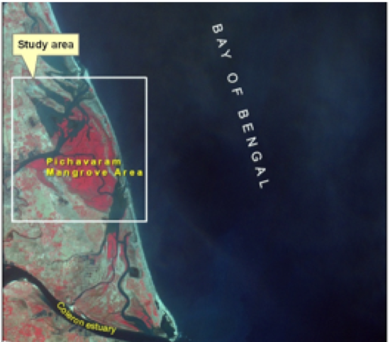
MGISCZM2017
Marine GIS Applications for Coastal Zone Management
This course provides an overview and hands on GIS applications pertaining to coastal zone using ArcGIS software. This comprises the data acquisition, processing, analysis and interpretation of spatial data. The applications of this course are aimed at producing inputs useful for the coastal zone management.
Aims and Objectives
•To provide an introduction to GIS for marine applications
•Utilization of open source spatial data
•To provide hands on GIS applications pertaining to the coastal zone
Learning Outcomes
•Knowledge and understanding of GIS, spatial data, raster and vector models
•Core tasks involved in the GIS analysis process including data acquisition, manipulation and analysis, and presentation and output
•Core functionality of ArcMap, Arc Catalogue and Arc Toolbox
•Creating and editing spatial data
•Awareness of coastal GIS data and applications
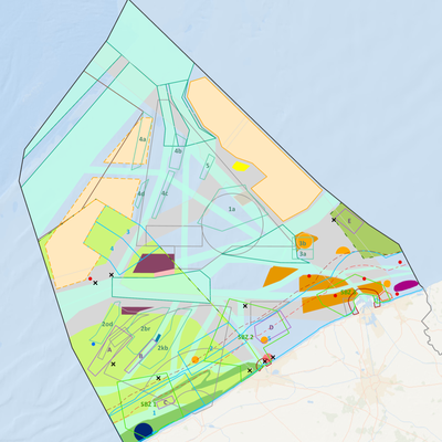
MGISICZM2018BE
Marine GIS Applications for Integrated Coastal Zone Management
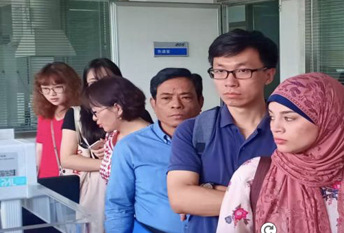
MIT2023
Marine Information Technologies
ERASMUSMARIS-26Spain
Monitoring microplastic pollution in coastal waters: From sampling and analysis to data
Summary
This blended training course, titled in Spanish “Monitoreo de la contaminación por microplásticos en aguas costeras: del muestreo y análisis a los datos”, aims to build the capacity of upper secondary school teachers and boat operators in the Comunidad Valenciana to participate in harmonised microplastic monitoring in coastal waters through the Erasmus Maris initiative.
The course combines online theoretical learning with practical field, laboratory, and data-management training. Participants will learn the full monitoring chain: understanding microplastic pollution in aquatic environments, collecting surface-water samples using a manta net, processing and analysing samples in the laboratory following standard operating procedures, applying quality assurance and quality control principles, managing data and metadata, and uploading validated information to the MARIS database.
The course is designed to empower teachers to implement microplastic monitoring activities with their students and to contribute to a wider citizen-science and environmental monitoring network. Boat operators will be trained to support safe and harmonised sampling operations at sea. The training includes online lessons and quizzes, practical laboratory work with reference material, boat-based sampling demonstrations, and hands-on use of the MARIS data portal.
Participants will learn the full monitoring chain: understanding microplastic pollution in aquatic environments, collecting surface-water samples using a manta net, processing and analysing samples in the laboratory following standard operating procedures, applying quality assurance and quality control principles, managing data and metadata, and uploading validated information to the MARIS database.
The course is organised by ASE / Ayam Sailing Europe and the University of Alicante, implemented in the framework of the Erasmus Maris initiative, with the support of the UNESCO IOC OceanTeacher Global Academy (OTGA).
Needs and priorities
Microplastic pollution is a growing environmental concern in coastal and marine environments. Reliable monitoring requires harmonised sampling, analysis, data management, and quality-control procedures. At the same time, effective microplastic monitoring requires data collection over wider geographical areas and repeated time periods, which is difficult to achieve through conventional scientific monitoring alone. Citizen science can help address this gap by expanding monitoring capacity through trained local actors. Schools and teachers are especially relevant in this context: once trained, teachers can support recurring monitoring activities with students, embed ocean literacy and environmental science into education, and contribute harmonised data and metadata to a shared monitoring system. Local maritime actors further strengthen the approach by supporting safe and standardised sampling operations.
This course responds to the need for practical capacity development in coastal microplastic monitoring in Spain, with a specific focus on the Comunidad Valenciana. The training supports teachers and boat operators to become local actors in a structured monitoring system. By combining scientific protocols with educational implementation, the course strengthens the capacity of schools to contribute to ocean literacy, citizen science, and evidence-based environmental action.
The course contributes to IOC capacity development priorities by:
- providing applied training for teachers and local operators;
- supporting access to standardised scientific methods and digital tools;
- promoting ocean literacy and environmental education in secondary schools;
- strengthening local capacity to generate comparable environmental data;
- supporting the use of harmonised data and metadata systems for future integration with wider marine data infrastructures.
The course also supports the objectives of the Erasmus Maris initiative by preparing teachers and local partners to collect, analyse, document, and upload microplastic monitoring data following common procedures.
Format and Duration
This is a blended course combining online self-paced learning with two days of synchronous practical training.
Online component (self-paced)
Lessons and quizzes on microplastic pollution, sampling and analysis methods, standard operating procedures, data management, unique identifiers, and MARIS/EMODnet integration. Approximately 4 hours. Participants may complete the online quizzes during or after the practical training days.
Onsite practical training:
- Day 1 - 22 May 2026, 16:00–20:00 CEST: Laboratory training and MARIS database/data-entry training. Venue: IES LA MAR, Jávea, Spain.
- Day 2 - 23 May 2026, 09:30–13:30 CEST: Manta-net sampling practice, online course/quizzes, and final debriefing. Venues: Club Náutico Dénia and IES Sorts de la Mar, Dénia, Spain.
Total estimated workload: approximately 14 hours (10 hours synchronous + 4 hours asynchronous).
⚠️ Attendance at both practical sessions is mandatory for certification.
Venue
- IES LA MAR, Jávea, Spain - laboratory training
- Club Náutico Dénia, Dénia, Spain - boat-based manta-net sampling
- IES Sorts de la Mar, Dénia, Spain - online quizzes and computer-based work
Language of Instruction: Spanish. The online lessons and quizzes are currently in English; a Spanish translation may be made available before the course.
Learning Outcomes
Upon successful completion of the course, participants will be able to:
- Explain the main sources, pathways, and environmental relevance of microplastic pollution in aquatic and coastal environments
- Describe how microplastics are distributed in surface waters and sediments, and why harmonised monitoring is needed
- Apply the Erasmus Maris manta-net sampling protocol for surface-water microplastic monitoring
- Record essential sampling metadata including GPS coordinates, environmental conditions, sea state, and sampling duration
- Process microplastic samples in the laboratory following the Erasmus Maris standard operating procedure
- Carry out main laboratory steps: sample preparation, digestion, density separation, filtration, visual counting, and optional Nile Red staining
- Understand the purpose of reference material and QA/QC checks
- Use the MARIS database and data portal to enter monitoring data and metadata in a structured way
- Explain the importance of unique identifiers, standardised formats, and traceability for environmental data management
- Implement Erasmus Maris / M.A.R.I.S. monitoring activities with students and local partners after the course
Course Content
Online
- Definition of microplastics and distinction between primary and secondary microplastics
- Microplastics in aquatic environments: transport, distribution, density, and accumulation
- Pathways through which microplastics enter aquatic environments
- Sampling and analysis methods for microplastic assessment
- Standard operating procedures for microplastic analysis
- Challenges of integrating data from multiple sources
- Data management approaches: Back-End Consolidation and Front-End Responsibility
- Unique identifiers and data structure in the MARIS monitoring system
- Integration of MARIS data into wider marine data systems, including EMODnet
Onsite
- Welcome and group distribution
- Delivery and explanation of sampling protocols
- Boat-based manta-net sampling demonstration and practice
- Recording of sampling metadata and environmental conditions
- Laboratory training and MARIS database/data-entry training
- Introduction to the UNESCO/OTGA online microplastics course and quizzes
- Final debriefing and explanation of next steps for certification and post-course monitoring
Target Audience
The course is primarily designed for upper secondary school teachers from the Comunidad Valenciana, Spain, interested in implementing microplastic monitoring activities with their students. A small group of boat operators supporting sampling activities are also included.
Expected participants: approximately 60 upper secondary school teachers and approximately 4 boat operators.
Basic science background recommended. No advanced laboratory experience required.
Organizers
- ASE / Ayam Sailing Europe
- University of Alicante
Implemented in the framework of the Erasmus Maris initiative, with the support of the UNESCO IOC OceanTeacher Global Academy (OTGA).
Facilitators
- Kamel Labibes - Ayam Sailing Europe (ASE)
- Carlos Sanz Lázaro - University of Alicante
- Raquel Sánchez Romero - University of Alicante
- Alba Benito Kaesbach - University of Alicante
- Antonia Trompeta - ASE / Ayam Sailing Europe, Erasmus Maris Educational Network Coordinator, Valencian Community
Registration, Costs, and Technological Requirements
There are no tuition fees for participants. Travel, accommodation, and any personal costs are the responsibility of participants or their institutions.
Participants need access to:
- A computer or tablet for online lessons and quizzes
- A web browser and ability to use an online learning platform
- Basic familiarity with spreadsheets or data-entry forms (useful but not mandatory)
- A smartphone or GPS-enabled device (useful for recording coordinates during sampling)
- Access to the MARIS data portal
No advanced software installation is required.
UNESCO is committed to promoting equal access principles. Applications from minority or underrepresented groups are strongly encouraged.
Assessment & Certificate
- To receive the certificate, participants must:
- Attend the mandatory practical sessions on 22 and 23 May 2026
- Complete the required online lessons and quizzes
- Actively participate in sampling, laboratory, and data-management activities
- Follow the Erasmus Maris sampling and analysis SOPs
- Correctly process and analyse reference samples within an accepted recovery range
- Correctly upload complete data and metadata to the MARIS database
- Complete the mandatory course evaluation/feedback form
Contacts
For course organisation, please contact: Dr Kamel Labibes - coordination@ayamsailing.eu
For additional questions, please contact the OTGA Secretariat (ioc.training@unesco.org), always using the name of the course as email subject.
Cancellation Policy
In the event of cancellation of the course by the OTGA or its affiliates, we will provide notification of cancellation at least 7 days prior to the course date. In the event of cancellation by the attendee, we should receive notification of cancellation at least 7 days prior to the course date.

OODM-MSP2026en
MSPglobal course on ocean observations and data management for MSP (ENGLISH)
This online self-paced course aims to support ocean practitioners in understanding how effective data management and ocean observations underpin evidence-based Marine/Maritime Spatial Planning (MSP). It highlights the critical role that reliable, accessible, and well-managed data play in informing planning processes, supporting decision-making, and enabling sustainable use of marine and coastal areas.
Building on internationally recognized practices and guidance developed by the Intergovernmental Oceanographic Commission (IOC) of UNESCO and MSPglobal initiative, this course introduces fundamental concepts of data, metadata, and data management relevant to MSP, and suggests relevant tools and services for MSP practitioners. Participants will explore the role of Spatial Data Infrastructures (SDIs) as key enablers for data sharing, interoperability, and collaboration, and will examine why SDIs are particularly beneficial for MSP initiatives. Practical insights are provided on how SDIs can be established, maintained, and continuously improved to meet evolving planning needs.
Additionally, the course introduces key elements of ocean observations and their relevance for MSP, including an overview of observation systems, data types, and monitoring approaches. The basics of Essential Ocean Variables (EOVs) and Essential Climate Variables (ECVs) are also included, explaining how these standardized variables support consistent, comparable, and policy-relevant information for marine planning. Participants will learn how to identify, access, and assess suitable ocean observation data to support specific MSP objectives and contexts. The course also highlights emerging trends and future directions in data management, SDIs, and ocean observations, and discusses implications for the evolving practice of MSP.
Needs and priority
There is increasing demand from IOC Member States and regions for practical guidance on how ocean observations and data management can be effectively applied within Marine/Maritime Spatial Planning (MSP) processes. Many MSP initiatives continue to face challenges related to limited access to reliable and interoperable marine data, fragmented data management systems, and insufficient capacity to translate ocean observations into planning-relevant information. Addressing these gaps is critical to support evidence-based MSP.
This course responds to these needs by strengthening capacities in ocean observation and data management as essential enablers of MSP. It supports IOC Programmes and regional priorities by promoting internationally recognized standards, tools, and guidance developed by the IOC and the MSPglobal initiative, including the use of Spatial Data Infrastructures (SDIs), Essential Ocean Variables (EOVs), and Essential Climate Variables (ECVs). By building foundational knowledge and practical understanding, the course enhances the ability of practitioners to identify, access, and apply suitable data for MSP in diverse national and regional contexts.
The course directly contributes to the IOC Capacity Development Strategy by providing accessible, self-paced training through the OceanTeacher Global Academy, enabling broad participation across regions and supporting equitable access to capacity development opportunities, particularly for capacity-constrained Member States.
The course contributes to the achievement of all IOC’s high-level objectives, in particular Objective 1: Heathy ocean and sustained ocean ecosystem services; Objective 3: Resilience to climate change and contribution to its mitigation and Objective 4: Scientifically-founded services for the sustainable ocean economy. It also directly contribute to the strategic objectives of the IOC-Wide Strategy on Sustainable Ocean Planning and Management (2025–2030) and the objectives of the IOC Strategic Plan for Ocean Data and Information Management (2023–2029).
Format and Duration
This is a self-paced online course, comprising various learning resources, activities and assessments, with a total of 25 hours estimated for completion.
Language of instruction: English
Learning outcomes
After successfully completing this course, learners will:
- Explain the role of ocean observation and data in supporting evidence-based Marine Spatial Planning.
- Identify key types of environmental, socio-economic, and spatial data used in MSP processes.
- Understand core principles of data management, including FAIR, CARE, and TRUST frameworks.
- Describe how spatial data infrastructures (SDIs) enable the organisation, sharing, and use of marine data.
- Recognise the main ocean observation platforms, technologies, and essential variables used to monitor marine environments.
- Apply ocean observation data to support planning processes, including analysis, scenario development, and decision-support tools.
- Understand how emerging technologies, such as digital twins, big data, and artificial intelligence, are transforming ocean data analysis.
- Recognise the importance of collaboration, data sharing, and global observation networks in strengthening MSP and sustainable ocean governance.
Course content
The course is composed of four online modules:
Module 1: Introduction to data and its importance to MSP
This module provides an introduction to MSP context, including the role of data in ocean management, fundamental data management principles and practices, the basics of spatial data, and principles of data security and responsible data sharing.
Module 2: Spatial Data Infrastructure for MSP
This module introduces Spatial Data Infrastructures and their role in supporting MSP, including its main components, creation and maintenance, institutional arrangements, stakeholder engagement, and capacity development.
Module 3: Ocean Observations for MSP
This module provides a comprehensive overview of ocean observation and its integration into MSP, within ocean data collection, management, coordination, and application to support evidence-based decisions. It also includes key concepts, technologies, frameworks, and practical aspects.
Module 4: Emerging trends in ocean observation for MSP
This module covers emerging topics of global importance, such as advances in sensor technology and autonomous systems applications, data availability and resolution, the Digital Twins of the Ocean, big data and artificial intelligence, global cooperation, transboundary marine spatial planning, and emerging ocean industries data.
Target audience
Delivered as a self-paced online course with open enrollments, this training is designed for practitioners working in the technical context of ocean and coastal data management, Spatial Data Infrastructures (SDI), and Ocean Observations within Marine Spatial Planning (MSP) initiatives. This includes data and information managers, Geographical Information System (GIS) specialists, ocean observation professionals, technical advisors, and planners with a strong data and analytical role. The course provides a shared learning framework that strengthens technical capacity and data literacy for MSP, contributing to MSPglobal’s vision of a well-informed, connected, and evidence-driven global community of MSP practitioners and stakeholders.
Pre-requisites:
- Basic understanding of the concept of data and data management.
- Basic knowledge of ocean data.
- Basic computer literacy.
- Good English working knowledge.
Organizers
This course was developed by MSPglobal, through IOC’s Marine Policy and Regional Coordination Section, Ocean Observations and Services Section, and the International Oceanographic Data & Information Exchange Programme.
Facilitators
This course was developed by:
- Annette Scheffer [OE profile]
- Niccolò Bassan [OE profile]
- Michele Quesada da Silva [OE profile]
We also acknowledge the contribution of different experts:
- Andrej Abramic [OE profile]
- Carolina García Valencia [OE profile]
- Dawn Wright [OE profile]
- Louis Demargne [OE profile]
- Manuel Frias [OE profile]
- Maeva Tesan [OE profile]
- Nathalie Tonné [OE profile]
- Pascal Derycke [OE profile]
- Stefano Menegon [OE profile]
- Veronica Nieves [OE profile]
Registration, costs, and technological requirements
This course is offered on a continuous basis, with open registrations as yearly cohorts, with no tuition fees.
To follow this course, participants shall have:
-
Access to a computer or mobile device with Windows, Android, or Mac OS.
-
Latest version of either Chrome, Edge, Firefox or Safari web browsers, with JavaScript and cookies enabled
-
Broadband internet access (minimum bandwidth of 0.5 Mbps (Receive and Send)
-
Audio speakers or headphones
-
Basic computer skills, such as finding resources through search engines and the ability to be self-directed in learning new technology skills (e.g. following a step-by-step tutorial, online video help, or access to support to learn necessary skills)
How to enroll:
Enrolment is available from 7 April 2026, for this yearly cohort.
To access this course, you must register on the OceanExpert (www.oceanexpert.org) and have an individual account approved (this is not done immediately). Once your OceanExpert account is activated, you must:
- Log in OTGA e-Learning Platform, using your OceanExpert username and password; and
- Register with the enrolment key: IOCoodm-2026
Assessment & Certificate
This is a self-taught course that includes quizzes designed to help learners assess their own learning at regular intervals. In order to successfully complete the course and award a Certificate at the end, the following is mandatory:
- Complete every lesson, activity, and assessment;
- Complete all quizzes (80% minimum score, maximum 3 attempts, 40 minutes time limit for each attempt, questions may differ between attemps);
- Complete the mandatory pre-test and post-test; and
- Submit the required feedback form, which is mandatory for all OTGA courses.
Contacts
For any questions, please contact OTGA Secretariat (ioc.training@unesco.org) always using the name of the course as e-mail subject.
Cancellation policy
In the event of cancellation of the course by the OTGA or its affiliates, we will provide notification of cancellation at least 7 days prior to the course date. In the event of cancellation by the attendee, we should receive notification of cancellation at least 7 days prior to the course date.
Additional acknowledgement
This course was developed based on the MSPglobal Data Toolboxes Volume 1“How to develop a Spatial Data Infrastructure for MSP” and Volume 2 “How to use Ocean Observations for MSP”. We gratefully acknowledge all contributors who made these publications possible.
We thank the external partners who granted use of images/visuals to enhance the materials of this course, including: British Antarctic Survey; European Space Agency (ESA) / ATG medialab; Clive McMahon.
NFPOGO-ODM2023
NF-POGO Centre of Excellence. Ocean Data Management 2023
This 2 week-long module on Ocean Data Management is part of the Nippon Foundation-POGO Centre of Excellence (NF-POGO CofE) and hosted by AWI (cohort 2023). This module is part of an intensive training course for young professionals at the post-graduate level, ten months in duration, with an intake of ten trainees per year. The course is sponsored by the Nippon Foundation and hosted by the Alfred Wegener Institute for Polar and Marine Research.
This module provides a comprehensive introduction to a wide variety of earth science datasets, formats and analysis software. Students will learn and practice methods using a common ocean area, and they are expected to create a personal project of data products for a marine region of their own choosing. Personal projects are presented by the students at the end of the course.
Course/Module Dates: 5-16 June 2023
NFPOGO-ODM2022
NF-POGO Centre of Excellence. Ocean Data Management module
This 2 week-long module on Ocean Data Management is part of the Nippon Foundation-POGO Centre of Excellence (NF-POGO CofE) and hosted by AWI (cohort 2022). This module is part of an intensive training course for young professionals at the post-graduate level, ten months in duration, with an intake of ten trainees per year. The course is sponsored by the Nippon Foundation and hosted by the Alfred Wegener Institute for Polar and Marine Research.
This module provides a comprehensive introduction to a wide variety of earth science datasets, formats and analysis software. Students will learn and practice methods using a common ocean area, and they are expected to create a personal project of data products for a marine region of their own choosing. Personal projects are presented by the students at the end of the course.
Course/Module Dates: 28 March-8 April 2022
NFPOGO-ODM2021_Unit5
NF-POGO Centre of Excellence. Ocean Data Management module
This 2 week-long module on Ocean Data Management is part of the Nippon Foundation-POGO Centre of Excellence (NF-POGO CofE) and hosted by AWI (cohort 2021). This module is part of an intensive training course for young professionals at the post-graduate level, ten months in duration, with an intake of ten trainees per year. The course is sponsored by the Nippon Foundation and hosted by the Alfred Wegener Institute for Polar and Marine Research.
This module provides a comprehensive introduction to a wide variety of earth science datasets, formats and analysis software. Students will learn and practice methods using a common ocean area, and they are expected to create a personal project of data products for a marine region of their own choosing. Personal projects are presented by the students at the end of the course.
Course/Module Dates: 15-26 February 2021
ROAEM25-Canada
NF-POGO Centre of Excellence. Online resources for marine ecosystem analysis 2025
This introductory training is designed for participants beginning to work with online ocean data. The course provides practical guidance on accessing freely available in situ and remote oceanographic datasets, and on using open-source software tools to generate basic ocean data products. Participants will gain experience in obtaining key oceanographic variables—including data from the World Ocean Database, sea surface temperature, chlorophyll-a concentration, wind, and surface currents—and in visualizing and processing them to support initial analysis and assessment of meso- to large-scale marine and coastal ecosystems.
Venue
Marine Institute of Memorial University. St Johns, Newfoundland, Canada
Learning outcomes
As a result of this course, CofE scholars will acquire basic knowledge to:
- Obtaining relevant oceanographic variables such as ocean surface temperature, chlorophyll-a concentration, surface currents,
- Visualising and developing products to support initial, analysis and assessment of meso to large-scale marine and coastal ecosystems.
Target audience
The training is open to the 10 CofE scholars. More information on the training programme at https://www.ofi.ca/programs/centre/program
Pre-requisites:
Participants must:
-
Have prior knowledge of oceanography;
-
Bring their own laptop;
-
A working knowledge of English.
Course content
Module 1: Introduction to Ocean Observation
- Importance of observational oceanography and the Global Ocean Observing System
- Platforms for collecting and visualising oceanographic data
Module 2: Defining Area of Interest & Folder structure
- Selection and delimitation of area of interest.
- Organisation of folder structure and file names
Module 3: Ocean Data View & World Ocean Data database
- The World Ocean Database (WOD), select and download WOD data
- The Ocean Data View (ODV), download and install ODV
- Create data collection on ODV
- Import and analyse WOD data on ODV
- Quality control on ODV
- Prepare and export products on ODV
- Geographic Coordination System and Basic GIS file formats
- QGIS, download and install, basic layout
Module 5: Creating a GIS project with basic marine and auxiliary data
- Sources of basic, auxiliary data sources for marine GIS
- Import shape and raster format data into the GIS
- Shape and raster layers clipping
- Prepare map figure
- Obtain Essential Ocean Variables from diverse portals
- GIS tools such as interpolation, clipping with masks, extract isolines from raster, raster calculator, derive vectors from scalar components
Module 7: Online visualisation of oceanographic products
- Acquaint with oceanographic data portals and their basic tools for plotting and consulting oceanographic parameters of interest
- Export products (figures, plots, data, GIS format files)
Language of instruction: English
Duration, Synchronous Sessions, and Format
The training will take place face-to-face between 24 to 28 November, 2025, with a duration of approximately 35 hours.
Live sessions are planned from Monday to Friday, from 9:00-12:30 and 13:30-17:00.
The course has an online learning component to complement the learning activities and assessments. Live online sessions may be broadcasted if one or more scholars are not able to be present on-site.
Instructors
Organizers
Participation
This course is offered by NF-POGO Centre of Excellence in Observational Oceanography programme to its scholars.
POGO and UNESCO are committed to promoting equal access principles. Participation from minority or underrepresented groups are strongly encouraged.
Assessment & Certificate
Participants will carry out guided exercises in the classroom and OTGA e-Learning platform, focusing first on a shared Area of Interest (AOI). They will then apply the same methods individually to a second AOI of their choice. On the final day, each participant will present their results to the group, demonstrating the skills acquired throughout the training. The 12 assignments and the final presentation will be graded, and sucessfull completion will require achieving 70% passmark.
Contacts
- Course Coordinator: Lilian A. Krug lakrug@ualg.pt
- OTGA Secretariat: ioc.training@unesco.org
Costs
Free of charge. There are no tuition fees.
Cancellation policy
In the event of cancellation of the course by the OTGA or its affiliates, we will provide notification of cancellation at least 7 days prior to the course date. In the event of cancellation by the attendee, we should receive notification of cancellation at least 7 days prior to the course date.
OBIS Asian nodes2017
OBIS Asian nodes and Coral Reef
The course provides an introduction to the Ocean Biogeographic Information System (OBIS). This includes best practices in marine biogeographic data management, data publication, data access, data analysis and data visualisation.
Aims and Objectives
- Reinforce and expand the OBIS network in the South-East Asian Region
- Increase awareness on international standards and best practices related to marine biogeographic data management
- Increase the amount and quality of open access biodiversity data published through OBIS and its OBIS nodes
- Increase the use of data from OBIS for research, species conservation and area-based management applications for sustainable development
OBIS Chile2018
OBIS Marine Biodiversity Data Management
El presente curso se presenta como una oportunidad para actualizar la información acerca de los formatos y estándares que se utilizan en OBIS.
OBIS se encuentra en un trayecto de renovación y mejora de ciertos procedimientos, especialmente los que se refieren a los controles de calidad de los datos suministrados. Durante el presente curso se expondrán conceptos y procedimientos sobre: usos de la plataforma OBIS, procedimientos para organizar los datos según ciertos estándres y formatos, ¿cómo publicar datos en OBIS? y cuáles son las mejores prácticas para el aprovechamiento de los datos que se encuentran en OBIS.
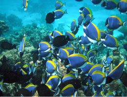
OBIS Nodes2017
OBIS Nodes Training Course
Training the OBIS nodes and the trainers (at the OBIS nodes and OceanTeacher regional training centres) was considered a top priority at the last SG-OBIS meeting. The training will include:
- The application of ratified Darwin Core terms
- OBIS-ENV-DATA standard (combining sampling events, occurrences, abiotic+ biotic measurements and sampling facts).
- QC tools (including the OBIS tools R package: https://github.com/iobis/obistools) ;
- Data publication (IPT), including metadata management
- Data access and visualization (including the OBIS R package: https://github.com/iobis/robis) ;
- There will be time for discussions and tackling specific use cases including output.

BlueCarbon_China2024
Observation technique about blue carbon
This training course will focus on raising the knowledge on the monitoring, assessment, and accounting of marine blue carbon. And also the related instrumentation and calibration of some biogeochemical parameters are the main content of the training course. The course will use case studies relevant for the Western Pacific.
Learning outcomes
By the end of the course, the participants should:
- Have a comprehensive understanding of the monitoring and assessment of coastal blue carbon.
- Be able to explain the role of connotation, Classification, and Accounting of Marine Carbon Sequestration.
- Be familiar with the instrumentation and calibration of some biogeochemical parameters.
Target audience and prerequisites
Include, but are not limited to, the following researchers and management staff on marine ecological observation, who deal with biogeochemical parameter measurements and instrumentation.
Language of instruction: English
Course content
Day 1 The monitoring and assessment of coastal blue carbon
Day 2 Connotation, Classification, and Accounting of Marine Carbon Sequestration
Day 3-5 Instrumentation and calibration of some biogeochemical parameters (dissolved oxygen and pH in seawater for example)
- utilization and maintenance of dissolved oxygen and pH instruments/sensors
- calibration of dissolved oxygen and pH sensors for seawater use in a lab
- calibration method of multi-parameter compensation for optical dissolved oxygen sensor in seawater
Instructors
Learner assessment and certificate
Assessment will be done through (online) quizzes.
Successful completion of the assignments (passmark: 80%) and active attendance of all of the synchronous sessions will be needed to be awarded a certificate of completion
Technology requirements
To complete this course, you should have access to:
- Latest version of either Chrome, Edge, or Firefox, web browsers
- Access to internet
- Firewalls must be disabled in order to be able to attend the synchronous live sessions
Course Duration, Synchronous Sessions, and Format
The course will take place online between November 25 to 29, 2024, with a duration of approximately 20 hours.
This is a 20-hour training course that will run online between 25-29 Nov 2024, including 3 (daily) synchronous sessions to be held between 13-16 pm (UTC+8) using BigBlueButton web conferencing platform.
The course includes 15 hours of synchronous work (content and discussion) plus 5 hours of individual asynchronous work for completion of assessments.
Application process and selection criteria
A limited number of seats (45) are available. Please complete the online application form available on this LINK. The applications start 01 October 2024. The deadline to submit the application is 31 October 2024 (23:59 CET: Central European Time).
UNESCO is committed to promoting equal access principles. Applications from minority or underrepresented groups are strongly encouraged.
The Selecting Committee will be set up by the hosts (NCOSM and NMDIS), which will comprise the course coordinator, organizers, and lecturers. Selection criteria include the applicant’s academic background, professional experience/duties (such as marine observation, blue carbon and ecosystem data management), and how the applicant will be able to apply the new knowledge acquired. Priority will be given to participants from the West Pacific
Contacts
- Course Coordinators: YU Jianqing yujianqing@ncosm.org.cn; Xu Dian ncosmws@ncosm.org.cn
- OTGA Secretariat: ioc.training@unesco.org
Costs
Free of charge. There are no tuition fees.
The instructors will give the course voluntarily with support from NCOSM.
Cancellation policy
In the event of cancellation of the course by the OTGA or its affiliates, we will provide notification of cancellation at least 7 days prior to the course date. In the event of cancellation by the attendee, we should receive notification of cancellation at least 7 days prior to the course date.
ODM2022
Ocean Data Management 2022
SP_ODM2023
Ocean Data Management 2023
This online, fully self-paced training course provides a comprehensive introduction to the management of marine data, including the guiding principles of data management and typical responsibilities for data managers, data stewards and scientists.
This course is developed by, and for, marine data managers, data stewards and researchers, working in institutions responsible for the collection and good management of marine data.
During this training course, you will be introduced to several general aspects related to the management of marine data, including, metadata, quality control, data policy, data sharing and publishing, data management plans and the research data life cycle. By the end of this course, you will be able to describe and implement the core tasks required for the processing of marine data, explain the importance of metadata, advise researchers on the research data life cycle and explain why a good data management plan is key from the very first initiation steps of a project.
SP_ODM2024
Ocean Data Management 2024
This online, fully self-paced training course provides a comprehensive introduction to the management of marine data, including the guiding principles of data management and typical responsibilities for data managers, data stewards and scientists.
This course is developed by, and for, marine data managers, data stewards and researchers, working in institutions responsible for the collection and good management of marine data.
During this training course, you will be introduced to several general aspects related to the management of marine data, including, metadata, quality control, data policy, data sharing and publishing, data management plans and the research data life cycle. By the end of this course, you will be able to describe and implement the core tasks required for the processing of marine data, explain the importance of metadata, advise researchers on the research data life cycle and explain why a good data management plan is key from the very first initiation steps of a project.
Learning outcomes
By the end of this training, participants should be able to:
- Describe the phases of the Research Data Life Cycle
- Explain the concept of a Data Management Plan
- Explain the concept and importance of metadata
- identify suitable file formats for data preservation and sharing
- Identify appropriate repositories for your data
- Summarise the goal of assigning a data licence
- Explain the common concerns related to data reuse
Target audience
Marine data managers, data stewards and researchers, working in institutions responsible for the collection and good management of marine data.
This is a self-taught course that includes quizzes designed to help learners assess their own learning at regular intervals.Learner Assessment
This is a self-taught course that includes quizzes designed to help learners assess their own learning at regular intervals. In order to successfully complete the course and award a Certificate at the end, the following is mandatory:
- complete all lessons in each Module of the course;
- complete all quizzes (70% minimum score for each quiz);
Note: submitting the course feedback survey is mandatory to obtain the course certificate.
Technology requirements
To complete this course, participants should have access to:
- Computer with Windows or Mac operating system
- Latest version of either Chrome, Edge, Firefox, or Safari web browsers
How to enroll
Please register on the OceanExpert website (www.oceanexpert.org). Once your OceanExpert account is approved (this is not done immediately), you can self-enrol in the course. If you already have an OceanExpert account, you can self-enrol in the course using your OceanExpert username and password. Enrolment is available until 1 December 2024.
First log-in OceanTeacher, then access the course page and click on self-enrollment.
The enrolment key is Odm2024-2
For any questions please contact the OTGA Secretariat (ioc.training@unesco.org) always using the name of the course as email subject.
There are no tuition fees.
UNESCO is committed to promote equal access principles. Applications from minority or underrepresented groups are strongly encouraged.
Feedback survey
At the end of the course, you will be asked to fill out a feedback survey. This information will be used to improve future courses.
SP_ODM2025
Ocean Data Management 2025
This online, fully self-paced training course provides a comprehensive introduction to the management of marine data, including the guiding principles of data management and typical responsibilities for data managers, data stewards and scientists.
This course is developed by, and for, marine data managers, data stewards and researchers, working in institutions responsible for the collection and good management of marine data.
During this training course, you will be introduced to several general aspects related to the management of marine data, including, metadata, quality control, data policy, data sharing and publishing, data management plans and the research data life cycle. By the end of this course, you will be able to describe and implement the core tasks required for the processing of marine data, explain the importance of metadata, advise researchers on the research data life cycle and explain why a good data management plan is key from the very first initiation steps of a project.
Details: https://oceanexpert.org/event/4664
Learning outcomes
By the end of this training, participants should be able to:
- Describe the phases of the Research Data Life Cycle
- Explain the concept of a Data Management Plan
- Explain the concept and importance of metadata
- identify suitable file formats for data preservation and sharing
- Identify appropriate repositories for your data
- Summarise the goal of assigning a data licence
- Explain the common concerns related to data reuse
Course contents
- General overview of data management, its principles and organisation
- Research Data Life Cycle
- Data Management Plan
- Open & FAIR data
- Data licences
- Metadata
- Data standards & quality control
Target audience
Marine data managers, data stewards and researchers, working in institutions responsible for the collection and good management of marine data.
Language and computer skills required (Applicants are expected to have):
- a good working knowledge of English
- basic computer skills
- the ability to find resources through search engines
- the ability to be self-directed in learning new technology skills (e.g. following a step-by-step tutorial, online video help, or access to support to learn necessary skills)
Instructors/Organisers
This course is organised by the OceanTeacher Global Academy with the assistance of the Flanders Marine Institute.
Course duration and format:
The course will be delivered online between 1 February 2025 and 31 May 2025. The estimated time to complete the self-paced course is approximately 35 hours.
Learner Assessment:
This is a self-taught course that includes quizzes designed to help learners assess their own learning at regular intervals. In order to successfully complete the course and award a Certificate at the end, the following is mandatory:
- complete all lessons in each Module of the course;
- complete all quizzes (70% minimum score for each quiz).
Note: submitting the course feedback survey is mandatory to obtain the course certificate.
Technology requirements
To complete this course, participants should have access to:
- Computer with Windows or Mac operating system
- Latest version of either Chrome, Edge, Firefox, or Safari web browsers
How to enroll
Please register on the OceanExpert website (www.oceanexpert.org). Once your OceanExpert account is approved (this is not done immediately), you can self-enrol in the course. If you already have an OceanExpert account, you can self-enroll in the course using your OceanExpert username and password. Enrolment is available from 1 February until 15 May 2025.
First log in OceanTeacher, then access the course page and click on self-enrollment.
The enrolment key is ODM*2025
For any questions please contact the OTGA Secretariat (ioc.training@unesco.org) always using the name of the course as email subject.
There are no tuition fees.
UNESCO is committed to promote equal access principles. Applications from minority or underrepresented groups are strongly encouraged.
Feedback survey
At the end of the course, you will be asked to fill out a feedback survey. This information will be used to improve future courses.
SP_ODM2025-2
Ocean Data Management 2025 (2nd cohort)
This online, fully self-paced training course provides a comprehensive introduction to the management of marine data, including the guiding principles of data management and typical responsibilities for data managers, data stewards and scientists.
This course is developed by, and for, marine data managers, data stewards and researchers, working in institutions responsible for the collection and good management of marine data.
During this training course, you will be introduced to several general aspects related to the management of marine data, including, metadata, quality control, data policy, data sharing and publishing, data management plans and the research data life cycle. By the end of this course, you will be able to describe and implement the core tasks required for the processing of marine data, explain the importance of metadata, advise researchers on the research data life cycle and explain why a good data management plan is key from the very first initiation steps of a project.
Details:
Learning outcomes
By the end of this training, participants should be able to:
- Describe the phases of the Research Data Life Cycle
- Explain the concept of a Data Management Plan
- Explain the concept and importance of metadata
- identify suitable file formats for data preservation and sharing
- Identify appropriate repositories for your data
- Summarise the goal of assigning a data licence
- Explain the common concerns related to data reuse
Course contents
- General overview of data management, its principles and organisation
- Research Data Life Cycle
- Data Management Plan
- Open & FAIR data
- Data licences
- Metadata
- Data standards & quality control
Target audience
Marine data managers, data stewards and researchers, working in institutions responsible for the collection and good management of marine data.
Language and computer skills required (Applicants are expected to have):
- a good working knowledge of English
- basic computer skills
- the ability to find resources through search engines
- the ability to be self-directed in learning new technology skills (e.g. following a step-by-step tutorial, online video help, or access to support to learn necessary skills)
Instructors/Organisers
This course is organised by the OceanTeacher Global Academy with the assistance of the Flanders Marine Institute.
Course duration and format:
The course will be delivered online between 1 July 2025 and 31 October 2025. The estimated time to complete the self-paced course is approximately 35 hours.
Learner Assessment:
This is a self-taught course that includes quizzes designed to help learners assess their own learning at regular intervals. In order to successfully complete the course and be awarded a Certificate at the end, the following is mandatory:
- complete all lessons in each Module of the course;
- successfully complete the pre- and post-assessment;
- complete all quizzes (70% minimum score for each quiz).
Note: submitting the course feedback survey is mandatory to obtain the course certificate.
Technology requirements
To complete this course, participants should have access to:
- Computer with Windows or Mac operating system
- Latest version of either Chrome, Edge, Firefox, or Safari web browsers
How to enroll
Please register on the OceanExpert website (www.oceanexpert.org). Once your OceanExpert account is approved (this is not done immediately), you can self-enrol in the course. If you already have an OceanExpert account, you can self-enroll in the course using your OceanExpert username and password. Enrolment is available from 1 July until 15 October 2025.
First log in OceanTeacher, then access the course page and click on self-enrollment.
The enrolment key is ODM*2025
For any questions please contact the OTGA Secretariat (ioc.training@unesco.org) always using the name of the course as email subject.
There are no tuition fees.
UNESCO is committed to promote equal access principles. Applications from minority or underrepresented groups are strongly encouraged.
Feedback survey
At the end of the course, you will be asked to fill out a feedback survey. This information will be used to improve future courses.
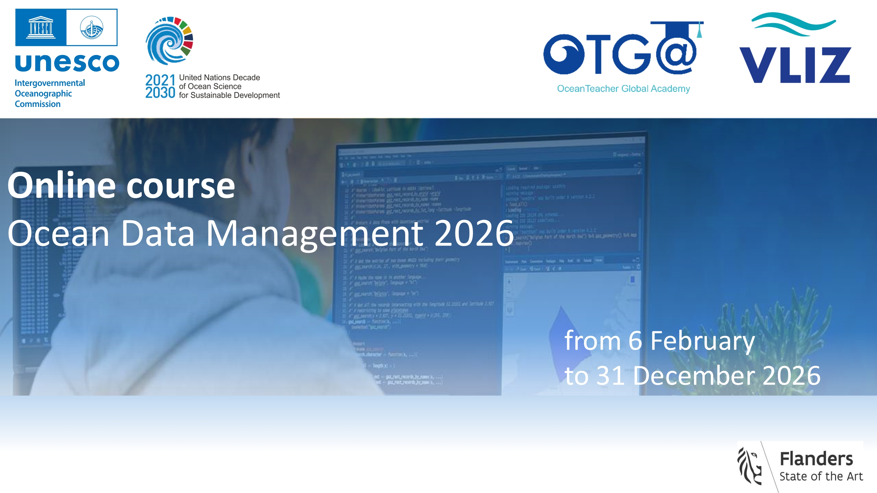
SP_ODM2026
Ocean Data Management 2026
This online, fully self-paced training course provides a comprehensive introduction to the management of marine data, including the guiding principles of data management and typical responsibilities for data managers, data stewards and scientists.
This course is developed by, and for, marine data managers, data stewards and researchers, working in institutions responsible for the collection and good management of marine data.
During this training course, you will be introduced to several general aspects related to the management of marine data, including, metadata, quality control, data policy, data sharing and publishing, data management plans and the research data life cycle. By the end of this course, you will be able to describe and implement the core tasks required for the processing of marine data, explain the importance of metadata, advise researchers on the research data life cycle and explain why a good data management plan is key from the very first initiation steps of a project.
Needs and priorities
This training contributes to IOC action on enhancing the capacity of its Member States to access technology, physical infrastructure, data and information (output 2; IOC Capacity Development Strategy, 2023-2030).
It links to IOC Strategic Plan for Ocean Data and Information Management (2023-2029) by adding to the support of community data principles such as FAIR (Findable, Accessible, Interoperable and Reusable), CARE (Collective benefit, Authority to control, Responsibility, Ethics), and TRUST (Transparency, Responsibility, User Focus, Sustainability, Technology); and by providing training to facilitate publishing of research findings by scientists (with special attention to scientists in developing countries).
Learning outcomes
By the end of this training, participants should be able to:
- Describe the phases of the Research Data Life Cycle
- Explain the concept of a Data Management Plan
- Explain the concept and importance of metadata
- identify suitable file formats for data preservation and sharing
- Identify appropriate repositories for your data
- Summarise the goal of assigning a data licence
- Explain the common concerns related to data reuse
Course content
- General overview of data management, its principles and organisation
- Research Data Life Cycle
- Data Management Plan
- Open & FAIR data
- Data licences
- Metadata
- Data standards & quality control
Target audience
This course is open to any person interested in learning about Ocean Data Management.
It was prepared for: marine data managers, data stewards and researchers, working in institutions responsible for the collection and good management of marine data.
Language and computer skills required:
- a good working knowledge of English
- basic computer skills
- the ability to find resources through search engines
- the ability to be self-directed in learning new technology skills (e.g. following a step-by-step tutorial, online video help, or access to support to learn necessary skills)
Instructors/Organisers
This course is organised by the OceanTeacher Global Academy with the assistance of the Flanders Marine Institute, with the contribuitions of:
- Leen Vandepitte
- Greg Reed
- Katrina Exter
- Laurian Van Maldeghem
- Marie Robberecht
- Charlotte Dhondt
- Ruben Perez Perez
- Alice Pohle
Course duration and format
The course will be delivered online continuously on a yearly basis. This cohort is open until 31 December 2026. The estimated time to complete the self-paced course is approximately 35 hours.
Learner Assessment
This is a self-taught course that includes quizzes designed to help learners assess their own learning at regular intervals. In order to successfully complete the course and be awarded a Certificate at the end, the following is mandatory:
- complete all lessons in each Module of the course;
- successfully complete the pre- and post-assessment; and
- complete all quizzes (70% minimum score for each quiz).
Note: submitting the course feedback survey is mandatory to obtain the course certificate.
Technology requirements
To complete this course, participants should have access to:
- Computer with Windows or Mac operating system
- Latest version of either Chrome, Edge, Firefox, or Safari web browsers
How to enroll
Please register on the OceanExpert website (www.oceanexpert.org). Once your OceanExpert account is approved (this is not done immediately), you can self-enrol in the course. If you already have an OceanExpert account, you can self-enroll in the course using your OceanExpert username and password. Enrolment is available till 31 December 2026.
First log in OceanTeacher, then access the course page and click on self-enrollment.
The enrolment key is Odm**2026
For any questions please contact the OTGA Secretariat (ioc.training@unesco.org) always using the name of the course as email subject.
There are no tuition fees.
UNESCO is committed to promote equal access principles. Applications from minority or underrepresented groups are strongly encouraged.
Feedback survey
At the end of the course, you will be asked to fill out a feedback survey. This information will be used to improve future courses.
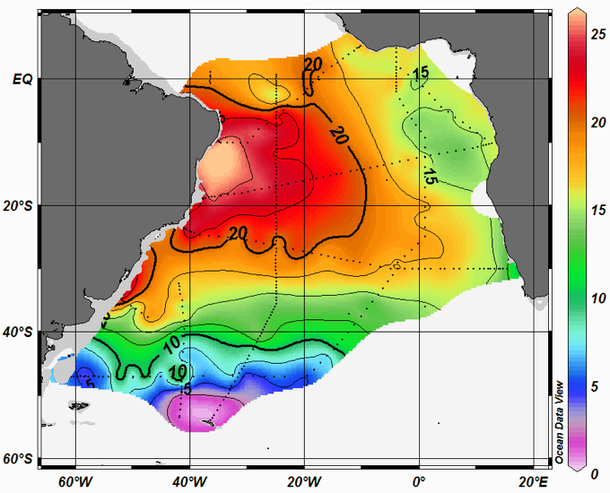
ODMR2018
Ocean Data Management for Researchers
This training course is aimed at researchers at the post-graduate level and provides a comprehensive introduction to a variety of marine datasets and formats and the use of software for synthesis and analysis of marine data. The importance of good research data management practices and the role of researchers will also be highlighted. Personal projects are presented by the students at the end of the course.
DataStewardship2021
Ocean Data Stewardship in the Decade of Ocean Science for Sustainable Development
Co-Growth 2026 China
Ocean Governance & Sustainable Coastal Growth and Resilience Course (Co-Growth 2nd Edition)
This comprehensive course provides an in-depth exploration of coastal resilience concepts that are key in supporting sustainable business practices and protecting communities against natural hazards and climate change-related impacts. Through immersive and hands on onsite activities, participants will learn and implement the principles, technologies, and strategies needed to understand, assess, and bolster resilience within coastal regions, while emphasizing business responsibility and proactive risk management tailored to Asia-Pacific context.
Building on the success of previous editions, this two-week program will run from 5 to 18 September, with sessions held successively across three Chinese coastal cities: Sanya, Hangzhou and Qingdao. Jointly guided by the Ministry of Natural Resources (MNR) of China, the Intergovernmental Oceanographic Commission (IOC) of UNESCO and the International Ocean Institute (IOI), the training is co-organized by National Marine Data and Information Service (NMDIS), the Second Institute of Oceanography (SIO), MR and the Hainan Provincial Oceanic Administration. It serves as a key regional capacity-building activity targeting marine administrators and technical specialists from developing nations across the Western Pacific. The course is also supported by the Decade Collaborative Centre for Coastal Resilience and its Partner Alliance Network, with contributions to the in-person training from Hereon and the University of Bologna.
The baseline Co-Growth learning framework was conceptualized by the Decade Collaborative Centre for Coastal Resilience (DCC-CR), with the support of the IOC’s Decade Capacity Development Facility (CDF) and OceanTeacher Global Academy (OTGA).
Place and venue
-
Sanya: Yazhou Bay Science and Technology City Innovation Research Valley
-
Hangzhou: Second Institute of Oceanography
-
Qingdao: Ocean University of China (West Coast Campus), Wanda Vista Hotel Qingdao Oriental Movie Metropolis.
Needs and priority analysis
This training contributes to IOC action on enhancing the capacity of its Member States to access technology, physical infrastructure, data and information through promoting human resources development at individual and institutional levels (output 1 and 2 of IOC Capacity Development Strategy, 2023-2030); and to the UN Ocean Decade by addressing capacity development needs of partners involved in current and future Ocean Decade Actions.
It also contributes to the implementation of IOC Medium-term Strategy (2022-2029) and IOC WESTPAC Call to action SGOs Tokyo Statement, by facilitating initiatives to improve Resilience to climate change and contribution to its mitigation.
Learning outcomes
After completing this course, participants will be able to:
-
Explain the fundamentals and applications of blue carbon ecosystems, including basic and advanced theory, carbon sequestration mechanisms, and practical case studies drawn from Chinese coastal management experience.
-
Apply remote sensing and machine learning techniques to oceanographic problems, including coastal water monitoring, high-resolution 3D ocean field reconstruction, neural network fundamentals, and AI-driven analysis of extreme sea-level events.
-
Evaluate the impacts of climate change on coastal and marine systems, including sea level rise, statistical modelling of extreme events, storm surge dynamics, and associated adaptation strategies.
-
Assess frameworks for sustainable ocean governance and environmental protection, covering ocean economy and governance principles, management of areas beyond national jurisdiction, coral reef monitoring, and hands-on observation through field site visits and emerging sensor technologies.
Course content
See the final version of the programme HERE.
Target audience and prerequisites
This course is designed for early-career scientists and professionals as part of their professional development and continuing education. It is especially intended for early-career scientists, young professionals working in coastal consulting firms, coastal managers and operators, and staff from environmental protection and civil protection agencies. Priority will be given to researchers and technical staff (such as managers and operators) from national and international institutions involved in ocean science, marine services, and ocean management in the Asia-Pacific region.
Language of instruction: English
Instructors
Course Coordinators
Contributing to the lectures:
Peng Zhao
Ballin Cong
Marco Marani
Lingling Li
Junxiao Zhang
Yuan Bing
Weili Wang
Bing Yuan
Xianqiang He
Wei Chen
Other contributors:
Course format
This is a face-to-face training with live sessions will run daily from 9:00-17:00 approximately. The total course duration is approximately 112 hours.
Learner assessment
This course contains one final report as core assessment. Other non-graded assessments may be included in the hands-on activities.
Evaluation/Certificate
A certificate will be awarded to the participants upon successful completion of:
-
All sessions face-to-face;
-
Final report (passmark: 70%);
-
Completion of a pre and post-test; and
-
Completion of a feedback survey.
Technology requirements/computer skills
-
Basic computer skills and experience in working in a digital learning environment.
-
Notions on QGIS and Python programming (Jupyter notebooks environment).
Application process
Managed externally by the Ministry of Foreign Affairs of China.
Number of participants
Approximately 35.
Costs
This course is offered with no tuition fees.
Participants were granted support for lodging, transportation, and subsistence during the course from the organizers.
Contacts
For additional questions, please contact OTGA Secretariat (ioc.training@unesco.org) always using the name of the course as e-mail subject.
Cancellation policy
In the event of cancellation of the course by the OTGA or its affiliates, we will provide notification of cancellation at least 7 days prior to the course date. In the event of cancellation by the attendee, we should receive notification of cancellation at least 7 days prior to the course date.
OCEANDATACOLOR2017
Ocean-colour data in climate studies
The course will deliver training in ocean-colour data and their applications in climate studies. Remote sensing experts from the Plymouth Marine Laboratory (PML) will guide students through a combination of lectures and computer-based exercises covering the following topics:
- Introduction to ocean colour;
- Modelling primary production;
- Ocean colour applications for ecosystem state assessment;
- Climate impacts and feedbacks;
- Ocean colour in data assimilation;
- Dataset archive, management, visualisation and analysis.
Students will also have opportunity of informal discussion with instructors outside of the formal lectures. A visit of the NERC Earth Observation Data Acquisition and Analysis Service (NEODAAS) that is hosted at PML will be provided.
QAQC2022EN
Quality Assurance and Quality Control on Marine Ecosystem-based Management
This training course will focus on raising the awareness for the need
for Quality Assurance and Quality Control on Marine Ecosystem-based
Management. Participants will be introduced to up-to-date best
practices and standards as well as the quality assurance and quality
control on marine ecosystem observation, and marine
instrument measurement testing, specifically on the four important
sectors of the whole process of QA and QC,
namely sensors, laboratory, data processing, and product application.
The course will use case studies relevant for the Western Pacific.

QMF2017
Quality Management System Essentials for NODCs and ADUs
Overview
The IODE maintains a global network of National Oceanographic Data Centres (NODC) and Associate Data Units (ADU) responsible for the collection, quality control, archive and online publication of many millions of ocean observations. The concept of quality management has become increasingly significant for these centres to meet national and international competency standards for delivery of data products and services. The IODE Quality Management Framework encourages NODCs and ADUs to implement a quality management system which will lead to the accreditation.
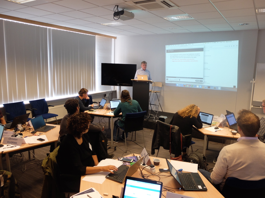
Objectives
This training workshop provides an introduction for NODCs and ADUs involved in the development, implementation and management of a Quality Management System which will assist in the adoption of comprehensive management practices and increased confidence in the quality of their data, products and services. The objectives are to:
- Introduce the IODE Quality Management Framework
- Introduce the ISO 9000 series of standards
- Provide a description of a Quality Management System
- Describe the importance of quality management for oceanographic data
- Describe the accreditation process for NODCs and ADUs
Learning Outcomes
By the end of the course, learners should be able to:
- Understand the fundamental requirements of the ISO 9001:2015 international standard
- Identify situations and processes within their own organisations to be included in the quality management system
- Understand the requirements of the IODE accreditation process
Assessment
This is a practical workshop. The participants will work in teams to complete exercises on each topic to reinforce learning and understanding of the requirements for a quality management system and the IODE accreditation for NODCs and ADUs.

QMF2020
Quality Management System Essentials for NODCs and ADUs 2020

QMF2024
Quality Management System Essentials for NODCs and ADUs 2024
Details: https://oceanexpert.org/event/3990
OAGHANA_2026
Regional Training Course on Ocean Acidification Monitoring, Data Management, and SDG 14.3.1 Reporting
Summary
This course will provide participants with foundational and practical training in ocean acidification monitoring, with emphasis on the ocean carbonate system, field sampling, laboratory analysis, data quality control, data management, and reporting in support of Sustainable Development Goal indicator 14.3.1.
The course will guide participants through the full ocean acidification monitoring workflow, from planning field observations and collecting samples to laboratory analysis, data interpretation, quality assurance, and submission of data to relevant global data systems. It will also introduce the role of ocean acidification observations in understanding marine ecosystem vulnerability, coastal resource management, and long term ocean change.
The programme will be delivered as a blended course. The online component will provide core theoretical knowledge and ensure that learners with different levels of prior experience develop a common foundation. The onsite component will focus on practical demonstrations, hands-on field and laboratory methods, data analysis exercises, and development of country level or institutional monitoring plans.
Format and Duration
This is a blended course consisting of two phases:
Phase 1: Online Pre-training Course (self-paced) 25 May – 24 June 2026
Approximately 20 asynchronous hours across 7 modules (video lectures, readings, quizzes).
Total estimated workload Phase 1 : 20 hours.
Phase 2: In-person Practical Training (University of Ghana) 29 June – 3 July 2026
Approximately 40 hours of practical demonstrations, lab sessions, data analysis, and group work.
*Note that the in-person training is will only be available for a limited group of people.
Total estimated workload Phase 1 and 2: 60 hours.
⚠️ Participants are required to complete the online phase before attending the in-person training. Attendance during the onsite phase is mandatory for selected in-person participants.
Venue: University of Ghana, Ghana
Language of instruction: English
Learning outcomes
By the end of this training, participants should be able to:
- Explain the concept of ocean acidification and describe its implications for marine ecosystems, coastal communities, and ocean resources
- Describe the ocean carbonate system and identify key carbonate chemistry parameters (pH, total alkalinity, dissolved inorganic carbon, pCO₂, and calcium carbonate saturation state)
- Identify appropriate field sampling procedures and laboratory methods for OA monitoring
- Apply basic quality assurance and quality control principles to ocean acidification data
- Interpret ocean acidification datasets and assess spatial and temporal variability
- Manage ocean acidification datasets using good data management practices
- Describe the SDG 14.3.1 indicator methodology and explain the data submission process
- Design a basic ocean acidification monitoring plan for their country or institution
Course content
Online
Module 1 : Introduction to Ocean Acidification
Module 2 : The Ocean carbonate system
Module 3 : Data quality and management
Module 4: the 14.3.1 SDG Indicator Methodology
Module 5: Laboratory experiments for ocean acidification
Module 6: Chemical observations in the field
Module 7: Biological observations in the field
Onsite
- Field sampling planning and sample collection and preservation
- Laboratory demonstrations and quality checks
- Data analysis exercises
- Group discussions and participant presentations
- Development of a basic ocean acidification monitoring plan
Target audience
The course is intended for students, early-career researchers, laboratory technicians, marine science professionals, and staff of relevant national institutions from countries in the Eastern Tropical Atlantic region. Priority will be given to applicants affiliated with BIOTTA focal points, national oceanographic institutions, universities, environmental agencies, or laboratories involved in marine monitoring.
Basic knowledge of marine science, chemistry, oceanography, or related fields is recommended.
Places available: 11 participants for the full blended course (online + onsite); up to 24 additional participants for the online component only.
Organizers
This course is jointly organized by the Intergovernmental Oceanographic Commission (IOC) of UNESCO, through the Ocean Science Section and the OceanTeacher Global Academy (OTGA), University of Ghana OTGA Regional Training Centre, The Ocean Foundation, and OMI - Ocean Margins Initiative.
In-person Instructors
- Prof. Kim Currie: National Institute of Water and Atmospheric Research (NIWA)
- Dr. Leticia Barbero: National Oceanic and Atmospheric Administration (NOAA)
Instructors who prepared the online materials for the IOC Ocean Acidification course, first version:
- Prof. Helen Findlay: Plymouth Marine Laboratory
- Dr. Sam Dupont: University of Gothenburg
- Dr. Kirsten Isensee: IOC of UNESCO
- Dr. Adrienne Sutton: NOAA/PMEL
- Prof. Christopher Sabine: University of Hawaii – Manoa
Course Coordinator Prof. Edem Mahu: University of Ghana RTC edemmahu@gmail.com / emahu@ug.edu.gh
Registration, costs, and technological requirements
Applications for this course are now closed (deadline: 25 April 2026). Selected participants have been notified.
(For reference, the original application form was available at: https://lnkd.in/dbu-Xpsc)
Selected participants will not be required to pay course registration or training fees. Support for travel, accommodation, meals, and local transport will be subject to available funding and communicated to selected participants before the course starts.
To complete the online course, participants need access to:
- A computer with Windows, Mac OS, or Linux
- Latest version of Chrome, Edge, Firefox, or Safari
- Stable internet connection (minimum 0.5 Mbps)
- Basic computer literacy; familiarity with spreadsheets recommended
UNESCO is committed to promoting equal access principles. Applications from minority or underrepresented groups are strongly encouraged.
Assessment & Certificate
Certificates will be issued to participants who:
- Complete all required online modules
- Achieve a minimum score of 70% across required quizzes and assessment activities
- Participate in the onsite practical sessions (where applicable)
- Complete the mandatory course evaluation form
Contacts
For course organisation, please contact: Prof. Edem Mahu – edemmahu@gmail.com / emahu@ug.edu.gh
For additional questions, please contact the OTGA Secretariat (ioc.training@unesco.org), always using the name of the course as email subject.
Cancellation policy
In the event of cancellation of the course by the OTGA or its affiliates, we will provide notification of cancellation at least 7 days prior to the course date. In the event of cancellation by the attendee, we should receive notification of cancellation at least 7 days prior to the course date.
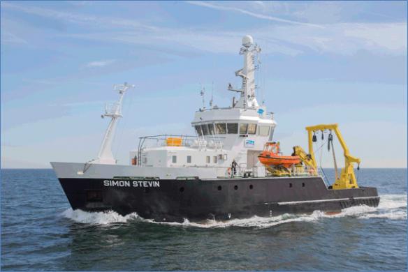
RCPM2018BE
Research Cruise Planning & Management
This course provides an overview of requirements for organizing a Research Cruise within a project and/or submitting a request for ship time. The course takes place mainly in a classroom but includes a visit to a Marine station and a research vessel, where participants will be introduced to sampling equipment and marine research infrastructure used for onboard research, including demonstrations of the use and maintenance of marine sampling equipment, oceanographic (biological, chemical and physical data) sampling, data collection and data management.

RDM2017BE
Research Data Management
Basic scientific research requires sound data management practices to support the collection and curation of data to encourage data sharing using internationally agreed rules of data exchange, and to facilitate data discovery and use in the long term. Research Data Management (RDM) covers the planning, creating, storing, organizing, accessing, sharing, describing, publishing and curating of data. RDM is mandated by many funding agencies and increasingly by governments to provide access to funded research results. The management of data, particularly large-scale data, has many challenges, and the roles of researchers, facilities that manage marine data, repositories and libraries are coming together to provide access, preservation and archive of this data and the scholarly products associated with it.

The learning outcomes of this course are to:
- Understand the importance of maintaining integrity (accuracy and completeness) of data.
- Develop skills in writing and implementing a (Research) Data Management Plan, including those associated with Funding agency requirements and mandates.
- Gain knowledge of the terminology of Open Access and Open Data as it applies to Research Data Management.
- Advance knowledge in the current landscape of Research Data Management, and internationally organized efforts to develop standards and tools in this field.
- Recognize the importance of good research data management practice.
- Gain knowledge of the data publishing and citation process.
- Access to European marine data repositories.
- Awareness of main European based marine research projects (e.g. EMODNET, SeaDataCloud, etc)
MOOC 2018 edition Module 1: Project Management
Research Design, Data Management & Data Communication in Marine Sciences - Module 1 - Research Design
Research Design, Data Management & Data Communication in Marine Sciences
MOOC 2018 edition Module 1: Project Management
MOOC 2018 edition Module 2: Data Management
Research Design, Data Management & Data Communication in Marine Sciences - Module 2 - Data Management
Research Design, Data Management & Data Communication in Marine Sciences - MOOC 2018 edition
Module 2: Data Management
MOOC 2018 edition Module 3: Science Communication
Research Design, Data Management & Data Communication in Marine Sciences - Module 3 - Data Communication
Research Design, Data Management & Data Communication in Marine Sciences
Module 3: Scientific Communication
SEAMARCS
Strengthening Sea Level Monitoring and Data Management in East Africa for Coastal Resilience and Community Safety Technical Training
The Strengthening Sea Level Monitoring and Data Management in East Africa for Coastal Resilience and Community Safety Technical Training – SEAMARCS is a five-day technical capacity development course designed to strengthen national and regional capabilities in sea-level observation, data management, and applied sea-level science within the Sub-Saharan Africa and South West Indian Ocean (SWIO) region
The course aims to provide participants with practical and theoretical knowledge required to install, operate and maintain tide gauge stations contributing to the Global Sea Level Observing System (GLOSS). Core content includes:
- Sea-level measurement technologies, station installation, maintenance, and troubleshooting
- Data telemetry and operational data exchange with the IOC Sea Level Station Monitoring Facility (SLSMF) and other international data centres
- Sea-level data processing, quality control (including automated QC using the IOC SLSMF API), tidal analysis and interpretation
- Fundamental sea-level science, including tides, surges, seiches, tsunamis, sea-level rise, and vertical land motion
- Practical field exercises, including a site visit to operational tide gauge stations and basic surveying and levelling techniques (optical and GNSS).
- The training targets technicians, hydrographers, surveyors, and early-career oceanographers who are directly involved in water level observations and data analysis, with an emphasis on hands-on learning and operational problem-solving in a real-world context.
Learning outcomes
Upon successful completion of the Strengthening Sea Level Monitoring and Data Management in East Africa for Coastal Resilience and Community Safety Technical Training – SEAMARCS, participants will be able to:
Identify and describe the main sea-level measurement technologies used in GLOSS tide gauge stations and explain their operational strengths and limitations.
- Configure and manage data telemetry systems to enable timely transmission of sea-level data from national stations to the IOC Sea Level Station Monitoring Facility (SLSMF) and other relevant international data centres.
- Apply standard sea-level data processing and quality control procedures, including the use of automated quality control tools and the IOC SLSMF API.
- Interpret sea-level time series (mareograms) to identify and distinguish physical phenomena such as tides, seiches, storm surges, tsunamis, and longer-term sea-level variability.
- Perform basic tidal analysis and explain the concept and use of tidal datums in hydrographic, oceanographic, and maritime applications.
- Explain the role of vertical land motion and site stability in sea-level observations and integrate levelling and GNSS information into station assessments.
- Demonstrate practical field skills through site visits and hands-on exercises, including basic surveying and inspection of operational tide gauge infrastructure.
Course content
The training will support the subsequent installation of SEAMARCS tide gauge stations at locations in Kenya, Mozambique, Madagascar and Seychelle. The training will strengthen the technical and operational capacities of personnel responsible for sea-level monitoring systems and associated data management in participating countries. The training will provide both theoretical and practical knowledge on tide gauge operation, calibration, maintenance, quality control and data management.
The training combines theoretical lectures, practical exercises, system demonstrations, and a field visit to ensure participants gain applied operational skills in sea-level observation and data management.
1. Introduction and Regional Context
- Overview of the GLOSS and its role within IOC programmes
- Network reports and experience-sharing by participating Member States
- Regional sea-level monitoring challenges and priorities in the Indian Ocean region
2. Sea-Level Measurement Technologies
- Overview of sea-level measurement principles
- Types of tide gauges and sensors used in GLOSS stations
- Strengths, limitations, and suitability of different technologies for operational monitoring
3. Tide Gauge Installation, Operation, and Maintenance
- Anatomy and components of a tide gauge station
- Installation requirements and best practices
- Routine maintenance procedures and operational checks
- Troubleshooting common technical problems affecting station performance
4. Data Telemetry and International Data Exchange
- Data transmission systems and telemetry options
- Establishing and maintaining data delivery links with the IOC Sea Level Station Monitoring Facility (SLSMF)
- Overview of other international and GLOSS sea-level data centres
- Practical troubleshooting session to establish or improve data links
5. Sea-Level Data Processing and Quality Control
- Introduction to sea-level data formats and processing workflows
- Manual and automated quality control procedures
- Use of the IOC SLSMF API for automated quality control
- Practical exercises using real sea-level datasets
- Tidal analysis using TTide
6. Sea-Level Science and Data Interpretation
- Interpretation of mareograms and sea-level records
- Identification of physical processes affecting sea level, including:
- Tides
- Seiches
- Storm surges
- Tsunamis
- Sea-level rise and variability
- Overview of tidal analysis methods and tidal datums
7. Vertical Land Motion and Site Stability
- Concepts of vertical land motion (VLM) and its impact on sea-level observations
- Theory of levelling methods (optical levelling and GNSS)
- Integration of GNSS and levelling data with sea-level observations
- Overview of GNSS and VLM data centres supporting sea-level monitoring
8. Practical Field Activities
- Site visit to an operational tide gauge station
- Hands-on inspection of station components and surroundings
- Basic surveying and levelling exercises in the field
- Application of learned concepts in a real operational environment
Target audience
The training is intended for professionals from IOC Member States in Sub-Saharan Africa and SWIO region who are currently involved, or expected to be involved, in sea-level observation and data management activities. Specifically, the target audience includes:
- Technicians responsible for the operation and maintenance of tide gauge stations including the prospective SEAMARCS stations
- Hydrographers and surveyors working with coastal and water level measurements
- Data analysts involved in processing and quality control of sea-level data
- Early-career or entry-level oceanographers engaged in sea-level or coastal observation programmes
Participants are typically affiliated with national oceanographic, hydrographic, or maritime institutions contributing, or planning to contribute, sea-level data to IOC systems such as GLOSS and the IOC Sea Level Station Monitoring Facility (SLSMF).
Prerequisites
- No prior specialised knowledge of tides or advanced sea-level science is required
- Basic understanding of oceanographic or tidal concepts is desirable
- Basic computer skills are required, including the ability to work with digital data and software tools
- Some familiarity with water level data processing requirements or operational measurement environments is expected
- Willingness and ability to participate in hands-on fieldwork, including a site visit to a tide gauge station and basic survey exercises
Selection Criteria
Professional relevance
- Candidates must be currently involved, or expected to be involved, in sea‑level observation, tide gauge operation, or water‑level data analysis within a national oceanographic, hydrographic, or maritime institution
Institutional role and applicability
Priority is given to nominees whose responsibilities allow them to directly apply the training outcomes to the operation, maintenance, or data management of tide gauge stations contributing to GLOSS and IOC systems
Regional eligibility
- Applicants have been selected from countries which are in the scope of the SEAMARCS project and a follow-on project.
Basic computer skills
- Some familiarity with water‑level data processing or measurement environments
- An ability to participate fully in hands‑on technical and field activities
Language proficiency
- Sufficient working knowledge of English, as the training will be conducted entirely in English
Commitment to full participation
- Availability to attend the entire onsite training period (29 June – 03 July 2026), including practical sessions and the site visit
- Gender and geographic balance (where applicable)
- Selection may take into account equitable geographic representation and gender balance, in line with IOC capacity development principles
Course language: English
Instructors
Duration: 37 hours - 5 days onsite
Learner assessment
Written and oral assessments throughout the training course
Certificate
After completing the written and oral assessment, and the feedback survey, a certificate will be provided.
Technology requirements
Participants should be able to:
- Use a personal computer confidently, including basic operating system functions (file management, installing or running software, connecting to networks)
- Work with digital datasets, including opening, viewing, and managing sea-level or time‑series data files
- Use common productivity software, such as spreadsheets and document viewers, to review, organize, and inspect data outputs
- Access and use web-based platforms and online tools, including browser-based data portals and APIs demonstrated during the training (e.g. IOC Sea Level Station Monitoring Facility tools)
Technical Skills:
- Basic knowledge of water level data processing requirements, sufficient to follow instruction on data quality control and analysis workflows
- Familiarity with digital communication and data transmission concepts, supporting understanding of telemetry and data exchange with international data centres
Willingness and ability to engage in hands-on technical sessions, including practical exercises using IOC tools, APIs, and real sea-level dataset
Venue
Hotel Tivoli Maputo, Av. 25 Setembro, nº 1321
340 Maputo, Moçambique
Organisers
- Intergovernmental Oceanographic Commission of UNESCO (UNESCO‑IOC)’s Global Sea Level Observing System (GLOSS)
Ex-employees of the National Oceanography Centre (NOC), United Kingdom - Flanders Marine Institute (VLIZ)
- UNESCO‑IOC Project Office for IODE (Ostend, Belgium)
Contacts
For course organization, please contact: Angela Hibbert (course organiser)
For additional questions, please contact OTGA Secretariat (ioc.training@unesco.org) always using the name of the course as e-mail subject.
Cancellation policy
In the event of cancellation of the course by the OTGA or its affiliates, we will provide notification of cancellation at least 7 days prior to the course date. In the event of cancellation by the attendee, we should receive notification of cancellation at least 7 days prior to the course date.
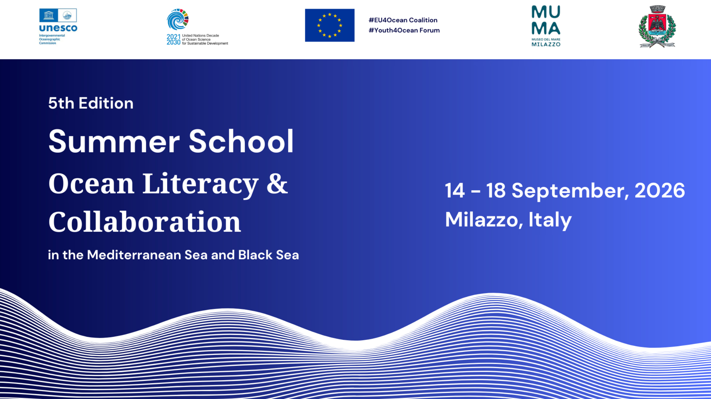
OLSSchool*Milazzo2026
Summer School on Ocean Literacy and Collaboration – Sustainable Blue Tourism in the Mediterranean and Black Seas
-
Gain familiarity with the objectives and activities of the EU4Ocean Coalition and the Youth4Ocean Forum and their contribution to the United Nations Decade of Ocean Science for Sustainable Development;
Explore how ocean literacy can inform tourism planning, destination management, education, and visitor engagement in Mediterranean and Black Sea coastal areas
Develop practical skills for transdisciplinary collaboration in the design and implementation of ocean-related projects;
Learn to integrate diverse knowledge systems, cultural contexts, and local perspectives when working towards a sustainable blue economy;
Strengthen science communication skills through storytelling, public engagement, and policy advocacy
- Francesca Santoro (UNESCO-IOC)
- Ottavia Carlon (UNESCO-IOC)
- Carmelo Isgrò (MuMa – Museo del Mare Milazzo)
- Carolyn Berger (MuMa – Museo del Mare Milazzo)
- Angelo Sciacca (Institute for Sustainable Development and International Relations – IDDRI)
- Ernesto Rollando (Freelance Consultant)
- Elissa Phillips (Incredible Oceans)
- Virginia Di Marco (Assicurazioni Generali)
- Natasa Vaidianu (Ovidius University of Constanța)
- Giovanni Mangano (Capo Milazzo Marine Protected Area)
- Teresa Romeo (Sicily Marine Centre – Stazione Zoologica Anton Dohrn)
- Claudio Berti (Stazione Zoologica Anton Dohrn)
- Gender balance
- Geographical representation
- Age range: up to 35 years old
- Background: all the sectors are encouraged to apply. We will pay attention to create an interdisciplinary group.
- Priority will be given to youth from the Mediterranean Sea and Black Sea, as well as members of the Y4O Forum and ECOPs
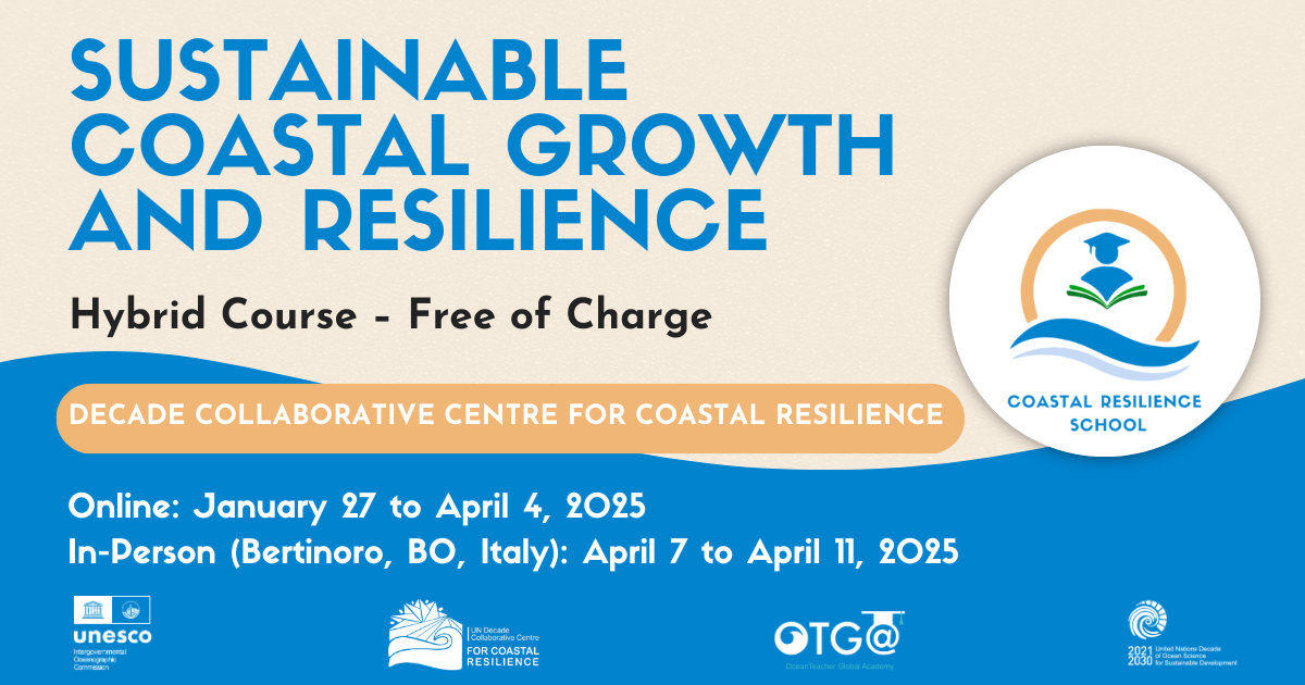
SCGR2025EN
Sustainable Coastal Growth and Resilience
Summary
This hybrid course, organized by the Decade Collaborative Centre for Coastal Resilience, provides an in-depth exploration of coastal resilience and its vital role in supporting sustainable business practices and protecting communities against climate change-related impacts. Through five interconnected modules and an in-presence hands-on week, participants will learn and implement the principles, technologies, and strategies needed to understand, assess, and bolster resilience within coastal regions, while emphasizing business responsibility and proactive risk management.
Venue
The course will be subdivided into two phases:
An online phase will take place through OTGA e-learning platform.
An in-person phase which will be held in Bertinoro, Italy, at the University Residential Center of Bertinoro (CE.U.B.).
Learning outcomes
By the end of the course the participants should be able to:
- Understand Coastal Resilience and its Business Implications
- Utilize Operational Oceanography Products for Hazard Analysis
- Assess Environmental Impact and Manage Coastal Risks
- Apply Enabling Technologies to Coastal Resilience Challenges
- Develop Practical Resilience Solutions for Critical Coastal Infrastructure
- Showcase innovative solutions executing a Real-World Coastal Resilience Project
Target audience
The course is a post-graduate and early-career course for professional development and continuing education. The course is particularly aimed at early-career scientists, young professionals from coastal consulting firms, coastal managers and operators, as well as members of environmental protection agencies and civil protection organizations.
Pre-requisites
Course content
- Overview of Coastal Resilience and its Business Implications
- Understanding Coastal Hazards Using Operational Oceanography
- Environmental Impact Assessment and Risk Management
- Enabling Technologies for Coastal Resilience
- Innovative Solutions for Coastal Resilience
Language of instruction: English
Course Duration
The course will span a total of ten weeks (~90 hours in total) from 27 January to 11 April 2025 in hybrid format, with the structure includes the following:
- Five week-modules of online asynchronous learning (10 hours per week - 50 hours total)
- Five weeks of Webinars (1-2 hours per week - 10 hours total) and tutoring sessions (20 hours)
- One-week in-person workshop, 7-11 April 2025 (30 hours)
Certificate
OTGA - ISO Certificate will be awarded to the participants upon completion of assignments, assessment tests, and delivery of a project according to the course planning.
Notes
Application process
**(APPLICATIONS FOR THIS COURSE ARE NOW CLOSED)**
A limited number of seats (25) are available. Please fill out the online application form available at this LINK:https://otga.wufoo.com/forms/z3uoa8z1fqqqpu/
The applications start on 15 November 2024. The deadline to submit the application is 15 December 2024 (23:59 CET: Central European Time).
- CV containing (upload)
- Description of Education and information on Masterʼs degree in relevant fields.
- Description of Professional Experience
- Current position
- English Proficiency Certificates
- Motivation Letter - 1000 words- explaining alignment with course goals
- Reference Letters (optional but encouraged) (upload)
Selection criteria
UNESCO is committed to promoting equal access principles. Applications from minority or underrepresented groups are strongly encouraged.
Selection will be based on:
- Pertinence of Master's degree
- Relevant work experience in coastal management, environmental consulting, urban planning, marine conservation, or related fields
- Proficiency in written and spoken English
- Submission of a complete application
Priority consideration will be given to applicants from underrepresented countries, particularly in the Global South.
Costs
Free of charge. There are no tuition fees.
This course is offered with no tuition fees, and all participation costs will be fully covered by the organizers. Full financial coverage for in-person week will be provided by the Decade Collaborative Center for Coastal Resilience (DCC-CR).
Contacts
For any questions, please contact OTGA Secretariat (ioc.training@unesco.org) or DCC-CR secretariat (difa.dcc-cr@unibo.it) always using the name of the course as e-mail subject.
Cancellation policy
In the event of cancellation of the course by the OTGA or its affiliates, we will provide notification of cancellation at least 7 days prior to the course date. In the event of cancellation by the attendee, we should receive notification of cancellation at least 7 days prior to the course date.
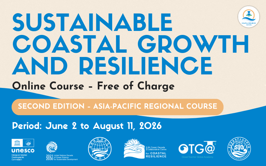
SCGR2026online Asia-Pacific
Sustainable Coastal Growth and Resilience_2026
This comprehensive course provides an in-depth exploration of Coastal Resilience concepts that are key in supporting sustainable business practices and protecting communities against natural hazards and climate change-related impacts. Through five interconnected online modules and a range of interactive learning activities, participants will learn and implement the principles, technologies, and strategies needed to understand, assess, and bolster resilience within coastal regions, while emphasizing business responsibility and proactive risk management tailored to Asia-Pacific context.
Building on the success of its first edition, this course is a fully online training focused on the Asia-Pacific regional needs and priorities, jointly coordinated by the Second Institute of Oceanography of China, Ministry of Natural Resources (SIOMNR), the IOC OceanTeacher Global Academy Regional Training Centre China (National Marine Data and Information Service-China, NMDIS), the Decade Collaborative Centre for Coastal Resilience (DCC-CR), the Western Pacific Subcommission of the Intergovernmental Oceanographic Commission of UNESCO (IOC WESTPAC), Decade Capacity Development Facility (CDF), the Euro-Mediterranean Center on Climate Change (CMCC) of Italy and the CINECA Interactive Computing Services in Bologna, Italy.
Needs and priority
This training contributes to Intergovernmental Oceanographic Commission of UNESCO (IOC)'s action on enhancing the capacity of its Member States to access technology, physical infrastructure, data and information through promoting human resources development at individual and institutional levels (output 1 and 2 of IOC Capacity Development Strategy, 2023-2030); and to the UN Ocean Decade by addressing capacity development needs of partners involved in current and future actions.
This activity also contributes to the implementation of IOC Medium-term Strategy (2022-2029) and IOC WESTPAC Call to action SGOs Tokyo Statement, by facilitating initiatives to improve resilience to climate change and contribute to its mitigation.
Learning outcomes
After completing this course, participants will be able to:
- Understand the fundamentals of coastal resilience and its implications for science-based services and operations.
- Utilize operational oceanography products for hazard assessment.
- Apply enabling technologies to coastal resilience challenges.
- Develop practical resilience solutions for critical coastal infrastructure.
- Showcase innovative applied solutions through Real-World coastal resilience projects
Course content
The course is composed of five online modules:
- Overview of Coastal Resilience and its importance for Business
- Understanding coastal hazards from operational oceanography products
- Impact Assessment and risk management
- Enabling technologies for Coastal Resilience
- Solutions for Coastal Resilience
The content will be further complemented by interactive discussions, case studies, and collaborative learning activities to support knowledge exchange and practical application.
Target audience
This course is designed for early-career ocean scientists and professionals as part of their professional development and continuing education. It is especially intended for early-career ocean scientists and professionals working in coastal consulting firms, coastal managers and operators, and staff from environmental protection and civil protection agencies. Priority will be given to researchers and technical staff (such as managers and operators) from national and international institutions involved in ocean science, marine services, and ocean management in the Asia-Pacific region.
The eligible list of countries includes: Bangladesh*, Brunei Darussalam, Cambodia, China*, Cook Islands*, Democratic People's Republic of Korea*, Federated States of Micronesia, Fiji*, French Polynesia, Indonesia*, Kiribati*, Lao PDR, Malaysia*, Maldives*, Myanmar*, Nauru*, New Caledonia, Niue*, Palau*, Papua New Guinea*, Philippines*, Republic of the Marshall Islands, Samoa*, Solomon Islands*, Sri Lanka*, Thailand*, Timor-Leste*, Tonga*, Tuvalu*, Vanuatu*, Viet Nam*. (* are IOC Member States).
Pre-requisites
Educational and Professional Qualification:
-
A minimum of a Masters degree in one of the following fields: Environmental Sciences, Marine Biology, Coastal Engineering, Urban Planning, Political Science, International Affairs, Economics, Business, or a related discipline; OR a minimum of 5 years of relevant work experience in areas such as coastal management, environmental consulting, urban planning, marine conservation, or other related fields.
-
Professional affiliation with national or international infrastructure (within ocean/marine or related entities and agencies) and/or 1-5 years of relevant work experience in coastal management, environmental consulting, urban planning, marine conservation, or related fields.
Language Proficiency:
-
Demonstrated proficiency in written and spoken English.
Additional Requirements:
-
Submission of a complete application, including a Statement of Purpose.
-
Priority consideration will be given to international applicants from Least Developed Countries or Small Island Developing States in the Asia-Pacific Region. See the list of eligible countries above.
Technology requirements/computer skills:
- Basic computer skills and experience in working in a digital learning environment.
- Experience with QGIS and Python programming (Jupyter notebooks environment).
Language of instruction: English
Course Coordinators
Contributing subject experts will be available later on.
Course Format & Duration
The online modules include both self-paced activities and weekly synchronous sessions (attendance is strongly recommended and tracked, but not mandatory). The online modules comprise an estimated 70 hours of training and will be available from 2 June until 11 August, 2026.
Assessment & Certificate
This course contains self-paced automated assessments as well as written and oral assignments. A certificate will be awarded to the participants upon successful completion of:
- All modules and lessons;
- Assessments and assignments (passmark: 70%);
- Completion of a pre and post-test; and
- Completion of a feedback survey.
Application
A limited number of seats are available, to be confirmed by the organizers at a later stage, depending on the support and accessibility required to the training activities.
Applications process will run through OTGA online form. Please fill out the online application form available at this LINK. Applications open on 11 March 2026. The deadline to submit the application is 26 March 2026 (23:59 CET: Central European Time). Extended deadline: 02 April 2026 (23:59 CEST). NEW and LAST Extended deadline: 8 April 2026 (23:59 CEST).
Documents requested
Applicants will be requested to describe and/or upload the following documents and information:
- CV containing a description of education and technical background, a description of professional experience, details on the current affiliation;
- Proof of English Proficiency (Fluency); and
- A Statement of Purpose of 1000 words explaining motivation and alignment with course goals, and requirements.
Additional documentation, such as a letter of endorsement of affiliated institution and personal documents, may be requested by OTGA during the selection process.
Selection criteria
UNESCO is committed to promoting equal access principles. Applications from minority or underrepresented groups are strongly encouraged.
Selection will be based on fit to the best fit to the pre-requisites mentioned above.
Costs
Free of charge. There are no tuition fees.
Contacts
For any questions, please contact OTGA Secretariat (ioc.training@unesco.org) always using the name of the course as e-mail subject.
Cancellation policy
In the event of cancellation of the course by the OTGA or its affiliates, we will provide notification of cancellation at least 7 days prior to the course date. In the event of cancellation by the attendee, we should receive notification of cancellation at least 7 days prior to the course date.
Training course and Identification Qualification in Harmful Marine Microalgae 2026(1)
Since 1993 the IOC has conducted training courses on harmful microalgae. The purpose has been to improve the taxonomic and identification skills of the participants for research purposes and for practical monitoring of harmful algal blooms.
From 2006 the IOC training in HAB identification has been offered within a new framework which gives accreditation. The present course includes now a practical exam at the end of the course with an IOC Certificate of Proficiency in Identification of Harmful Algae issued to participants who pass the exam. We know by experience that many of the more than 500 trainees we have had over the years have wished the courses to give accreditation, and in some countries, the IOC courses have become a reference for laboratories to be approved for carrying out regulatory monitoring for harmful microalgae.
The IOC Science and Communication Centre on Harmful Algae, University of Copenhagen, Denmark is organizing the course.
IOC Training Course and Identification Qualification in Harmful Marine Microalgae 2026
Course description: The course includes 100 hours of teaching and is divided into two parts. 1) The first part of the course is organised online using the elearning platform of IOC/IODE/OceanTeacher Global Academy, giving general introductions to the various groups of harmful algae; this part is mainly for self-study and estimated to 40 hours of reading. 2) The second part is a practical course in species identification (see tentative programme below). Part 2 includes 60 hours of teaching and a microscope will be available to each participant during the entire period, see also link below.
Participants: The course is aimed at participants who have some years of practical experience in identification of microalgae. The number of participants is limited to 16. If there are more applicants than available seats, priority will be given to applicants who have direct research or management responsibilities with regard to the occurrence of harmful algae.
Dates: Part 1 will be offred through the eLearning platform of OTGA’ from October onwards; part 2 takes place from 28 February 2026
Venue on site: IOC Science and Communication Centre on Harmful Algae, Department of Biology, University of Copenhagen, Denmark.
Language: English.
Course lecturers: Dr. Santiago Fraga, Dr. Jacob Larsen, Dr. Nina Lundholm, Professor Øjvind Moestrup.
Enquiries may be sent to Jacob Larsen, jacobl@bio.ku.dk
Price: The course is organized on a cost-recovery basis. The price of the course is 4200 EUR and it is a package deal, which covers all expenses during the course period, see also link below; thus
- Accommodation, - c/o Danhostel, Lejrskolevej 4, 3400 Hillerød.
- All meals during the course, starting with an evening meal upon arrival
- Access to the distant learning programme on the OceanTeacher Global Academy eLearning platform
- Teaching material including hard copies or pdf-versions of the following books which will be distributed during the practical part of the course:
- Lassus, P., Chomérat, N., Hess, P. & Nézan, E. 2016. Toxic and Harmful Microalgae of the World Ocean. – Denmark. International Society for the Study of Harmful Algae / Intergovernmental Oceanographic Commission of Unesco. IOC Manuals and Guides 68, 523 pp. (hard copy)
- Hoppenrath, M., Chomérat, N., Horiguchi, T., Murray, S.A. & Rhodes, L. 2023. Marine benthic dinoflagellates – their relevance for science and society (2nd, revised edition). - Senckenberg Gesellschaft für Naturforschung, Frankfurt am Main, Germany. Senckenberg Buch vol. 88, 376 pp.
- Karlson, B., Cusack, C. & Bresnan, E. (eds). 2010. Microscopic and molecular methods fro quantitative phytoplankton analysis. – IOC Manuals and Guides 55, Paris, Unesco, 110 pp. (pdf-version)
- Larsen, J. & Nguyen, N.L. (eds). 2004. Potentially toxic microalgae of Vietnamese waters. – Opera Bot. 140: 5-216 (pdf-version)
- Reguera, B., Alonso, R., Moreira, A., Méndez, S., Dechraoui-Bottein, M.-Y. (eds). 2016. Guide for designing and implementing a plan to monotor toxin-producing microalge. 2nd ed. – IOC Gudies and Manuals 59, Intergovernmental Oceanographic Commission (IOC) of Unesco and International Atomic Energy Agency (IAEA), Paris and Vienna, 66 pp. (pdf-version)
- Proceedings from various HAB conferences (pdf-versions)
- Copies of all lectures given during the course
- Use of facilities, microscopes, samples, and cultures
- Tuition during the practical part of the course
Species identification
This part of the course will focus on identification of harmful algal species by light microscopy, with particular reference to the ‘IOC Taxonomic Reference List on Toxic Plankton Algae’. The use of electron microscopy will be introduced, but practical exercises are not included. During the course, the following species will be demonstrated either as cultures (*subject to the availability of cultures) or as preserved material.
Haptophyceae*: Chrysochromulina spp. Prymnesium spp.
Raphidophyceae*: Chattonella antiqua, C. ovata, C. subsalsa, Fibrocapsa japonica, Heterosigma akashiwo, Olisthodiscus luteus (Olisthodiscophyceae).
Dictyochophyceae*: Pseudo-chattonella verruculosa
Dinophyceae: Prorocentrum concavum, P. cordatum, P. emarginatum, P. gracile, P. obtusidens, P. hoffmannianum, P. lima, P. micans, P. rhathymum, P. rostratum, P. scutellum, P. triestenum
Dinophysis acuta, D. acuminata, D. caudata, D. fortii, D. miles, Phalacroma mitra, D. norvegica, P. rotundatum, D. tripos
Alexandrium affine, A. minutum*, A. catenella, A. ostenfeldii, A. pacificum*, A. pseudogonyaulax, A. tamarense, A. taylorii
Pyrodinium bahamense, Lingulodinium polyedrum, Protoceratium reticulatum, Gonyaulax polygramma, G. spinifera, Vulcanodinium rugosum, Gambierdiscus spp, Coolia spp., Ostreopsis spp.
Akashiwo sanguinea*, Amphidinium carterae*, Margalefidinium polykrikoides*, Gymnodinium catenatum*, G. impudicum*, Karenia mikimotoi*, K. papilionaceae*, K. selliformis*, Karlodinium armiger*, K. micrum*, Noctiluca scintillans.
Bacillariophyceae: Pseudo-nitzschia australis, P. calliantha*, P. delicatissima, P. fraudulenta, P. multiseries, P. pungens*, P. seriata, Nitzschia navis-varingica.
Cyanobacteria: Anabaena spp, Anabaenopsis spp, Aphanizomenon spp., Cylindro-spermopsis spp., Microcystis spp, Nodularia spumigena, Trichodesmium sp.
Feedback survey
At the end of the course, you will be asked to fill out a feedback survey. This information will be used to improve future courses. Note: submitting the course feedback survey is mandatory to obtain the course certificate
Certificate: A certificate of completion will be awarded to all participants who attended all classes and activities and completed the final test onsite.
Cancellation policy:
In the event of cancellation of the course by the OTGA or its affiliates, we will provide notification of cancellation at least 7 days prior to the course date. In the event of cancellation by the attendee, we should receive notification of cancellation at least 7 days prior to the course date.
Tsunami
Tsunami Mitigation
Course description
This training provides an in-depth understanding of tsunami mitigation strategies, emphasizing early warning systems and effective risk communication. Participants will explore the principles and mechanisms behind tectonic and non-tectonic tsunami early warning systems, focusing on their implementation in Indonesia. The course will also cover real-world case studies from Indonesia and Japan, providing hands-on learning experiences to enhance practical skills.
Learning outcomes
- understand the principles and best practices of tsunami mitigation
- Understand the basic knowledge of tectonic-tsunami early warning system
- Understand the basic knowledge of non-tectonic tsunami early warning system
- Able to communicate the risk of tsunami
- Able to demonstrate the case study of tsunami mitigation presented during the hands-on
The course content is listed as follows
- Overview of Global Tsunami Mitigation
- Tsunami Literation and Mitigation, Case study in Japan
- Tsunami Mitigation, Case study in Indonesia
- Introduction to Tectonic-Tsunami Early Warning System in Indonesia
- Introduction to Non Tectonic-Tsunami Early Warning System in Indonesia
- Risk Communication
By the end of this training, participants will be equipped with the knowledge to assess tsunami risks, communicate effectively in crisis situations, and apply mitigation measures in their respective fields. Through hands-on training in cutting-edge data processing techniques, participants will gain the scientific expertise needed to derive accurate insights, enhancing their capabilities to contribute effectively to mitigate tsunami.
The major learning activities of the training will be included
- Lectures
- Discussions
- Case studies
- Coaching
- Hands-on
- Exercise
- Action Plan
synchronous sessions
There will be synchronous sessions every day (see agenda)
Target audience and prerequisites
The primary targeted audience will be disaster management professionals, researchers, policymakers, and anyone who is involved in tsunami mitigation and risk reduction strategies activities. Participants have at least a bachelor's degree or have an equivalent level of academic background geophysics, seismology, or any subject relevant to disaster management, preferably under the age of 45 years old, and have sufficient command of spoken and written English.
Language of instruction
English
Instructors
- Overview of Global Tsunami Mitigation: Dr. Nelly Florida Riama (14 July 2025)
- Tsunami Literation and Mitigation, case study tsunami Japan of 1 January 2024: Professor Megumi Sugimoto (14 July 2025)
- Tsunami Mitigation, case study tsunami Indonesia: Dr Weniza (15 July 2025)
- Introduction to Tsunami Ready Recognition Program: Ms Suci Dewi Anugerah (15 July 2025)
- Lesson learnt on Tsunami Ready Implementation in Indonesia: Mr. Admiral Musa (15 July 2025)
- Introduction to Tectonic-Tsunami Early Warning System in Indonesia: Dr Wijayanto (16 July 2025)
- Introduction to Non-Tectonic-Tsunami Early Warning System in Indonesia: Mr Januar Arifin (17 July 2025)
- Risk Communication: Professor Ota Yoko (18 July 2025)
course duration (1 learning hours = 45 minutes):
- Synchronous: 24 learning hours
- Asynchronous: 18 learning hours
- Total: 42 learning hours
Learner assessment
Initial assessment will be done through the pre-test before the class starts.
For formative evaluation, assignments and discussions the OTGA/BMKG Learning Management System will be used .
For the summative assessment, at the end of the course, participants will have a post-test and have to write an action plan on how they will implement the knowledge they gained during the training and a report following a timeline of the proposed action plan.
Certificate
a certificate will be issued if the participant meets the criteria
- present in all sessions/class (100% attendance)
- completed a minimum of 90% of all the assignments
- receive a score of 60 out of 100 on the post-test
Technology requirements
Participants are required to have access to a computer (laptop or PC) with a stable internet connection. Basic proficiency in Microsoft Office (Word, Excel, and PowerPoint) is necessary for completing assignments and engaging with course materials. No advanced IT skills are required.
Pre-requisites no
Application process
A limited number of seats (30) are available. Please fill out the online application form available at this LINK
The deadline to submit the application is 25 June 2025 (23:59 CET: Central European Time).
Selection criteria
- Relevance to the Field – Applicants must have relevancy in tsunami mitigation, disaster management, or other related fields in their work/ studies.
- Completion of Registration Documents – Applicants must submit all required registration documents within the specified deadline to be considered for selection.
Costs
Free of charge. There are no tuition fees.
Contacts
For any questions, please contact OTGA Secretariat (ioc.training@unesco.org) or Anni Arumsari Fitriany (anni.arumsari@bmkg.go.id) always using the name of the course as e-mail subject.
Cancellation policy
In the event of cancellation of the course by the OTGA or its affiliates, we will provide notification of cancellation at least 7 days prior to the course date. In the event of cancellation by the attendee, we should receive notification of cancellation at least 7 days prior to the course date.
https://oceanexpert.org/event/4793
IOOSOBIS2018
U.S. Integrated Ocean Observing System (IOOS) Biological Data Training Workshop
This workshop builds on the successful partnership between the U.S. Integrated Ocean Observing System (IOOS) and the Ocean Biogeographic Information System (OBIS-USA) in coordination with IOC’s OceanTeacher Global Academy, and OBIS international to develop a community of practice around the management and analysis of marine biological data. It will provide hands-on training in a computer lab setting and is intended to educate participants on the benefits, goals, technology and process to standardize biological data (and associated physical or chemical data) and make it accessible via OBIS and IOOS, including the MBON Portal. The workshop will also expose participants to OBIS, IOOS and MBON applications for using those data.
IOC BBNJ 2026
Using Science, Knowledge & Tools to operationalise the BBNJ Agreement
Background
A legally binding agreement for the conservation and sustainable use of marine biological diversity of areas beyond national jurisdiction (BBNJ Agreement) is the third implementing agreement under the United Nations Convention on the Law of the Sea. Entry into force in January 2026 marks 20 years since discussions at UN level had begun. The BBNJ Agreement combines the conservation of marine species and their sustainable use and includes diverse stakeholders in the future design of ocean governance, including Indigenous Peoples and local communities, scientists, industry, and decision-makers. It is a significant step towards comprehensive protection and use of marine biodiversity in areas beyond national jurisdiction.
The Agreement establishes a number of subsidiary bodies and mechanisms for its implementation: a scientific and technical body, providing science and knowledge advice in the process; a clearing house mechanism as a centralized data sharing platform, a financial mechanism, and various committees on benefit-sharing, capacity building and technology transfer, and implementation and compliance. Science and knowledge play a crucial role in the implementation of the agreement and are the focus of this course.
Course overview and objectives
This online training introduces the BBNJ Agreement and focuses on the role that ocean science and knowledge play for its implementation, including implications for the global community and opportunities for science, services and management in and about ABNJ.
The course aims to support individuals and institutions of diverse groups in understanding the scientific realities of the ocean and data sharing opportunities (i.e. across maritime zones between countries and different ocean depths; between the Exclusive Economic Zones and High Seas; and across sectors and geographical regions for enhanced cooperation and coordination with and among other instruments, frameworks and bodies).
The use of science and knowledge on the ocean and its marine ecosystems are particularly evident in operationalization of the Agreement’s processes to assess potential impacts on the marine environment of planned activities, including in considerations for strategic environmental assessments and when assessing cumulative impacts, as well as in the establishment of area-based management tools, including marine protected areas, in the efforts to conserve and sustainably use marine biodiversity through geographical tools in a dynamic, connected and changing ocean. Additionally, understanding capacity needs, accessing existing capacity building and technology transfer initiatives, provided by different institutions and linking different types of ocean data and information can strengthen our knowledge on marine biodiversity in an interconnected ocean.
Format and Duration
This is a self-paced online course, comprising various learning resources, activities and assessments, with a total of 20 hours estimated for completion.
Language of instruction: English
Learning outcomes
After successfully completing this course, learners will:
- Have an improved understanding about the context out of which the BBNJ Agreement emerged
- Be able to detail its objectives and four pillars
- Recognize the potential implications of the BBNJ Agreement for national, regional and global contexts—particularly in terms of ocean science, area-based management, activities in ABNJ, environmental impact assessment, and capacity building and the transfer of marine technology
- Be able to name databases and services useful for the operationalization of the BBNJ Agreement
- Know how to consider the scientific realities of a connected and changing ocean in policy measures and management
- Be sensitive to a variety of actors active in exploring, protecting, using and valuing the ocean.
- Recognize factors for successful operationalization of the agreement.
Course content
The course is composed of three online modules:
Module 1. Introduction to marine biodiversity of areas beyond national jurisdiction, which provides an overview of natural environment of the open ocean, existing ocean governance framework, and the related ocean science and knowledge.
M1-Lesson 1. Life in the Sea: A connected and changing ocean
M1-Lesson 2. Ocean Biodiversity Governance
M1-Lesson 3. Global Ocean Science & Knowledge
Module 2. BBNJ Agreement in Practice, which covers elements & aims of the Agreement, technical competencies needed for its operationalization across all pillars, and needs and priorities for ocean science.
M2-Lesson 1. Marine Genetic Resources
M2-Lesson 2. Area-Based Management Tools, including Marine Protected Areas
M2-Lesson 3. Environmental Impact Assessment
M2-Lesson 4. Capacity Building and Transfer of Marine Technology
M2-Lesson 5. Cross-cutting topics
Module 3. Actors, Mechanisms, Data Sharing and Tools under the BBNJ Agreement, which covers opportunities for individuals and nations, pathways for strengthening cooperation and coordination in the implementation of the Agreement, reflections on emerging technologies, and the intrinsic value of marine biodiversity.
M3-Lesson 1. Ocean Cooperation
M3-Lesson 2. Overview of Instruments, Frameworks, and Bodies
M3-Lesson 3. Potential opportunities to engage
M3-Lesson 4. Data and Tools supporting BBNJ Agreement
M3-Lesson 5. Emerging ocean technologies
M3-Lesson 6. The inherent value of marine biodiversity
Target audience
This course is open to everyone interested in the science and knowledge in support of the BBNJ Agreement, and it was designed primarily to support the ocean science community, including researchers, practitioners, technical staff, decision-makers, students, and other groups of society.
Organizers
This course was developed by the Intergovernmental Oceanographic Commission of UNESCO (IOC), in support of the joint training activities of the Ocean Decade Capacity Development Facility (CDF) and the OceanTeacher Global Academy (OTGA).
The learning materials compile ocean science data, information, and knowledge available globally in support of BBNJ Agreement, supplemented by consultations and contributions of invited experts, institutions, and national authorities worldwide.
Facilitators
This training was developed with the assistance of Dr. Ina Tessnow-Von Wysocki, in collaboration with NaYeon Kim, Dr. Ana Carolina Mazzuco, and Sophie Guibert.
Learning materials were complemented by various Expert Contributions through interviews or lectures, including: Abbe Brown, Adel Heenan, Abdi Tunggal Priyanto, Adel Heenan, Aimée Komugabe-Dixson, Alice McDonald, Aline Kuehl-Stenzel, Amehr Hakim, Anna Metaxas, Ashley Dias, Becky Hitchin, Carlos A. Zuniga, Aurelie Spadone, Clement Mulalap, Cong Bailin, Daniel Kachelriess, David Johnson, Fuad Bateh, Gerald Singh, Harriet Harden-Davies, Hugo Gorziglia, Jaqueline Espenilla, Joelle Richard, Jodi Edwards, Julian Barbierie, Júlia Schütz Veiga, Karen Evans, Laurent Chmiel, Linlin Zhao, Lisa Levin, Lowri Griffiths, Marcel Jaspars, Makrita Solitei, Melissa Abderrahim, Michelle Bender, Olaf Meynecke, Paul DeBruyn, Paul Snelgrove, Peter Burger, Quentin Hanich, Robert Blasiak, Sarah Lothian, Shenghao Liu, Susan Gardner, Thomas Vanagt, Ward Appeltans, Yafeng Yang, and Youngdawng Moh.
Registration, costs, and technological requirements
This course is offered on a continuous basis, with open registrations as yearly cohorts, with no tuition fees.
To follow this course, participants shall have:
-
Access to a computer or mobile device with Windows, Android, or Mac OS.
-
Latest version of either Chrome, Edge, Firefox or Safari web browsers, with JavaScript and cookies enabled
-
Broadband internet access (minimum bandwidth of 0.5 Mbps (Receive and Send)
-
Audio speakers or headphones
-
Basic computer skills, such as finding resources through search engines and the ability to be self-directed in learning new technology skills (e.g. following a step-by-step tutorial, online video help, or access to support to learn necessary skills)
How to enroll:
Enrolment is available from 25 March 2026, for this cohort. Note that the course materials will be available for registered participants from 13 April 2026.
To access this course, you must register on the OceanExpert (www.oceanexpert.org) and have an individual account approved (this is not done immediately). Once your OceanExpert account is activated, you must:
- Log in OTGA e-Learning Platform, using your OceanExpert username and password; and
- Register with the enrolment key: IOCbbnj-2026
Assessment & Certificate
This course contains self-paced automated online knowledge checks and assessments.
In order to successfully complete the course and be awarded a certificate, the following are mandatory:
- Complete all modules and lessons.
- Complete all quizzes (80% pass mark, 3 attempts).
- Complete the pre and post-assessment questionaries.
- Submit the feedback survey.
Contacts
For any questions, please contact OTGA Secretariat (ioc.training@unesco.org) always using the name of the course as e-mail subject.
Cancellation policy
In the event of cancellation of the course by the OTGA or its affiliates, we will provide notification of cancellation at least 7 days prior to the course date. In the event of cancellation by the attendee, we should receive notification of cancellation at least 7 days prior to the course date.