
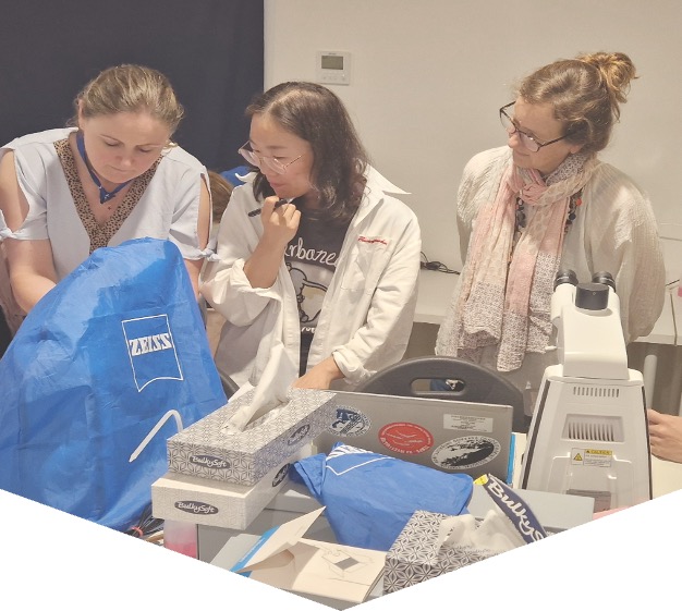
IOC Training Course and Identification Qualification in Harmful Marine Microalgae 2026
Since 1993 the IOC has conducted training courses on harmful microalgae. The purpose has been to improve the taxonomic and identification skills of the participants for research purposes and for practical monitoring of harmful algal blooms.
From 2006 the IOC training in HAB identification has been offered within a new framework which gives accreditation. The present course includes now a practical exam at the end of the course with an IOC Certificate of Proficiency in Identification of Harmful Algae issued to participants who pass the exam. We know by experience that many of the more than 500 trainees we have had over the years have wished the courses to give accreditation, and in some countries, the IOC courses have become a reference for laboratories to be approved for carrying out regulatory monitoring for harmful microalgae.
The IOC Science and Communication Centre on Harmful Algae, University of Copenhagen, Denmark is organizing the course.
IOC Training Course and Identification Qualification in Harmful Marine Microalgae 2026
Course description: The course includes 100 hours of teaching and is divided into two parts. 1) The first part of the course is organised online using the elearning platform of IOC/IODE/OceanTeacher Global Academy, giving general introductions to the various groups of harmful algae; this part is mainly for self-study and estimated to 40 hours of reading. 2) The second part is a practical course in species identification (see tentative programme below). Part 2 includes 60 hours of teaching and a microscope will be available to each participant during the entire period, see also link below.
Participants: The course is aimed at participants who have some years of practical experience in identification of microalgae. The number of participants is limited to 16. If there are more applicants than available seats, priority will be given to applicants who have direct research or management responsibilities with regard to the occurrence of harmful algae.
Dates: Part 1 will be offred through the eLearning platform of OTGA’ from October onwards; part 2 takes place onsite from 12-24 October 2026.
Venue on site: IOC Science and Communication Centre on Harmful Algae, Department of Biology, University of Copenhagen, Denmark.
Language: English.
Course lecturers: Dr. Santiago Fraga, Dr. Jacob Larsen, Dr. Nina Lundholm, Professor Øjvind Moestrup.
Enquiries may be sent to Jacob Larsen, jacobl@bio.ku.dk
Costs: The course is organized on a cost-recovery basis. The price of the course is 4500 EUR and it is a package deal, which covers all expenses during the course period, see also link below; thus
- Accommodation, arriving to the course venue on 12 October, check-in from 16.00, and check-out on 24 October at 10.00
- All meals during the course, starting with an evening meal upon arrival on 12 Oct. and finishing with breakfast on 24 Oct.
- Access to the distant learning programme on Ocean Teacher which will be available two- months prior to the practical course
- Teaching material including hard copies or pdf-versions of the following books which will be distributed during the practical part of the course:
- Lassus, P., Chomérat, N., Hess, P. & Nézan, E. 2016. Toxic and Harmful Microalgae of the World Ocean. – Denmark. International Society for the Study of Harmful Algae / Intergovernmental Oceanographic Commission of Unesco. IOC Manuals and Guides 68, 523 pp. (pdf-version)
- Hoppenrath, M., Chomérat, N., Horiguchi, T., Murray, S.A. & Rhodes, L. 2023. Marine benthic dinoflagellates – their relevance for science and society (2nd, revised edition). - Senckenberg Gesellschaft für Naturforschung, Frankfurt am Main, Germany. Senckenberg Buch vol. 88, 376 pp.
- Karlson, B., Cusack, C. & Bresnan, E. (eds). 2010. Microscopic and molecular methods fro quantitative phytoplankton analysis. – IOC Manuals and Guides 55, Paris, Unesco, 110 pp. (pdf-version)
- Larsen, J. & Nguyen, N.L. (eds). 2004. Potentially toxic microalgae of Vietnamese waters. – Opera Bot. 140: 5-216 (pdf-version)
- Reguera, B., Alonso, R., Moreira, A., Méndez, S., Dechraoui-Bottein, M.-Y. (eds). 2016. Guide for designing and implementing a plan to monotor toxin-producing microalge. 2nd ed. – IOC Gudies and Manuals 59, Intergovernmental Oceanographic Commission (IOC) of Unesco and International Atomic Energy Agency (IAEA), Paris and Vienna, 66 pp. (pdf-version)
- Proceedings from various HAB conferences (pdf-versions)
- Copies of all lectures given during the course
- Use of facilities, microscopes, samples, and cultures
- Tuition during the practical part of the course
Species identification
This part of the course will focus on identification of harmful algal species by light microscopy, with particular reference to the ‘IOC Taxonomic Reference List on Toxic Plankton Algae’. The use of electron microscopy will be introduced, but practical exercises are not included. During the course, the following species will be demonstrated either as cultures (*subject to the availability of cultures) or as preserved material.
Haptophyceae*: Chrysochromulina spp. Prymnesium spp.
Raphidophyceae*: Chattonella antiqua, C. ovata, C. subsalsa, Fibrocapsa japonica, Heterosigma akashiwo, Olisthodiscus luteus (Olisthodiscophyceae).
Dictyochophyceae*: Pseudo-chattonella verruculosa
Dinophyceae: Prorocentrum concavum, P. cordatum, P. emarginatum, P. gracile, P. obtusidens, P. hoffmannianum, P. lima, P. micans, P. rhathymum, P. rostratum, P. scutellum, P. triestenum
Dinophysis acuta, D. acuminata, D. caudata, D. fortii, D. miles, Phalacroma mitra, D. norvegica, P. rotundatum, D. tripos
Alexandrium affine, A. minutum*, A. catenella, A. ostenfeldii, A. pacificum*, A. pseudogonyaulax, A. tamarense, A. taylorii
Pyrodinium bahamense, Lingulodinium polyedrum, Protoceratium reticulatum, Gonyaulax polygramma, G. spinifera, Vulcanodinium rugosum, Gambierdiscus spp, Coolia spp., Ostreopsis spp.
Akashiwo sanguinea*, Amphidinium carterae*, Margalefidinium polykrikoides*, Gymnodinium catenatum*, G. impudicum*, Karenia mikimotoi*, K. papilionaceae*, K. selliformis*, Karlodinium armiger*, K. micrum*, Noctiluca scintillans.
Bacillariophyceae: Pseudo-nitzschia australis, P. calliantha*, P. delicatissima, P. fraudulenta, P. multiseries, P. pungens*, P. seriata, Nitzschia navis-varingica.
Cyanobacteria: Anabaena spp, Anabaenopsis spp, Aphanizomenon spp., Cylindro-spermopsis spp., Microcystis spp, Nodularia spumigena, Trichodesmium sp.
Feedback survey
At the end of the course, you will be asked to fill out a feedback survey. This information will be used to improve future courses. Note: submitting the course feedback survey is mandatory to obtain the course certificate
Certificate: A certificate of completion will be awarded to all participants who attended all classes and activities and completed the final test onsite.
Cancellation policy:
In the event of cancellation of the course by the OTGA or its affiliates, we will provide notification of cancellation at least 7 days prior to the course date. In the event of cancellation by the attendee, we should receive notification of cancellation at least 7 days prior to the course date.
ERASMUSMARIS-26
Erasmus Maris 2026: Monitoring microplastic pollution in coastal waters: From sampling and analysis to data
Collaboration and teamwork are central, and the training concludes with a certificate ceremony recognizing participants' achievements.
Who is it for?
The course is designed for approximately 60 upper secondary students and 14 science teachers from participating European Schools. The teachers will follow the trainer pathway, enabling them to implement Erasmus Maris activities with their students after the course. Two facilitators from Wings of the Ocean will also follow the trainer pathway to support future implementation in France.
Venue
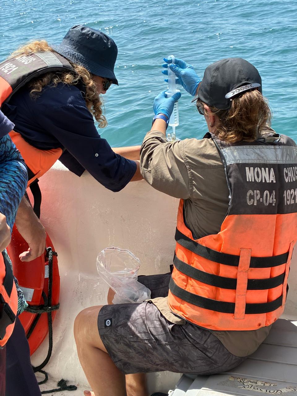
Microplastic sampling with a manta net.
This includes:
Approximately 20 hours of synchronous practical training distributed across 14–18 September 2026;
approximately 12 hours of online/asynchronous learning, including lessons and quizzes.
The practical training includes laboratory analysis, field sampling, introduction to the MARIS database, and supervised data-entry activities. The online component includes theoretical lessons and quizzes
Language of Instruction
Spanish.
The online lessons and quizzes are currently in English. If translation is completed before the course, the online materials may also be made available in Spanish.
Instructors
- Kamel Labibes: Chair- Ayam Sailing Europe,ASE)
- Carlos Sanz Lázaro: Professor, Department of Ecology, Faculty of Sciences, University of Alicante; Ramón Margalef Multidisciplinary Institute for Environmental Studies (IMEM), University of Alicante
Internal process. Each of the schools participating in the Erasmus Maris program, spread across EU different countries, have chosen six students to participate in the program. Applicants have expressed a genuine interest in environmental issues. presentation, and performance at school were also taken into account.
UNESCO is committed to promoting equal access principles. Applications from minority or underrepresented groups are strongly encouraged. For any questions please contact the OTGA Secretariat (ioc.training@unesco.org) always using the name of the course as the email subject.
Contacts
- Dr Kamel Labibes: coordination@ayamsailing.eu
- OTGA Secretariat: ioc.training@unesco.org
In case of need for further clarifications please use the contacts above, always using as email subject.
Feedback survey
At the end of the course, you will be asked to fill out a feedback survey. This information will be used to improve future courses.
Cancellation policy
In the event of cancellation of the course by the OTGA or its affiliates, we will provide notification of cancellation at least 7 days prior to the course date. In the event of cancellation by the attendee, we should receive notification of cancellation at least 7 days prior to the course date.
OLSSchool*Milazzo2026
Summer School on Ocean Literacy and Collaboration – Sustainable Blue Tourism in the Mediterranean and Black Seas
-
Gain familiarity with the objectives and activities of the EU4Ocean Coalition and the Youth4Ocean Forum and their contribution to the United Nations Decade of Ocean Science for Sustainable Development;
Explore how ocean literacy can inform tourism planning, destination management, education, and visitor engagement in Mediterranean and Black Sea coastal areas
Develop practical skills for transdisciplinary collaboration in the design and implementation of ocean-related projects;
Learn to integrate diverse knowledge systems, cultural contexts, and local perspectives when working towards a sustainable blue economy;
Strengthen science communication skills through storytelling, public engagement, and policy advocacy
- Francesca Santoro (UNESCO-IOC)
- Ottavia Carlon (UNESCO-IOC)
- Carmelo Isgrò (MuMa – Museo del Mare Milazzo)
- Carolyn Berger (MuMa – Museo del Mare Milazzo)
- Angelo Sciacca (Institute for Sustainable Development and International Relations – IDDRI)
- Ernesto Rollando (Freelance Consultant)
- Elissa Phillips (Incredible Oceans)
- Virginia Di Marco (Assicurazioni Generali)
- Natasa Vaidianu (Ovidius University of Constanța)
- Giovanni Mangano (Capo Milazzo Marine Protected Area)
- Teresa Romeo (Sicily Marine Centre – Stazione Zoologica Anton Dohrn)
- Claudio Berti (Stazione Zoologica Anton Dohrn)
- Gender balance
- Geographical representation
- Age range: up to 35 years old
- Background: all the sectors are encouraged to apply. We will pay attention to create an interdisciplinary group.
- Priority will be given to youth from the Mediterranean Sea and Black Sea, as well as members of the Y4O Forum and ECOPs

MSP-ICZM 2026
Planificación espacial marina y gestión marino-costera en Colombia: estrategias para la gobernanza del océano
El curso proporciona conceptos básicos, principios y metodologías sobre Manejo Integrado de Zonas Costeras (MIZC) y Planificación Espacial Marina (PEM), sus aplicaciones en casos prácticos, y en general, herramientas que facilitan el trabajo de los encargados de la gestión y planificación del medio marino y costero. Busca también propiciar un espacio de retroalimentación e intercambio de experiencias por parte de todos los participantes de acuerdo a sus conocimientos y lecciones aprendidas en temas de planificación y manejo de la zona costera en la región.
https://oceanexpert.org/event/5076
Local: Cartagena, Colombia (por confirmar sitio)
Needs and priorities
El curso proporciona los conceptos y metodologías fundamentales del Manejo Integrado de Zonas Costeras (MIZC) y la Planificación Espacial Marina (PEM), así como sus aplicaciones mediante casos prácticos y el uso de herramientas para la gestión y planificación de los espacios costeros y marinos. Además, fortalece las capacidades de comunidades, instituciones y demás actores locales para participar de manera efectiva en procesos de planificación, formulación e implementación de planes de manejo, zonificación, articulación interinstitucional, análisis integrado de información y desarrollo de proyectos. De esta manera, promueve el intercambio de conocimientos y experiencias, contribuyendo al fortalecimiento de una gobernanza marino-costera más participativa, integrada y orientada hacia la sostenibilidad.
Resultados generales de aprendizaje
Al completar con éxito esta capacitación, los participantes podrán:
-
Conceptos fundamentales y contexto del Manejo Integrado de Zonas Costeras (MIZC) y la Planificación Espacial Marina (PEM) en los procesos de planificación de los espacios marinos y costeros.
-
Metodologías del MIZC y la PEM aplicadas como herramientas para la planificación, el ordenamiento y la gestión de los espacios marinos y costeros.
-
Herramientas y enfoques aplicables al MIZC y la PEM, incluyendo temáticas transversales como gobernanza, participación de actores, cambio climático, conservación de la biodiversidad, economía azul y gestión basada en ecosistemas.
-
Estudios de caso nacionales e internacionales que ilustran la aplicación de los enfoques de MIZC y PEM.
Contenido y planificación del curso
El curso está estructurado en tres módulos que integran fundamentos conceptuales, gobernanza y aplicaciones prácticas de la Planificación Espacial Marina (PEM). Los principales temas incluyen: marco internacional de los océanos, conceptos y principios de la PEM, Manejo Integrado de Zonas Costeras (MIZC), gobernanza participativa, marco jurídico colombiano, uso de datos y SIG, experiencias nacionales e internacionales, cambio climático, Economía Azul, conservación y restauración marina, cooperación transfronteriza y ordenamiento territorial marino. Entre las actividades destacan cuestionarios y evaluaciones, análisis de casos, ejercicios de identificación de actores y conflictos, diseño de procesos de PEM, mapeo de condiciones actuales y futuras, paneles de reflexión y la elaboración de un plan integrado de Planificación Espacial Marina aplicado a un territorio específico.
Audiencia: Profesionales, comunidades y funcionarios de entidades a nivel nacional, regional y local, vinculados a pilotos PEM tanto nacionales como locales, y otras pertenecientes a instituciones/autoridades con potencialidad de desarrollar estos instrumentos de planificación.
Prerrequisitos
-
Pertenecer a una institución o autoridad con competencias en la gestión de los espacios marinos y costeros, a nivel nacional, regional o local.
-
Preferentemente, ser funcionario con vínculo laboral vigente en la institución o entidad a la que pertenece.
-
Tener preferentemente menos de 50 años de edad.
-
No haber participado ni aprobado este mismo curso en la convocatoria del año anterior.
Idioma de instrucción
Español
Instructores y organizadores
El contenido de este curso fue proporcionado por:
Gisela Paredes Leguizamón – Parques Nacionales Naturales (Colombia)
Natalia Quintero – Ministerio de Ambiente y Desarrollo Sostenible (Colombia)
Ángela López – Consultor Independiente
Julio César Rodríguez Peláez– Autoridad ambiental local (Corporación Autónoma Regional del Cauca -CRC)
Roberto Enrique Lastra Mier – Universidad del Atlántico (Colombia)
Natalia Solis– MSPglobal COI (Costa Rica)
Milena Hernández-Ortiz– INVEMAR
Anny Paola Zamora – INVEMAR
Esta capacitación está organizada por RTC Colombia (INVEMAR) en colaboración con y la UNESCO IOC OceanTeacher Global Academy, IOCARIBE e MSPglobal.
Evaluaciones y certificados
Asistencia, cumplimiento y participación en trabajos en grupo y quices.
Se expedirá un certificado a los estudiantes que tengan una participación activa en el 100% del curso, participación en trabajos y realización de quices.
Requisitos tecnológicos
Para completar este curso, los participantes deben tener acceso a:
- Computadora con un sistema operativo moderno (Windows, macOS o Linux)
- Última versión de los navegadores web Chrome, Edge, Firefox o Safari
- JavaScript y cookies habilitados
- Acceso a internet de banda ancha (ancho de banda mínimo de 0.5 Mbps (Recepción y Envío))
- Altavoces o auriculares, micrófono
Duración y formato del curso
Este curso se impartirá en formato presencial, 20 horas teórico-prácticas distribuidas en 3 días.
Costo: Este curso no tiene costo de matrícula.
Cómo participar
La participación en esta capacitación es solo por invitación.
Contatos
- OTGA Secretariat: ioc.training@unesco.org
Para cualquier consulta por favor contactar con la Secretaría de OTGA utilizando siempre el nombre del curso como asunto del correo electrónico.
Política de cancelación
En caso de cancelación del curso por parte de la OTGA o sus afiliados, se notificará con al menos 7 días de antelación. En caso de cancelación por parte del asistente, se nos notificará con al menos 7 días de antelación.

Microplásticos_2026
Microplásticos: Fundamentos científicos para a ciência e a política ambiental
Descrição do curso:
A poluição por plásticos tornou-se um dos desafios ambientais mais urgentes da nossa época, exigindo que cientistas, gestores ambientais e formuladores de políticas compreendam a ciência subjacente aos microplásticos. Este curso oferece uma introdução abrangente à formação, propriedades, destino ambiental, impactos e monitoramento de microplásticos sob a perspectiva da ciência dos polímeros. Os participantes aprenderão os princípios científicos necessários para avaliar criticamente as pesquisas atuais, compreender os dados de monitoramento e participar da tomada de decisões ambientais baseadas em evidências. A dinâmica do curso baseia-se na transmissão de conhecimento consolidado e de ponta sobre o tema e na abertura de espaço para debates entre alunos e professores.
Resultados de aprendizagem:
1. Explicar a origem e as vias de formação dos microplásticos.
2. Compreender como a composição e as propriedades dos polímeros influenciam o comportamento ambiental.
3. Avaliar as metodologias de monitoramento e suas limitações.
4. Compreender os fundamentos das propriedades dos polímeros, especialmente aquelas relevantes para a compreensão do seu potencial impacto ambiental.
5. Discutir o papel dos aditivos, da degradação e do intemperismo nos impactos ambientais.
6. Discutir as iniciativas políticas internacionais atuais utilizando evidências científicas.
Conteúdo do curso
1. Poluição por plástico: história, definições e desafios globais
2. Fundamentos da ciência dos polímeros: transição vítrea, fusão e cristalização; difusão; aditivos, degradação;
3. Formação e fontes de microplásticos: fontes locais e difusas, fontes terrestres e marinhas, microplásticos negligenciados;
4. Transporte e destino ambiental: vias de transporte da terra para o oceano, processos de transporte físico e biológico, fatores físicos que determinam o destino, sumidouros ambientais, microplásticos de legado;
5. Monitoramento e métodos analíticos: amostragem em ambientes terrestres, de água doce e marinhos, separação, caracterização, identificação, contaminação cruzada e garantia e controle de qualidade.
6. Impactos ambientais e biológicos: impactos físicos e químicos, efeitos ecotoxicológicos e vias de exposição humana
7. Políticas ambientais: as iniciativas políticas atuais e em desenvolvimento para o enfrentamento da questão da poluição plástica, incluindo o Tratado Global sobre Plásticos do PNUMA
Público-alvo e pré-requisitos:
Cientistas ambientais, cientistas marinhos, ecólogos, químicos, engenheiros, gestores ambientais, formuladores de políticas, educadores, estudantes de pós-graduação e profissionais de todas as áreas interessados em poluição plástica.
Não é necessário conhecimento prévio em ciência de polímeros. O curso é voltado para participantes com diversas formações científicas e profissionais. Estudantes de todos os níveis de formação acadêmica são bem-vindos.
Idioma e competências tecnológicas requeridas:
-
um bom conhecimento prático de Português
-
conhecimentos básicos de informática
-
a capacidade de encontrar recursos por meio de mecanismos de pesquisa digitais
-
a capacidade de ser autodirigido no aprendizado de novas habilidades tecnológicas (por exemplo, seguindo um tutorial passo a passo, ajuda em vídeo on-line ou acesso a suporte para aprender as habilidades necessárias)
Observação: Todas as aulas são preparadas para alunos sem conhecimento específico em química, física ou biologia. A história dos cursos anteriores no Brasil contou com participação significativa de profissionais das Ciências Humanas e Sociais e de uma ampla gama de setores públicos.
Língua de instrução: Português. Algumas partes do curso podem ser oferecidas em inglês.
Instrutores:
Walter Ruggeri Waldman – Universidade Federal de São Carlos
Maria Fernanda Rosa da Silva – Universidade Federal de São Carlos
Rafael Vinícius de Oliveira – Universidade Federal de São Carlos
Adriana Sheyla Moura Murari – Universidade Federal de São Carlos
Avaliações e Certificado
- completar todas as lições de cada Módulo do curso
- completar todos os questionários (pontuação mínima de 70% para cada questionário)
- responder a pesquisa de satisfação
Requisitos tecnológicos/habilidades em informática Utilização da plataforma OTGA, YouTube e Google Docs. Todas as plataformas são de código aberto.
Pré-requisitos: Nenhum pré-requisito.
Como se inscrever
As inscrições são realizadas online. Siga o passo-a-passo:
Registre-se no site da OceanExpert (www.oceanexpert.org). Assim que sua conta OceanExpert for aprovada (isso não é feito imediatamente), você poderá se inscrever no curso. Se você já possui uma conta OceanExpert, você pode se inscrever no curso usando seu nome de usuário e senha OceanExpert. As inscrições estão disponíveis de 1 de agosto 2026 (12:00, hora de Bruxelas, CEST).Inscrições até 15 de setembro, duas semanas antes do início do curso.
Pesquisa de satisfação
Ao final do curso, você será solicitado a preencher uma pesquisa de feedback. Essas informações serão usadas para melhorar cursos futuros.
Contatos:
- através do email: walter@ufscar.br
- Secretariado da OTGA por e-mail ioc.training@unesco.org (utilizar sempre o nome do curso como assunto de e-mail)
Blue Impact Lab
Blue Impact Lab
Course description
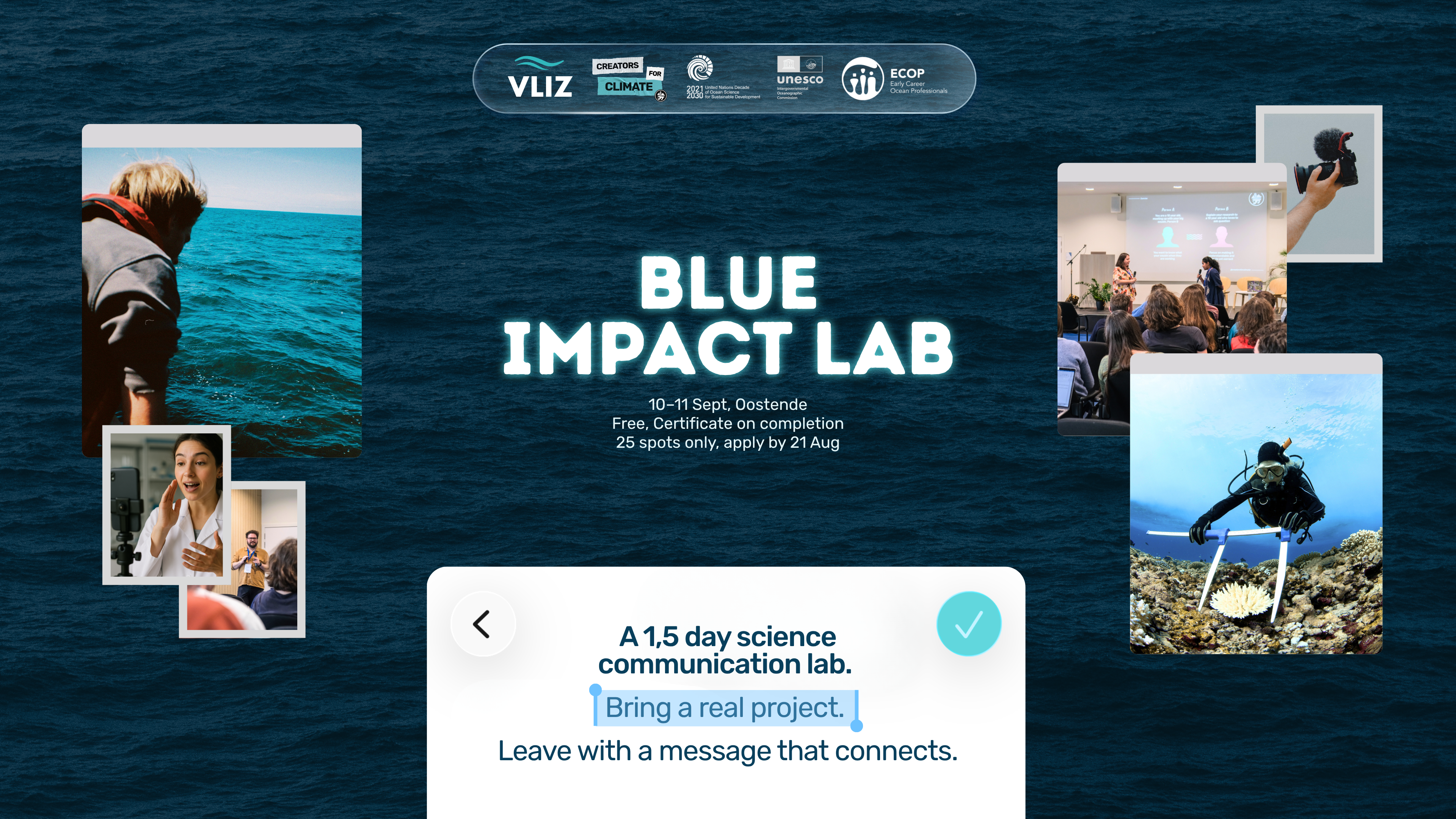
A 1,5 day hands-on science communication learning lab for Early Career Ocean Professionals (ECOPs). Focused on audience concretization, strategy, and practical application rather than generic media training. Participants bring a real project to work on directly. The goal of the Blue Impact lab is to provide participants with a workflow and strategic tools to use at the start of their science communication efforts.
Learning Outcomes
- Understand why and where science communication does not get traction
- Understand the difference between awareness and adoption by an audience
- Map a real target audience for their project, more specific than "the general public"
- Understand communication as a strategic choice, not an output after the fact
- Reframe a message toward what that audience needs to take away
- Read in real time whether a message is working, and adjust it if needed
- Give and receive structured, useful feedback on communication work from peers
- Leave the lab with at least one peer contact they can turn to for feedback on their communication work going forward
Course content
DAY 1: 10 September 2026 (14:00-17:00)
- Goal setting & Agenda
- Science communication with impact
- Writing your core message and who you're actually trying to reach
- Does the message connect (or not)?
- Backcasting and sharing
- Recap and prep for day 2
DAY 2: 11 September 2026 (10:00-17:00)
- The Impact Workflow
- Define your own impact for this case
- Audience concretization
- Audience context and entry points
- Message stress-test
- Backcasting and sharing
- Close and next steps
Target audience and prerequisites
Early Career Ocean Professionals already working (not students only). From a marine-related master programme or from a marine-related sector (governmental, non-governmental, private sector or academia). Primarily Belgian/European context since course will be on-site. Senior/expert practitioners also participate, in an audience role.
Prerequisites:
- Working experience in the marine sector or research
- A real working case to bring, or a credible substitute (e.g. the November Ocean conference, for participants without an active project)
- Working proficiency in English
Language of instruction: English
Instructor(s):
Tom Janssen (creators for Climate) main instructor and facilitator
Angeliki Karampourouni
Course structure: Blended format. Online part: IOC OceanTeacher Global Academy + Onsite part: InnovOceanCampus- VLIZ, Jacobsenstraat 1-8400 Oostende, Belgium
Course duration: +/- 9-10 hours
Learner assessment: Non-scored. Participants submit a copy (photograph) of filled-in digital or physical canvases. Submissions kept private given sensitive case studies may be discussed.
Evaluation/certificate:
Certificate issued via OTGA on completion. Criteria: full attendance across both days plus canvas submission
Technology requirements and pre-requisites: None required to follow the course. May offer an AI tool as a optional extra, not mandatory - non pre-requisites.
Application process: OTGA application form - open till 30 August 2026
max number of people: 25
costs: free of charge
The course is financed by the National Decade Committee for Belgium as a support to capacity development opportunities for ECOPs, local networks in Belgium, and contribution to blue skills and IOC-UNESCO Capacity development strategy (2023-2030).
Lunch and coffee break will be provided for both days of the training
Travel costs are covered by the participants
Feedback survey: At the end of the course, you will be asked to fill out a feedback survey. This information will be used to improve future courses.
Cancellation policy:
In the event of cancellation of the course by the OTGA or its affiliates, we will provide notification of cancellation at least 7 days prior to the course date. In the event of cancellation by the attendee, we should receive notification of cancellation at least 7 days prior to the course date.
SEAMARCS
Strengthening Sea Level Monitoring and Data Management in East Africa for Coastal Resilience and Community Safety Technical Training
The Strengthening Sea Level Monitoring and Data Management in East Africa for Coastal Resilience and Community Safety Technical Training – SEAMARCS is a five-day technical capacity development course designed to strengthen national and regional capabilities in sea-level observation, data management, and applied sea-level science within the Sub-Saharan Africa and South West Indian Ocean (SWIO) region
The course aims to provide participants with practical and theoretical knowledge required to install, operate and maintain tide gauge stations contributing to the Global Sea Level Observing System (GLOSS). Core content includes:
- Sea-level measurement technologies, station installation, maintenance, and troubleshooting
- Data telemetry and operational data exchange with the IOC Sea Level Station Monitoring Facility (SLSMF) and other international data centres
- Sea-level data processing, quality control (including automated QC using the IOC SLSMF API), tidal analysis and interpretation
- Fundamental sea-level science, including tides, surges, seiches, tsunamis, sea-level rise, and vertical land motion
- Practical field exercises, including a site visit to operational tide gauge stations and basic surveying and levelling techniques (optical and GNSS).
- The training targets technicians, hydrographers, surveyors, and early-career oceanographers who are directly involved in water level observations and data analysis, with an emphasis on hands-on learning and operational problem-solving in a real-world context.
Learning outcomes
Upon successful completion of the Strengthening Sea Level Monitoring and Data Management in East Africa for Coastal Resilience and Community Safety Technical Training – SEAMARCS, participants will be able to:
Identify and describe the main sea-level measurement technologies used in GLOSS tide gauge stations and explain their operational strengths and limitations.
- Configure and manage data telemetry systems to enable timely transmission of sea-level data from national stations to the IOC Sea Level Station Monitoring Facility (SLSMF) and other relevant international data centres.
- Apply standard sea-level data processing and quality control procedures, including the use of automated quality control tools and the IOC SLSMF API.
- Interpret sea-level time series (mareograms) to identify and distinguish physical phenomena such as tides, seiches, storm surges, tsunamis, and longer-term sea-level variability.
- Perform basic tidal analysis and explain the concept and use of tidal datums in hydrographic, oceanographic, and maritime applications.
- Explain the role of vertical land motion and site stability in sea-level observations and integrate levelling and GNSS information into station assessments.
- Demonstrate practical field skills through site visits and hands-on exercises, including basic surveying and inspection of operational tide gauge infrastructure.
Course content
The training will support the subsequent installation of SEAMARCS tide gauge stations at locations in Kenya, Mozambique, Madagascar and Seychelle. The training will strengthen the technical and operational capacities of personnel responsible for sea-level monitoring systems and associated data management in participating countries. The training will provide both theoretical and practical knowledge on tide gauge operation, calibration, maintenance, quality control and data management.
The training combines theoretical lectures, practical exercises, system demonstrations, and a field visit to ensure participants gain applied operational skills in sea-level observation and data management.
1. Introduction and Regional Context
- Overview of the GLOSS and its role within IOC programmes
- Network reports and experience-sharing by participating Member States
- Regional sea-level monitoring challenges and priorities in the Indian Ocean region
2. Sea-Level Measurement Technologies
- Overview of sea-level measurement principles
- Types of tide gauges and sensors used in GLOSS stations
- Strengths, limitations, and suitability of different technologies for operational monitoring
3. Tide Gauge Installation, Operation, and Maintenance
- Anatomy and components of a tide gauge station
- Installation requirements and best practices
- Routine maintenance procedures and operational checks
- Troubleshooting common technical problems affecting station performance
4. Data Telemetry and International Data Exchange
- Data transmission systems and telemetry options
- Establishing and maintaining data delivery links with the IOC Sea Level Station Monitoring Facility (SLSMF)
- Overview of other international and GLOSS sea-level data centres
- Practical troubleshooting session to establish or improve data links
5. Sea-Level Data Processing and Quality Control
- Introduction to sea-level data formats and processing workflows
- Manual and automated quality control procedures
- Use of the IOC SLSMF API for automated quality control
- Practical exercises using real sea-level datasets
- Tidal analysis using TTide
6. Sea-Level Science and Data Interpretation
- Interpretation of mareograms and sea-level records
- Identification of physical processes affecting sea level, including:
- Tides
- Seiches
- Storm surges
- Tsunamis
- Sea-level rise and variability
- Overview of tidal analysis methods and tidal datums
7. Vertical Land Motion and Site Stability
- Concepts of vertical land motion (VLM) and its impact on sea-level observations
- Theory of levelling methods (optical levelling and GNSS)
- Integration of GNSS and levelling data with sea-level observations
- Overview of GNSS and VLM data centres supporting sea-level monitoring
8. Practical Field Activities
- Site visit to an operational tide gauge station
- Hands-on inspection of station components and surroundings
- Basic surveying and levelling exercises in the field
- Application of learned concepts in a real operational environment
Target audience
The training is intended for professionals from IOC Member States in Sub-Saharan Africa and SWIO region who are currently involved, or expected to be involved, in sea-level observation and data management activities. Specifically, the target audience includes:
- Technicians responsible for the operation and maintenance of tide gauge stations including the prospective SEAMARCS stations
- Hydrographers and surveyors working with coastal and water level measurements
- Data analysts involved in processing and quality control of sea-level data
- Early-career or entry-level oceanographers engaged in sea-level or coastal observation programmes
Participants are typically affiliated with national oceanographic, hydrographic, or maritime institutions contributing, or planning to contribute, sea-level data to IOC systems such as GLOSS and the IOC Sea Level Station Monitoring Facility (SLSMF).
Prerequisites
- No prior specialised knowledge of tides or advanced sea-level science is required
- Basic understanding of oceanographic or tidal concepts is desirable
- Basic computer skills are required, including the ability to work with digital data and software tools
- Some familiarity with water level data processing requirements or operational measurement environments is expected
- Willingness and ability to participate in hands-on fieldwork, including a site visit to a tide gauge station and basic survey exercises
Selection Criteria
Professional relevance
- Candidates must be currently involved, or expected to be involved, in sea‑level observation, tide gauge operation, or water‑level data analysis within a national oceanographic, hydrographic, or maritime institution
Institutional role and applicability
Priority is given to nominees whose responsibilities allow them to directly apply the training outcomes to the operation, maintenance, or data management of tide gauge stations contributing to GLOSS and IOC systems
Regional eligibility
- Applicants have been selected from countries which are in the scope of the SEAMARCS project and a follow-on project.
Basic computer skills
- Some familiarity with water‑level data processing or measurement environments
- An ability to participate fully in hands‑on technical and field activities
Language proficiency
- Sufficient working knowledge of English, as the training will be conducted entirely in English
Commitment to full participation
- Availability to attend the entire onsite training period (29 June – 03 July 2026), including practical sessions and the site visit
- Gender and geographic balance (where applicable)
- Selection may take into account equitable geographic representation and gender balance, in line with IOC capacity development principles
Course language: English
Instructors
Duration: 37 hours - 5 days onsite
Learner assessment
Written and oral assessments throughout the training course
Certificate
After completing the written and oral assessment, and the feedback survey, a certificate will be provided.
Technology requirements
Participants should be able to:
- Use a personal computer confidently, including basic operating system functions (file management, installing or running software, connecting to networks)
- Work with digital datasets, including opening, viewing, and managing sea-level or time‑series data files
- Use common productivity software, such as spreadsheets and document viewers, to review, organize, and inspect data outputs
- Access and use web-based platforms and online tools, including browser-based data portals and APIs demonstrated during the training (e.g. IOC Sea Level Station Monitoring Facility tools)
Technical Skills:
- Basic knowledge of water level data processing requirements, sufficient to follow instruction on data quality control and analysis workflows
- Familiarity with digital communication and data transmission concepts, supporting understanding of telemetry and data exchange with international data centres
Willingness and ability to engage in hands-on technical sessions, including practical exercises using IOC tools, APIs, and real sea-level dataset
Venue
Hotel Tivoli Maputo, Av. 25 Setembro, nº 1321
340 Maputo, Moçambique
Organisers
- Intergovernmental Oceanographic Commission of UNESCO (UNESCO‑IOC)’s Global Sea Level Observing System (GLOSS)
Ex-employees of the National Oceanography Centre (NOC), United Kingdom - Flanders Marine Institute (VLIZ)
- UNESCO‑IOC Project Office for IODE (Ostend, Belgium)
Contacts
For course organization, please contact: Angela Hibbert (course organiser)
For additional questions, please contact OTGA Secretariat (ioc.training@unesco.org) always using the name of the course as e-mail subject.
Cancellation policy
In the event of cancellation of the course by the OTGA or its affiliates, we will provide notification of cancellation at least 7 days prior to the course date. In the event of cancellation by the attendee, we should receive notification of cancellation at least 7 days prior to the course date.
SEAICE_2026ES
Observador de Hielo Marino y Témpanos _2026
Descripción del curso
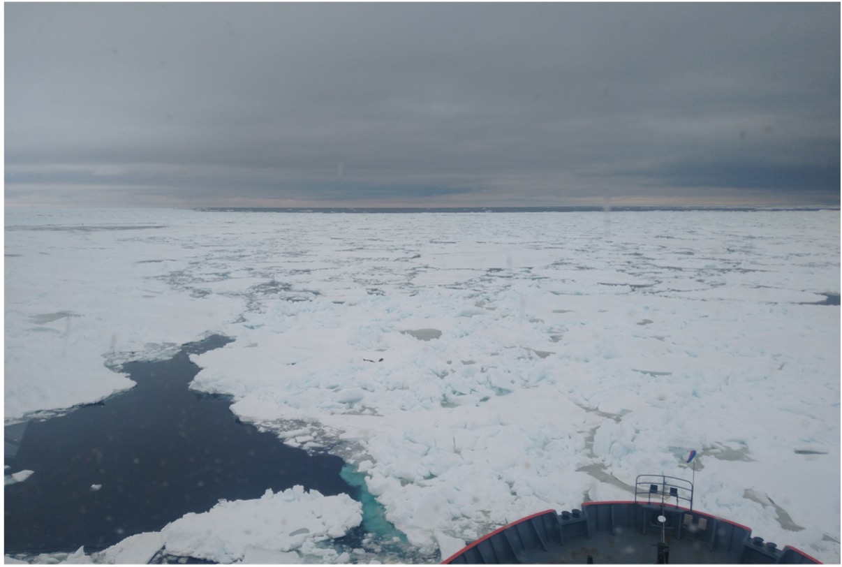
Las observaciones de hielo marino y témpanos son una fuente de información sobre lugares remotos como las regiones polares y son de gran utilidad para la cartografía de hielo y la validación de estudios climáticos.
Este curso está diseñado para certificar la capacidad de los observadores en aguas polares. Desde el proceso de formación del hielo marino hasta la realización de observaciones desde buques o estaciones utilizando el Sistema de Información Glaciología (SIGLAC). Además, se darán los conocimientos para la interpretación de cartas de hielo y otras herramientas para usos operativos
Objetivos
Este curso tiene como objetivo proporcionar los conocimientos para la realización de observaciones desde buques y estaciones polares y las herramientas para comprender los productos disponibles para usos operativos a través de la navegación en aguas polares.
Resultados de aprendizaje
Una vez finalizado el curso los participantes tendrán los conocimientos, capacidades y experiencia para:
Reconocer tipos de hielo marino y témpanos.
Realizar observaciones de hielo marino y témpanos desde su codificación hasta exportación del mensaje final.
Usar y entender cartas de hielo.
Conocer los recursos disponibles para su uso operativo en aguas polares.
Contenido del curso
Introducción al Continente Antártico.
Introducción a las observaciones glaciológicas.
Hielo marino, proceso de formación, estados de desarrollo, formas, concentración, aberturas en el hielo, características de la superficie del hielo, estados de fusión.
Hielo de origen terrestre, témpanos, tempanitos y gruñones.
Indicadores relativos al cielo y aire.
Técnicas de reconocimiento y codificación de las observaciones del hielo marino y témpanos desde buques y bases.
Uso del software SIGLAC.
Cartas de hielo y recursos para usos operativos.
Público objetivo y requisitos previos
Investigadores y personal con actividades que involucren aguas polares y/o requieran de herramientas para el reconocimiento y registro del hielo marino y témpanos.
Idioma de instrucción: Español
Requisitos tecnológicos/habilidades em informática
Sistema de Gestión de Aprendizaje (Moodle)
-
Computadora con Windows o Mac OS
-
Última versión de los navegadores web Chrome, Edge, Firefox o Safari
-
JavaScript y cookies habilitados
-
Acceso a Internet de banda ancha (ancho de banda mínimo de 0,5 Mbps) Recepción y Envío
-
Altavoces o auriculares, Micrófono
Sistema de conferencia web Big Blue Button
-
Se recomienda la última versión de los navegadores Chrome, Edge o Firefox
Habilidades informáticas requeridas
Uso del software SIGLAC
Instructores
Lic. Esp. Soledad Tiranti– Servicio de Hidrografía Naval
Formato del curso: En Línea
Sesiones sincrónicas
Clases virtuales en vivo, casos de estudio y ejercicios prácticos.
Duración estimada del curso
15 horas
Evaluación del aprendizaje
Se incluyen ejercicios y examen final como formas de evaluación.
Evaluación/Certificado
Para obtener un certificado es necesario completar con éxito (puntuación de corte) estas evaluaciones y completa la encuesta de retroalimentación.
Requisitos previos: n/a
Número de participantes: -
Costos: El curso es gratuito
La UNESCO está comprometida con la promoción de los principios de igualdad de acceso. Se alienta especialmente la presentación de solicitudes por parte de personas pertenecientes a grupos minoritarios o subrepresentados. Si tiene alguna pregunta, comuníquese con la Secretaría de la OTGA (ioc.training@unesco.org), indicando siempre el nombre del curso en el asunto del correo electrónico.
Proceso de solicitud
Complete el formulario de solicitud en línea disponible en: La fecha límite para presentar las solicitudes es el 21 de junio 2026 (23:59 CEST: hora de Europa Central).
Política de cancelació:
En caso de cancelación del curso por parte de la OTGA o sus afiliados, notificaremos la cancelación con al menos 7 días de antelación a la fecha del curso. En caso de cancelación por parte del participante, deberá notificarnos la cancelación con al menos 7 días de antelación a la fecha del curso.
Marine Data Management, Governance and the MEDIN toolset (October 2026)
The Marine Environmental Data and Information Network (MEDIN) is a partnership of UK organisations committed to improving access to marine data. MEDIN is open to all with an interest in marine data and information. MEDIN is funded by a consortium of 16 sponsors and has over 60 partners that represent government departments and agencies, research organisations and private companies committed to practise good data management. MEDIN reports to the UK Marine Science Coordination Committee.
This ONLINE course demonstrates how data management ‘best practice’ can improve organisational efficiency in data acquisition, analysis, curation and sharing. It covers data use with respect to corporate risk, re-use, audit and traceability, whilst at the same time helping minimising costs.
The course will equip attendees to better meet the challenge of keeping on top of the ever-increasing volumes and types of data that is being created and how to manage this data and make it available to users as meaningful information, whether using proprietary or open-source software and systems as enablers.
Aims & Objectives
The course aims to give participants a broad understanding of data governance, management principles, and system components and how data can be published information and re-used with a focus on the tools that the Marine Environmental Data and Information Network (MEDIN) provides as examples of best practice.
Expected Learning Outcomes
- An understanding of MEDIN and why data management is important and how it can reduce costs, risk, and add value through extending its original purpose.
- An understanding of the fundamentals of how data is collected, managed, published and used plus how important metadata is!
- An appreciation of data management components based on the International Data Management Association Book of Knowledge (DM-BOK)
- Knowledge of the importance of metadata and practical guidance in its creation, maintenance and dissemination
- Have an appreciation of the need to use words, phrases and terms to describe or explain marine data content and to understand how controlled vocabularies are used within the MEDIN standard and guidelines
- Appreciate how geospatial data can be accurately represented
- Understand the role and value of adopting data governance and how this relates to business management and corporate governance.
- Understand what discovery metadata is, what the MEDIN discovery metadata standard is and how it is used on the MEDIN portal.
- Be able to use the online metadata editor and metadata maestro to create MEDIN compliant discovery metadata records.
- Understand the ways in which data is now published and considerations associated with sharing and re-use
- Appreciate that the MEDIN data guidelines are a tool to create consistent datasets with comprehensive metadata, that allows data to be shared, understood and reused by others with ease.
Course content
The course comprises a series of presentations, demonstrations and check-point reviews, with a large practical element to help users become familiar with:
- Why data management is important and how it can and arguably should be part of an organisations business management framework alongside quality, occupational health and safety, and information security, all of which are covered by ISO accreditation.
- The role of a data policy and management plan, and things to consider and how data can be shared, published and re-used.
- Data management principles, standards and components, including data lifecycle and quality, the role of vocabularies (or data dictionaries) and the importance of creating, maintaining and publishing metadata.
- The resources and other benefits of MEDIN and practical instruction in the use of the MEDIN data guidelines, metadata standard and controlled vocabularies.
Course modules include:
- Module 1. Course content and objectives
- Module 2. Introduction to MEDIN as an exemplar data partnership and management framework
- Module 3. Data management overview, principles and organisation
- Module 4. Data in a Business Management Framework (Policy, Planning, Review)
- Module 5. Standards Overview
- Module 6. Data management components frameworks and infrastructure
- Module 7. Practical session
- Module 8. MEDIN Data Guidelines
- Module 9. Data Sharing and Publishing
- Module 10. Course Summary
Target audience and prerequisites
This training course is suitable for anyone responsible for collecting or managing marine environmental data in the public sector, industry, or for education or research, for example:
- Existing and potential data managers who wish to gain an overview of data governance, policy and principles and/or want to learn more about using the MEDIN metadata standard data guidelines in their day to day work.
- Contractors who want to implement good data management practice and/or have been asked to supply MEDIN compliant metadata.
- Bachelors/masters/PhD students or recent graduates interested in data management best practice and adding to their professional skill set.
Pre-requisites: An understanding of marine data collection is beneficial, however no prior knowledge of MEDIN or data management is required. Familiarity with different marine data types, and how data is acquired and used, would be helpful but not essential. Prior knowledge or practical experience in data management is not required.
Language of Instruction: English
Instructors
- Roseanna Wright (MEDIN/NOC)
-
Alice Rysiecki (MEDIN/NOC)
- Colm Walsh (MEDIN/NOC)
- Chloe Figueroa-Ashforth (DASSH/MBA)
- Julie Bunt (DASSH/MBA)
- Mike Osborne (OceanWise)
Course Format and Duration
The course takes place over 5 days with online lectures delivered in live sessions (2-3 hours, with regular breaks) in the mornings (UK time) and independent-study and practical assignments in the afternoons.
Monday-Friday: approx. 09:00-12:00 GMT/BST + drop-in sessions 14:00-14:30 GMT/BST
Attendance not mandatory, sessions are recorded.
Application Process
Please self-enroll on the course on the OceanTeacher Global Academy e-Learning Platform:
The course enrolment key can be found on the MEDIN website. Number of places is limited to 60 participants.
Contacts:
-
MEDIN: Roseanna Wright (roswri@bodc.ac.uk) (Course Organiser)
-
OTGA Secretariat: ioc.training@unesco.org
In case of need for further clarifications please use the contacts above, always using as email subject:
(Online) Marine Data Management, Governance and the MEDIN toolset, October 2026
Costs
No tuition fee.
This course is organised by MEDIN in collaboration with UNESCO IOC OceanTeacher Global Academy.
More information about MEDIN's workshops can be found on https://www.medin.org.uk/medin-workshops
Assessment and Certificates
A combination of quizzes and assignments to ensure understanding and practical application of knowledge and skills acquired during the course.
Certificates will be issues based on the required activities (chapters, quizzes and assignments) for each pathway (Governance, Practical MEDIN, or Combined) being completed.
The course has been awarded official recognition as contributing to the Continuing Professional Development (CPD) requirements of the Institute of Marine Engineering, Science and Technology’s (IMarEST’s) members.
Feedback survey:
At the end of the course, you will be asked to fill out a feedback survey. This information will be used to improve future courses.
Cancellation policy:
In the event of cancellation of the course by the OTGA or its affiliates, we will provide notification of cancellation at least 7 days prior to the course date. In the event of cancellation by the attendee, we should receive notification of cancellation at least 7 days prior to the course date.
Marine Data Management, Governance and the MEDIN toolset (September 2026)
The Marine Environmental Data and Information Network (MEDIN) is a partnership of UK organisations committed to improving access to marine data. MEDIN is open to all with an interest in marine data and information. MEDIN is funded by a consortium of 16 sponsors and has over 60 partners that represent government departments and agencies, research organisations and private companies committed to practice good data management. MEDIN reports to the UK Marine Science Coordination Committee.
This ONLINE course demonstrates how data management ‘best practice’ can improve organisational efficiency in data acquisition, analysis, curation and sharing. It covers data use with respect to corporate risk, re-use, audit and traceability, whilst at the same time helping minimising costs.
The course will equip attendees to better meet the challenge of keeping on top of the ever-increasing volumes and types of data that is being created and how to manage this data and make it available to users as meaningful information, whether using proprietary or open-source software and systems as enablers.
Aims & Objectives
The course aims to give participants a broad understanding of data governance, management principles, and system components and how data can be published information and re-used with a focus on the tools that the Marine Environmental Data and Information Network (MEDIN) provides as examples of best practice.
Expected Learning Outcomes
- An understanding of MEDIN and why data management is important and how it can reduce costs, risk, and add value through extending its original purpose.
- An understanding of the fundamentals of how data is collected, managed, published and used plus how important metadata is!
- An appreciation of data management components based on the International Data Management Association Book of Knowledge (DM-BOK)
- Knowledge of the importance of metadata and practical guidance in its creation, maintenance and dissemination
- Have an appreciation of the need to use words, phrases and terms to describe or explain marine data content and to understand how controlled vocabularies are used within the MEDIN standard and guidelines
- Appreciate how geospatial data can be accurately represented
- Understand the role and value of adopting data governance and how this relates to business management and corporate governance.
- Understand what discovery metadata is, what the MEDIN discovery metadata standard is and how it is used on the MEDIN portal.
- Be able to use the online metadata editor and metadata maestro to create MEDIN compliant discovery metadata records.
- Understand the ways in which data is now published and considerations associated with sharing and re-use
- Appreciate that the MEDIN data guidelines are a tool to create consistent datasets with comprehensive metadata, that allows data to be shared, understood and reused by others with ease.
Course content
The course comprises a series of presentations, demonstrations and check-point reviews, with a large practical element to help users become familiar with:
- Why data management is important and how it can and arguably should be part of an organisations business management framework alongside quality, occupational health and safety, and information security, all of which are covered by ISO accreditation.
- The role of a data policy and management plan, and things to consider and how data can be shared, published and re-used.
- Data management principles, standards and components, including data lifecycle and quality, the role of vocabularies (or data dictionaries) and the importance of creating, maintaining and publishing metadata.
- The resources and other benefits of MEDIN and practical instruction in the use of the MEDIN data guidelines, metadata standard and controlled vocabularies.
Course modules include:
- Module 1. Course content and objectives
- Module 2. Introduction to MEDIN as an exemplar data partnership and management framework
- Module 3. Data management overview, principles and organisation
- Module 4. Data in a Business Management Framework (Policy, Planning, Review)
- Module 5. Standards Overview
- Module 6. Data management components frameworks and infrastructure
- Module 7. Practical session
- Module 8. MEDIN Data Guidelines
- Module 9. Data Sharing and Publishing
- Module 10. Course Summary
Target audience and prerequisites
This training course is suitable for anyone responsible for collecting or managing marine environmental data in the public sector, industry, or for education or research, for example:
- Existing and potential data managers who wish to gain an overview of data governance, policy and principles and/or want to learn more about using the MEDIN metadata standard data guidelines in their day to day work.
- Contractors who want to implement good data management practice and/or have been asked to supply MEDIN compliant metadata.
- Bachelors/masters/PhD students or recent graduates interested in data management best practice and adding to their professional skill set.
Pre-requisites: An understanding of marine data collection is beneficial, however no prior knowledge of MEDIN or data management is required. Familiarity with different marine data types, and how data is acquired and used, would be helpful but not essential. Prior knowledge or practical experience in data management is not required.
Language of Instruction: English
Instructors
-
Alice Rysiecki (MEDIN/NOC)
- Colm Walsh (MEDIN/NOC)
- Chloe Figueroa-Ashforth (DASSH/MBA)
- Julie Bunt (DASSH/MBA)
- Mike Osborne (OceanWise)
Course Format and Duration
The course takes place over 5 days with online lectures delivered in live sessions (2-3 hours, with regular breaks) in the mornings (UK time) and independent-study and practical assignments in the afternoons.
Monday-Friday: approx. 09:00-12:00 GMT/BST + drop-in sessions 14:00-14:30 GMT/BST
Attendance not mandatory, sessions are recorded.
Application Process
Please self-enroll on the course on the OceanTeacher Global Academy e-Learning Platform:
The course enrolment key can be found on the MEDIN website. Number of places is limited to 60 participants.
Contacts:
-
MEDIN: Alice Rysiecki (alirys@noc.ac.uk) (Course Organiser)
-
OTGA Secretariat: ioc.training@unesco.org
In case of need for further clarifications please use the contacts above, always using as email subject:
(Online) Marine Data Management, Governance and the MEDIN toolset, September 2026
Costs
No tuition fee.
This course is organised by MEDIN in collaboration with UNESCO IOC OceanTeacher Global Academy.
More information about MEDIN's workshops can be found on https://www.medin.org.uk/medin-workshops
Assessment and Certificates
A combination of quizzes and assignments to ensure understanding and practical application of knowledge and skills acquired during the course.
Certificates will be issues based on the required activities (chapters, quizzes and assignments) for each pathway (Governance, Practical MEDIN, or Combined) being completed.
The course has been awarded official recognition as contributing to the Continuing Professional Development (CPD) requirements of the Institute of Marine Engineering, Science and Technology’s (IMarEST’s) members.
Feedback survey:
At the end of the course, you will be asked to fill out a feedback survey. This information will be used to improve future courses.
Cancellation policy:
In the event of cancellation of the course by the OTGA or its affiliates, we will provide notification of cancellation at least 7 days prior to the course date. In the event of cancellation by the attendee, we should receive notification of cancellation at least 7 days prior to the course date.
PythonES-2026
Visualizaciones con Python
Descripción del curso
Curso teórico y práctico que cubre los fundamentos y técnicas necesarias para crear visualizaciones efectivas y comprensibles utilizando Python.
El objetivo del curso es proporcionar los conocimientos y habilidades necesarios para analizar datos, seleccionar representaciones gráficas apropiadas y comunicar resultados de manera clara mediante herramientas modernas de visualización. Se explorarán bibliotecas especializadas como Matplotlib, Seaborn, Plotly y Altair, junto con buenas prácticas de diseño y principios de visualización científica.
Al finalizar el curso, los estudiantes serán capaces de desarrollar visualizaciones estáticas e interactivas que permitan la interpretación de conjuntos de datos complejos, la creación de informes visuales y la aplicación de técnicas avanzadas para presentar resultados en entornos académicos y/o profesionales.
Resultados de aprendizaje
El curso proporcionará las herramientas necesarias para comprender y aplicar los principios fundamentales de la visualización de datos utilizando Python, desde un enfoque interdisciplinario que combina estadística, diseño y comunicación de datos. Se abordarán las distintas etapas del proceso de visualización, desde la preparación y limpieza de datos, hasta la selección de tipos de gráficos adecuados, su implementación con bibliotecas especializadas y la interpretación visual de los resultados.
Al finalizar este curso, los estudiantes deberán estar preparados para diseñar e implementar visualizaciones efectivas, tanto estáticas como interactivas, capaces de comunicar información compleja de manera clara y precisa utilizando herramientas como Matplotlib, Seaborn, Plotly y Altair. También podrán integrar visualizaciones en informes, paneles o presentaciones orientadas al análisis y la toma de decisiones.
Contenido del curso
- Introducción a la visualización de datos y fundamentos teóricos
Importancia de la visualización en el análisis de datos
Tipos de datos y elección del gráfico adecuado
Errores comunes en la representación de datos - Visualización básica con Matplotlib
Creación de gráficos de líneas, barras, dispersión e histogramas
Personalización de ejes, colores, estilos y etiquetas
Organización de múltiples gráficos y figuras
Visualización estadística con Seaborn - Gráficos para explorar relaciones entre variables
Representaciones categóricas, distribuciones y correlaciones
Control de paletas de colores, estilos y plantillas visuales
Visualizaciones interactivas con Plotly y Altair - Introducción a visualizaciones dinámicas e interactivas
Creación de paneles y gráficos exploratorios
Exportación de visualizaciones a HTML y notebooks - Proyecto final de integración
Narrativa de datos: cómo comunicar un mensaje visualmente
Evaluación de la efectividad de una visualización
Proyecto final: desarrollo de una visualización integral utilizando datos reales (a elección del estudiante o proporcionados por el instructor)
Público objetivo y requisitos previos
El curso está dirigido a graduados, estudiantes de posgrado, profesionales e investigadores.
Idioma de instrucción: Español
Instructores
Guillermo Adrián Nicora, Geofísico, Servicio de Hidrografía Naval
Formato del curso: En Línea
Sesiones sincrónicas
El curso constará de cinco sesiones de tres horas cada una, complementadas con cinco horas de lectura individual y resolución de casos.
Duración estimada del curso (3-21 agusto 2026)
20 horas (15 asincrónicas – 5 para lectura y resolución de casos).
Posibilidad de una sesión en directo de 2 horas para preguntas (una sola vez)
Prueba previa y posterior - Otras actividades
Para obtener el certificado del curso, los participantes deberán tener al menos un 80 por ciento de asistencia y completar y aprobar las actividades asignadas.
También deberán ver todas las lecciones en video, completar y aprobar las actividades asignadas y entregar los ejercicios correspondientes dentro de los plazos establecidos y completa la encuesta de retroalimentación.
Requisitos previos: n/a
Criterios de selección
Estudiantes y profesionales con intereses relacionados, considerando distribución geográfica y perspectiva de género (Personas que trabajen en ciencias naturales)
Número de participantes: 40
Costos: El curso es gratuito
ERASMUSMARIS-26Spain
Monitoring microplastic pollution in coastal waters: From sampling and analysis to data
Summary
This blended training course, titled in Spanish “Monitoreo de la contaminación por microplásticos en aguas costeras: del muestreo y análisis a los datos”, aims to build the capacity of upper secondary school teachers and boat operators in the Comunidad Valenciana to participate in harmonised microplastic monitoring in coastal waters through the Erasmus Maris initiative.
The course combines online theoretical learning with practical field, laboratory, and data-management training. Participants will learn the full monitoring chain: understanding microplastic pollution in aquatic environments, collecting surface-water samples using a manta net, processing and analysing samples in the laboratory following standard operating procedures, applying quality assurance and quality control principles, managing data and metadata, and uploading validated information to the MARIS database.
The course is designed to empower teachers to implement microplastic monitoring activities with their students and to contribute to a wider citizen-science and environmental monitoring network. Boat operators will be trained to support safe and harmonised sampling operations at sea. The training includes online lessons and quizzes, practical laboratory work with reference material, boat-based sampling demonstrations, and hands-on use of the MARIS data portal.
Participants will learn the full monitoring chain: understanding microplastic pollution in aquatic environments, collecting surface-water samples using a manta net, processing and analysing samples in the laboratory following standard operating procedures, applying quality assurance and quality control principles, managing data and metadata, and uploading validated information to the MARIS database.
The course is organised by ASE / Ayam Sailing Europe and the University of Alicante, implemented in the framework of the Erasmus Maris initiative, with the support of the UNESCO IOC OceanTeacher Global Academy (OTGA).
Needs and priorities
Microplastic pollution is a growing environmental concern in coastal and marine environments. Reliable monitoring requires harmonised sampling, analysis, data management, and quality-control procedures. At the same time, effective microplastic monitoring requires data collection over wider geographical areas and repeated time periods, which is difficult to achieve through conventional scientific monitoring alone. Citizen science can help address this gap by expanding monitoring capacity through trained local actors. Schools and teachers are especially relevant in this context: once trained, teachers can support recurring monitoring activities with students, embed ocean literacy and environmental science into education, and contribute harmonised data and metadata to a shared monitoring system. Local maritime actors further strengthen the approach by supporting safe and standardised sampling operations.
This course responds to the need for practical capacity development in coastal microplastic monitoring in Spain, with a specific focus on the Comunidad Valenciana. The training supports teachers and boat operators to become local actors in a structured monitoring system. By combining scientific protocols with educational implementation, the course strengthens the capacity of schools to contribute to ocean literacy, citizen science, and evidence-based environmental action.
The course contributes to IOC capacity development priorities by:
- providing applied training for teachers and local operators;
- supporting access to standardised scientific methods and digital tools;
- promoting ocean literacy and environmental education in secondary schools;
- strengthening local capacity to generate comparable environmental data;
- supporting the use of harmonised data and metadata systems for future integration with wider marine data infrastructures.
The course also supports the objectives of the Erasmus Maris initiative by preparing teachers and local partners to collect, analyse, document, and upload microplastic monitoring data following common procedures.
Format and Duration
This is a blended course combining online self-paced learning with two days of synchronous practical training.
Online component (self-paced)
Lessons and quizzes on microplastic pollution, sampling and analysis methods, standard operating procedures, data management, unique identifiers, and MARIS/EMODnet integration. Approximately 4 hours. Participants may complete the online quizzes during or after the practical training days.
Onsite practical training:
- Day 1 - 22 May 2026, 16:00–20:00 CEST: Laboratory training and MARIS database/data-entry training. Venue: IES LA MAR, Jávea, Spain.
- Day 2 - 23 May 2026, 09:30–13:30 CEST: Manta-net sampling practice, online course/quizzes, and final debriefing. Venues: Club Náutico Dénia and IES Sorts de la Mar, Dénia, Spain.
Total estimated workload: approximately 14 hours (10 hours synchronous + 4 hours asynchronous).
⚠️ Attendance at both practical sessions is mandatory for certification.
Venue
- IES LA MAR, Jávea, Spain - laboratory training
- Club Náutico Dénia, Dénia, Spain - boat-based manta-net sampling
- IES Sorts de la Mar, Dénia, Spain - online quizzes and computer-based work
Language of Instruction: Spanish. The online lessons and quizzes are currently in English; a Spanish translation may be made available before the course.
Learning Outcomes
Upon successful completion of the course, participants will be able to:
- Explain the main sources, pathways, and environmental relevance of microplastic pollution in aquatic and coastal environments
- Describe how microplastics are distributed in surface waters and sediments, and why harmonised monitoring is needed
- Apply the Erasmus Maris manta-net sampling protocol for surface-water microplastic monitoring
- Record essential sampling metadata including GPS coordinates, environmental conditions, sea state, and sampling duration
- Process microplastic samples in the laboratory following the Erasmus Maris standard operating procedure
- Carry out main laboratory steps: sample preparation, digestion, density separation, filtration, visual counting, and optional Nile Red staining
- Understand the purpose of reference material and QA/QC checks
- Use the MARIS database and data portal to enter monitoring data and metadata in a structured way
- Explain the importance of unique identifiers, standardised formats, and traceability for environmental data management
- Implement Erasmus Maris / M.A.R.I.S. monitoring activities with students and local partners after the course
Course Content
Online
- Definition of microplastics and distinction between primary and secondary microplastics
- Microplastics in aquatic environments: transport, distribution, density, and accumulation
- Pathways through which microplastics enter aquatic environments
- Sampling and analysis methods for microplastic assessment
- Standard operating procedures for microplastic analysis
- Challenges of integrating data from multiple sources
- Data management approaches: Back-End Consolidation and Front-End Responsibility
- Unique identifiers and data structure in the MARIS monitoring system
- Integration of MARIS data into wider marine data systems, including EMODnet
Onsite
- Welcome and group distribution
- Delivery and explanation of sampling protocols
- Boat-based manta-net sampling demonstration and practice
- Recording of sampling metadata and environmental conditions
- Laboratory training and MARIS database/data-entry training
- Introduction to the UNESCO/OTGA online microplastics course and quizzes
- Final debriefing and explanation of next steps for certification and post-course monitoring
Target Audience
The course is primarily designed for upper secondary school teachers from the Comunidad Valenciana, Spain, interested in implementing microplastic monitoring activities with their students. A small group of boat operators supporting sampling activities are also included.
Expected participants: approximately 60 upper secondary school teachers and approximately 4 boat operators.
Basic science background recommended. No advanced laboratory experience required.
Organizers
- ASE / Ayam Sailing Europe
- University of Alicante
Implemented in the framework of the Erasmus Maris initiative, with the support of the UNESCO IOC OceanTeacher Global Academy (OTGA).
Facilitators
- Kamel Labibes - Ayam Sailing Europe (ASE)
- Carlos Sanz Lázaro - University of Alicante
- Raquel Sánchez Romero - University of Alicante
- Alba Benito Kaesbach - University of Alicante
- Antonia Trompeta - ASE / Ayam Sailing Europe, Erasmus Maris Educational Network Coordinator, Valencian Community
Registration, Costs, and Technological Requirements
There are no tuition fees for participants. Travel, accommodation, and any personal costs are the responsibility of participants or their institutions.
Participants need access to:
- A computer or tablet for online lessons and quizzes
- A web browser and ability to use an online learning platform
- Basic familiarity with spreadsheets or data-entry forms (useful but not mandatory)
- A smartphone or GPS-enabled device (useful for recording coordinates during sampling)
- Access to the MARIS data portal
No advanced software installation is required.
UNESCO is committed to promoting equal access principles. Applications from minority or underrepresented groups are strongly encouraged.
Assessment & Certificate
- To receive the certificate, participants must:
- Attend the mandatory practical sessions on 22 and 23 May 2026
- Complete the required online lessons and quizzes
- Actively participate in sampling, laboratory, and data-management activities
- Follow the Erasmus Maris sampling and analysis SOPs
- Correctly process and analyse reference samples within an accepted recovery range
- Correctly upload complete data and metadata to the MARIS database
- Complete the mandatory course evaluation/feedback form
Contacts
For course organisation, please contact: Dr Kamel Labibes - coordination@ayamsailing.eu
For additional questions, please contact the OTGA Secretariat (ioc.training@unesco.org), always using the name of the course as email subject.
Cancellation Policy
In the event of cancellation of the course by the OTGA or its affiliates, we will provide notification of cancellation at least 7 days prior to the course date. In the event of cancellation by the attendee, we should receive notification of cancellation at least 7 days prior to the course date.
datos derivados de ADN
Gestión de datos derivados de ADN
Descripción del curso
Este curso tiene como objetivo proporcionar un contexto esencial sobre los datos derivados del ADN y la importancia de gestionar y publicar esta información de manera eficaz en la región, con especial énfasis en los datos derivados de muestras de ADN ambiental (ADNe). El curso abarca conceptos clave relacionados con los datos de ADN, incluyendo datos genéticos, compilación de datos y campos esenciales de datos de ADN. Se hace hincapié en la información necesaria para estructurar correctamente los conjuntos de datos y los metadatos asociados para su publicación en OBIS.
Finalmente, los participantes tendrán la oportunidad de trabajar con sus propios conjuntos de datos, abordar los desafíos comunes en la preparación y el envío de datos, y recibir orientación para facilitar una publicación exitosa.
Resultados del aprendizaje
Al completar con éxito este curso, el alumno podrá:
• Comprender los registros de ocurrencia basados en ADN
• Identificar las diferentes categorías de datos genéticos
• Definir los datos de ocurrencia derivados del ADN
• Reconocer la importancia de procesar los datos antes de formatearlos para DwC
• Manejar datos brutos de ADN ambiental
• Crear el núcleo de ocurrencia y la extensión de datos derivados del ADN
• Cargar el conjunto de datos en OBIS
• Recuperar información de OBIS
• Importancia y beneficios de la carga de datos
Contenido del curso
Módulo 1: Introducción a los datos de ADN
• Datos de ADN
• Tipos de datos genéticos
Módulo 2: Recopilación de datos de ADN
• Recopilación de datos de ADN para las categorías I y II: ADN ambiental y metabarcoding
• Recopilación de datos de ADN para la categoría III: datos de qPCR
• Ejemplo de las categorías I y II: ADN ambiental
Ejercicio 4-1: Describir los campos de datos de ADN
Caso de estudio
Público objetivo y requisitos previos
Este curso está dirigido a hispanohablantes interesados en aprender a gestionar datos derivados del ADN:
• Personal encargado de la gestión de datos.
• Investigadores que trabajan con ADN ambiental.
Requisitos:
• Conocimientos básicos de informática.
• Capacidad para autogestionar el aprendizaje (por ejemplo, siguiendo guías paso a paso, videotutoriales y manuales).
• Familiaridad con el uso de hojas de cálculo para el análisis de datos (por ejemplo, Excel).
Idioma de instrucción
español
Instructoras
1) Elizabeth Lawrence, IOC-UNESCO
2) Emilie Boulanger, IOC-UNESCO
3) Saara Suominen, IOC-UNESCO
4) Vanessa Yepes-Narvaez, INVEMAR
Fechas del curso
29 de junio - 31 de julio 2026
Formato del curso
en línea & in situ (Instituto de Investigaciones Marinas y Costeras “José Benito Vives de Andreis”- INVEMAR- Colombia)
en línea: 29 de junio - 31 de julio
in situ: 20 de julio - 24 de julio
Informaciones del curso
Habrá dos sesiones síncronas: el 10 y el 17 de julio a las 9:00 GMT-5. La asistencia es obligatoria.
16-20 horas
Evaluación del alumno
Evaluaciones (cuestionarios)
Certificado
El estudiante recibirá el certificado una vez que haya completado la revisión exhaustiva de cada módulo.
Requisitos tecnológicos/habilidades informáticas
• Equipo informático
• Conocimientos básicos de informática.
• Familiaridad con el uso de hojas de cálculo para trabajar con datos (por ejemplo, Excel, Numbers).
Cómo inscribirse
Los participantes del curso serán seleccionados y se les proporcionará información sobre cómo inscribirse directamente.
Para cualquier consulta, póngase en contacto con la Secretaría de la OTGA (ioc.training@unesco.org) indicando siempre el nombre del curso en el asunto del correo electrónico.
La inscripción es gratuita.
Encuesta de satisfacción
Al finalizar el curso, se le pedirá que complete una encuesta de satisfacción. Esta información se utilizará para mejorar los cursos futuros.
Política de cancelación
En caso de cancelación del curso por parte de la OTGA o sus afiliados, se notificará la cancelación con al menos 7 días de antelación a la fecha del curso. En caso de cancelación por parte del participante, deberá notificarnos la cancelación con al menos 7 días de antelación a la fecha del curso.
ROAEM2026-1
Recursos online para análise de ecossistemas marinhos 2026 (1º turma)
Neste curso online, os participantes aprenderão a aceder a dados oceanográficos in situ e remotos disponíveis gratuitamente online e a explorar software gratuitos para desenvolver dados e análises básicas de ecossistemas marinhos e costeiros de meso a larga escala. Trata-se de uma formação de nível introdutório, ideal para quem está dando os primeiros passos na utilização de dados oceanográficos.
Objetivos
Como resultado deste curso, os participantes irão adquirir conhecimentos básicos para apoiar uma análise inicial, de meso a grande escala, de ecossistemas marinhos e costeiros. Estes incluem:
- Obtenção de variáveis auxiliares (e.g., limites administrativos, batimetria) e oceanográficas (e.g., temperatura da superfície do mar, concentração de clorofila-a)
- Funções básicas em Sistemas de Informação Geográfica (SIG) em software geral (QGIS) e específicos à oceanografia (Ocean Data Viewer)
- Visualização e o desenvolvimento de produtos online e em ambiente SIG.
Resultados de aprendizagem
No final deste curso, os participantes deverão ser capazes de:
- Capacidade demonstrada de acessar, extrair e gerenciar conjuntos de dados oceanográficos de acesso livre, provenientes tanto de fontes in situ quanto remotas, aplicando-os no apoio à análise de ecossistemas marinhos e costeiros.
- Aplicou ferramentas de visualização e geoespaciais de código aberto, incluindo Ocean Data View (ODV) e QGIS, para processar, realizar o controle de qualidade e interpretar Variáveis Oceânicas Essenciais e outros conjuntos de dados ambientais relevantes.
- Desenvolveu e apresentou produtos de dados marinhos integrados para áreas de interesse definidas, demonstrando competência na organização de processos analíticos, na produção de mapas e figuras e na condução de avaliações preliminares de ecossistemas.
Conteúdo
Módulo 1: Introdução a Observação do Oceano
- Importância da oceanografia observacional e do Sistema Global de Observação do Oceano (GOOS)
- Plataformas de observação e amostragem
Módulo 2: Definição de Área de Interesse (AoI) e estrutura de pastas
- Seleção e delimitação da área de interesse.
- Organização da estrutura de pastas e nomes de arquivos
Módulo 3: Ocean Data View & World Ocean Data database
- World Ocean Database (WOD), selecionar e baixar dados WOD
- Ocean Data View (ODV), baixar e instalar ODV
- Criar coleção de dados no ODV
- Importar e analisar dados WOD no ODV
- Controle de qualidade no ODV
- Preparar e exportar produtos no ODV
Módulo 4: Introdução a Sistemas de Informação Geográfica (SIG) & QGIS
- Sistema de Informação Geográfica e formatos básicos de arquivos SIG
- QGIS, baixar e instalar, interface do usuário
Módulo 5: Criar um projeto SIG com dados auxiliares e dados marinhos simples
- Fontes de dados marinhos simples e auxiliares para SIG
- Importar dados de formato vetorial (shape) e matriz (raster) no SIG
- Recorte de camadas vetoriais (shape) e matriciais (raster)
- Preparar e exportar figura cartográfica
Módulo 6: Importar Variáveis Essenciais do Oceano (EOVs)
- Obter EOVs a partir de diversos portais
- Ferramentas de SIG tais como interpolação, recorte com máscaras, extração de isolinhas, cálculos, derivação de vetores de componentes escalares
Módulo 7: Visualização online de produtos oceanográficos
- Familiarização com portais de dados oceanográficos e suas ferramentas básicas para plotagem e consulta de variáveis de interesse
- Exportar produtos (figuras, plots, dados, arquivos de formato SIG)
Público-alvo
Alunos de graduação (bacharelado) e pós-graduação (mestrado e doutorado), e profissionais em início de carreira nas áreas de oceanografia, ciências do mar, biologia marinha e/ou afins.
Idioma: Português
Instrutores/Organizadores
1 Partnership for Observation of the Global Ocean (POGO)
2 Centre of Marine Sciences of the Algarve (CCMAR)
Duração e formato do curso:
O curso terá lugar on-line maioritariamente em modo assíncrono. O curso inclui cerca de 7 horas de trabalho individual assíncrono, por semana, num total de cerca de 30 horas de trabalho, a serem concluídos no período entre 15 de junho a 15 de julho de 2026. Os módulos do curso devem ser concluídos sequencialmente.
Caso os organizadores considerem necessário, poderão organizar-se algumas sessões síncronas para discussão ou esclarecimento de dúvidas. Em todo o caso, haverá assistência assíncrona durante o curso.
Pré-requisitos tecnológicos:
- Computador com sistema operativo Windows
- Versão mais recente dos browsers Chrome (preferencial) e Firefox
- Direitos de administrador no computador/laptop a utilizar durante o curso
- Java Runtime Engine (Java 9 JRE) instalado ou 70 MB de espaço para o instalar
- Processador Intel® Core™ i3 ou similar/superior
- Espaço em disco de 3 GB ou mais
- 2 GB ou mais de RAM
- QGIS versão 3.40 ou a mais recente (estável) disponível no momento do curso
Nota: o curso destina-se a utilizadores de Windows
Avaliação / Certificado
Um certificado de participação será emitido se todos os segmentos dos módulos do curso forem concluídos e um mínimo de 70% for alcançado no total das avaliações (questões de múltiplas respostas, V/F, exercícios).
Processo de candidatura
O número de lugares disponíveis é limitado (Até 30 brasileiros e até 5 de outras nacionalidades de língua portuguesa). Preencha o formulário de inscrição on-line disponível em: https://otga.wufoo.com/forms/m1dacw9o0rkb4ow/
O prazo para submissão da candidatura é 30 maio, 2026 (23:59 CEST: Central European Time). Critérios de seleção:
- Alunos de graduação (bacharelado) e pós-graduação (mestrado e doutorado), e profissionais em início de carreira nas áreas de oceanografia, ciências do mar, biologia marinha e/ou afins.
- Fluência em Português e conhecimentos práticos de inglês
- Competências informáticas básicas
- Preferência a candidatos brasileiros que não tenham participado em formações anteriores semelhantes no âmbito do OTGA
Custos: Não se aplicam propinas ou taxas de inscrição.
A UNESCO está empenhada em promover os princípios de igualdade de acesso. As inscrições de grupos minoritários ou sub-representados são fortemente encorajadas.
Em caso de dúvidas entre em contato com a Secretaria da OTGA (ioc.training@unesco.org) usando sempre o nome do curso como assunto do e-mail.
Política de cancelamento
Em caso de cancelamento do curso pela OTGA ou afiliados, notificaremos o cancelamento pelo menos 7 dias antes da data do curso. Em caso de cancelamento pelo participante, deveremos receber notificação de cancelamento pelo menos 7 dias antes da data do curso.
GLOSS Sealevel
IOC of UNESCO GLOSS Sea-level Training for North Africa
Course description:
The IOC of UNESCO GLOSS Sea Level Training for North Africa is a five-day technical capacity development course designed to strengthen national and regional capabilities in sea-level observation, data management, and applied sea-level science within the North-Eastern Atlantic and Mediterranean region, with a particular focus on North African Member States. The course aims to provide participants with practical and theoretical knowledge required to operate, maintain, and sustain tide gauge stations contributing to the Global Sea Level Observing System (GLOSS).
Core content include:
-
Sea-level measurement technologies, station installation, maintenance, and troubleshooting
-
Data telemetry and operational data exchange with the IOC Sea Level Station Monitoring Facility (SLSMF) and other international data centres
-
Sea-level data processing, quality control (including automated QC using the IOC SLSMF API), and interpretation
-
Fundamental sea-level science, including tides, surges, seiches, tsunamis, sea-level rise, and vertical land motion
-
Practical field exercises, including site visits to operational tide gauge stations and basic surveying and levelling techniques (optical and GNSS).
Audience:
The training is intended for professionals from IOC Member States in North Africa and the NEAM region who are currently involved, or expected to be involved, in sea-level observation and data management activities.
Specifically, the target audience includes:
-
Technicians responsible for the operation and maintenance of tide gauge stations
-
Hydrographers and surveyors working with coastal and water level measurements
-
Data analysts involved in processing and quality control of sea-level data
-
Early-career or entry-level oceanographers engaged in sea-level or coastal observation programmes
Participants are typically affiliated with national oceanographic, hydrographic, or maritime institutions contributing, or planning to contribute, sea-level data to IOC systems such as GLOSS and the IOC Sea Level Station Monitoring Facility (SLSMF).
Learning outcomes:
Upon successful completion of the IOC of UNESCO GLOSS Sea Level Training for North Africa, participants will be able to:
-
Identify and describe the main sea-level measurement technologies used in GLOSS tide gauge stations and explain their operational strengths and limitations.
-
Configure and manage data telemetry systems to enable timely transmission of sea-level data from national stations to the IOC Sea Level Station Monitoring Facility (SLSMF) and other relevant international data centres.
-
Apply standard sea-level data processing and quality control procedures, including the use of automated quality control tools and the IOC SLSMF API.
-
Interpret sea-level time series (mareograms) to identify and distinguish physical phenomena such as tides, seiches, storm surges, tsunamis, and longer-term sea-level variability.
-
Perform basic tidal analysis and explain the concept and use of tidal datums in hydrographic, oceanographic, and maritime applications.
-
Explain the role of vertical land motion and site stability in sea-level observations and integrate levelling and GNSS information into station assessments.
-
Demonstrate practical field skills through site visits and hands-on exercises, including basic surveying and inspection of operational tide gauge infrastructure.
Course content:
The training combines theoretical lectures, practical exercises, system demonstrations, and a field visit to ensure participants gain applied operational skills in sea-level observation and data management.
1. Introduction and Regional Context
-
Overview of the GLOSS and its role within IOC programmes
-
Network reports and experience-sharing by participating Member States
-
Regional sea-level monitoring challenges and priorities in North Africa and the NEAM region
2. Sea-Level Measurement Technologies
-
Overview of sea-level measurement principles
-
Types of tide gauges and sensors used in GLOSS stations
-
Strengths, limitations, and suitability of different technologies for operational monitoring
3. Tide Gauge Installation, Operation, and Maintenance
-
Anatomy and components of a tide gauge station
-
Installation requirements and best practices
-
Routine maintenance procedures and operational checks
-
Troubleshooting common technical problems affecting station performance
4. Data Telemetry and International Data Exchange
-
Data transmission systems and telemetry options
-
Establishing and maintaining data delivery links with the IOC Sea Level Station Monitoring Facility (SLSMF)
-
Overview of other international and GLOSS sea-level data centres
-
Practical troubleshooting session to establish or improve data links
5. Sea-Level Data Processing and Quality Control
-
Introduction to sea-level data formats and processing workflows
-
Manual and automated quality control procedures
-
Use of the IOC SLSMF API for automated quality control
-
Practical exercises using real sea-level datasets
6. Sea-Level Science and Data Interpretation
-
Interpretation of mareograms and sea-level records
-
Identification of physical processes affecting sea level, including: Tides/Seiches/ Storm/surges/Tsunamis/ Sea-level rise and variability / Overview of tidal analysis methods and tidal datums
7. Vertical Land Motion and Site Stability
-
Concepts of vertical land motion (VLM) and its impact on sea-level observations
-
Theory of levelling methods (optical levelling and GNSS)
-
Integration of GNSS and levelling data with sea-level observations
-
Overview of GNSS and VLM data centres supporting sea-level monitoring
8. Practical Field Activities
-
Site visit to an operational tide gauge station
-
Hands-on inspection of station components and surroundings
-
Basic surveying and levelling exercises in the field
-
Application of learned concepts in a real operational environment
Prerequisites:
-
No prior specialised knowledge of tides or advanced sea-level science is required
-
Basic understanding of oceanographic or tidal concepts is desirable
-
Basic computer skills are required, including the ability to work with digital data and software tools
-
Some familiarity with water level data processing requirements or operational measurement environments is expected
-
Willingness and ability to participate in hands-on fieldwork, including a site visit to a tide gauge station and basic survey exercises
Language of instruction: English
Instructors:
Technology requirements:
Participants should be able to:
-
Use a personal computer confidently, including basic operating system functions (file management, installing or running software, connecting to networks)
-
Work with digital datasets, including opening, viewing, and managing sea-level or time‑series data files
-
Use common productivity software, such as spreadsheets and document viewers, to review, organize, and inspect data outputs
-
Access and use web-based platforms and online tools, including browser-based data portals and APIs demonstrated during the training (e.g. IOC Sea Level Station Monitoring Facility tools)
Technical Skills:
-
Basic knowledge of water level data processing requirements, sufficient to follow instruction on data quality control and analysis workflows
-
Familiarity with digital communication and data transmission concepts, supporting understanding of telemetry and data exchange with international data centres
-
Willingness and ability to engage in hands-on technical sessions, including practical exercises using IOC tools, APIs, and real sea-level datasets
re-requisites: not applicable
Selection criteria:
-
Professional relevance
Candidates must be currently involved, or expected to be involved, in sea‑level observation, tide gauge operation, or water‑level data analysis within a national oceanographic, hydrographic, or maritime institution
-
Institutional role and applicability
Priority is given to nominees whose responsibilities allow them to directly apply the training outcomes to the operation, maintenance, or data management of tide gauge stations contributing to GLOSS and IOC systems
-
Regional eligibility
Applicants must be nominated by eligible IOC Member States from North Africa and the NEAM region, as specified in the call (Algeria, Cabo Verde, Cyprus, Egypt, Israel, Jordan, Libya, Mauritania, Morocco, and Tunisia)
-
Basic computer skills
-
Some familiarity with water‑level data processing or measurement environments
-
An ability to participate fully in hands‑on technical and field activities
-
Sufficient working knowledge of English, as the training will be conducted entirely in English
-
Commitment to full participation
-
Availability to attend the entire onsite training period (18–22 May 2026), including practical sessions and the site visit
-
Gender and geographic balance (where applicable)
-
Selection may take into account equitable geographic representation and gender balance, in line with IOC capacity development principles
Learner assessment:
Written and oral assessments throughout the training course.
Duration: 37 hours
Certificate:
A certificate will be issued at the end of the training course - details to be defined
Venue:
Innovocean campus- Unesco/IOC Project office for IODE - Jacobsenstraat 1, 8400 Oostende- Belgium.
Organizers:
-
Intergovernmental Oceanographic Commission of UNESCO (UNESCO‑IOC)
-
Ex-employees of the National Oceanography Centre (NOC), United Kingdom
-
Flanders Marine Institute (VLIZ)
-
UNESCO‑IOC Project Office for IODE (Ostend, Belgium)
-
CoastWAVE 2.0 Project (DG ECHO, co‑funding)
Contacts:
For course organization, please contact: [TO BE UPDATED]
For additional questions, please contact OTGA Secretariat (ioc.training@unesco.org) always using the name of the course as e-mail subject.
Cancellation policy:
In the event of cancellation of the course by the OTGA or its affiliates, we will provide notification of cancellation at least 7 days prior to the course date. In the event of cancellation by the attendee, we should receive notification of cancellation at least 7 days prior to the course date.
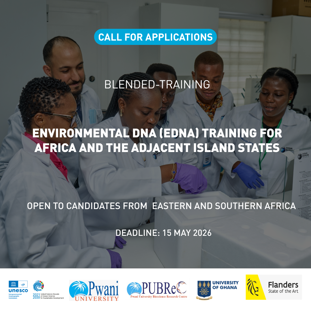
eDNA_Africa_2026
Environmental DNA (eDNA) Training for Africa and the Adjacent Island States 2026
Environmental DNA (eDNA) sampling and analysis have become an increasingly popular tool for studying biodiversity and monitoring ecosystems. It provides a relatively easy, non-invasive method to scan environments; estimate number of species, assess biodiversity, and monitor changes in a community without having to collect organism samples. Monitoring of endangered species, invasive species, pathogens, and harmful algal bloom Additionally, eDNA has the potential to inform on the movements and habitat associations of endangered/rare species, migratory species, water quality, detecting and tracking invasive species, harmful algal blooms, pathogens, and parasites. eDNA uses traces of genetic materials that organisms leave behind in water, soil, or air. Regardless of its wide application, knowledge of this technique is still underused in several parts of the world, such as in Africa.
Marine ecosystems of Africa and the adjacent island states are teeming with biodiversity, including 439 key marine biodiversity areas. These ecosystems are facing significant threats from climate change, overexploitation, invasive species, urbanization, and other factors, as such, impact on biodiversity. Therefore, there is an urgent need to accelerate the understanding of African biodiversity patterns and monitor ecosystems more efficiently. Implementing eDNA techniques in biodiversity assessment in African countries is a promising opportunity to maximize the conservation and management of marine life.
In this context, this blended training aims to provide participants with a comprehensive theoretical understanding of environmental DNA (eDNA) and its applications in environmental sciences. It will cover all relevant aspects from eDNA sampling, laboratory and bioinformatic analysis, data analysis of results and possible application. The participants will learn about the origins of eDNA, how it enters the environment, and its significance in measuring biodiversity. The training will give an overview of eDNA, including its definition and different ecosystems where it can be studied with a specific focus on marine ecosystems.
Venue
Pwani University, Kenya
General Learning Goals
By the end of the course, the participants are expected to have:
- Increased understanding of the eDNA technology and its practical application.
- Enhanced skills in the collection and preservation of eDNA samples.
- Practical knowledge and skills in the extraction of eDNA samples.
- Insights on the analysis of eDNA data, and use of bioinformatics tools.
- Knowledge of utilization of eDNA technique in assessing marine biodiversity and monitoring ecosystems.
This course includes an online preparation component where participants will learn how to:
- Explain what eDNA is, its sources, and its ecological significance.
- Describe workflows for eDNA sampling, preservation, laboratory analysis, and bioinformatics.
- Identify key challenges, limitations, and good practices in eDNA studies.
- Understand quality control (QC), data stewardship, and ethical considerations in eDNA research.
- Recognise how eDNA data can inform policy, conservation, and ecosystem monitoring in Africa’s marine environments.
Target audience
The training is focused on ocean practitioners from Eastern and Southern Africa countries, including Early Ocean Career Professionals (ECOPs) and mid-career ocean scientists interested in and needing to use eDNA in their scientific or technical work.
Pre-requisites
Participants must:
-
Have prior knowledge of marine biodiversity sampling and monitoring.
-
Bring their laptop.
-
A working knowledge of English.
-
Applicants must be from Eastern or Southern Africa.
Course content
Module 1: Foundations of Environmental DNA (eDNA) Science
Module 2: eDNA-Omics and Their Applications
Module 3: eDNA Workflows and Practical Considerations
Module 4: eDNA Bioinformatics Analysis
Module 5: Data Interpretation, Bias, and Policy Relevance
All these theoretical modules will be complemented by targeted hands-on activities for 1 week, face-to face training at the Pwani University, Kenya.
Language of instruction: English
Course Duration, Synchronous Sessions, and Format
The course will take place face-to-face between 27 July and 2 August, 2026, with a duration of approximately 40 hours.
The course has an online learning component to be completed before the onsite classes of approximately 12h.
Participants will be required to:
- Complete online self-paced learning activities before the onsite classes.
- Familiarize themselves with the documentation and methods shared by the group previously.
Instructors
Organizers
Application process and selection criteria
OTGA online application form. Before starting the online application process, applicants must: (a) create a profile in OceanExpert (www.oceanexpert.org); (b) prepare a Curriculum Vitae; and (c) prepare a motivational statement highlighting the relevance of this course for the candidate's career (maximum 300 words).
A limited number of seats are available (20 seats). Please complete the online application form available on this LINK [https://otga.wufoo.com/forms/mfp4obc0qqy8qa/]. The applications start on 30 April 2026. The deadline to submit the application is 15 May 2026.
UNESCO is committed to promoting equal access principles. Applications from minority or underrepresented groups are strongly encouraged.
Assessment & Certificate
Participants will be required to complete a preparation phase online before the course, attend all sessions of the face-to-face training in Kenya, and successfully complete the course activities and assessments. A certificate of completion will be issued for those who complete these requisites.
Contacts
- Course Coordinators: Ibukun Adewumi i.adewumi@unesco.org; Edwin Mwashinga e.mwashinga@unesco.org;
- OTGA Secretariat: ioc.training@unesco.org
Costs
Free of charge. There are no tuition fees.
For the selected participants, course organizers will cover the costs of travel, accommodation, local transport, and food. Eligibility for support requires meeting the pre-requisites and target audience. The instructors will give the course voluntarily.
Costs of this training are co-sponsored by the Ocean Decade Capacity Development Facility and the UNESCO IOC Project Office for IODE.
Cancellation policy
In the event of cancellation of the course by the OTGA or its affiliates, we will provide notification of cancellation at least 7 days prior to the course date. In the event of cancellation by the attendee, we should receive notification of cancellation at least 7 days prior to the course date.
Event details: https://www.oceanexpert.org/event/5013
OAGHANA_2026
Regional Training Course on Ocean Acidification Monitoring, Data Management, and SDG 14.3.1 Reporting
Summary
This course will provide participants with foundational and practical training in ocean acidification monitoring, with emphasis on the ocean carbonate system, field sampling, laboratory analysis, data quality control, data management, and reporting in support of Sustainable Development Goal indicator 14.3.1.
The course will guide participants through the full ocean acidification monitoring workflow, from planning field observations and collecting samples to laboratory analysis, data interpretation, quality assurance, and submission of data to relevant global data systems. It will also introduce the role of ocean acidification observations in understanding marine ecosystem vulnerability, coastal resource management, and long term ocean change.
The programme will be delivered as a blended course. The online component will provide core theoretical knowledge and ensure that learners with different levels of prior experience develop a common foundation. The onsite component will focus on practical demonstrations, hands-on field and laboratory methods, data analysis exercises, and development of country level or institutional monitoring plans.
Format and Duration
This is a blended course consisting of two phases:
Phase 1: Online Pre-training Course (self-paced) 25 May – 24 June 2026
Approximately 20 asynchronous hours across 7 modules (video lectures, readings, quizzes).
Total estimated workload Phase 1 : 20 hours.
Phase 2: In-person Practical Training (University of Ghana) 29 June – 3 July 2026
Approximately 40 hours of practical demonstrations, lab sessions, data analysis, and group work.
*Note that the in-person training is will only be available for a limited group of people.
Total estimated workload Phase 1 and 2: 60 hours.
⚠️ Participants are required to complete the online phase before attending the in-person training. Attendance during the onsite phase is mandatory for selected in-person participants.
Venue: University of Ghana, Ghana
Language of instruction: English
Learning outcomes
By the end of this training, participants should be able to:
- Explain the concept of ocean acidification and describe its implications for marine ecosystems, coastal communities, and ocean resources
- Describe the ocean carbonate system and identify key carbonate chemistry parameters (pH, total alkalinity, dissolved inorganic carbon, pCO₂, and calcium carbonate saturation state)
- Identify appropriate field sampling procedures and laboratory methods for OA monitoring
- Apply basic quality assurance and quality control principles to ocean acidification data
- Interpret ocean acidification datasets and assess spatial and temporal variability
- Manage ocean acidification datasets using good data management practices
- Describe the SDG 14.3.1 indicator methodology and explain the data submission process
- Design a basic ocean acidification monitoring plan for their country or institution
Course content
Online
Module 1 : Introduction to Ocean Acidification
Module 2 : The Ocean carbonate system
Module 3 : Data quality and management
Module 4: the 14.3.1 SDG Indicator Methodology
Module 5: Laboratory experiments for ocean acidification
Module 6: Chemical observations in the field
Module 7: Biological observations in the field
Onsite
- Field sampling planning and sample collection and preservation
- Laboratory demonstrations and quality checks
- Data analysis exercises
- Group discussions and participant presentations
- Development of a basic ocean acidification monitoring plan
Target audience
The course is intended for students, early-career researchers, laboratory technicians, marine science professionals, and staff of relevant national institutions from countries in the Eastern Tropical Atlantic region. Priority will be given to applicants affiliated with BIOTTA focal points, national oceanographic institutions, universities, environmental agencies, or laboratories involved in marine monitoring.
Basic knowledge of marine science, chemistry, oceanography, or related fields is recommended.
Places available: 11 participants for the full blended course (online + onsite); up to 24 additional participants for the online component only.
Organizers
This course is jointly organized by the Intergovernmental Oceanographic Commission (IOC) of UNESCO, through the Ocean Science Section and the OceanTeacher Global Academy (OTGA), University of Ghana OTGA Regional Training Centre, The Ocean Foundation, and OMI - Ocean Margins Initiative.
In-person Instructors
- Prof. Kim Currie: National Institute of Water and Atmospheric Research (NIWA)
- Dr. Leticia Barbero: National Oceanic and Atmospheric Administration (NOAA)
Instructors who prepared the online materials for the IOC Ocean Acidification course, first version:
- Prof. Helen Findlay: Plymouth Marine Laboratory
- Dr. Sam Dupont: University of Gothenburg
- Dr. Kirsten Isensee: IOC of UNESCO
- Dr. Adrienne Sutton: NOAA/PMEL
- Prof. Christopher Sabine: University of Hawaii – Manoa
Course Coordinator Prof. Edem Mahu: University of Ghana RTC edemmahu@gmail.com / emahu@ug.edu.gh
Registration, costs, and technological requirements
Applications for this course are now closed (deadline: 25 April 2026). Selected participants have been notified.
(For reference, the original application form was available at: https://lnkd.in/dbu-Xpsc)
Selected participants will not be required to pay course registration or training fees. Support for travel, accommodation, meals, and local transport will be subject to available funding and communicated to selected participants before the course starts.
To complete the online course, participants need access to:
- A computer with Windows, Mac OS, or Linux
- Latest version of Chrome, Edge, Firefox, or Safari
- Stable internet connection (minimum 0.5 Mbps)
- Basic computer literacy; familiarity with spreadsheets recommended
UNESCO is committed to promoting equal access principles. Applications from minority or underrepresented groups are strongly encouraged.
Assessment & Certificate
Certificates will be issued to participants who:
- Complete all required online modules
- Achieve a minimum score of 70% across required quizzes and assessment activities
- Participate in the onsite practical sessions (where applicable)
- Complete the mandatory course evaluation form
Contacts
For course organisation, please contact: Prof. Edem Mahu – edemmahu@gmail.com / emahu@ug.edu.gh
For additional questions, please contact the OTGA Secretariat (ioc.training@unesco.org), always using the name of the course as email subject.
Cancellation policy
In the event of cancellation of the course by the OTGA or its affiliates, we will provide notification of cancellation at least 7 days prior to the course date. In the event of cancellation by the attendee, we should receive notification of cancellation at least 7 days prior to the course date.
![Building Capacity on Biodiversity-Inclusive and Climate-Smart MSP and Area-Based Management for ABNJ [onsite training]](https://classroom.oceanteacher.org/pluginfile.php/129899/course/overviewfiles/eventImage.png)
MSP-BBNJ Korea 2026
Building Capacity on Biodiversity-Inclusive and Climate-Smart MSP and Area-Based Management for ABNJ [onsite training]
This in-person training is a joint initiative aiming to enhance national and regional capacity for marine spatial planning (MSP) with tools applied to areas within and beyond national jurisdiction, including ecosystem-based and climate-resilient approaches, and area-based management methodologies and processes.
The training includes two parts:
Part 1 - Regional training on Biodiversity Inclusive and Climate Smart Marine Spatial Planning for Asia and Pacific
A 2-day course aiming to strengthen the capacity of MSP practitioners and decision-makers to integrate biodiversity conservation, climate adaptation and mitigation, and inclusive governance into planning processes. Building on the MSPglobal International Guide and its complementary volumes on Biodiversity-Inclusive and Climate-Smart MSP , the course combines conceptual alignment with hands-on application. Participants will develop a shared understanding of ecosystem-based and climate-resilient planning principles, explore the implications of biodiversity loss and climate change for marine management, and examine policy alignment and inclusive governance approaches. Through interactive exercises and a simulated MSP process, they will learn how to apply these principles across all phases of the MSP cycle from scoping and assessment to plan development, implementation, monitoring, and adaptive management.
Part 2 - Applying Marine Spatial Planning Tools to Area-Based Management in Areas Beyond National Jurisdiction (ABNJ) for Asia and Pacific
This 3-day training equips practitioners working in MSP or MPA management, ocean governance, conservation, management, and related fields with the frameworks and practical knowledge needed to design Area-Based Management Tool (ABMT) proposals in Areas Beyond National Jurisdiction (ABNJ) under the BBNJ Agreement. Building on the MSPglobal International Guide on Marine Spatial Planning, the course bridges established MSP methodologies with the scientific and technical requirements of BBNJ governance and operationalization, exploring how biodiversity, climate, and equity — including the integration of traditional knowledge of Indigenous Peoples and Local Communities (IPLCs) — apply in ABNJ contexts.
Format and Duration
All sessions will happen synchronously ONSITE. The agenda of the sessions will be shared once confirmed.
This course has an estimated time duration of:
-
16 hours (Part 1), from 13 to 14 July 2026
-
24 hours (Part 2), from 15 to 17 July 2026
*Note that participants may choose or be selected to participate in only one or both parts of the training.
Venue:
South Korea, Busan; Hotel Conference Room
Language of instruction: English
Learning outcomes
Part 1 - Regional training on Biodiversity Inclusive and Climate Smart Marine Spatial Planning for Asia and Pacific
By the successful completion of the first part of the training, participants will be able to:
-
-
Apply biodiversity-inclusive and climate-smart principles across the different phases of the MSP process;
-
-
-
Identify entry points for integrating biodiversity, climate, and equity considerations throughout the MSP cycle;
-
-
-
Design and facilitate stakeholder engagement processes that support inclusive and equitable marine governance;
-
-
-
Communicate MSP strategies effectively to diverse audiences and stakeholders;
-
-
-
Engage in and contribute to regional and global communities of practice on biodiversity-inclusive and climate-smart MSP.
-
Part 2 - Applying Marine Spatial Planning Tools to Area-Based Management in Areas Beyond National Jurisdiction (ABNJ) for Asia and Pacific
Upon successful completion of this second course, participants will be able to:
-
-
Detail the scientific and technical requirements for ABMT proposals under the BBNJ Agreement, including supporting methodologies.
-
-
-
Distinguish components of biodiversity-inclusive and climate-smart spatial planning applied to ABNJ governance.
-
-
-
Understand the use of MSP-based analysis in ABMT proposals for ABNJ, including integration of global spatial datasets on biodiversity, human activities, and climate to identify areas of significance.
-
-
-
Discuss the implications of data gaps for spatial decision-making and ABMT design and implementation.
-
-
-
Assess the transferability of MSP spatial analysis approaches demonstrated in the case studies to their own national or regional ABNJ contexts, identifying relevant data sources, governance actors (including the role of Indigenous Populations and Local Communities’ knowledge), and potential constraints.
-
Course content
Part 1 - Regional training on Biodiversity Inclusive and Climate Smart Marine Spatial Planning for Asia and Pacific
Day 1 (From Concepts to Planning Foundations) focuses on establishing a common interpretation of what biodiversity-inclusive and climate-smart MSP means in operational terms, including implications of biodiversity loss, climate change, and sustainability for MSP decisions. Through facilitated discussions and applied exercises, participants will examine marine ecosystem functioning, climate pressures, nature-based solutions, ecosystem-based planning principles, policy alignment, and inclusive governance, developing a shared conceptual language that distinguishes biodiversity-inclusive and climate-smart MSP from conventional planning approaches. This training day will include the following sessions:
Session 1.1 —Why Biodiversity-Inclusive and Climate-Smart MSP?
Session 1.2 — Marine Ecosystems, Climate Change and Nature-Based Solutions
Session 1.3 — Ecosystem-Based Approach as the Operational Backbone of MSP
Session 1.4 — Aligning MSP with Biodiversity and Climate Policy Frameworks
Session 1.5 — Inclusion, Rights and Knowledge in Marine Planning
Day 2 (Applying Biodiversity-Inclusive and Climate-Smart MSP Across the Planning Cycle) is fully application-oriented and structured around a simulated MSP process. Working in multidisciplinary teams, participants will apply biodiversity-inclusive and climate-smart principles across the full MSP cycle, from framing the planning context and objectives to assessment, plan development, implementation, monitoring, and adaptive management. Using simplified spatial data and planning scenarios, participants will explore ecological sensitivities, climate risks, cumulative impacts, trade-offs, and governance options, and translate plans into implementable strategies and communication messages. The training concludes with reflection on leadership, communication, and stakeholder engagement, reinforcing the role of MSP as a strategic, adaptive, and inclusive governance tool in the face of biodiversity and climate challenges. This training day will include the following sessions:
Session 1.6 — Framing the Planning Context and Designing a Biodiversity Inclusive Climate-Smart MSP Process
Session 1.7 — Assessing Ecosystems, Climate Risks and Spatial Pressures
Session 1.8 — Developing Biodiversity-Inclusive and Climate-Smart Spatial Strategies
Session 1.9 — From Plan to Action: Implementation, Monitoring and Adaptive Management
Session 1.10 — Communicating MSP and Building Long-Term Support
Part 2 - Applying Marine Spatial Planning Tools to Area-Based Management in Areas Beyond National Jurisdiction (ABNJ) for Asia and Pacific
Days 3 to 5 focus on applying biodiversity-inclusive and climate-smart planning within the framework of the BBNJ Agreement, with an emphasis on how the process feeds into developing Area-Based Management Tool (ABMT) proposals. These sessions guide participants from understanding proposal requirements and design options, building on scientific and spatial evidence to applying these elements through demonstration of practical case studies.
Day 3 (Understanding ABMT and the development of proposals in the context of the BBNJ Agreement). Participants will work through the sequence from identifying a relevant candidate site in Areas Beyond National Jurisdiction, and examining the Annex I biodiversity criteria, including how each can be demonstrated through spatial and scientific evidence. The sessions will also introduce ABMT design approaches and relevant legal instruments, frameworks, and bodies , and, discuss how national MSP experience can inform ABMT design in areas beyond national jurisdiction, including how IPLC knowledge and rights can be reflected in proposals.
Day 4 (Building the evidence base required for ABMT proposals). Participants will explore ecosystem-based management and conservation tools such as key biodiversity areas (KBAs) and ecosystem and biologically significant areas (EBSAs), and related approaches, in support of Annex I criteria. The sessions will also cover the role of Environmental Impact Assessments (EIA) and Strategic Environmental Assessments (SEA) under the BBNJ framework, including the data required to perform these evaluations and develop proposals.
Day 5 (Applying ABMT in single and multi-sector case studies and various data contexts. Participants will examine, through case scenarios, how biodiversity evidence, impact assessment, and governance arrangements inform ABMT proposals, including the coordination and cooperation across existing sectoral bodies to support decision-making. The training sessions conclude with reflection on lessons learned, common gaps, and the steps needed to advance ABMT development in participants’ own contexts.
Target audience
This training is designed for practitioners working in marine spatial planning (MSP), ocean governance, or related fields — particularly those involved in MSP processes or BBNJ implementation at national or regional levels, including the design and application of area-based management tools (ABMTs) in ABNJ. It aims to strengthen participants’ capacity to integrate biodiversity and climate considerations across the MSP cycle, while also developing practical insights into the design and implementation of ABMT proposals in Areas Beyond National Jurisdiction (ABNJ) inspired by MSP principles, tools and experience. Typical participants include government officials, staff of regional organizations (e.g. RFMOs and Regional Seas Programmes), and technical operators from NGOs engaged in MSP or ABNJ-related work.
Organizers
This training course is jointly organized by the IOC (in support of the MSPglobal, Ocean Decade Capacity Development Facility, OceanTeacher Global Academy, and IOC Sub-Commission for the Western Pacific (WESTPAC) activities) in collaboration with the Korea Institute of Ocean Science and Technology (KIOST), and the Irish Marine Institute.
Part 1 of the training is developed under the MSPglobal initiative with the support of co-funding from the European Union. Part 2 of the training is developed under CDF/OTGA with funding with the support of co-funding from KIOST and Irish Marine Institute (Our Shared Oceans).
Facilitators
The training sessions will be delivered with the support of experts from IOC (including, Catarina Fonseca, Niccolo Bassan, NaYeon Kim, and Ana Carolina Mazzuco, others to be confirmed), the Korea Institute of Ocean Science and Technology (names to be confirmed); and the Irish Marine Institute (names to be confirmed).
Registration, costs, and technological requirements
Candidates should meet at least one of the following criteria:
-
Currently working in an operational MSP or BBNJ-related role (e.g., MSP or BBNJ focal point, or equivalent)
-
Employed by a government agency, regional organization (RFMO, Regional Seas Programme), or NGO with an active mandate in marine spatial planning or ocean governance
-
Formally nominated or endorsed by their organization or government, confirming institutional support for participation
List of eligible countries for the open call for participation: Cook Islands, Fiji, Kiribati, Maldives, Marshall Islands, Micronesia (Federated States of), Nauru, Niue, Palau, Papua New Guinea, Samoa, Solomon Islands, Timor-Leste, Torkelau, Tonga, Tuvalu, and Vanuatu.
*Note remaining part of the available places will be dedicated to direct contact invitations issued by IOC WESTPAC to its Members.
Application and selection:
- Individuals wishing to participate in the open call shall submit their information in this APPLICATION FORM, open from 10 to 30 April 2026. A limited number of seats will be available for this category of participation.
- Invited participants will receive a direct email communication from IOC, and including additional guidance and instructions.
Costs:
This course has no tuition fees.
Lunch and dinner will be provided on-site to all selected participants.
For the open call for participation, travel support will be provided to a limited number of participants (approximately 12), including accommodation and flight tickets.
Additional travel support may be available to a very restricted number of participants of the invited poll (WESTPAC). Details to be shared with selected invitees and adapted to the participation modality in reference of part 1 and 2.
-
Access to a computer or mobile device with Windows, Android, or Mac OS.
-
Latest version of either Chrome, Edge, Firefox or Safari web browsers, with JavaScript and cookies enabled
-
Broadband internet access (minimum bandwidth of 0.5 Mbps (Receive and Send)
-
Audio speakers or headphones
-
Basic computer skills, such as finding resources through search engines and the ability to be self-directed in learning new technology skills (e.g. following a step-by-step tutorial, online video help, or access to support to learn necessary skills)
Additional requisites:
All participants are strongly encouraged to complete the following online courses prior to attending the training:
-
MSPglobal course on Biodiversity-Inclusive and Climate-Smart MSP (20h, OTGA) — strongly recommended for Part 1
-
Using Science, Knowledge & Tools to Operationalise the BBNJ Agreement (35h, OTGA) required for Part 2, as the in-person sessions build directly on this content
Assessment & Certificate
This training will include pre-and-post self-assessments, and a final assignment report.
*Note that the preparation online courses suggested in the pre-requisites have a different assessment rationale, and certificate of completion.
To receive a Certificate of Completion, for each part of the training course, participants shall:
-
Fully attend to the in-person sessions
-
Engage and complete every proposed training activity
-
Successfully complete the report assignment
-
Complete the mandatory pre- and post-assessment.
Submit the required feedback form is mandatory.
Contacts
For course organization, please contact: TO BE ADDED
For additional questions, please contact OTGA Secretariat (ioc.training@unesco.org) always using the name of the course as e-mail subject.
Cancellation policy
In the event of cancellation of the course by the OTGA or its affiliates, we will provide notification of cancellation at least 7 days prior to the course date. In the event of cancellation by the attendee, we should receive notification of cancellation at least 7 days prior to the course date.
Training course and Identification Qualification in Harmful Marine Microalgae 2026(1)
Since 1993 the IOC has conducted training courses on harmful microalgae. The purpose has been to improve the taxonomic and identification skills of the participants for research purposes and for practical monitoring of harmful algal blooms.
From 2006 the IOC training in HAB identification has been offered within a new framework which gives accreditation. The present course includes now a practical exam at the end of the course with an IOC Certificate of Proficiency in Identification of Harmful Algae issued to participants who pass the exam. We know by experience that many of the more than 500 trainees we have had over the years have wished the courses to give accreditation, and in some countries, the IOC courses have become a reference for laboratories to be approved for carrying out regulatory monitoring for harmful microalgae.
The IOC Science and Communication Centre on Harmful Algae, University of Copenhagen, Denmark is organizing the course.
IOC Training Course and Identification Qualification in Harmful Marine Microalgae 2026
Course description: The course includes 100 hours of teaching and is divided into two parts. 1) The first part of the course is organised online using the elearning platform of IOC/IODE/OceanTeacher Global Academy, giving general introductions to the various groups of harmful algae; this part is mainly for self-study and estimated to 40 hours of reading. 2) The second part is a practical course in species identification (see tentative programme below). Part 2 includes 60 hours of teaching and a microscope will be available to each participant during the entire period, see also link below.
Participants: The course is aimed at participants who have some years of practical experience in identification of microalgae. The number of participants is limited to 16. If there are more applicants than available seats, priority will be given to applicants who have direct research or management responsibilities with regard to the occurrence of harmful algae.
Dates: Part 1 will be offred through the eLearning platform of OTGA’ from October onwards; part 2 takes place from 28 February 2026
Venue on site: IOC Science and Communication Centre on Harmful Algae, Department of Biology, University of Copenhagen, Denmark.
Language: English.
Course lecturers: Dr. Santiago Fraga, Dr. Jacob Larsen, Dr. Nina Lundholm, Professor Øjvind Moestrup.
Enquiries may be sent to Jacob Larsen, jacobl@bio.ku.dk
Price: The course is organized on a cost-recovery basis. The price of the course is 4200 EUR and it is a package deal, which covers all expenses during the course period, see also link below; thus
- Accommodation, - c/o Danhostel, Lejrskolevej 4, 3400 Hillerød.
- All meals during the course, starting with an evening meal upon arrival
- Access to the distant learning programme on the OceanTeacher Global Academy eLearning platform
- Teaching material including hard copies or pdf-versions of the following books which will be distributed during the practical part of the course:
- Lassus, P., Chomérat, N., Hess, P. & Nézan, E. 2016. Toxic and Harmful Microalgae of the World Ocean. – Denmark. International Society for the Study of Harmful Algae / Intergovernmental Oceanographic Commission of Unesco. IOC Manuals and Guides 68, 523 pp. (hard copy)
- Hoppenrath, M., Chomérat, N., Horiguchi, T., Murray, S.A. & Rhodes, L. 2023. Marine benthic dinoflagellates – their relevance for science and society (2nd, revised edition). - Senckenberg Gesellschaft für Naturforschung, Frankfurt am Main, Germany. Senckenberg Buch vol. 88, 376 pp.
- Karlson, B., Cusack, C. & Bresnan, E. (eds). 2010. Microscopic and molecular methods fro quantitative phytoplankton analysis. – IOC Manuals and Guides 55, Paris, Unesco, 110 pp. (pdf-version)
- Larsen, J. & Nguyen, N.L. (eds). 2004. Potentially toxic microalgae of Vietnamese waters. – Opera Bot. 140: 5-216 (pdf-version)
- Reguera, B., Alonso, R., Moreira, A., Méndez, S., Dechraoui-Bottein, M.-Y. (eds). 2016. Guide for designing and implementing a plan to monotor toxin-producing microalge. 2nd ed. – IOC Gudies and Manuals 59, Intergovernmental Oceanographic Commission (IOC) of Unesco and International Atomic Energy Agency (IAEA), Paris and Vienna, 66 pp. (pdf-version)
- Proceedings from various HAB conferences (pdf-versions)
- Copies of all lectures given during the course
- Use of facilities, microscopes, samples, and cultures
- Tuition during the practical part of the course
Species identification
This part of the course will focus on identification of harmful algal species by light microscopy, with particular reference to the ‘IOC Taxonomic Reference List on Toxic Plankton Algae’. The use of electron microscopy will be introduced, but practical exercises are not included. During the course, the following species will be demonstrated either as cultures (*subject to the availability of cultures) or as preserved material.
Haptophyceae*: Chrysochromulina spp. Prymnesium spp.
Raphidophyceae*: Chattonella antiqua, C. ovata, C. subsalsa, Fibrocapsa japonica, Heterosigma akashiwo, Olisthodiscus luteus (Olisthodiscophyceae).
Dictyochophyceae*: Pseudo-chattonella verruculosa
Dinophyceae: Prorocentrum concavum, P. cordatum, P. emarginatum, P. gracile, P. obtusidens, P. hoffmannianum, P. lima, P. micans, P. rhathymum, P. rostratum, P. scutellum, P. triestenum
Dinophysis acuta, D. acuminata, D. caudata, D. fortii, D. miles, Phalacroma mitra, D. norvegica, P. rotundatum, D. tripos
Alexandrium affine, A. minutum*, A. catenella, A. ostenfeldii, A. pacificum*, A. pseudogonyaulax, A. tamarense, A. taylorii
Pyrodinium bahamense, Lingulodinium polyedrum, Protoceratium reticulatum, Gonyaulax polygramma, G. spinifera, Vulcanodinium rugosum, Gambierdiscus spp, Coolia spp., Ostreopsis spp.
Akashiwo sanguinea*, Amphidinium carterae*, Margalefidinium polykrikoides*, Gymnodinium catenatum*, G. impudicum*, Karenia mikimotoi*, K. papilionaceae*, K. selliformis*, Karlodinium armiger*, K. micrum*, Noctiluca scintillans.
Bacillariophyceae: Pseudo-nitzschia australis, P. calliantha*, P. delicatissima, P. fraudulenta, P. multiseries, P. pungens*, P. seriata, Nitzschia navis-varingica.
Cyanobacteria: Anabaena spp, Anabaenopsis spp, Aphanizomenon spp., Cylindro-spermopsis spp., Microcystis spp, Nodularia spumigena, Trichodesmium sp.
Feedback survey
At the end of the course, you will be asked to fill out a feedback survey. This information will be used to improve future courses. Note: submitting the course feedback survey is mandatory to obtain the course certificate
Certificate: A certificate of completion will be awarded to all participants who attended all classes and activities and completed the final test onsite.
Cancellation policy:
In the event of cancellation of the course by the OTGA or its affiliates, we will provide notification of cancellation at least 7 days prior to the course date. In the event of cancellation by the attendee, we should receive notification of cancellation at least 7 days prior to the course date.
SP_BDM_2026
Biological Data Management 2026
This course will provide a comprehensive introduction for the management and archive of marine biological data, including the guiding principles of biological data management and typical responsibilities for data managers. Several types of biological data will be tackled, including observational data, image-derived data and omics data and how these data can be formatted, standardized and quality controlled before being submitted to wider regional, national and international initiatives. Watch the video below for a brief overview and introduction.
Find all the information on how to enroll in this course on:
https://oceanexpert.org/event/5000
As a follow-up of the bi-annually opened Ocean Data Management Training course, this course provides a comprehensive introduction for the management and archive of marine biological data, including the guiding principles of biological data management and typical responsibilities for data manager. Several types of biological data will be tackled, including observational data, image-derived data and omics data and how these data can be formatted, standardized and quality controlled before being submitted to wider regional, national and international initiatives.
By the end of this course, participants will be able to describe the core tasks required for the processing and distributing of biological marine data, explain the importance of following standards, both for the data and the metadata and identify possible data flow mechanisms and pathways to ensure their data are shared as widely as possible, thereby stimulating re-use.
Learning outcomes
Upon successful completion of this training, learners will be able to:
- Describe the core tasks required for the processing and distributing of biological marine data
- Explain the importance of following standards, both for the data and the metadata
- Identify possible data flow mechanisms and pathways to ensure their data are shared as widely as possible, thereby stimulating re-use
Course contents
Topics will include: Guiding principles in data management, Data formats, metadata, quality control, data policy, data sharing and publishing, and a main focus on data management of various types of biological data. It is organized in the following modules:
- Module 1. Guiding principles in data management
- Module 2. Fundamentals of marine biological data management and the Research Data Life Cycle
- Module 3. Best practices for data capture
- Module 4. Transferring your (meta)data to Darwin Core
- Module 5. Common issues with data format and quality
- Module 6. Preservation & publication of marine biological data
- Module 7. Imagery data
- Module 8. DNA-derived data
- Module 9. Data archaeology & rescuing historical data
Target audience
- Marine data managers
- NODC and/or ADU staff
- Data stewards and researchers
- Early career researchers
Language and computer skills required
- a good working knowledge of English
- basic computer skills
- the ability to find resources through search engines
- the ability to be self-directed in learning new technology skills (e.g. following a step-by-step tutorial, online video help, or access to support to learn necessary skills)
Instructors/Organisers
This course is organised by the OceanTeacher Global Academy with the assistance of the Flanders Marine Institute:
- Leen Vandepitte (general coordination) – Flanders Marine Institute (VLIZ)
- Laura Marquez
- Lynn Delgat
- Charlotte Dhondt
- Patricia Cabrera
- Carolien Knockaert
- Ruben Perez
- Salvador Fernandez
- Stefanie Dekeyzer
- Wim Decock
- Cyril Radermecker
Course duration and format:
The course will be delivered online between April and December 2026. The estimated time to complete the self-paced course is approximately 35 hours.
Learner Assessment:
This is a self-taught course that includes quizzes designed to help learners assess their own learning at regular intervals. In order to successfully complete the course and award a Certificate at the end, the following is mandatory:
-
- Complete all lessons in each Module of the course
- Complete all quizzes with 70% minimum score. For each quiz you are allowed 2 attempts and the highest grade is recorded
- Complete pre and post tests
Note: submitting the course feedback survey is mandatory to obtain the course certificate.
Technology requirements
To complete this course, participants should have access to:
- Computer with Windows or Mac operating system
- Latest version of either Chrome, Edge, Firefox, or Safari web browsers
How to enrol
Please register on the OceanExpert website (www.oceanexpert.org). Once your OceanExpert account is approved (this is not done immediately), you can self-enrol in the course. If you already have an OceanExpert account, you can self-enrol in the course using your OceanExpert username and password. Enrolment is available until 15 December 2026 and the course closes 31 December 2026
First log-in OceanTeacher, then access the course page and click on self-enrollment.
The enrolment key is BDM**2026
For any questions please contact the OTGA Secretariat (ioc.training@unesco.org) always using the name of the course as email subject.
There are no tuition fees.
UNESCO is committed to promote equal access principles. Applications from minority or underrepresented groups are strongly encouraged.
Feedback survey
At the end of the course, you will be asked to fill out a feedback survey. This information will be used to improve future courses.
Cancellation policy
In the event of cancellation of the course by the OTGA or its affiliates, we will provide notification of cancellation at least 7 days prior to the course date. In the event of cancellation by the attendee, we should receive notification of cancellation at least 7 days prior to the course date.