
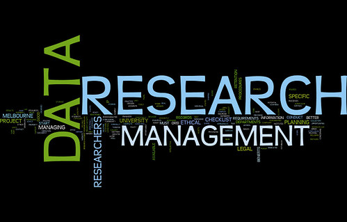
RDM2017
OTGA/KMFRI Research Data Management
The course will provide comprehensive training in research data management in order to lay the foundations for a common approach for research data management amongst researchers, repositories and facilities (including libraries) that manage marine data, thereby helping to ensure that the data is accessible, standardized and maintained over time.

OBIS_SP2017
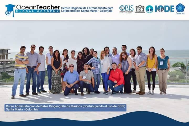
Administración de Datos Biogeográficos Marinos (Contribuyendo al Uso de OBIS)
El curso proporciona una introducción al Sistema de Información Biogeográfica de los Océanos (Ocean Biogeographic Information System - OBIS). Esto incluye las mejores prácticas en la gestión de los datos biogeográficos marinos, publicación de los datos para su libre acceso (IPT), acceso a los datos, organización, análisis y su visualización.
Metas y Objetivos
- Ampliar la red de colaboradores OBIS.
- Mejorar la calidad de los datos biogeográficos marinos.
- Aumentar el conocimiento de las normas internacionales y las mejores prácticas relacionadas con los datos biogeográficos marinos.
- Aumentar la cantidad de datos de libre acceso publicados através de OBIS y sus nodos del OBIS.
- Incrementar el uso de datos de OBIS para la ciencia, la conservación de las especies y las aplicaciones de gestión basadas en áreas.
Link to event on IODE Calendar: https://www.iode.org/index.php?option=com_oe&task=viewEventRecord&eventID=2001
OBIS_GALAP2017
Administración de Datos Biogeográficos Marinos (Contribuyendo al Uso de OBIS) (Galapagos)
El curso proporciona una introducción al Sistema de Información Biogeográfica de los Océanos (Ocean Biogeographic Information System - OBIS). Esto incluye las mejores prácticas en la gestión de los datos biogeográficos marinos, publicación de los datos para su libre acceso (IPT), acceso a los datos, organización, análisis y su visualización.
Metas y Objetivos
- Ampliar la red de colaboradores OBIS.
- Mejorar la calidad de los datos biogeográficos marinos.
- Aumentar el conocimiento de las normas internacionales y las mejores prácticas relacionadas con los datos biogeográficos marinos.
- Aumentar la cantidad de datos de libre acceso publicados através de OBIS y sus nodos del OBIS.
- Incrementar el uso de datos de OBIS para la ciencia, la conservación de las especies y las aplicaciones de gestión basadas en áreas.

OBIS_MERIDA2017
Administración de Datos Biogeográficos Marinos (Contribuyendo al Uso de OBIS) (Merida)
El curso proporciona una introducción al Sistema de Información Biogeográfica de los Océanos (Ocean Biogeographic Information System - OBIS). Esto incluye las mejores prácticas en la gestión de los datos biogeográficos marinos, publicación de los datos para su libre acceso (IPT), acceso a los datos, organización, análisis y su visualización.
Metas y Objetivos
- Ampliar la red de colaboradores OBIS.
- Mejorar la calidad de los datos biogeográficos marinos.
- Aumentar el conocimiento de las normas internacionales y las mejores prácticas relacionadas con los datos biogeográficos marinos.
- Aumentar la cantidad de datos de libre acceso publicados através de OBIS y sus nodos del OBIS.
- Incrementar el uso de datos de OBIS para la ciencia, la conservación de las especies y las aplicaciones de gestión basadas en áreas.

OADAM2017
Digital Repositories: the Pathway from Open Access to Digital Asset Management
This course will travel the pathway from digital repositories in the OA movement, stopping to discuss important repository parameters. Expansion as multimedia repositories and descriptions of their uses in digital asset management will bring participants to the crossroad discussion on using repositories as research information recording systems and how this transformation in digital repository uses has changed the role of libraries.
Duration: 5 days
DUOODPS2017
Discovery and Use of Operational Ocean Data Products and Services
Overview
This course will demonstrate the data resources available from operational program. The focus will be on operational activities, how to download data and use software to visualize. It will be a mix of practical and theoretical.
Aims and Objectives
- To provide an introduction to Operational Oceanography.
- Discovery and Use of Operational Ocean Data Products and Services.
- Hands on for Visualizing the model and in situ derived data products.
Learning outcomes
- Knowledge and understanding of Operational Oceanography.
- Tasks involved in Operational Analysis and Forecast methods.
- Oceanographic Data sources, Quality Control/Quality Assurance, monitoring systems and methods.
- Tools for visualizing the operational ocean data products.
Target audiences include, but not limited to the following:
- Ocean and coastal data managers.
- Researchers intending to use data products for scientific analysis.
- Research scholars at various universities.
FunGeDaOc2017
Fundamentos da Gestão de Dados Oceanográficos
Descrição geral
O curso providencia uma introdução abrangente a gestão de dados oceanográficos. Os participantes irão aprender e praticar métodos de manuseamento de dados oceanográficos usando banco e formato de dados comuns, cobrindo uma variedade de ambientes oceânicos, desde o mar-alto, plataforma costeira até aos estuários. Serão usados os programas “Ocean Data View” e Matlab para aceder, processar, analisar e interpretar os dados. Espera-se que os participantes possam desenvolver projetos individuais a partir de dados oceanográficos de uma região oceânica do seu interesse. Para o efeito os participantes são encorajados a trazerem os seus dados para a formação. Os projetos individuais serão apresentados pelos participantes numa sessão a ter lugar no último dia de formação.
Objetivos
- Providenciar uma introdução aos dados e à problemática de gestão de dados oceanográficos
- Providenciar uma introdução ao programa Ocean Data View
- Providenciar uma introdução ao programa Matlab para o processamento de dados oceanográficos
- Acesso a dados oceanográficos disponíveis em bases de dados abertas (ex. WOCE, ARGO)
Tópicos
Técnicas de colheita de dados oceanográficos (CTD, ADCP, marégrafos, ondímetros, correntómetros de ancoragens, boias de deriva)
Gestão de dados oceanográficos (pratica, copia e arquivo, meta dados, dados de acesso livre)
Programas e dados oceanográficos de acesso livre.
Introdução ao Ocean Data View (introdução de dados, batimetria, linhas de contorno, traçar diagramas e perfis).
Introdução a Matlab (introdução de dados, batimetria, linhas de contorno, traçar diagramas e perfis)
Público objetivo
• Gestores de dados marinhos
• Staff de NODCs e/ou AUDs
• oceanógrafos e biólogos marinhos (incluindo estudantes ao nível do Ensino Superior)
OBIS2017FR
Gestion des données sur la biodiversité marine (OBIS)
Contexte
Le cours offre une introduction sur le système d'information biogéographique sur les océans (OBIS). Cela inclut les meilleures pratiques en matière de gestion des données biogéographiques marines, l’organisation, l'analyse et la visualisation de données sur la biodiversité marine.
Contenu
- Développer le réseau de collaborateurs d’OBIS ;
- Améliorer la qualité des données biogéographiques marines ;
- Accroître la sensibilisation sur les normes internationales et les meilleures pratiques de gestion de données biogéographiques marines ;
- Augmenter la quantité de données librement disponibles, publiées par les nœuds OBIS et OBIS ;
- Augmenter l'utilisation des données d’OBIS pour la science et leur application dans la conservation des espèces et la gestion des ressources marines et côtières ;
Global Nutrient Cycle
Training of trainers and technology validation on the Global Nutrient Management Toolbox
Training objective: To enable trainees to effectively use the Global Nutrient Management Toolbox to evaluate nutrient loading/flux and impacts (hypoxia) based on global change scenarios (climate, land management, sewage and wastewater management) from broad continental to regional (LMEs) scales; and hands-on development and scenario analysis using nutrient flow models for a selection of megacities represented by the participants at the training workshop.
Expected learning achievements:
- Understanding the science behind the nutrient flux modelling modules of the Toolbox;
- Understanding of toolbox modelling requirements and scenario runs at continental scale to that of large marine ecosystems (LMEs);
- Demonstration of Manila Bay model evaluations;
- Use model for nutrient flows in the various megacities, scenario analysis and interpretation of results;
- Understanding the linkages between the various tools and how these will be applied in decision support processes at both technical and policy levels.
Target audience: Technical and policy professionals in relevant sectors of agriculture, urban planning, wastewater management who are charged with responsibilities for planning and management of investments in sustainable resource use and pollution control. The trainees should be in positions of leadership who could serve as contact points for onward promotion and subsequent delivery of training in-country on the toolbox. The trainees are to come from the major global regions; Africa, Southeast Asia, Europe, North America, Latin America and small island states. Trainees should be from countries that represent the ‘typical’ circumstance for the region being represented.
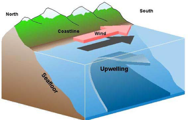
IDAUS2017
Integrated Data Analysis for Upwelling Studies
MQGIS2017
Marine GIS Applications (using QGIS)
MGISCZM2017
Marine GIS Applications for Coastal Zone Management
This course provides an overview and hands on GIS applications pertaining to coastal zone using ArcGIS software. This comprises the data acquisition, processing, analysis and interpretation of spatial data. The applications of this course are aimed at producing inputs useful for the coastal zone management.
Aims and Objectives
•To provide an introduction to GIS for marine applications
•Utilization of open source spatial data
•To provide hands on GIS applications pertaining to the coastal zone
Learning Outcomes
•Knowledge and understanding of GIS, spatial data, raster and vector models
•Core tasks involved in the GIS analysis process including data acquisition, manipulation and analysis, and presentation and output
•Core functionality of ArcMap, Arc Catalogue and Arc Toolbox
•Creating and editing spatial data
•Awareness of coastal GIS data and applications

OBIS Asian nodes2017
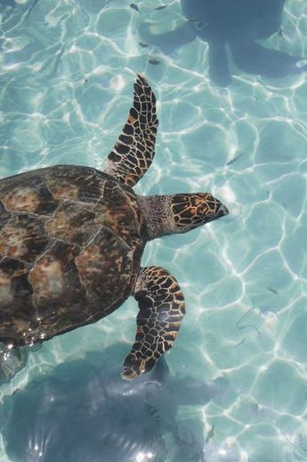
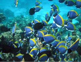
OBIS Asian nodes and Coral Reef
The course provides an introduction to the Ocean Biogeographic Information System (OBIS). This includes best practices in marine biogeographic data management, data publication, data access, data analysis and data visualisation.
Aims and Objectives
- Reinforce and expand the OBIS network in the South-East Asian Region
- Increase awareness on international standards and best practices related to marine biogeographic data management
- Increase the amount and quality of open access biodiversity data published through OBIS and its OBIS nodes
- Increase the use of data from OBIS for research, species conservation and area-based management applications for sustainable development
OBIS Nodes2017
OBIS Nodes Training Course
Training the OBIS nodes and the trainers (at the OBIS nodes and OceanTeacher regional training centres) was considered a top priority at the last SG-OBIS meeting. The training will include:
- The application of ratified Darwin Core terms
- OBIS-ENV-DATA standard (combining sampling events, occurrences, abiotic+ biotic measurements and sampling facts).
- QC tools (including the OBIS tools R package: https://github.com/iobis/obistools) ;
- Data publication (IPT), including metadata management
- Data access and visualization (including the OBIS R package: https://github.com/iobis/robis) ;
- There will be time for discussions and tackling specific use cases including output.
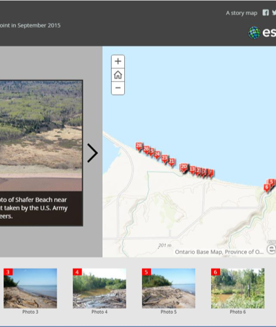
OL_Maps2017
Ocean Literacy and Story Telling Maps/Conocimiento del Océano y Cartografía Narrativa
Overview
Many regions of the world are currently promoting ocean literacy and are looking to different approaches to its implementation which includes an active role for citizens to have a much stronger input into identifying research and innovation priorities. Coastal Web Atlases (CWA) and web GIS have decades of experience promoting coastal and ocean literacy amongst specialized experts, policy makers and general public showing how coastal and marine data and information is shared, visualized and communicated.
Aims and Objectives
In line with the “Ocean Literacy for All” initiative coordinated by IOC-UNESCO, this workshop will focus on the following three goals related to ocean literacy to 1) Encourage cooperation and exchange on ocean education to improve ocean literacy frameworks; 2) Raise awareness of the two-way interactions between the ocean and peoples’ daily lives to empower citizens to adjust everyday behaviours; and 3) Apply innovative means to generating an ocean literate citizenry that recognizes environmental challenges and makes systematically informed and responsible decisions related to ocean stewardship and the use of ocean resources.
This is a practical and technical workshop. The participants will work in multinational and multilingual teams to complete workshop exercises to reinforce their knowledge and technical potential to use storytelling maps to disseminate knowledge related to our coasts and ocean.
--------------------------------------------------------------------------------------------------------------------------
Descripción General
En la actualidad, muchas regiones del mundo están promoviendo la educación sobre temas marinos a través del conocimiento y están estudiando diferentes enfoques para su aplicación, lo que incluye un papel activo para que los ciudadanos participen mucho más en la identificación de las prioridades de investigación e innovación. Los Atlas Costeros en línea (CWA por sus siglas en inglés) y los SIG accesibles a través de internet tienen décadas de experiencia en promover el conocimiento sobre el medio costero y marino entre expertos especializados, diseñadores de políticas y público en general mostrando cómo los datos y la información costera y marina son compartidos, visualizados y comunicados.
Metas y Objetivos
En consonancia con la iniciativa “Conocimiento sobre el océano para todos" coordinada por la COI y la UNESCO, este taller se centrará en los siguientes tres objetivos relacionados con la educación oceánica: 1) Fomentar la cooperación y el intercambio sobre educación de los océanos para mejorar los marcos de alfabetización del medio marino; 2) Aumentar la conciencia de las interacciones bidireccionales entre el océano y la vida cotidiana de las personas para fortalecer el conocimiento ciudadano con el fin de modificar los comportamientos cotidianos; y 3) Aplicar medios innovadores para promover una ciudadanía que reconozca los desafíos ambientales y tome decisiones sistemáticamente informadas y responsables acerca de la gestión del océano y el uso de sus recursos.
Este taller es práctico y técnico. Los participantes trabajarán en equipos de diferentes países e idiomas para completar ejercicios y así reforzar el conocimiento adquirido en los dos principales temas del taller.
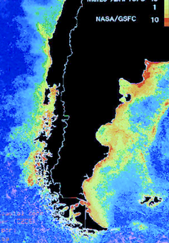
OCEANDATACOLOR2017
Ocean-colour data in climate studies
The course will deliver training in ocean-colour data and their applications in climate studies. Remote sensing experts from the Plymouth Marine Laboratory (PML) will guide students through a combination of lectures and computer-based exercises covering the following topics:
- Introduction to ocean colour;
- Modelling primary production;
- Ocean colour applications for ecosystem state assessment;
- Climate impacts and feedbacks;
- Ocean colour in data assimilation;
- Dataset archive, management, visualisation and analysis.
Students will also have opportunity of informal discussion with instructors outside of the formal lectures. A visit of the NERC Earth Observation Data Acquisition and Analysis Service (NEODAAS) that is hosted at PML will be provided.

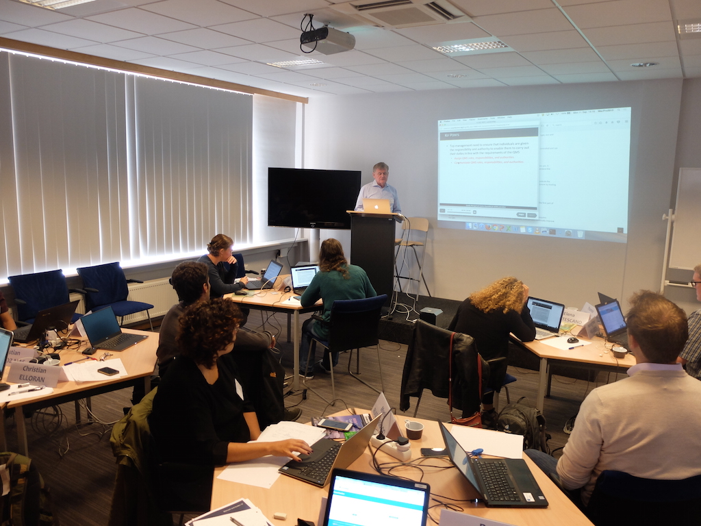
QMF2017
Quality Management System Essentials for NODCs and ADUs
Overview
The IODE maintains a global network of National Oceanographic Data Centres (NODC) and Associate Data Units (ADU) responsible for the collection, quality control, archive and online publication of many millions of ocean observations. The concept of quality management has become increasingly significant for these centres to meet national and international competency standards for delivery of data products and services. The IODE Quality Management Framework encourages NODCs and ADUs to implement a quality management system which will lead to the accreditation.
Objectives
This training workshop provides an introduction for NODCs and ADUs involved in the development, implementation and management of a Quality Management System which will assist in the adoption of comprehensive management practices and increased confidence in the quality of their data, products and services. The objectives are to:
- Introduce the IODE Quality Management Framework
- Introduce the ISO 9000 series of standards
- Provide a description of a Quality Management System
- Describe the importance of quality management for oceanographic data
- Describe the accreditation process for NODCs and ADUs
Learning Outcomes
By the end of the course, learners should be able to:
- Understand the fundamental requirements of the ISO 9001:2015 international standard
- Identify situations and processes within their own organisations to be included in the quality management system
- Understand the requirements of the IODE accreditation process
Assessment
This is a practical workshop. The participants will work in teams to complete exercises on each topic to reinforce learning and understanding of the requirements for a quality management system and the IODE accreditation for NODCs and ADUs.
RDM2017BE
Research Data Management
Basic scientific research requires sound data management practices to support the collection and curation of data to encourage data sharing using internationally agreed rules of data exchange, and to facilitate data discovery and use in the long term. Research Data Management (RDM) covers the planning, creating, storing, organizing, accessing, sharing, describing, publishing and curating of data. RDM is mandated by many funding agencies and increasingly by governments to provide access to funded research results. The management of data, particularly large-scale data, has many challenges, and the roles of researchers, facilities that manage marine data, repositories and libraries are coming together to provide access, preservation and archive of this data and the scholarly products associated with it.

The learning outcomes of this course are to:
- Understand the importance of maintaining integrity (accuracy and completeness) of data.
- Develop skills in writing and implementing a (Research) Data Management Plan, including those associated with Funding agency requirements and mandates.
- Gain knowledge of the terminology of Open Access and Open Data as it applies to Research Data Management.
- Advance knowledge in the current landscape of Research Data Management, and internationally organized efforts to develop standards and tools in this field.
- Recognize the importance of good research data management practice.
- Gain knowledge of the data publishing and citation process.
- Access to European marine data repositories.
- Awareness of main European based marine research projects (e.g. EMODNET, SeaDataCloud, etc)
MGISArc2017
Système d’Information Geographique (SIG): Application dans le Domaine Marin et Côtier (ArcGIS)
This course provides an in depth overview of the application of Geographic Information Systems (GIS) mapping and analyses to the marine environment using ArcGIS 9.x. The course will focus on commonly used coastal and marine datasets to show the potential applications of GIS within the marine sector. This course is specifically developed for the OTGA RTC Senegal and is an updated version of a previous version of the course.