subjectObserving Systems
Courses tagged with "subject::observing_systems"

OFS2024
Online Training on Ocean Forecast System
The Ocean model represents a numerical mathematical equation of the ocean and its interaction with the atmosphere and land. The ocean model in the Maritime Continent aims to capture the complex interaction between ocean and atmosphere in this region, therefore configuring an ocean model for a certain area needs to specify a specific domain, type of the equation and numerical methods used, the parameterization of sub grid-scale processes and forcing data used to drive the model, such as atmospheric data and boundary condition.
One of the most commonly used ocean models is the three-dimensional numerical model, which divides the ocean into a grid of cells and uses mathematical equations to simulate the physical processes within each cell. The model is initialized by ocean currents, temperature, salinity data, and other variables, and run over some time, typically several years, to simulate the evolution of the ocean under different conditions.
Among those models that existed, BMKG developed the BMKG Ocean Forecast System (BMKG-OFS) as one of the Meteo-Oceanography modelling systems used to support prediction and information about waves, ocean currents, salinity and sea temperature for the communities. The development of BMKG OFS is an attempt to fulfil community needs in various sectors such as sea transportation, fisheries, mining and energy, and marine-related activities.
BMKG OFS consists of 3 primary components: the Ocean Wave Model, Ocean Circulation Model, and Drifting model. The Ocean Wave Model named Ina-Waves is used to support sea wave information. The Ocean Circulation Model named Ina-Flows, is used to support current, salinity and sea temperature information at every depth. The drifting model is used to support object trajectory, sea level and coastal flood information.
This training will provide participants with a basic knowledge of ocean modelling in terms of marine warnings and forecasts. The way that the ocean numerical modelling system developed by BMKG supports operational analysis and forecast of ocean parameters (waves, ocean currents, sea temperature, salinity, and seawater level) will be also discussed. The processing and visualization of met-ocean data set from BMKG-OFS using open-source applications will be discussed briefly as supporting tools for data observation in the provision of marine meteorology services.
Learning outcomes:
- Understanding the basic concept of Ocean Observation Systems in the Maritime Continent
- Understanding the numerical ocean model and its configuration
- Understanding the ocean model configuration utilization
- Understanding visualization and utilization of ocean forecast system model
Course content:
- Introduction Lesson :
- Overview of Online Training on OFS
- Building Learning Commitment
- Lesson 1: The Concept of the Ocean Observation System in Maritime Continent
- Lesson 2: Numerical Ocean Model and the Configuration for Marine Forecast and Warning
- Lesson 3: Ocean Model Configuration
- Lesson 4: Visualization and Utilization of Ocean Forecast System Model
Target audience:
- Meteorologists
- Oceanographers
- Researchers
- Marine Data Analysts
- Marine Forecasters
Language of instruction: English
Instructors/Trainers:
Email: ahmad.fadlan@stmkg.ac.if
Specialization: Meteorologist, Marine Weather Observer and Analyst
Email: madona@bmkg.go.id
Specialization: Seismology
Email: khafid.pratama@bmkg.go.id
Specialization: Ocean Modeling, Physical Oceanography, Coastal Dynamic
Rafika Eka
Email: rantifa.agustira@bmkg.go.id
Specialization: Marine Meteorology, Ocean Numerical Model
Course duration and format:
25 hours (online) over a one-week period.
The course consists of the following formats but is not limited to:
- Lectures :
- Asynchronous sessions (using recording and tutorial video, reading, discussion forum)
- Synchronous sessions (webinar using Zoom Meeting Application, including breakout room activities for group activities)
- Discussion (synchronous and asynchronous via forum)
- Practice Exercises
- Case studies
- Manuals and Tutorials
- Games and Quizzes
- Demonstrations
- Project presentations
- Coaching
Learning assessment:
- Pre-Test and Post-Test: These tests are conducted before and after the training to assess the knowledge and skills gained by participants during the program.
- Quizzes: This encourages participants to review and solidify their understanding of the material.
- Learning journal: It is a reflective tool that allows participants to record their thoughts, experiences, and insights from the day’s learning activities. The tool encourages deeper understanding by prompting participants to think critically about their learning.
Pre-requisites:
- Good working knowledge of English
- Familiar with basic oceanographic
- Beginners will be given prioritized in this course
Certificate: Certificate will be issued for participants who ● Certificates will be issued for participants who attempt the pre-test and post-test quizzes and submit the learning journals. At the conclusion of the course, you will be asked to complete the post-course feedback survey to rate how the course has met your expectations.
Cancellation policy:
In the event of cancellation of the course by the OTGA or its affiliates, we will provide notification of cancellation at least 7 days prior to the course date. In the event of cancellation by the attendee, we should receive notification of cancellation at least 7 days prior to the course date.

ECOPOceanTech-2024
Introduction to Oceanographic Survey Techniques and Data Management
Summary
Global change requires studying the ocean in more detail and at longer and larger scales. Capacity development and training on standard survey techniques and the use of simple sensors has been identified as a tool to enhance ocean observation. This course serves as an introduction to oceanographic survey techniques and data processing. It is designed for Early Career Ocean Professionals (ECOPs), students, and other oceanographers who intend to pursue oceanography and marine sciences. Relevant oceanographic (physical, chemical, and biological) datasets will collected and used during the training, making it easy to relate, understand, and apply the course concept.
Venue: AquaBioTech Group, Mosta, Malta
Learning outcomes
By the end of the course, the learners are expected to:
- Be familiar with oceanographic survey techniques.
- Understand how to use simple data collection tools and sensors.
- Be familiar with measurement of temperature, salinity, turbidity, depth oxygen and chlorophyll.
- Produce meaningful descriptive statistics and informative graphs from raw data.
- Results interpretation and discussion for scientific communication and writing.
Course contents
The course will be divided into 4 modules:
Module 1: Field sampling techniques for basic coastal oceanographic parameters
- Introduction to oceanographic parameters temperature, salinity, turbidity, depth oxygen and chlorophyll.
- Preparing a field work checklist,
- Safety measures during field work
- Calibration, and deploying of sensors and equipment
- Field surveys
Module 2: Data visualization and management
- Data retrieval
- Data entry
- Data visualization in R software using ggplot package
- Simple analysis using R
- Data management: storage, sharing and repository
Module 3: Basics of scientific writing
- Language and structure
- Graphics and visuals
- Citation and referencing
- Plagiarism
Module 4: Basics of science communication and outreach
- Language and sentence structure in science communication
- PowerPoint Presentation
- Visuals for infographics
- Policy briefs
Target audience
ECOPs who are enrolled in a Bachelor’s or Master’s degree, or have completed their Masters Degree and intend to use this knowledge in their academic or research related work. No prior R knowledge will be required, but knowledge on basics of oceanography is desired. The current course is specifically targeting ECOPs from and/or based in the Mediterranean region (from Southern Europe, Northern Africa and Western Middle East).
Language of instruction: English
Moderators and Instructors
Ines Boujmil – Aqua Biotech Group
Dr. Anabel von Jackwoski - Stockholm University
Mr. Gabriel Akoko Juma – Alfred Wegener Institute, Germany
Organizers
This course is being organized with the support of the Early Career Ocean Professionals Programme, Alfred Wegener Institute, Helmholtz Centre for Polar and Marine Research, Stockholm University, Aqua Biotech Group, International Ocean Institute, Jean Monnet Centre of Excellence on Sustainable Blue Economy and UNESCO-IOC Ocean Teacher Global Academy.
Details: https://oceanexpert.org/event/4367

OceanObs-2024PT
Tecnologias de Observação Oceânica
https://oceanexpert.org/event/4568
Summary
O curso oferece uma gama de técnicas de oceanografia, com ênfase no uso de dados de campo in situ que estão disponíveis online. Mais importante, dará aos participantes experiência prática com dados e análises oceanográficas, particularmente flutuadores ARGO e bóias de deriva, que ajudam a visualizar processos físicos, bem como processos biológicos. Por exemplo, os flutuadores ARGO fornecem indicadores vitais, como temperatura, salinidade, perfis de pressão e parâmetros biogeoquímicos como oxigênio dissolvido, nitrato e pH, que são essenciais para a compreensão da produtividade biológica. Além disso, a temperatura da superfície do mar e as correntes de superfície são algumas das variáveis medidas por bóias de deriva, como os drifters SVP (Surface Velocity Program). Python, Panoply e Ocean Data View são algumas das ferramentas de software de alto nível neste currículo usadas para ensinar processamento de dados. Ao final deste curso de treinamento, os alunos serão capazes de classificar massas de água; identificar correntes oceânicas submesoescalares; analisar processos oceânicos, contribuindo assim para uma visão mais profunda da dinâmica dos oceanos.
Resultados de aprendizagem
- Classificar massas de água;
- Identificar correntes oceânicas submesoescala;
- Analisar variáveis biogeoquímicas oceânicas.
Conteúdo do curso
- Introdução à Oceanografia Física e Bioquímica;
- Introdução ao Python, Ocean Data View (ODV) e Panoply;
- Gráficos e plotagens usando Python, Ocean Data View (ODV) e Panoply;
- Análise de dados com Python.
- Identificar termoclinas, haloclinas e picnoclinas e discutir sua importância na estratificação e circulação oceânica;
- Entender o movimento das correntes de superfície e como elas são influenciadas pelos padrões de vento e pelo efeito Coriolis;
- Explorar a ligação entre oceanografia física e biogeoquímica marinha;
- Entender o conceito de formação e distribuição de massa de água e como essas massas contribuem para a circulação termohalina global;
- Explorar os caminhos do transporte de superfície e discutir implicações para poluição marinha, pesca e conservação.
Público-alvo
Será dada prioridade a participação investigadores, estudantes e profissionais da área da Oceanografia Física, Biologia Marinha e Química Marinha.
Idioma: Português
Requisitos tecnológicos
Os participantes deverão ter acesso a computador e internet.
Instrutores/Organizadores
Clousa Maueua - Oceanographic Institute of Mozambique (InOM)
Noca Furaca - Centro de Pesquisa e Tecnologias do Mar (CePTMAR-UEM)
António Hoguane - Oceanographic Institute of Mozambique (InOM)
Nélio Sitoe – Escola Superior de Ciências Marinhas e Costeiras (ESCMC - UEM)
*Os instrutores ministrarão o curso de forma voluntária.
Duração e formato do curso
Este curso será realizado online, com duração de 80 horas (77 assíncronas, 3 síncronas).
Haverá sessão síncrona para esclarecimentos, com duração de uma (1) hora cada sessão, agendadas para: 21 de outubro; 25 de outubro; e 29 de outubro.
Avaliação e certificado
Os participantes serão avaliados através de questionários (ao final de cada sessão) e deverá entregar um projeto final (com análise e visualização de dados para uma área de interesse). Será emitido um certificado considerando presença (todos os dias - 15%), completar as tarefas (35%), e finalizar os projetos (50%).
Processo de candidatura
O número de lugares disponíveis é limitado. Preencha o formulário de inscrição on-line disponível em: https://otga.wufoo.com/forms/zvz96y81hz8anv/.
O prazo para submissão da candidatura é até 04 de outubro de 2024 (23:59 CEST). Não há custos custos de matrícula.
*A UNESCO está empenhada em promover os princípios de igualdade de acesso. As inscrições de grupos minoritários ou sub-representados são fortemente encorajadas. Em caso de dúvidas entre em contato com a Secretaria da OTGA (ioc.training@unesco.org) usando sempre o nome do curso como assunto do e-mail.
Política de cancelamento
No caso de cancelamento do curso pela OTGA ou suas afiliadas, enviaremos um aviso de cancelamento pelo menos 7 dias antes da data do curso. Em caso de cancelamento por parte do participante, devemos receber um aviso de cancelamento pelo menos 7 dias antes da data do curso.

OCRS_India2024
Ocean Colour Remote Sensing - Data, Processing and Analysis 2024
Ocean colour analysis is a proven tool for determining the health of
ocean using oceanic biological activity through optical means. Phytoplankton
pigment, chlorophyll, are indicators of equilibrium of CO2
concentration between atmosphere and ocean. The oceanic colour changes due to chlorophyll
a provides the level of primary productivity whereas the colour change due to
CDOM can be attributed to the level of pollution and higher particulate matter.
The ability of optical sensors to map the spatial and temporal patterns of
ocean colour over regional and global scales has provided important insights
into the fundamental bio-optical properties and bio-physical processes
occurring in the aquatic media. Chlorophyll, SST and PAR can be operationally
scaled up to estimate primary production and estimate the fish stocks. This
training focuses on the basics of marine optics, ocean colour remote sensing,
and its applications such as mapping primary productivity, phytoplankton
classes and algal blooms.
Find all details about this course in: https://oceanexpert.org/event/4299 ;
Attendance to this course is by application only. Access will be granted to the selected participants.
SP_EMODnetBiology
Contributing datasets to EMODnet Biology
Learning goals
- Gain understanding of the EMODnet Biology project and how it interlinks with other European and international initiatives in the field of biodiversity knowledge.
- Recognize the importance of sharing biological data, taking into account the FAIR principles.
- Develop skills to correctly format biological data to EMODnet Biology and EurOBIS formats.
- Gain knowledge on the required quality control steps and on the importance of interoperability.
Target audience
Anyone interested in marine biodiversity data.
This is a self-taught course that includes quizzes designed to help learners assess their own learning at regular intervals.
How to enroll
Please register on the OceanExpert website (www.oceanexpert.org). Once your OceanExpert account is approved (this is not done immediately), you can self-enroll in the course. If you already have an OceanExpert account, you can self-enroll in the course using your OceanExpert username and password.
First log in OceanTeacher, then access the course page and click on self-enrollment.
The enrolment key is EMODNETBio**2023
For any questions please contact the OTGA Secretariat (ioc.training@unesco.org) or the EMODnet biology secretariat bio@emodnet.eu" target="_blank" rel="noopener">(bio@emodnet.eu) always using the name of the course as email subject.
There are no tuition fees.
UNESCO is committed to promoting equal access principles. Applications from minority or underrepresented groups are strongly encouraged.
OCRS_India2023
Ocean Colour Remote Sensing - Data, Processing and Analysis 2023
Ocean colour analysis is a proven tool for determining the health of
ocean using oceanic biological activity through optical means. Phytoplankton
pigment, chlorophyll, are indicators of equilibrium of CO2
concentration between atmosphere and ocean. The oceanic colour changes due to chlorophyll
a provides the level of primary productivity whereas the colour change due to
CDOM can be attributed to the level of pollution and higher particulate matter.
The ability of optical sensors to map the spatial and temporal patterns of
ocean colour over regional and global scales has provided important insights
into the fundamental bio-optical properties and bio-physical processes
occurring in the aquatic media. Chlorophyll, SST and PAR can be operationally
scaled up to estimate primary production and estimate the fish stocks. This
training focuses on the basics of marine optics, ocean colour remote sensing,
and its applications such as mapping primary productivity, phytoplankton
classes and algal blooms.
OOROAEM2023PT
Oceanografia Observacional e recursos online para análise de ecossistemas marinhos 2023
- Datas do curso: 23 Outubro - 18 Novembro 2023
REDCAM_2023
Curso de estresores marinos y costeros: herramientas para la gestión de la calidad ambiental marina [Énfasis en contaminación por microplásticos] REDCAM 2023

SP_PacMAN eDNA 2023
PacMAN eDNA: Marine Invasive Species Early Detection: Utilising Molecular Tools_2023 (self-paced)
This training course will provide and introduction to sample collection and sorting, including taxonomy and processing for DNA extraction, eDNA and qPCR analyses, as well as a quick guide on the use of the bioinformatics for sequence analysis to in-country (Fiji) managers and technical staff.
REDCAM2022ES
Curso REDCAM 2022: Curso de estresores marinos y costeros: herramientas para la gestión de la calidad ambiental marina. Énfasis en contaminación por microplásticos

PacMAN eDNA 2022
Marine Invasive Species Early Detection: Utilising Molecular Tools
This training course will provide and introduction to sample collection and sorting, including taxonomy and processing for DNA extraction, eDNA and qPCR analyses, as well as a quick guide on the use of the bioinformatics for sequence analysis to in-country (Fiji) managers and technical staff.
OBPS2022_ES
Ocean Best Practices Self-paced
This course is an introduction to the Ocean Best Practices System. A
best practice is a methodology that has repeatedly produced superior
results relative to other methodologies with the same objective; to be
fully elevated to a best practice, a promising method should be adopted
and employed by multiple organizations.
This short course provides an
overview of the importance and relevance of using and sharing Ocean Best
Practices and Standards, as well as on how to create, submit, share and
search for Best Practices in the Ocean Best Practices System (OBPS)
repository. This course is intended for University students, researchers
and ocean practitioners in general. It does not provide a certificate.

OCRS_India2022
Ocean Colour Remote Sensing - Data, Processing and Analysis
Ocean colour analysis is a proven tool for determining the health of
ocean using oceanic biological activity through optical means. Phytoplankton
pigment, chlorophyll, are indicators of equilibrium of CO2
concentration between atmosphere and ocean. The oceanic colour changes due to chlorophyll
a provides the level of primary productivity whereas the colour change due to
CDOM can be attributed to the level of pollution and higher particulate matter.
The ability of optical sensors to map the spatial and temporal patterns of
ocean colour over regional and global scales has provided important insights
into the fundamental bio-optical properties and bio-physical processes
occurring in the aquatic media. Chlorophyll, SST and PAR can be operationally
scaled up to estimate primary production and estimate the fish stocks. This
training focuses on the basics of marine optics, ocean colour remote sensing,
and its applications such as mapping primary productivity, phytoplankton
classes and algal blooms.

OOROAEM2022PT
Oceanografia Observacional e recursos online para análise de ecossistemas marinhos
- Datas do curso: 9 Maio - 10 Junho 2022
- Mais informações sobre o curso e como submeter uma candidatura em https://oceanexpert.org/event/3538
- Candidaturas até 24 de Abril 2022
SMEE_2022
Supporting Marine Earth Observation Educators
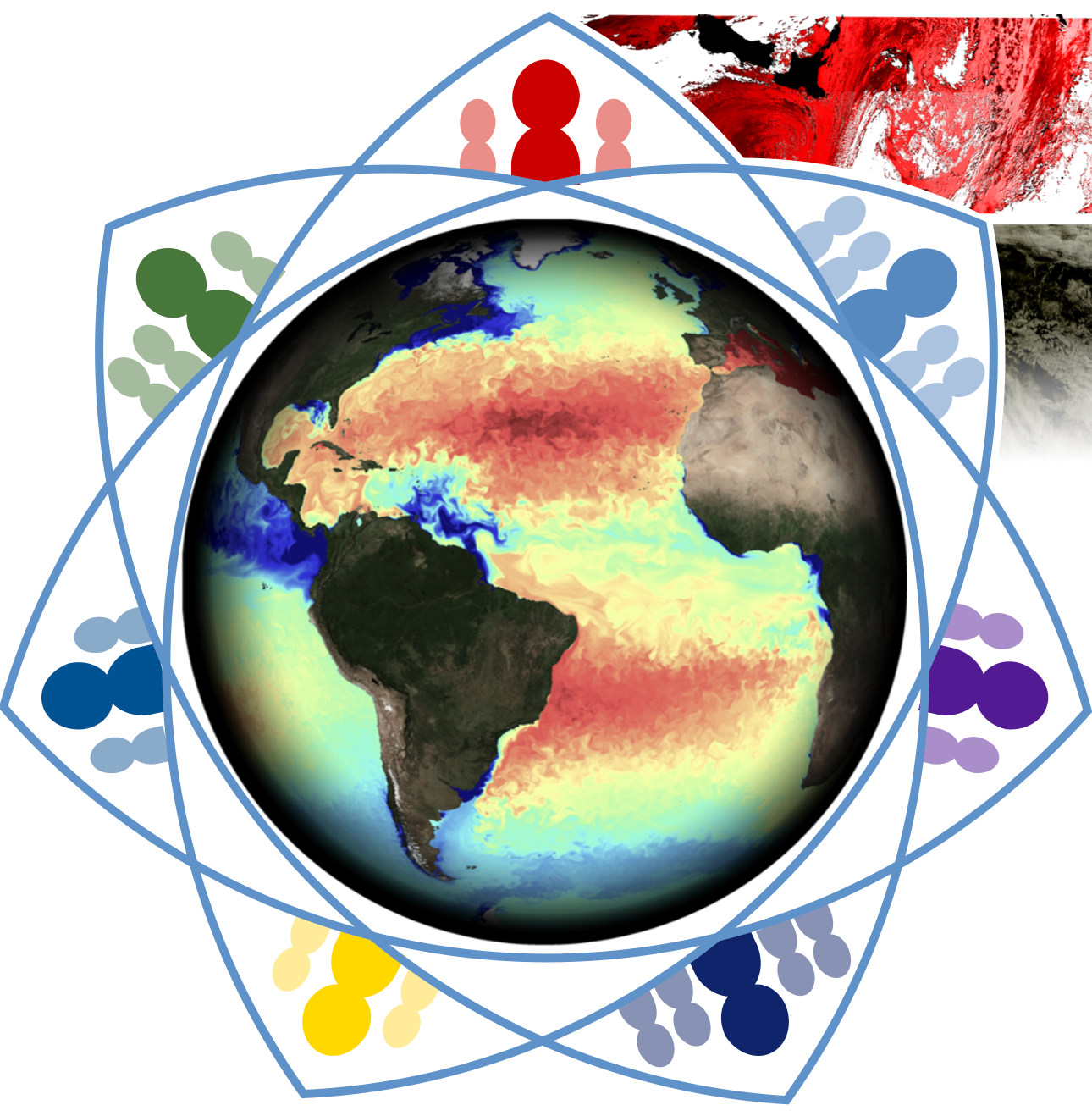
The purpose of this training workshop is to share knowledge, skills, resources and training techniques so that attendees are able to independently train others on available Earth Observation (EO) data and tools. During the course, participants will work with others to create their own (learning) artefacts. This is an interactive knowledge exchange workshop, not a technical training event.
Aims and objectives:
- To support marine and earth observation educators in their training activities, by sharing Copernicus Marine data resources and exchanging experience of different learning approaches.
- To foster a community of marine EO educators who can collaborate in future.
- To co-create learning artefacts that can used in participants own training activities and more broadly by the Earth observation community.
DUOOPS_2021
Discovery and Use of Operational Ocean Data Products and Services
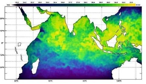
The course is aimed to provide an introduction to operational oceanography, discovery and use of operational ocean data products and services, hands on for visualizing the in situ, remote sensing and model derived data products.
SMEE_2021
Supporting Marine Earth Observation Educators
EMODnetBiology_2020
Contributing datasets to EMODnet Biology

Sentinel3_Tools_2020
Train the Trainers: Tools & techniques for teaching about Copernicus marine data
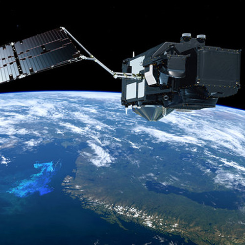
The current suite of Earth Observation satellites offer access to an unprecedented amount of information on the marine environment. Concurrently, there is a growing demand in research, governance, and commercial marine sectors, for personnel who can use this data. Training providers across these sectors is essential for maximizing the utility of this data and building necessary capacity. This course offers participants the opportunity to work with other trainers to incorporate the use of Copernicus marine data from EUMETSAT in to their own educational activities. Participants will learn how to use open access resources available through EUMETSAT and the Copernicus programme, and co-develop their own resources with a network of fellow participants and trainers from IODE, EUMETSAT and CMEMS. The course will delivered online only.

