Special | A | B | C | D | E | F | G | H | I | J | K | L | M | N | O | P | Q | R | S | T | U | V | W | X | Y | Z | ALL
E |
|---|
Elapsed timeTime between the maximum level arrival time and the arrival time of the first wave. | |
ETAEstimated time of arrival. Time of tsunami arrival at some fixed location, as estimated from modelling the speed and refraction of the tsunami waves as they travel from the source. ETA is estimated with very good precision if the bathymetry and source are well known (less than a couple of minutes). The first wave is not necessarily the largest, but it is usually one of the first five waves. | |
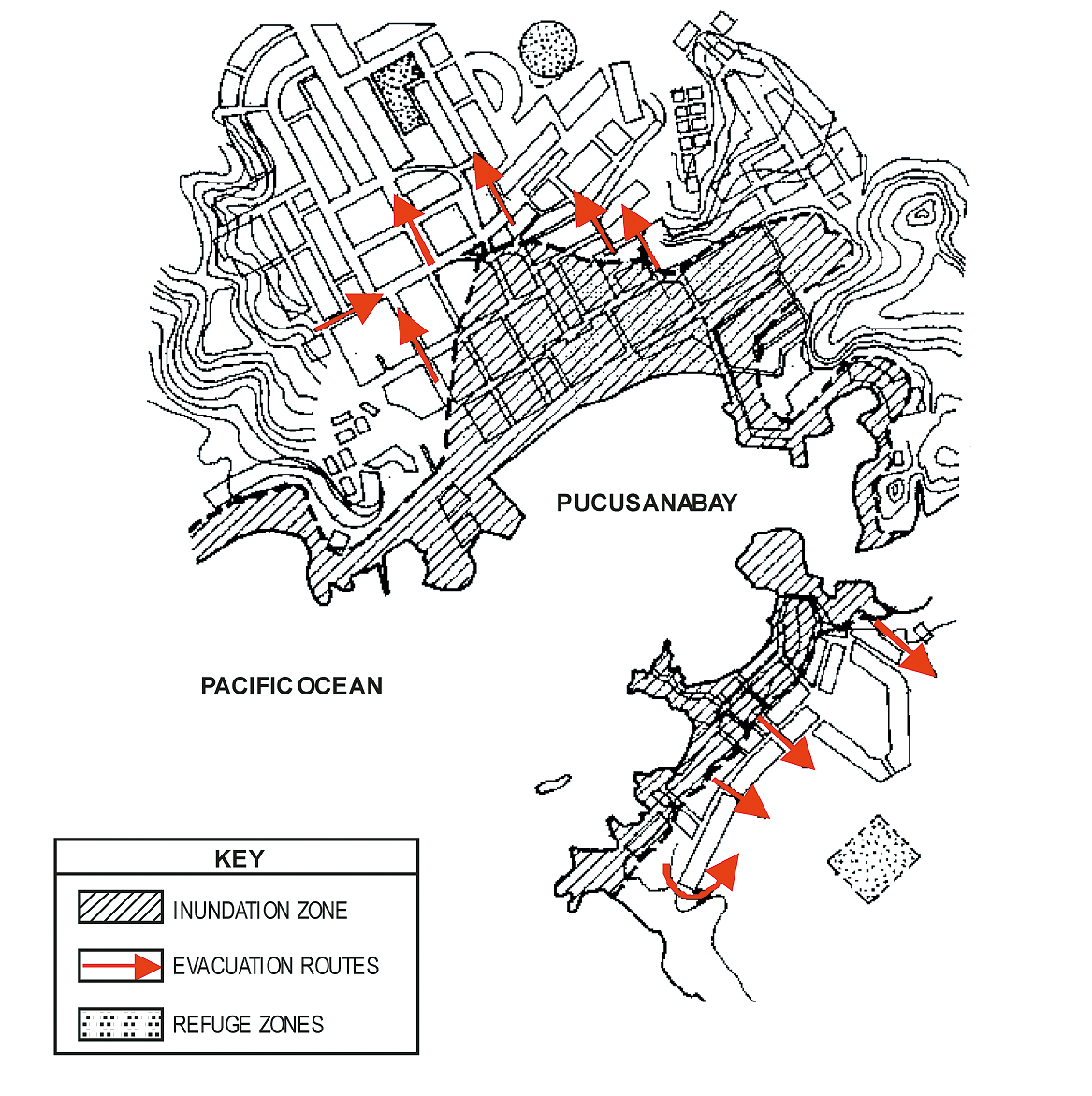
Evacuation mapA drawing or representation that outlines danger zones and designates limits beyond which people must be evacuated to avoid harm from tsunami waves. Evacuation routes are sometimes designated to ensure the efficient movement of people out of the evacuation zone to evacuation shelters.
Inundation and Evacuation Map created for the coastal town of Pucusana, Peru.
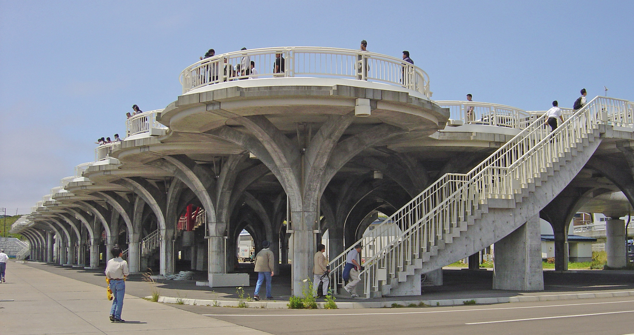
Elevated platform used for tsunami evacuation that also serves as a high-elevation scenic vista point for tourist. Okushiri Island, Japan. Photo courtesy of ITIC.
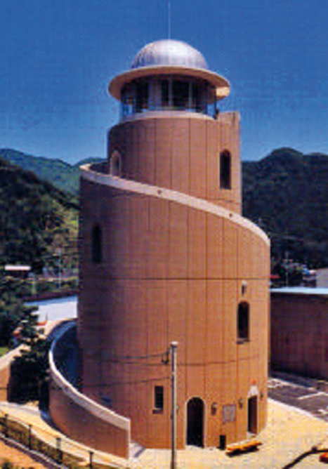
Emergency shelter building that also acts as community centre and Museum for Disaster Prevention. Kisei, Mie Prefecture, Japan. The building is 22 m high, has five floors covering 320 m², and holds 500 persons. Info courtesy of http://www.pref.mie.lg.jp/ENGLISH/ | |