DART® Deep-ocean Assessment
and Reporting of Tsunamis.The DART is an example of a
Tsunameter. An integrated system of hardware and software instrument for the early detection, measurement, and real-time
reporting of tsunamis in the open ocean.
Developed by the US NOAA Pacific Marine
Environmental Laboratory, the DART® system consists of a
seafloor bottom pressure recording system
capable of detecting tsunamison
the order of centimetres, and a moored
surface buoy for real-time communications. An acoustic link is used to
transmit data from the seafloor to the surface buoy.
The data are then relayed
via a satellite link to
ground stations, where signals are demodulated, for immediate
dissemination to the NOAA tsunami warnings centres. The DART® data,
along with state-of-the-art numerical modelling capabilities, are part
of a tsunami forecasting system
package that provides predictions of tsunami impact
along site-specific coasts. 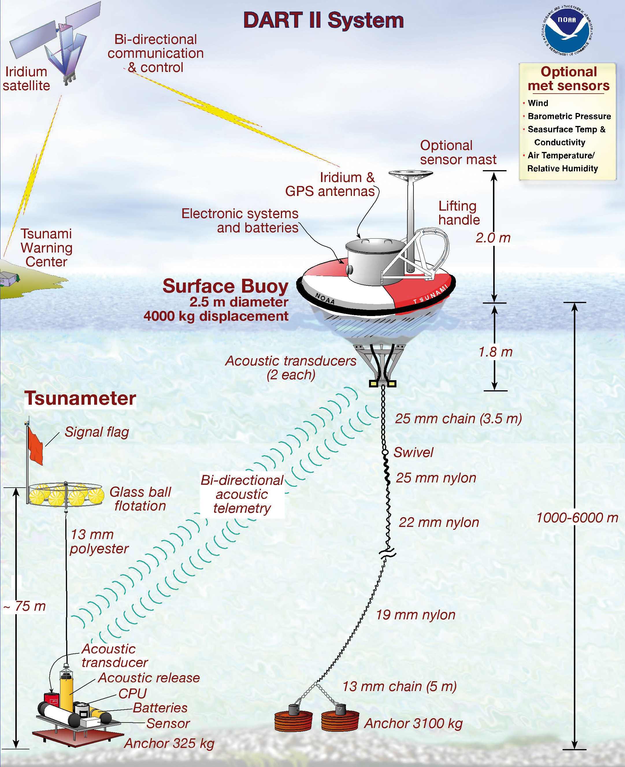
DART® II. Courtesy of NOAA.
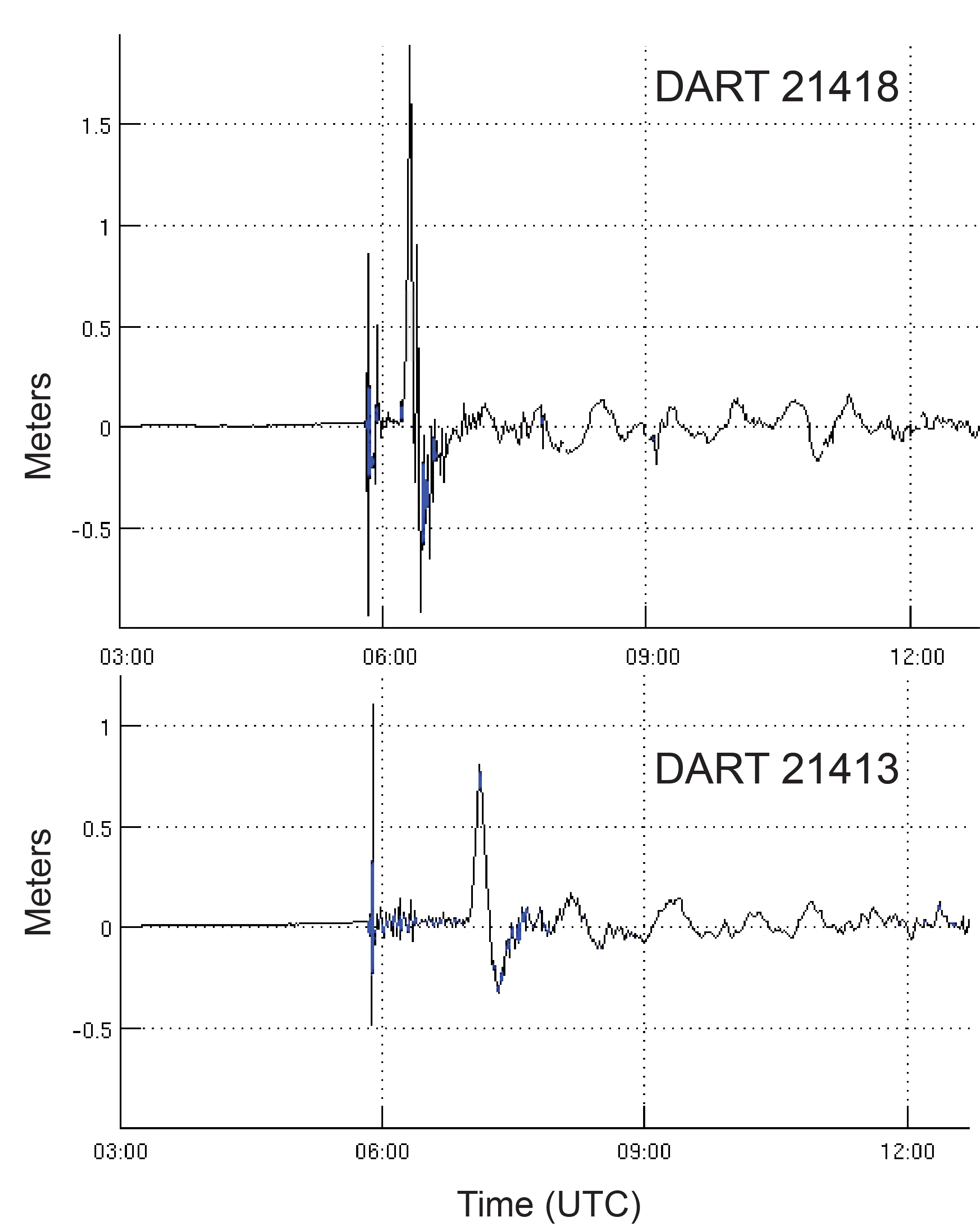
The 11 March 2011 tsunami recorded on DART® #21418 located
450 nautical miles northeast of Tokyo. The maximum wave
amplitude was 1.8 m measured at 33 min after the earthquake.
The 1st arrival on the record is from the earthquake shaking.
Data courtesy of NOAA. |