
Search results: 86
Marine Data Management, Governance and the MEDIN toolset (October 2026)
The Marine Environmental Data and Information Network (MEDIN) is a partnership of UK organisations committed to improving access to marine data. MEDIN is open to all with an interest in marine data and information. MEDIN is funded by a consortium of 16 sponsors and has over 60 partners that represent government departments and agencies, research organisations and private companies committed to practise good data management. MEDIN reports to the UK Marine Science Coordination Committee.
This ONLINE course demonstrates how data management ‘best practice’ can improve organisational efficiency in data acquisition, analysis, curation and sharing. It covers data use with respect to corporate risk, re-use, audit and traceability, whilst at the same time helping minimising costs.
The course will equip attendees to better meet the challenge of keeping on top of the ever-increasing volumes and types of data that is being created and how to manage this data and make it available to users as meaningful information, whether using proprietary or open-source software and systems as enablers.
Aims & Objectives
The course aims to give participants a broad understanding of data governance, management principles, and system components and how data can be published information and re-used with a focus on the tools that the Marine Environmental Data and Information Network (MEDIN) provides as examples of best practice.
Expected Learning Outcomes
- An understanding of MEDIN and why data management is important and how it can reduce costs, risk, and add value through extending its original purpose.
- An understanding of the fundamentals of how data is collected, managed, published and used plus how important metadata is!
- An appreciation of data management components based on the International Data Management Association Book of Knowledge (DM-BOK)
- Knowledge of the importance of metadata and practical guidance in its creation, maintenance and dissemination
- Have an appreciation of the need to use words, phrases and terms to describe or explain marine data content and to understand how controlled vocabularies are used within the MEDIN standard and guidelines
- Appreciate how geospatial data can be accurately represented
- Understand the role and value of adopting data governance and how this relates to business management and corporate governance.
- Understand what discovery metadata is, what the MEDIN discovery metadata standard is and how it is used on the MEDIN portal.
- Be able to use the online metadata editor and metadata maestro to create MEDIN compliant discovery metadata records.
- Understand the ways in which data is now published and considerations associated with sharing and re-use
- Appreciate that the MEDIN data guidelines are a tool to create consistent datasets with comprehensive metadata, that allows data to be shared, understood and reused by others with ease.
Course content
The course comprises a series of presentations, demonstrations and check-point reviews, with a large practical element to help users become familiar with:
- Why data management is important and how it can and arguably should be part of an organisations business management framework alongside quality, occupational health and safety, and information security, all of which are covered by ISO accreditation.
- The role of a data policy and management plan, and things to consider and how data can be shared, published and re-used.
- Data management principles, standards and components, including data lifecycle and quality, the role of vocabularies (or data dictionaries) and the importance of creating, maintaining and publishing metadata.
- The resources and other benefits of MEDIN and practical instruction in the use of the MEDIN data guidelines, metadata standard and controlled vocabularies.
Course modules include:
- Module 1. Course content and objectives
- Module 2. Introduction to MEDIN as an exemplar data partnership and management framework
- Module 3. Data management overview, principles and organisation
- Module 4. Data in a Business Management Framework (Policy, Planning, Review)
- Module 5. Standards Overview
- Module 6. Data management components frameworks and infrastructure
- Module 7. Practical session
- Module 8. MEDIN Data Guidelines
- Module 9. Data Sharing and Publishing
- Module 10. Course Summary
Target audience and prerequisites
This training course is suitable for anyone responsible for collecting or managing marine environmental data in the public sector, industry, or for education or research, for example:
- Existing and potential data managers who wish to gain an overview of data governance, policy and principles and/or want to learn more about using the MEDIN metadata standard data guidelines in their day to day work.
- Contractors who want to implement good data management practice and/or have been asked to supply MEDIN compliant metadata.
- Bachelors/masters/PhD students or recent graduates interested in data management best practice and adding to their professional skill set.
Pre-requisites: An understanding of marine data collection is beneficial, however no prior knowledge of MEDIN or data management is required. Familiarity with different marine data types, and how data is acquired and used, would be helpful but not essential. Prior knowledge or practical experience in data management is not required.
Language of Instruction: English
Instructors
- Roseanna Wright (MEDIN/NOC)
-
Alice Rysiecki (MEDIN/NOC)
- Colm Walsh (MEDIN/NOC)
- Chloe Figueroa-Ashforth (DASSH/MBA)
- Julie Bunt (DASSH/MBA)
- Mike Osborne (OceanWise)
Course Format and Duration
The course takes place over 5 days with online lectures delivered in live sessions (2-3 hours, with regular breaks) in the mornings (UK time) and independent-study and practical assignments in the afternoons.
Monday-Friday: approx. 09:00-12:00 GMT/BST + drop-in sessions 14:00-14:30 GMT/BST
Attendance not mandatory, sessions are recorded.
Application Process
Please self-enroll on the course on the OceanTeacher Global Academy e-Learning Platform:
The course enrolment key can be found on the MEDIN website. Number of places is limited to 60 participants.
Contacts:
-
MEDIN: Roseanna Wright (roswri@bodc.ac.uk) (Course Organiser)
-
OTGA Secretariat: ioc.training@unesco.org
In case of need for further clarifications please use the contacts above, always using as email subject:
(Online) Marine Data Management, Governance and the MEDIN toolset, October 2026
Costs
No tuition fee.
This course is organised by MEDIN in collaboration with UNESCO IOC OceanTeacher Global Academy.
More information about MEDIN's workshops can be found on https://www.medin.org.uk/medin-workshops
Assessment and Certificates
A combination of quizzes and assignments to ensure understanding and practical application of knowledge and skills acquired during the course.
Certificates will be issues based on the required activities (chapters, quizzes and assignments) for each pathway (Governance, Practical MEDIN, or Combined) being completed.
The course has been awarded official recognition as contributing to the Continuing Professional Development (CPD) requirements of the Institute of Marine Engineering, Science and Technology’s (IMarEST’s) members.
Feedback survey:
At the end of the course, you will be asked to fill out a feedback survey. This information will be used to improve future courses.
Cancellation policy:
In the event of cancellation of the course by the OTGA or its affiliates, we will provide notification of cancellation at least 7 days prior to the course date. In the event of cancellation by the attendee, we should receive notification of cancellation at least 7 days prior to the course date.
MEDIN_SEP2021
Marine Data Management, Governance and the MEDIN toolset (Sep 2021)
This free training course is suitable for anyone responsible for collecting or managing marine environmental data in the public sector, industry or for education or research. Familiarity with different marine data types, and how data is acquired and used, would be helpful but not essential. Prior knowledge or practical experience of data management is not required. The course can be taken as a whole, or attendees can select modules according to two streams: Governance; Practical MEDIN.
NOTE: This is edition September 2021
MEDIN_Sep2023
Marine Data Management, Governance and the MEDIN toolset (Sep 2023)
This free online training course is suitable for anyone responsible for collecting or managing marine environmental data in the public sector, industry or for education or research. Familiarity with different marine data types, and how data is acquired and used, would be helpful but not essential. Prior knowledge or practical experience of data management is not required. The course can be taken as a whole, or attendees can select modules according to two streams: Governance; Practical MEDIN.
MEDIN_Sep2024
Marine Data Management, Governance and the MEDIN toolset (Sep 2024)
This free online training course is suitable for anyone responsible for collecting or managing marine environmental data in the public sector, industry or for education or research. Familiarity with different marine data types, and how data is acquired and used, would be helpful but not essential. Prior knowledge or practical experience of data management is not required. The course can be taken as a whole, or attendees can select modules according to two streams: Governance; Practical MEDIN.
Marine Data Management, Governance and the MEDIN toolset (September 2026)
The Marine Environmental Data and Information Network (MEDIN) is a partnership of UK organisations committed to improving access to marine data. MEDIN is open to all with an interest in marine data and information. MEDIN is funded by a consortium of 16 sponsors and has over 60 partners that represent government departments and agencies, research organisations and private companies committed to practice good data management. MEDIN reports to the UK Marine Science Coordination Committee.
This ONLINE course demonstrates how data management ‘best practice’ can improve organisational efficiency in data acquisition, analysis, curation and sharing. It covers data use with respect to corporate risk, re-use, audit and traceability, whilst at the same time helping minimising costs.
The course will equip attendees to better meet the challenge of keeping on top of the ever-increasing volumes and types of data that is being created and how to manage this data and make it available to users as meaningful information, whether using proprietary or open-source software and systems as enablers.
Aims & Objectives
The course aims to give participants a broad understanding of data governance, management principles, and system components and how data can be published information and re-used with a focus on the tools that the Marine Environmental Data and Information Network (MEDIN) provides as examples of best practice.
Expected Learning Outcomes
- An understanding of MEDIN and why data management is important and how it can reduce costs, risk, and add value through extending its original purpose.
- An understanding of the fundamentals of how data is collected, managed, published and used plus how important metadata is!
- An appreciation of data management components based on the International Data Management Association Book of Knowledge (DM-BOK)
- Knowledge of the importance of metadata and practical guidance in its creation, maintenance and dissemination
- Have an appreciation of the need to use words, phrases and terms to describe or explain marine data content and to understand how controlled vocabularies are used within the MEDIN standard and guidelines
- Appreciate how geospatial data can be accurately represented
- Understand the role and value of adopting data governance and how this relates to business management and corporate governance.
- Understand what discovery metadata is, what the MEDIN discovery metadata standard is and how it is used on the MEDIN portal.
- Be able to use the online metadata editor and metadata maestro to create MEDIN compliant discovery metadata records.
- Understand the ways in which data is now published and considerations associated with sharing and re-use
- Appreciate that the MEDIN data guidelines are a tool to create consistent datasets with comprehensive metadata, that allows data to be shared, understood and reused by others with ease.
Course content
The course comprises a series of presentations, demonstrations and check-point reviews, with a large practical element to help users become familiar with:
- Why data management is important and how it can and arguably should be part of an organisations business management framework alongside quality, occupational health and safety, and information security, all of which are covered by ISO accreditation.
- The role of a data policy and management plan, and things to consider and how data can be shared, published and re-used.
- Data management principles, standards and components, including data lifecycle and quality, the role of vocabularies (or data dictionaries) and the importance of creating, maintaining and publishing metadata.
- The resources and other benefits of MEDIN and practical instruction in the use of the MEDIN data guidelines, metadata standard and controlled vocabularies.
Course modules include:
- Module 1. Course content and objectives
- Module 2. Introduction to MEDIN as an exemplar data partnership and management framework
- Module 3. Data management overview, principles and organisation
- Module 4. Data in a Business Management Framework (Policy, Planning, Review)
- Module 5. Standards Overview
- Module 6. Data management components frameworks and infrastructure
- Module 7. Practical session
- Module 8. MEDIN Data Guidelines
- Module 9. Data Sharing and Publishing
- Module 10. Course Summary
Target audience and prerequisites
This training course is suitable for anyone responsible for collecting or managing marine environmental data in the public sector, industry, or for education or research, for example:
- Existing and potential data managers who wish to gain an overview of data governance, policy and principles and/or want to learn more about using the MEDIN metadata standard data guidelines in their day to day work.
- Contractors who want to implement good data management practice and/or have been asked to supply MEDIN compliant metadata.
- Bachelors/masters/PhD students or recent graduates interested in data management best practice and adding to their professional skill set.
Pre-requisites: An understanding of marine data collection is beneficial, however no prior knowledge of MEDIN or data management is required. Familiarity with different marine data types, and how data is acquired and used, would be helpful but not essential. Prior knowledge or practical experience in data management is not required.
Language of Instruction: English
Instructors
-
Alice Rysiecki (MEDIN/NOC)
- Colm Walsh (MEDIN/NOC)
- Chloe Figueroa-Ashforth (DASSH/MBA)
- Julie Bunt (DASSH/MBA)
- Mike Osborne (OceanWise)
Course Format and Duration
The course takes place over 5 days with online lectures delivered in live sessions (2-3 hours, with regular breaks) in the mornings (UK time) and independent-study and practical assignments in the afternoons.
Monday-Friday: approx. 09:00-12:00 GMT/BST + drop-in sessions 14:00-14:30 GMT/BST
Attendance not mandatory, sessions are recorded.
Application Process
Please self-enroll on the course on the OceanTeacher Global Academy e-Learning Platform:
The course enrolment key can be found on the MEDIN website. Number of places is limited to 60 participants.
Contacts:
-
MEDIN: Alice Rysiecki (alirys@noc.ac.uk) (Course Organiser)
-
OTGA Secretariat: ioc.training@unesco.org
In case of need for further clarifications please use the contacts above, always using as email subject:
(Online) Marine Data Management, Governance and the MEDIN toolset, September 2026
Costs
No tuition fee.
This course is organised by MEDIN in collaboration with UNESCO IOC OceanTeacher Global Academy.
More information about MEDIN's workshops can be found on https://www.medin.org.uk/medin-workshops
Assessment and Certificates
A combination of quizzes and assignments to ensure understanding and practical application of knowledge and skills acquired during the course.
Certificates will be issues based on the required activities (chapters, quizzes and assignments) for each pathway (Governance, Practical MEDIN, or Combined) being completed.
The course has been awarded official recognition as contributing to the Continuing Professional Development (CPD) requirements of the Institute of Marine Engineering, Science and Technology’s (IMarEST’s) members.
Feedback survey:
At the end of the course, you will be asked to fill out a feedback survey. This information will be used to improve future courses.
Cancellation policy:
In the event of cancellation of the course by the OTGA or its affiliates, we will provide notification of cancellation at least 7 days prior to the course date. In the event of cancellation by the attendee, we should receive notification of cancellation at least 7 days prior to the course date.
MGISCZM2017
Marine GIS Applications for Coastal Zone Management
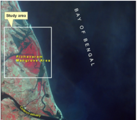
This course provides an overview and hands on GIS applications pertaining to coastal zone using ArcGIS software. This comprises the data acquisition, processing, analysis and interpretation of spatial data. The applications of this course are aimed at producing inputs useful for the coastal zone management.
Aims and Objectives
•To provide an introduction to GIS for marine applications
•Utilization of open source spatial data
•To provide hands on GIS applications pertaining to the coastal zone
Learning Outcomes
•Knowledge and understanding of GIS, spatial data, raster and vector models
•Core tasks involved in the GIS analysis process including data acquisition, manipulation and analysis, and presentation and output
•Core functionality of ArcMap, Arc Catalogue and Arc Toolbox
•Creating and editing spatial data
•Awareness of coastal GIS data and applications
MGISICZM2018BE
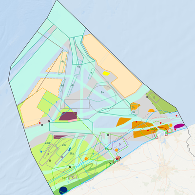
Marine GIS Applications for Integrated Coastal Zone Management
MIT2023
Marine Information Technologies
ERASMUSMARIS-26Spain
Monitoring microplastic pollution in coastal waters: From sampling and analysis to data
Summary
This blended training course, titled in Spanish “Monitoreo de la contaminación por microplásticos en aguas costeras: del muestreo y análisis a los datos”, aims to build the capacity of upper secondary school teachers and boat operators in the Comunidad Valenciana to participate in harmonised microplastic monitoring in coastal waters through the Erasmus Maris initiative.
The course combines online theoretical learning with practical field, laboratory, and data-management training. Participants will learn the full monitoring chain: understanding microplastic pollution in aquatic environments, collecting surface-water samples using a manta net, processing and analysing samples in the laboratory following standard operating procedures, applying quality assurance and quality control principles, managing data and metadata, and uploading validated information to the MARIS database.
The course is designed to empower teachers to implement microplastic monitoring activities with their students and to contribute to a wider citizen-science and environmental monitoring network. Boat operators will be trained to support safe and harmonised sampling operations at sea. The training includes online lessons and quizzes, practical laboratory work with reference material, boat-based sampling demonstrations, and hands-on use of the MARIS data portal.
Participants will learn the full monitoring chain: understanding microplastic pollution in aquatic environments, collecting surface-water samples using a manta net, processing and analysing samples in the laboratory following standard operating procedures, applying quality assurance and quality control principles, managing data and metadata, and uploading validated information to the MARIS database.
The course is organised by ASE / Ayam Sailing Europe and the University of Alicante, implemented in the framework of the Erasmus Maris initiative, with the support of the UNESCO IOC OceanTeacher Global Academy (OTGA).
Needs and priorities
Microplastic pollution is a growing environmental concern in coastal and marine environments. Reliable monitoring requires harmonised sampling, analysis, data management, and quality-control procedures. At the same time, effective microplastic monitoring requires data collection over wider geographical areas and repeated time periods, which is difficult to achieve through conventional scientific monitoring alone. Citizen science can help address this gap by expanding monitoring capacity through trained local actors. Schools and teachers are especially relevant in this context: once trained, teachers can support recurring monitoring activities with students, embed ocean literacy and environmental science into education, and contribute harmonised data and metadata to a shared monitoring system. Local maritime actors further strengthen the approach by supporting safe and standardised sampling operations.
This course responds to the need for practical capacity development in coastal microplastic monitoring in Spain, with a specific focus on the Comunidad Valenciana. The training supports teachers and boat operators to become local actors in a structured monitoring system. By combining scientific protocols with educational implementation, the course strengthens the capacity of schools to contribute to ocean literacy, citizen science, and evidence-based environmental action.
The course contributes to IOC capacity development priorities by:
- providing applied training for teachers and local operators;
- supporting access to standardised scientific methods and digital tools;
- promoting ocean literacy and environmental education in secondary schools;
- strengthening local capacity to generate comparable environmental data;
- supporting the use of harmonised data and metadata systems for future integration with wider marine data infrastructures.
The course also supports the objectives of the Erasmus Maris initiative by preparing teachers and local partners to collect, analyse, document, and upload microplastic monitoring data following common procedures.
Format and Duration
This is a blended course combining online self-paced learning with two days of synchronous practical training.
Online component (self-paced)
Lessons and quizzes on microplastic pollution, sampling and analysis methods, standard operating procedures, data management, unique identifiers, and MARIS/EMODnet integration. Approximately 4 hours. Participants may complete the online quizzes during or after the practical training days.
Onsite practical training:
- Day 1 - 22 May 2026, 16:00–20:00 CEST: Laboratory training and MARIS database/data-entry training. Venue: IES LA MAR, Jávea, Spain.
- Day 2 - 23 May 2026, 09:30–13:30 CEST: Manta-net sampling practice, online course/quizzes, and final debriefing. Venues: Club Náutico Dénia and IES Sorts de la Mar, Dénia, Spain.
Total estimated workload: approximately 14 hours (10 hours synchronous + 4 hours asynchronous).
⚠️ Attendance at both practical sessions is mandatory for certification.
Venue
- IES LA MAR, Jávea, Spain - laboratory training
- Club Náutico Dénia, Dénia, Spain - boat-based manta-net sampling
- IES Sorts de la Mar, Dénia, Spain - online quizzes and computer-based work
Language of Instruction: Spanish. The online lessons and quizzes are currently in English; a Spanish translation may be made available before the course.
Learning Outcomes
Upon successful completion of the course, participants will be able to:
- Explain the main sources, pathways, and environmental relevance of microplastic pollution in aquatic and coastal environments
- Describe how microplastics are distributed in surface waters and sediments, and why harmonised monitoring is needed
- Apply the Erasmus Maris manta-net sampling protocol for surface-water microplastic monitoring
- Record essential sampling metadata including GPS coordinates, environmental conditions, sea state, and sampling duration
- Process microplastic samples in the laboratory following the Erasmus Maris standard operating procedure
- Carry out main laboratory steps: sample preparation, digestion, density separation, filtration, visual counting, and optional Nile Red staining
- Understand the purpose of reference material and QA/QC checks
- Use the MARIS database and data portal to enter monitoring data and metadata in a structured way
- Explain the importance of unique identifiers, standardised formats, and traceability for environmental data management
- Implement Erasmus Maris / M.A.R.I.S. monitoring activities with students and local partners after the course
Course Content
Online
- Definition of microplastics and distinction between primary and secondary microplastics
- Microplastics in aquatic environments: transport, distribution, density, and accumulation
- Pathways through which microplastics enter aquatic environments
- Sampling and analysis methods for microplastic assessment
- Standard operating procedures for microplastic analysis
- Challenges of integrating data from multiple sources
- Data management approaches: Back-End Consolidation and Front-End Responsibility
- Unique identifiers and data structure in the MARIS monitoring system
- Integration of MARIS data into wider marine data systems, including EMODnet
Onsite
- Welcome and group distribution
- Delivery and explanation of sampling protocols
- Boat-based manta-net sampling demonstration and practice
- Recording of sampling metadata and environmental conditions
- Laboratory training and MARIS database/data-entry training
- Introduction to the UNESCO/OTGA online microplastics course and quizzes
- Final debriefing and explanation of next steps for certification and post-course monitoring
Target Audience
The course is primarily designed for upper secondary school teachers from the Comunidad Valenciana, Spain, interested in implementing microplastic monitoring activities with their students. A small group of boat operators supporting sampling activities are also included.
Expected participants: approximately 60 upper secondary school teachers and approximately 4 boat operators.
Basic science background recommended. No advanced laboratory experience required.
Organizers
- ASE / Ayam Sailing Europe
- University of Alicante
Implemented in the framework of the Erasmus Maris initiative, with the support of the UNESCO IOC OceanTeacher Global Academy (OTGA).
Facilitators
- Kamel Labibes - Ayam Sailing Europe (ASE)
- Carlos Sanz Lázaro - University of Alicante
- Raquel Sánchez Romero - University of Alicante
- Alba Benito Kaesbach - University of Alicante
- Antonia Trompeta - ASE / Ayam Sailing Europe, Erasmus Maris Educational Network Coordinator, Valencian Community
Registration, Costs, and Technological Requirements
There are no tuition fees for participants. Travel, accommodation, and any personal costs are the responsibility of participants or their institutions.
Participants need access to:
- A computer or tablet for online lessons and quizzes
- A web browser and ability to use an online learning platform
- Basic familiarity with spreadsheets or data-entry forms (useful but not mandatory)
- A smartphone or GPS-enabled device (useful for recording coordinates during sampling)
- Access to the MARIS data portal
No advanced software installation is required.
UNESCO is committed to promoting equal access principles. Applications from minority or underrepresented groups are strongly encouraged.
Assessment & Certificate
- To receive the certificate, participants must:
- Attend the mandatory practical sessions on 22 and 23 May 2026
- Complete the required online lessons and quizzes
- Actively participate in sampling, laboratory, and data-management activities
- Follow the Erasmus Maris sampling and analysis SOPs
- Correctly process and analyse reference samples within an accepted recovery range
- Correctly upload complete data and metadata to the MARIS database
- Complete the mandatory course evaluation/feedback form
Contacts
For course organisation, please contact: Dr Kamel Labibes - coordination@ayamsailing.eu
For additional questions, please contact the OTGA Secretariat (ioc.training@unesco.org), always using the name of the course as email subject.
Cancellation Policy
In the event of cancellation of the course by the OTGA or its affiliates, we will provide notification of cancellation at least 7 days prior to the course date. In the event of cancellation by the attendee, we should receive notification of cancellation at least 7 days prior to the course date.

OODM-MSP2026en
MSPglobal course on ocean observations and data management for MSP (ENGLISH)
This online self-paced course aims to support ocean practitioners in understanding how effective data management and ocean observations underpin evidence-based Marine/Maritime Spatial Planning (MSP). It highlights the critical role that reliable, accessible, and well-managed data play in informing planning processes, supporting decision-making, and enabling sustainable use of marine and coastal areas.
Building on internationally recognized practices and guidance developed by the Intergovernmental Oceanographic Commission (IOC) of UNESCO and MSPglobal initiative, this course introduces fundamental concepts of data, metadata, and data management relevant to MSP, and suggests relevant tools and services for MSP practitioners. Participants will explore the role of Spatial Data Infrastructures (SDIs) as key enablers for data sharing, interoperability, and collaboration, and will examine why SDIs are particularly beneficial for MSP initiatives. Practical insights are provided on how SDIs can be established, maintained, and continuously improved to meet evolving planning needs.
Additionally, the course introduces key elements of ocean observations and their relevance for MSP, including an overview of observation systems, data types, and monitoring approaches. The basics of Essential Ocean Variables (EOVs) and Essential Climate Variables (ECVs) are also included, explaining how these standardized variables support consistent, comparable, and policy-relevant information for marine planning. Participants will learn how to identify, access, and assess suitable ocean observation data to support specific MSP objectives and contexts. The course also highlights emerging trends and future directions in data management, SDIs, and ocean observations, and discusses implications for the evolving practice of MSP.
Needs and priority
There is increasing demand from IOC Member States and regions for practical guidance on how ocean observations and data management can be effectively applied within Marine/Maritime Spatial Planning (MSP) processes. Many MSP initiatives continue to face challenges related to limited access to reliable and interoperable marine data, fragmented data management systems, and insufficient capacity to translate ocean observations into planning-relevant information. Addressing these gaps is critical to support evidence-based MSP.
This course responds to these needs by strengthening capacities in ocean observation and data management as essential enablers of MSP. It supports IOC Programmes and regional priorities by promoting internationally recognized standards, tools, and guidance developed by the IOC and the MSPglobal initiative, including the use of Spatial Data Infrastructures (SDIs), Essential Ocean Variables (EOVs), and Essential Climate Variables (ECVs). By building foundational knowledge and practical understanding, the course enhances the ability of practitioners to identify, access, and apply suitable data for MSP in diverse national and regional contexts.
The course directly contributes to the IOC Capacity Development Strategy by providing accessible, self-paced training through the OceanTeacher Global Academy, enabling broad participation across regions and supporting equitable access to capacity development opportunities, particularly for capacity-constrained Member States.
The course contributes to the achievement of all IOC’s high-level objectives, in particular Objective 1: Heathy ocean and sustained ocean ecosystem services; Objective 3: Resilience to climate change and contribution to its mitigation and Objective 4: Scientifically-founded services for the sustainable ocean economy. It also directly contribute to the strategic objectives of the IOC-Wide Strategy on Sustainable Ocean Planning and Management (2025–2030) and the objectives of the IOC Strategic Plan for Ocean Data and Information Management (2023–2029).
Format and Duration
This is a self-paced online course, comprising various learning resources, activities and assessments, with a total of 25 hours estimated for completion.
Language of instruction: English
Learning outcomes
After successfully completing this course, learners will:
- Explain the role of ocean observation and data in supporting evidence-based Marine Spatial Planning.
- Identify key types of environmental, socio-economic, and spatial data used in MSP processes.
- Understand core principles of data management, including FAIR, CARE, and TRUST frameworks.
- Describe how spatial data infrastructures (SDIs) enable the organisation, sharing, and use of marine data.
- Recognise the main ocean observation platforms, technologies, and essential variables used to monitor marine environments.
- Apply ocean observation data to support planning processes, including analysis, scenario development, and decision-support tools.
- Understand how emerging technologies, such as digital twins, big data, and artificial intelligence, are transforming ocean data analysis.
- Recognise the importance of collaboration, data sharing, and global observation networks in strengthening MSP and sustainable ocean governance.
Course content
The course is composed of four online modules:
Module 1: Introduction to data and its importance to MSP
This module provides an introduction to MSP context, including the role of data in ocean management, fundamental data management principles and practices, the basics of spatial data, and principles of data security and responsible data sharing.
Module 2: Spatial Data Infrastructure for MSP
This module introduces Spatial Data Infrastructures and their role in supporting MSP, including its main components, creation and maintenance, institutional arrangements, stakeholder engagement, and capacity development.
Module 3: Ocean Observations for MSP
This module provides a comprehensive overview of ocean observation and its integration into MSP, within ocean data collection, management, coordination, and application to support evidence-based decisions. It also includes key concepts, technologies, frameworks, and practical aspects.
Module 4: Emerging trends in ocean observation for MSP
This module covers emerging topics of global importance, such as advances in sensor technology and autonomous systems applications, data availability and resolution, the Digital Twins of the Ocean, big data and artificial intelligence, global cooperation, transboundary marine spatial planning, and emerging ocean industries data.
Target audience
Delivered as a self-paced online course with open enrollments, this training is designed for practitioners working in the technical context of ocean and coastal data management, Spatial Data Infrastructures (SDI), and Ocean Observations within Marine Spatial Planning (MSP) initiatives. This includes data and information managers, Geographical Information System (GIS) specialists, ocean observation professionals, technical advisors, and planners with a strong data and analytical role. The course provides a shared learning framework that strengthens technical capacity and data literacy for MSP, contributing to MSPglobal’s vision of a well-informed, connected, and evidence-driven global community of MSP practitioners and stakeholders.
Pre-requisites:
- Basic understanding of the concept of data and data management.
- Basic knowledge of ocean data.
- Basic computer literacy.
- Good English working knowledge.
Organizers
This course was developed by MSPglobal, through IOC’s Marine Policy and Regional Coordination Section, Ocean Observations and Services Section, and the International Oceanographic Data & Information Exchange Programme.
Facilitators
This course was developed by:
- Annette Scheffer [OE profile]
- Niccolò Bassan [OE profile]
- Michele Quesada da Silva [OE profile]
We also acknowledge the contribution of different experts:
- Andrej Abramic [OE profile]
- Carolina García Valencia [OE profile]
- Dawn Wright [OE profile]
- Louis Demargne [OE profile]
- Manuel Frias [OE profile]
- Maeva Tesan [OE profile]
- Nathalie Tonné [OE profile]
- Pascal Derycke [OE profile]
- Stefano Menegon [OE profile]
- Veronica Nieves [OE profile]
Registration, costs, and technological requirements
This course is offered on a continuous basis, with open registrations as yearly cohorts, with no tuition fees.
To follow this course, participants shall have:
-
Access to a computer or mobile device with Windows, Android, or Mac OS.
-
Latest version of either Chrome, Edge, Firefox or Safari web browsers, with JavaScript and cookies enabled
-
Broadband internet access (minimum bandwidth of 0.5 Mbps (Receive and Send)
-
Audio speakers or headphones
-
Basic computer skills, such as finding resources through search engines and the ability to be self-directed in learning new technology skills (e.g. following a step-by-step tutorial, online video help, or access to support to learn necessary skills)
How to enroll:
Enrolment is available from 7 April 2026, for this yearly cohort.
To access this course, you must register on the OceanExpert (www.oceanexpert.org) and have an individual account approved (this is not done immediately). Once your OceanExpert account is activated, you must:
- Log in OTGA e-Learning Platform, using your OceanExpert username and password; and
- Register with the enrolment key: IOCoodm-2026
Assessment & Certificate
This is a self-taught course that includes quizzes designed to help learners assess their own learning at regular intervals. In order to successfully complete the course and award a Certificate at the end, the following is mandatory:
- Complete every lesson, activity, and assessment;
- Complete all quizzes (80% minimum score, maximum 3 attempts, 40 minutes time limit for each attempt, questions may differ between attemps);
- Complete the mandatory pre-test and post-test; and
- Submit the required feedback form, which is mandatory for all OTGA courses.
Contacts
For any questions, please contact OTGA Secretariat (ioc.training@unesco.org) always using the name of the course as e-mail subject.
Cancellation policy
In the event of cancellation of the course by the OTGA or its affiliates, we will provide notification of cancellation at least 7 days prior to the course date. In the event of cancellation by the attendee, we should receive notification of cancellation at least 7 days prior to the course date.
Additional acknowledgement
This course was developed based on the MSPglobal Data Toolboxes Volume 1“How to develop a Spatial Data Infrastructure for MSP” and Volume 2 “How to use Ocean Observations for MSP”. We gratefully acknowledge all contributors who made these publications possible.
We thank the external partners who granted use of images/visuals to enhance the materials of this course, including: British Antarctic Survey; European Space Agency (ESA) / ATG medialab; Clive McMahon.
NFPOGO-ODM2023
NF-POGO Centre of Excellence. Ocean Data Management 2023
This 2 week-long module on Ocean Data Management is part of the Nippon Foundation-POGO Centre of Excellence (NF-POGO CofE) and hosted by AWI (cohort 2023). This module is part of an intensive training course for young professionals at the post-graduate level, ten months in duration, with an intake of ten trainees per year. The course is sponsored by the Nippon Foundation and hosted by the Alfred Wegener Institute for Polar and Marine Research.
This module provides a comprehensive introduction to a wide variety of earth science datasets, formats and analysis software. Students will learn and practice methods using a common ocean area, and they are expected to create a personal project of data products for a marine region of their own choosing. Personal projects are presented by the students at the end of the course.
Course/Module Dates: 5-16 June 2023
NFPOGO-ODM2022
NF-POGO Centre of Excellence. Ocean Data Management module
This 2 week-long module on Ocean Data Management is part of the Nippon Foundation-POGO Centre of Excellence (NF-POGO CofE) and hosted by AWI (cohort 2022). This module is part of an intensive training course for young professionals at the post-graduate level, ten months in duration, with an intake of ten trainees per year. The course is sponsored by the Nippon Foundation and hosted by the Alfred Wegener Institute for Polar and Marine Research.
This module provides a comprehensive introduction to a wide variety of earth science datasets, formats and analysis software. Students will learn and practice methods using a common ocean area, and they are expected to create a personal project of data products for a marine region of their own choosing. Personal projects are presented by the students at the end of the course.
Course/Module Dates: 28 March-8 April 2022
NFPOGO-ODM2021_Unit5
NF-POGO Centre of Excellence. Ocean Data Management module
This 2 week-long module on Ocean Data Management is part of the Nippon Foundation-POGO Centre of Excellence (NF-POGO CofE) and hosted by AWI (cohort 2021). This module is part of an intensive training course for young professionals at the post-graduate level, ten months in duration, with an intake of ten trainees per year. The course is sponsored by the Nippon Foundation and hosted by the Alfred Wegener Institute for Polar and Marine Research.
This module provides a comprehensive introduction to a wide variety of earth science datasets, formats and analysis software. Students will learn and practice methods using a common ocean area, and they are expected to create a personal project of data products for a marine region of their own choosing. Personal projects are presented by the students at the end of the course.
Course/Module Dates: 15-26 February 2021
ROAEM25-Canada
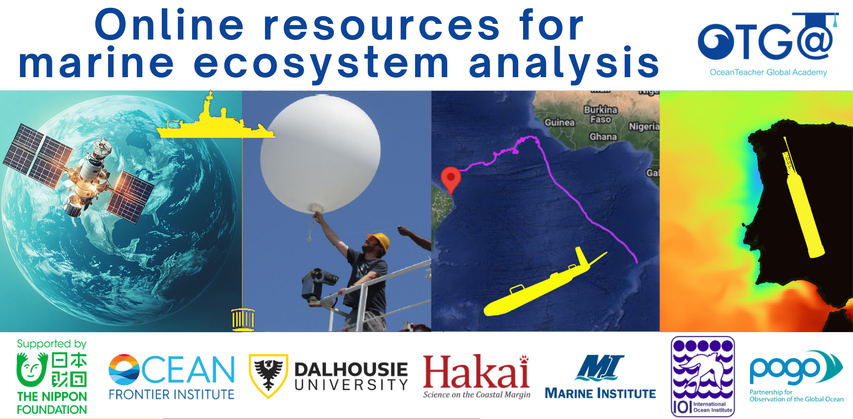
NF-POGO Centre of Excellence. Online resources for marine ecosystem analysis 2025
This introductory training is designed for participants beginning to work with online ocean data. The course provides practical guidance on accessing freely available in situ and remote oceanographic datasets, and on using open-source software tools to generate basic ocean data products. Participants will gain experience in obtaining key oceanographic variables—including data from the World Ocean Database, sea surface temperature, chlorophyll-a concentration, wind, and surface currents—and in visualizing and processing them to support initial analysis and assessment of meso- to large-scale marine and coastal ecosystems.
Venue
Marine Institute of Memorial University. St Johns, Newfoundland, Canada
Learning outcomes
As a result of this course, CofE scholars will acquire basic knowledge to:
- Obtaining relevant oceanographic variables such as ocean surface temperature, chlorophyll-a concentration, surface currents,
- Visualising and developing products to support initial, analysis and assessment of meso to large-scale marine and coastal ecosystems.
Target audience
The training is open to the 10 CofE scholars. More information on the training programme at https://www.ofi.ca/programs/centre/program
Pre-requisites:
Participants must:
-
Have prior knowledge of oceanography;
-
Bring their own laptop;
-
A working knowledge of English.
Course content
Module 1: Introduction to Ocean Observation
- Importance of observational oceanography and the Global Ocean Observing System
- Platforms for collecting and visualising oceanographic data
Module 2: Defining Area of Interest & Folder structure
- Selection and delimitation of area of interest.
- Organisation of folder structure and file names
Module 3: Ocean Data View & World Ocean Data database
- The World Ocean Database (WOD), select and download WOD data
- The Ocean Data View (ODV), download and install ODV
- Create data collection on ODV
- Import and analyse WOD data on ODV
- Quality control on ODV
- Prepare and export products on ODV
- Geographic Coordination System and Basic GIS file formats
- QGIS, download and install, basic layout
Module 5: Creating a GIS project with basic marine and auxiliary data
- Sources of basic, auxiliary data sources for marine GIS
- Import shape and raster format data into the GIS
- Shape and raster layers clipping
- Prepare map figure
- Obtain Essential Ocean Variables from diverse portals
- GIS tools such as interpolation, clipping with masks, extract isolines from raster, raster calculator, derive vectors from scalar components
Module 7: Online visualisation of oceanographic products
- Acquaint with oceanographic data portals and their basic tools for plotting and consulting oceanographic parameters of interest
- Export products (figures, plots, data, GIS format files)
Language of instruction: English
Duration, Synchronous Sessions, and Format
The training will take place face-to-face between 24 to 28 November, 2025, with a duration of approximately 35 hours.
Live sessions are planned from Monday to Friday, from 9:00-12:30 and 13:30-17:00.
The course has an online learning component to complement the learning activities and assessments. Live online sessions may be broadcasted if one or more scholars are not able to be present on-site.
Instructors
Organizers
Participation
This course is offered by NF-POGO Centre of Excellence in Observational Oceanography programme to its scholars.
POGO and UNESCO are committed to promoting equal access principles. Participation from minority or underrepresented groups are strongly encouraged.
Assessment & Certificate
Participants will carry out guided exercises in the classroom and OTGA e-Learning platform, focusing first on a shared Area of Interest (AOI). They will then apply the same methods individually to a second AOI of their choice. On the final day, each participant will present their results to the group, demonstrating the skills acquired throughout the training. The 12 assignments and the final presentation will be graded, and sucessfull completion will require achieving 70% passmark.
Contacts
- Course Coordinator: Lilian A. Krug lakrug@ualg.pt
- OTGA Secretariat: ioc.training@unesco.org
Costs
Free of charge. There are no tuition fees.
Cancellation policy
In the event of cancellation of the course by the OTGA or its affiliates, we will provide notification of cancellation at least 7 days prior to the course date. In the event of cancellation by the attendee, we should receive notification of cancellation at least 7 days prior to the course date.
OBIS Asian nodes2017
OBIS Asian nodes and Coral Reef
The course provides an introduction to the Ocean Biogeographic Information System (OBIS). This includes best practices in marine biogeographic data management, data publication, data access, data analysis and data visualisation.
Aims and Objectives
- Reinforce and expand the OBIS network in the South-East Asian Region
- Increase awareness on international standards and best practices related to marine biogeographic data management
- Increase the amount and quality of open access biodiversity data published through OBIS and its OBIS nodes
- Increase the use of data from OBIS for research, species conservation and area-based management applications for sustainable development
OBIS Chile2018
OBIS Marine Biodiversity Data Management
El presente curso se presenta como una oportunidad para actualizar la información acerca de los formatos y estándares que se utilizan en OBIS.
OBIS se encuentra en un trayecto de renovación y mejora de ciertos procedimientos, especialmente los que se refieren a los controles de calidad de los datos suministrados. Durante el presente curso se expondrán conceptos y procedimientos sobre: usos de la plataforma OBIS, procedimientos para organizar los datos según ciertos estándres y formatos, ¿cómo publicar datos en OBIS? y cuáles son las mejores prácticas para el aprovechamiento de los datos que se encuentran en OBIS.
OBIS Nodes2017
OBIS Nodes Training Course
Training the OBIS nodes and the trainers (at the OBIS nodes and OceanTeacher regional training centres) was considered a top priority at the last SG-OBIS meeting. The training will include:
- The application of ratified Darwin Core terms
- OBIS-ENV-DATA standard (combining sampling events, occurrences, abiotic+ biotic measurements and sampling facts).
- QC tools (including the OBIS tools R package: https://github.com/iobis/obistools) ;
- Data publication (IPT), including metadata management
- Data access and visualization (including the OBIS R package: https://github.com/iobis/robis) ;
- There will be time for discussions and tackling specific use cases including output.

BlueCarbon_China2024
Observation technique about blue carbon
This training course will focus on raising the knowledge on the monitoring, assessment, and accounting of marine blue carbon. And also the related instrumentation and calibration of some biogeochemical parameters are the main content of the training course. The course will use case studies relevant for the Western Pacific.
Learning outcomes
By the end of the course, the participants should:
- Have a comprehensive understanding of the monitoring and assessment of coastal blue carbon.
- Be able to explain the role of connotation, Classification, and Accounting of Marine Carbon Sequestration.
- Be familiar with the instrumentation and calibration of some biogeochemical parameters.
Target audience and prerequisites
Include, but are not limited to, the following researchers and management staff on marine ecological observation, who deal with biogeochemical parameter measurements and instrumentation.
Language of instruction: English
Course content
Day 1 The monitoring and assessment of coastal blue carbon
Day 2 Connotation, Classification, and Accounting of Marine Carbon Sequestration
Day 3-5 Instrumentation and calibration of some biogeochemical parameters (dissolved oxygen and pH in seawater for example)
- utilization and maintenance of dissolved oxygen and pH instruments/sensors
- calibration of dissolved oxygen and pH sensors for seawater use in a lab
- calibration method of multi-parameter compensation for optical dissolved oxygen sensor in seawater
Instructors
Learner assessment and certificate
Assessment will be done through (online) quizzes.
Successful completion of the assignments (passmark: 80%) and active attendance of all of the synchronous sessions will be needed to be awarded a certificate of completion
Technology requirements
To complete this course, you should have access to:
- Latest version of either Chrome, Edge, or Firefox, web browsers
- Access to internet
- Firewalls must be disabled in order to be able to attend the synchronous live sessions
Course Duration, Synchronous Sessions, and Format
The course will take place online between November 25 to 29, 2024, with a duration of approximately 20 hours.
This is a 20-hour training course that will run online between 25-29 Nov 2024, including 3 (daily) synchronous sessions to be held between 13-16 pm (UTC+8) using BigBlueButton web conferencing platform.
The course includes 15 hours of synchronous work (content and discussion) plus 5 hours of individual asynchronous work for completion of assessments.
Application process and selection criteria
A limited number of seats (45) are available. Please complete the online application form available on this LINK. The applications start 01 October 2024. The deadline to submit the application is 31 October 2024 (23:59 CET: Central European Time).
UNESCO is committed to promoting equal access principles. Applications from minority or underrepresented groups are strongly encouraged.
The Selecting Committee will be set up by the hosts (NCOSM and NMDIS), which will comprise the course coordinator, organizers, and lecturers. Selection criteria include the applicant’s academic background, professional experience/duties (such as marine observation, blue carbon and ecosystem data management), and how the applicant will be able to apply the new knowledge acquired. Priority will be given to participants from the West Pacific
Contacts
- Course Coordinators: YU Jianqing yujianqing@ncosm.org.cn; Xu Dian ncosmws@ncosm.org.cn
- OTGA Secretariat: ioc.training@unesco.org
Costs
Free of charge. There are no tuition fees.
The instructors will give the course voluntarily with support from NCOSM.
Cancellation policy
In the event of cancellation of the course by the OTGA or its affiliates, we will provide notification of cancellation at least 7 days prior to the course date. In the event of cancellation by the attendee, we should receive notification of cancellation at least 7 days prior to the course date.
ODM2022
Ocean Data Management 2022
SP_ODM2023
Ocean Data Management 2023
This online, fully self-paced training course provides a comprehensive introduction to the management of marine data, including the guiding principles of data management and typical responsibilities for data managers, data stewards and scientists.
This course is developed by, and for, marine data managers, data stewards and researchers, working in institutions responsible for the collection and good management of marine data.
During this training course, you will be introduced to several general aspects related to the management of marine data, including, metadata, quality control, data policy, data sharing and publishing, data management plans and the research data life cycle. By the end of this course, you will be able to describe and implement the core tasks required for the processing of marine data, explain the importance of metadata, advise researchers on the research data life cycle and explain why a good data management plan is key from the very first initiation steps of a project.