
Search results: 86
MDExc-2025EN
From Observation to Action: Empowering communities towards excellence in marine data
This course aims to equip ocean data leaders in regions across the globe with the knowledge and tools to grow their own communities of practice, thereby developing professional expertise and data literacy for ocean data producers, curators, and users as identified in the Ocean Decade’s Data Strategy Implementation Plan.
General learning outcomes
Upon successful completion of this training, participants will be able to:
- Support community buy-in and develop learning opportunities to train others within their own countries and regions about ocean data
- Seed and lead their own local or regional ocean data Communities of Practice
- Play leading roles in the Decade Coordination Office for Ocean Data Sharing’s global Community of Practice
- Lead cross-border cooperation on specific data sharing topics of interest
Course content & planning
Four modules of three topics delivered on-online with targeted, in-person follow-up.
Each topic will consist of:
- One one-hour lecture - pre-recorded to allow learners to watch at their own pace
- Follow-up discussion time - online, in groups
- Activities to re-inforce the learning
Module 1 (November 2025)
1.1 Setting the scene: Why ocean data management, incentives to sharing data, and the global ocean data landscape
-
- Aim: To provide an introduction and overview to the course; to describe some of the impacts, benefits and motivations in sharing well-managed ocean data; to give an overview of the global and regional ocean data sharing networks and initiatives.
- Outcome: Learners will be able to explain to others why it is important to manage and share ocean data and what options are available to make this happen at a global scale
1.2 Understanding roles: The IODE Quality Framework, Steps, Roles of Individuals
-
- Aim: To give an introduction to the Quality Framework that IODE uses to manage and share ocean data across its network; to outline the various roles that exist within the framework and how these relate to an ocean data community of practice
- Outcome: Learners will be able to describe the key roles that are needed in an ocean data community of practice and the quality framework that activity sits within
1.3 Identifying your ocean data community: Who will you engage with, support, and train?
-
- Aim: To help learners consider who their ocean data community is and what the focus of learning/training needs in that community is
- Outcome: Learners will be able to identify the purpose of their community of practice, and to identify and invite potential members
Module 2 (December 2025)
2.1 Planning: making your marine projects and programmes “data first”
-
- Aim: To explain to learners the Data Management Planning process and how it helps in making a project or programme “data first’
- Outcome: Learners will be able to lead in Data Management Planning in their organisation or community of practice
2.2 Quality data matters
-
- Aim: To introduce learners to a range of thematic data quality issues, which may be beyond their normal area of expertise and to the impacts of data quality on the re-use of data in a range of ocean applications
- Outcome: Learners will have an overview of the importance of ocean data quality which they can bring to their communities of practice and be informed of key resources which they can point their communities of practice
2.3 Building your ocean data community:
-
- Aim: To equip learners with skills in building a community of practice in ocean data management and sharing
- Outcome: Learners will be confident in their ability to grow a community of practice from the potential members identified in Block 1.
Module 3 (January 2025)
3.1 Putting data to work - sharing ocean data to enable insight and action
-
- Aim: To enable communities of practice to understand how to prepare data for sharing, where to share and some tools that can be used to share data which can then be used in creating insights
- Outcome: Learners will be able to encourage data sharing in their communities of practice, and advise on best practices, technology choices, etc
3.2 How do I get credit for sharing my data? Moving from data sharing to data publication
-
- Aim: To help learners to understand the difference between sharing data and formal data publication, the benefits of data publication, how to get started, and how to use digital object identifiers for datasets
- Outcome: Learners will be able to describe data publication to their communities of practice and be aware of options to allow for formal citation of datasets created by their communities of practice
3.3 Creating learning spaces in your ocean data community
-
- Aim: A key activity of communities of practice is sharing knowledge and helping members to learn from each other. This session will focus on the key aspects of a healthy peer-based learning environment, and will be followed in block 4 by a session on designing effective learning sessions
- Outcome: Learners will be able to foster healthy environments in their communities of practice to allow the growth and development of members
Module 4 (February 2026)
4.1 What is the IODE network and who is involved
-
- Aim: The IODE network is the key ocean data sharing network globally and consists of a number of components. This session will introduce learners to the makeup of IODE’s network and its scope of work
- Outcome: Learners will be able to introduce the IODE network to their communities of practice and to align activities of the community to IODE activity, including working alongside National Oceanographic Data Centres and Associated Data Units
4.2 Getting organisational support and buy-in
-
- Aim: As data communities of practice are often engaged in organisational change, getting buy-in or support for their activities is key. This session will equip learners with tools to help with raising the profile of and engagement with their communities of practice leading to greater impact.
- Outcome: Learners will be equipped with skills and knowledge to effectively communicate the work of their communities of practice to a range of stakeholders and to get buy-in from decision makers
4.3 Designing learning
-
- Aim: Communities of Practice support their members by giving them focussed learning opportunities. This session will introduce the concepts in designing effective learning opportunities
- Outcomes: Learners will be able to plan effective and targeted training sessions to develop skills within their communities of practice
In-person Follow-up (2026)
- Aims: To provide in-person spaces to follow-up on the train-the-trainer course content and to develop individual roadmaps to action, implementation of which will be followed up online
- Outcomes: Learners will have developed personal action plans to put into practice the skills they have acquired throughout the course and have organised the first follow-up session with the course leaders
Information about these sessions will be updated [HERE] once confirmed.
Target audience & pre-requisites
This course was prepared for ocean practitioners and institutions interested in becoming focal points to collaborate with the Decade Coordination Office for Ocean Data Sharing in building a network of recommended practices around good data management and sharing.
Participation will require:
- Good working knowledge of English (*the course will be delivered in multiple languages, but external resources may be in English)
- Basic computer skills
- Knowledge of ocean data management is advised (completed the OTGA course)
- Knowledge of ocean data
Language of instruction
English and Spanish
Instructors and Organizers
Content for this course was provided by:
- Adam Leadbetter
- Rob Thomas
- Jan-Bart Calewaert
- Ana Carolina Mazzuco
- Taco de Bruin
- Peter Burger
- Margarita López-Velosa
- Other instructors from each region (to be confirmed)
This training is organized by the Decade Coordination Office for Ocean Data Sharing in collaboration with the the Ocean Decade Coordination Unit and the UNESCO IOC OceanTeacher Global Academy (Programme Component of IODE).
Assessments and Certificate
This course contain a set of online multiple-question automated assessments to evaluate your learning, and a final action plan to be developed and implemented individually. Participants will be required to complete a pre and post self-assessment related to the course content, and be requested to fill out a feedback survey at the end of the course to reflect on your learning experience and identify areas for improvement. This will also provide valuable feedback for course teachers and organisers to enhance future training sessions.
To receive a Certificate of Completion, learners must:
- Achieve a minimum score of 80% on all quizzes;
- Complete every lesson, activity, and assessment;
- Complete the mandatory pre-test and post-test;
- Develop and implement an action plan;
- Participate in online live sessions (75% attendance);
- Submit the required feedback form, which is mandatory for all OTGA courses.
After completion of the course, participants will be invited to join follow ups and monthly meetings with the DCO for Ocean Data Sharing to continue the network building and future training of other participants.
Technology requirements
To complete this course, participants should have access to:
- Computer with a modern operating system (Windows, macOS, or Linux)
- Latest version of either Chrome, Edge, Firefox or Safari web browsers
- JavaScript and cookies enabled
- Broadband internet access (minimum bandwidth of 0.5 Mbps (Receive and Send)
- Speakers or headphones, Microphone
Course duration and format
This course will be conducted in a blended format, through a combination of online self-paced activities, instructor led sessions and assessments, and hands-on work. The duration of the course (Blocks 1, 2, 3, and 4 and related activities) is a total of 25 hours.
Live sessions schedule:
18 November 2025
16 December 2025
5 February 2026
5 March 2026
Note that the training course may be complemented by face-to-face in-person follow-up module - to be scheduled in 2026 - dates and venue to be confirmed by region.
Cost: This course has no tuition fees.
How to participate
Participation in this training is invitation only, coordinated in collaboration with the National Committees, Coordination Offices and Centres of the Ocean Decade.
Contacts
- DCO Ocean Data Sharing: oceandatasharing@unesco.org
- OTGA Secretariat: ioc.training@unesco.org
For any questions please contact the OTGA Secretariat always using the name of the course as the email subject.
Cancellation policy
In the event of cancellation of the course by the OTGA or its affiliates, we will provide notification of cancellation at least 7 days prior to the course date. In the event of cancellation by the attendee, we should receive notification of cancellation at least 7 days prior to the course date.
OceanExpert announcement: https://oceanexpert.org/event/4867
BC-VLab3*2025
How to use a Virtual Laboratory on Carbon Plankton Dynamics
This 4-hour course is designed to empower ocean scientists by providing a comprehensive understanding and practical skills in using a Carbon Plankton Dynamics Virtual Laboratory (VLab), running in Blue-Cloud Virtual Research Environment (VRE). Participants will learn how to explore carbon plankton data, patterns, and processes relevant to marine ecology using a virtual environment. Knowing that the carbon pump in marine ecosystems operates as a key mechanism for carbon dynamics, learning how to use a virtual carbon plankton model can provide support to enhance knowledge in marine life dynamics, as well as perform science-based decision-making. This course uses datasets and scenarios of the Belgian Part of the North Sea and the Gulf of Trieste to demonstrate the capabilities of the models, which can be applied and adapted for other regions and conditions.
The course aims to empower ocean scientists with a comprehensive understanding and practical skills in using a Virtual Laboratory (Vlab) on Carbon Plankton Dynamics within the Blue-Cloud VRE. By accessing various digital tools, you will be able to utilize models to study carbon plankton and apply them to make decisions related to the carbon pump mechanism based on data products and modelling outputs.
Learning outcomes
Upon successful completion of this training, participants will be able to:
- Identify key data collection processes and partners involved in research within the Belgian Part of the North Sea and the Gulf of Trieste and the development of the Carbon Plankton Dynamics Virtual Laboratory.
- Explain the importance of carbon plankton dynamics for scientific research, modeling, and oceanography.
- Define the purpose and functionalities, and the services provided by the Virtual Laboratory.
- Identify and utilize near-real-time data within the Virtual Laboratory for use in Nutrient–Phytoplankton–Zooplankton–Detritus (NPZD)-type models.
- Access relevant data from Blue-Cloud Data Discovery and Access service (DD&AS)
- Format data files for use in the Virtual Laboratory
- Operate the Virtual Laboratory (VLab) on Carbon Plankton Dynamics to simulate and analyze phytoplankton dynamics in the specified regions.
- Analyze model results related to the contributions of bottom-up and top-down drivers by the RShiny App within the Virtual Laboratory.
- Quantify the relative contributions of bottom-up and top-down drivers in phytoplankton dynamics using the NPZD-type model within the Virtual Laboratory.
- Interpret marine ecosystem management decisions based on model outputs from the Virtual Laboratory (VLab).
Course content
-
Module 1: Introduction to the Virtual Laboratory - This module introduces the Virtual Laboratory on Carbon Plankton Dynamics, its services, the relevance of carbon plankton dynamics, and key partners, focusing on their roles in data collection and modeling within the Belgian Part of the North Sea and Gulf of Trieste as a use case.
-
Module 2: Data Collection - This module guides on the types of data needed for the Virtual Laboratory on Carbon Plankton Dynamics, methods to access data (DD&AS), and the process of building and formatting data files, focusing on data from the Belgian Part of the North Sea and Gulf of Trieste.
-
Module 3: Discovering the Model - This module provides hands-on experience in operating the Virtual Laboratory on Carbon Plankton Dynamics using the handbook, focusing on how to use near-real-time data to run an NPZD-type model.
-
Module 4: RShiny App - This module teaches participants how to use the RShiny App in the Virtual Laboratory on Carbon Plankton Dynamics, focusing on visualizing and interpreting data related to phytoplankton dynamics in the Belgian Part of the North Sea and Gulf of Trieste.
Target audience
- Graduate students and postdoctoral researchers in marine and environmental sciences;
- IT professionals supporting research activities in scientific institutions; and
- Project managers and coordinators involved in research projects that utilise Virtual Research Environments (VREs).
Proficient in the following is required:
- The ability to be self-directed in learning new technology skills (e.g. following a step-by-step tutorial, online video help, or access to support to learn necessary skills)
- Basic computer skills
- Finding resources through search engines
Language of instruction
English
Instructors and Organizers
Content for this course was provided by:
This training is organized by the EU BlueCloud2026 project in collaboration with the UNESCO IOC OceanTeacher Global Academy, RTC Belgium, and contributions from project partners' experts (Flanders Marine Institute VLIZ, National Institute of Oceanography and Applied Geophysics (OGS) of Italy).
Blue-Cloud 2026 aims at a further evolution of this pilot ecosystem into a Federated European Ecosystem to deliver FAIR & Open data and analytical services, instrumental for deepening research of oceans, EU seas, coastal & inland waters. It develops a thematic marine extension to EOSC for open web-based science, serving the needs of the EU Blue Economy, Marine Environment and Marine Knowledge agendas.
Assessments and Certificate
This course contain a set of multiple-question automated assessments to evaluate your learning. Participants will be required to complete a pre and post self-assessment related to the course content, and be requested to fill out a feedback survey at the end of the course to reflect on your learning experience and identify areas for improvement. This will also provide valuable feedback for course teachers and organisers to enhance future training sessions.
To receive a Certificate of Completion, learners must:
- Achieve a minimum score of 70% on all quizzes.
- Complete every lesson, activity, and assessment.
- Complete the mandatory pre-test and post-test.
- Submit the required feedback form, which is mandatory for all OTGA courses.
Technology requirements
To complete this course, participants should have access to:
- Computer with a modern operating system (Windows, macOS, or Linux)
- Latest version of either Chrome, Edge, Firefox or Safari web browsers
- JavaScript and cookies enabled
- Broadband internet access (minimum bandwidth of 0.5 Mbps (Receive and Send)
- Speakers or headphones, Microphone
Course duration and format
For this first round, the course will be available online between 17 September 2025 and 31 July 2026. The estimated time to complete the self-paced course is approximately 4 hours.
Cost: This course has no tuition fees.
The training course is Funded by the European Union, with additional support from UNESCO IOC.
How to enrol
Please register on the OceanExpert website (www.oceanexpert.org). Once your OceanExpert account is approved (this is not done immediately), you can self-enrol in the course. If you already have an OceanExpert account, you can self-enrol in the course using your OceanExpert username and password.
First log-in OceanTeacher, then access the course page and click on self-enrolment. The enrolment key for all courses is VLab3*2025EN1
Contacts
- OTGA Secretariat: ioc.training@unesco.org
For any questions please contact the OTGA Secretariat always using the name of the course as the email subject.
Cancellation policy
In the event of cancellation of the course by the OTGA or its affiliates, we will provide notification of cancellation at least 7 days prior to the course date. In the event of cancellation by the attendee, we should receive notification of cancellation at least 7 days prior to the course date.
OceanExpert announcement: https://oceanexpert.org/event/4858
BC-VLab4
How to use a Virtual Laboratory on Marine Environmental Indicators
Summary
This 8-hour course is designed to empower ocean scientists by providing comprehensive understanding and practical skills in using the Marine Environmental Indicators Virtual Laboratory running in Blue-Cloud Virtual Research Environments (VREs). Evaluating environmental conditions of marine areas is crucial to provide data-based support for decision-making in ocean management. In this course, the participants will learn about important and widely used marine environmental indicators: 1) Marine Heatwave (MHW), 2) Ocean Heat Content (OHC), 3) Trophic Index (TRIX), and 4) Storm Severity Index (SSI).
The general goal is to equip ocean scientists with the knowledge and skills to effectively navigate, utilize, and customize the Marine Environmental Indicators Virtual Lab for assessing marine environmental conditions and supporting ocean management decisions.
This course is organized by CMCC, INGV, OGS, KNMI, and VLIZ, with the support of the UNESCO IOC OceanTeacher Global Academy (OTGA).
Format and Duration
This is a fully online, self-paced course with no synchronous sessions. The estimated time required to complete the course is approximately 4 hours of asynchronous activities, including video lectures, readings, quizzes, and practical exercises.
Venue
Online
Language of Instruction: English
Learning Outcomes
Upon successful completion of this training, learners will be able to:
- Use the Virtual Laboratory within a Virtual Research Environment
- Explain the relevance of marine environmental indicators
- Calculate the Marine Heatwave (MHW) indicator
- Interpret spatial trends of the Marine Heatwave (MHW) indicator
- Explain the Ocean Heat Content (OHC) indicator
- Analyze spatial trends of the Ocean Heat Content (OHC) indicator
- Identify potential eutrophication hotspots using the Trophic Index (TRIX)
- Understand and compute the Storm Severity Index (SSI), interpret its spatial and temporal patterns, and analyze storm impacts using Jupyter Notebooks and cloud-based tools within the Virtual Research Environment
- Use the MEI Web Application to generate environmental indicators
Course Content
The course is composed of six online modules:
- Module 1: Introduction This module provides a comprehensive overview of marine environmental indicators, delving into their significance in assessing ocean health and their application in informed decision-making. Participants will learn about the crucial role these indicators play in evaluating marine ecosystems and gain an understanding of the BlueCloud VLab and its partners involved in this initiative.
- Module 2: Marine Heatwave (MHW) This module explores the computation of the Marine Heatwave indicator, providing insights into its relevance for understanding climate change effects on sea surface temperature. Participants will gain a clear understanding of the data sources used to calculate this indicator, and learn to navigate and utilize the provided notebook for practical analysis and visualization.
- Module 3: Ocean Heat Content (OHC) This module provides a thorough exploration of the Ocean Heat Content indicator, offering a comprehensive understanding of its significance as a key metric in assessing global climate change and its impact on ocean dynamics. Participants will delve into the various data sources that inform this indicator, and acquire practical skills in utilizing the provided notebook for in-depth analysis and interpretation of OHC data.
- Module 4: Trophic Index (TRIX) This module examines the impact and application of the Trophic Index, focusing on its utility as a key indicator of eutrophication and overall water quality in marine environments. Participants will be introduced to the relevant data sources that are used to calculate the Trophic Index, and will gain hands-on experience using the provided notebook for data analysis and informed interpretation of Trophic Index values.
- Module 5: Storm Severity Index (SSI) This module delves into the impact of the Storm Severity Index, investigating its role as a crucial measure of coastal vulnerability and its implications for risk assessment and management. Participants will explore the data sources used in calculating the SSI and gain the expertise needed to apply the provided notebook for practical calculations and informed interpretation of storm-related impacts. In addition users will be taught how to run the Storm Severity Index on the Cloud Computing Platform.
- Module 6: Using the MEI Web Application This module provides a practical introduction to the MEI Web Application, which allows users to compute and explore all Marine Environmental Indicators through an intuitive graphical interface. This module focuses on how to use the web app to run the same analyses covered in the previous modules using Jupyter Notebookin, in a simpler, code-free environment. Participants will learn how to navigate the web interface, select indicators, configure parameters, and interpret the generated outputs.
Target Audience
This course was prepared for researchers, data scientists, and academic professionals involved in ocean science and related fields who are interested in enhancing research capabilities through advanced digital tools and collaborative platforms. It is also suitable for:
- Graduate students and postdoctoral researchers in marine and environmental sciences
- IT professionals supporting research activities in scientific institutions
- Project managers and coordinators involved in research projects that utilize Virtual Research Environments (VREs)
Prior experience with D4Science or Virtual Research Environments and scientific programming may be required.
Organizers
- CMCC https://www.cmcc.it, https://oceanexpert.org/institution/15381
- INGV https://www.ingv.it, https://oceanexpert.org/institution/6939
- OGS https://www.ogs.it/en, https://oceanexpert.org/institution/6941
- KNMI https://www.knmi.nl/home, https://oceanexpert.org/institution/12233
- VLIZ https://vliz.be/nl, https://oceanexpert.org/institution/6223
Facilitators
- Francesco Palermo: CMCC (https://oceanexpert.org/expert/77906)
- Rafael De Menezes: CMCC (https://oceanexpert.org/expert/30900)
- Simona Simoncelli: INGV (https://oceanexpert.org/expert/22199)
- Enrico Baglione: INGV (https://oceanexpert.org/expert/56170)
- Nydia Catalina Reyes Suarez: OGS (https://oceanexpert.org/expert/37482)
- Jan Willem Noteboom: KNMI (https://orcid.org/0000-0002-4909-7865)
- Marco Lettere: Nubisware
Registration, Costs, and Technological Requirements
This course has no tuition fee and is open to everyone. No application is required, self-enrolment with open registrations.
To follow this course, participants need access to:
- A computer with a modern operating system (Windows, macOS, or Linux)
- Latest version of Chrome, Edge, Firefox, or Safari
- JavaScript and cookies enable
- dBroadband internet access (minimum 0.5 Mbps)
- Speakers or headphones, microphone
Prior experience with D4Science or Virtual Research Environments and scientific programming may be required for some activities. Additional resources can be found at: https://blue-cloud.org/
UNESCO is committed to promoting equal access principles. Registration from minority or underrepresented groups is strongly encouraged.
How to enrol
Please register on the OceanExpert website (www.oceanexpert.org). Once your OceanExpert account is approved (this is not done immediately), you can self-enrol in the course. If you already have an OceanExpert account, you can self-enrol in the course using your OceanExpert username and password.
First log-in OceanTeacher, then access the course page and click on self-enrolment. The enrolment key for all courses is VLab4*2026EN1
Assessment & Certificate
This course contains a set of multiple-question automated assessments to evaluate your learning. You will be required to complete a pre and post self-assessment related to the course content, and be requested to fill out a feedback survey at the end of the course to reflect on your learning experience and identify areas for improvement. This will also provide valuable feedback for course teachers and organisers to enhance future training sessions.
Note: All quizzes are graded automatically, and the grades are returned to you immediately.
A certificate will be awarded to all participants that successfully completed all the lessons, activities and assessments. The passmark is 80%. Responding to the feedback survey is a requirement for certificates to be awarded in all OTGA courses.
Contacts
For course organisation, please contact: Cyrielle Delvenne; cyrielle.delvenne@vliz.be
For additional questions, please contact the OTGA Secretariat (ioc.training@unesco.org), always using the name of the course as email subject.
Cancellation Policy
In the event of cancellation of the course by the OTGA or its affiliates, we will provide notification of cancellation at least 7 days prior to the course date. In the event of cancellation by the attendee, we should receive notification of cancellation at least 7 days prior to the course date.

ECOPOceanTech-2024
Introduction to Oceanographic Survey Techniques and Data Management
Summary
Global change requires studying the ocean in more detail and at longer and larger scales. Capacity development and training on standard survey techniques and the use of simple sensors has been identified as a tool to enhance ocean observation. This course serves as an introduction to oceanographic survey techniques and data processing. It is designed for Early Career Ocean Professionals (ECOPs), students, and other oceanographers who intend to pursue oceanography and marine sciences. Relevant oceanographic (physical, chemical, and biological) datasets will collected and used during the training, making it easy to relate, understand, and apply the course concept.
Venue: AquaBioTech Group, Mosta, Malta
Learning outcomes
By the end of the course, the learners are expected to:
- Be familiar with oceanographic survey techniques.
- Understand how to use simple data collection tools and sensors.
- Be familiar with measurement of temperature, salinity, turbidity, depth oxygen and chlorophyll.
- Produce meaningful descriptive statistics and informative graphs from raw data.
- Results interpretation and discussion for scientific communication and writing.
Course contents
The course will be divided into 4 modules:
Module 1: Field sampling techniques for basic coastal oceanographic parameters
- Introduction to oceanographic parameters temperature, salinity, turbidity, depth oxygen and chlorophyll.
- Preparing a field work checklist,
- Safety measures during field work
- Calibration, and deploying of sensors and equipment
- Field surveys
Module 2: Data visualization and management
- Data retrieval
- Data entry
- Data visualization in R software using ggplot package
- Simple analysis using R
- Data management: storage, sharing and repository
Module 3: Basics of scientific writing
- Language and structure
- Graphics and visuals
- Citation and referencing
- Plagiarism
Module 4: Basics of science communication and outreach
- Language and sentence structure in science communication
- PowerPoint Presentation
- Visuals for infographics
- Policy briefs
Target audience
ECOPs who are enrolled in a Bachelor’s or Master’s degree, or have completed their Masters Degree and intend to use this knowledge in their academic or research related work. No prior R knowledge will be required, but knowledge on basics of oceanography is desired. The current course is specifically targeting ECOPs from and/or based in the Mediterranean region (from Southern Europe, Northern Africa and Western Middle East).
Language of instruction: English
Moderators and Instructors
Ines Boujmil – Aqua Biotech Group
Dr. Anabel von Jackwoski - Stockholm University
Mr. Gabriel Akoko Juma – Alfred Wegener Institute, Germany
Organizers
This course is being organized with the support of the Early Career Ocean Professionals Programme, Alfred Wegener Institute, Helmholtz Centre for Polar and Marine Research, Stockholm University, Aqua Biotech Group, International Ocean Institute, Jean Monnet Centre of Excellence on Sustainable Blue Economy and UNESCO-IOC Ocean Teacher Global Academy.
Details: https://oceanexpert.org/event/4367

GLOSS Sealevel
IOC of UNESCO GLOSS Sea-level Training for North Africa
Course description:
The IOC of UNESCO GLOSS Sea Level Training for North Africa is a five-day technical capacity development course designed to strengthen national and regional capabilities in sea-level observation, data management, and applied sea-level science within the North-Eastern Atlantic and Mediterranean region, with a particular focus on North African Member States. The course aims to provide participants with practical and theoretical knowledge required to operate, maintain, and sustain tide gauge stations contributing to the Global Sea Level Observing System (GLOSS).
Core content include:
-
Sea-level measurement technologies, station installation, maintenance, and troubleshooting
-
Data telemetry and operational data exchange with the IOC Sea Level Station Monitoring Facility (SLSMF) and other international data centres
-
Sea-level data processing, quality control (including automated QC using the IOC SLSMF API), and interpretation
-
Fundamental sea-level science, including tides, surges, seiches, tsunamis, sea-level rise, and vertical land motion
-
Practical field exercises, including site visits to operational tide gauge stations and basic surveying and levelling techniques (optical and GNSS).
Audience:
The training is intended for professionals from IOC Member States in North Africa and the NEAM region who are currently involved, or expected to be involved, in sea-level observation and data management activities.
Specifically, the target audience includes:
-
Technicians responsible for the operation and maintenance of tide gauge stations
-
Hydrographers and surveyors working with coastal and water level measurements
-
Data analysts involved in processing and quality control of sea-level data
-
Early-career or entry-level oceanographers engaged in sea-level or coastal observation programmes
Participants are typically affiliated with national oceanographic, hydrographic, or maritime institutions contributing, or planning to contribute, sea-level data to IOC systems such as GLOSS and the IOC Sea Level Station Monitoring Facility (SLSMF).
Learning outcomes:
Upon successful completion of the IOC of UNESCO GLOSS Sea Level Training for North Africa, participants will be able to:
-
Identify and describe the main sea-level measurement technologies used in GLOSS tide gauge stations and explain their operational strengths and limitations.
-
Configure and manage data telemetry systems to enable timely transmission of sea-level data from national stations to the IOC Sea Level Station Monitoring Facility (SLSMF) and other relevant international data centres.
-
Apply standard sea-level data processing and quality control procedures, including the use of automated quality control tools and the IOC SLSMF API.
-
Interpret sea-level time series (mareograms) to identify and distinguish physical phenomena such as tides, seiches, storm surges, tsunamis, and longer-term sea-level variability.
-
Perform basic tidal analysis and explain the concept and use of tidal datums in hydrographic, oceanographic, and maritime applications.
-
Explain the role of vertical land motion and site stability in sea-level observations and integrate levelling and GNSS information into station assessments.
-
Demonstrate practical field skills through site visits and hands-on exercises, including basic surveying and inspection of operational tide gauge infrastructure.
Course content:
The training combines theoretical lectures, practical exercises, system demonstrations, and a field visit to ensure participants gain applied operational skills in sea-level observation and data management.
1. Introduction and Regional Context
-
Overview of the GLOSS and its role within IOC programmes
-
Network reports and experience-sharing by participating Member States
-
Regional sea-level monitoring challenges and priorities in North Africa and the NEAM region
2. Sea-Level Measurement Technologies
-
Overview of sea-level measurement principles
-
Types of tide gauges and sensors used in GLOSS stations
-
Strengths, limitations, and suitability of different technologies for operational monitoring
3. Tide Gauge Installation, Operation, and Maintenance
-
Anatomy and components of a tide gauge station
-
Installation requirements and best practices
-
Routine maintenance procedures and operational checks
-
Troubleshooting common technical problems affecting station performance
4. Data Telemetry and International Data Exchange
-
Data transmission systems and telemetry options
-
Establishing and maintaining data delivery links with the IOC Sea Level Station Monitoring Facility (SLSMF)
-
Overview of other international and GLOSS sea-level data centres
-
Practical troubleshooting session to establish or improve data links
5. Sea-Level Data Processing and Quality Control
-
Introduction to sea-level data formats and processing workflows
-
Manual and automated quality control procedures
-
Use of the IOC SLSMF API for automated quality control
-
Practical exercises using real sea-level datasets
6. Sea-Level Science and Data Interpretation
-
Interpretation of mareograms and sea-level records
-
Identification of physical processes affecting sea level, including: Tides/Seiches/ Storm/surges/Tsunamis/ Sea-level rise and variability / Overview of tidal analysis methods and tidal datums
7. Vertical Land Motion and Site Stability
-
Concepts of vertical land motion (VLM) and its impact on sea-level observations
-
Theory of levelling methods (optical levelling and GNSS)
-
Integration of GNSS and levelling data with sea-level observations
-
Overview of GNSS and VLM data centres supporting sea-level monitoring
8. Practical Field Activities
-
Site visit to an operational tide gauge station
-
Hands-on inspection of station components and surroundings
-
Basic surveying and levelling exercises in the field
-
Application of learned concepts in a real operational environment
Prerequisites:
-
No prior specialised knowledge of tides or advanced sea-level science is required
-
Basic understanding of oceanographic or tidal concepts is desirable
-
Basic computer skills are required, including the ability to work with digital data and software tools
-
Some familiarity with water level data processing requirements or operational measurement environments is expected
-
Willingness and ability to participate in hands-on fieldwork, including a site visit to a tide gauge station and basic survey exercises
Language of instruction: English
Instructors:
Technology requirements:
Participants should be able to:
-
Use a personal computer confidently, including basic operating system functions (file management, installing or running software, connecting to networks)
-
Work with digital datasets, including opening, viewing, and managing sea-level or time‑series data files
-
Use common productivity software, such as spreadsheets and document viewers, to review, organize, and inspect data outputs
-
Access and use web-based platforms and online tools, including browser-based data portals and APIs demonstrated during the training (e.g. IOC Sea Level Station Monitoring Facility tools)
Technical Skills:
-
Basic knowledge of water level data processing requirements, sufficient to follow instruction on data quality control and analysis workflows
-
Familiarity with digital communication and data transmission concepts, supporting understanding of telemetry and data exchange with international data centres
-
Willingness and ability to engage in hands-on technical sessions, including practical exercises using IOC tools, APIs, and real sea-level datasets
re-requisites: not applicable
Selection criteria:
-
Professional relevance
Candidates must be currently involved, or expected to be involved, in sea‑level observation, tide gauge operation, or water‑level data analysis within a national oceanographic, hydrographic, or maritime institution
-
Institutional role and applicability
Priority is given to nominees whose responsibilities allow them to directly apply the training outcomes to the operation, maintenance, or data management of tide gauge stations contributing to GLOSS and IOC systems
-
Regional eligibility
Applicants must be nominated by eligible IOC Member States from North Africa and the NEAM region, as specified in the call (Algeria, Cabo Verde, Cyprus, Egypt, Israel, Jordan, Libya, Mauritania, Morocco, and Tunisia)
-
Basic computer skills
-
Some familiarity with water‑level data processing or measurement environments
-
An ability to participate fully in hands‑on technical and field activities
-
Sufficient working knowledge of English, as the training will be conducted entirely in English
-
Commitment to full participation
-
Availability to attend the entire onsite training period (18–22 May 2026), including practical sessions and the site visit
-
Gender and geographic balance (where applicable)
-
Selection may take into account equitable geographic representation and gender balance, in line with IOC capacity development principles
Learner assessment:
Written and oral assessments throughout the training course.
Duration: 37 hours
Certificate:
A certificate will be issued at the end of the training course - details to be defined
Venue:
Innovocean campus- Unesco/IOC Project office for IODE - Jacobsenstraat 1, 8400 Oostende- Belgium.
Organizers:
-
Intergovernmental Oceanographic Commission of UNESCO (UNESCO‑IOC)
-
Ex-employees of the National Oceanography Centre (NOC), United Kingdom
-
Flanders Marine Institute (VLIZ)
-
UNESCO‑IOC Project Office for IODE (Ostend, Belgium)
-
CoastWAVE 2.0 Project (DG ECHO, co‑funding)
Contacts:
For course organization, please contact: [TO BE UPDATED]
For additional questions, please contact OTGA Secretariat (ioc.training@unesco.org) always using the name of the course as e-mail subject.
Cancellation policy:
In the event of cancellation of the course by the OTGA or its affiliates, we will provide notification of cancellation at least 7 days prior to the course date. In the event of cancellation by the attendee, we should receive notification of cancellation at least 7 days prior to the course date.
IOC Training Course and Identification Qualification in Harmful Marine Microalgae 2026
Since 1993 the IOC has conducted training courses on harmful microalgae. The purpose has been to improve the taxonomic and identification skills of the participants for research purposes and for practical monitoring of harmful algal blooms.
From 2006 the IOC training in HAB identification has been offered within a new framework which gives accreditation. The present course includes now a practical exam at the end of the course with an IOC Certificate of Proficiency in Identification of Harmful Algae issued to participants who pass the exam. We know by experience that many of the more than 500 trainees we have had over the years have wished the courses to give accreditation, and in some countries, the IOC courses have become a reference for laboratories to be approved for carrying out regulatory monitoring for harmful microalgae.
The IOC Science and Communication Centre on Harmful Algae, University of Copenhagen, Denmark is organizing the course.
IOC Training Course and Identification Qualification in Harmful Marine Microalgae 2026
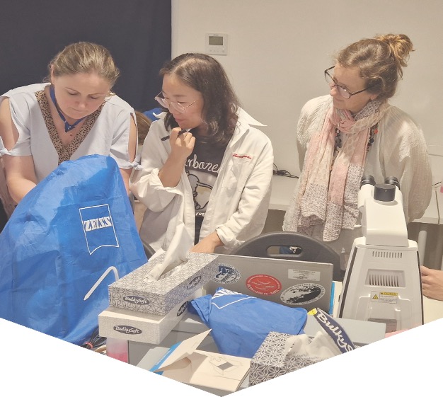
Course description: The course includes 100 hours of teaching and is divided into two parts. 1) The first part of the course is organised online using the elearning platform of IOC/IODE/OceanTeacher Global Academy, giving general introductions to the various groups of harmful algae; this part is mainly for self-study and estimated to 40 hours of reading. 2) The second part is a practical course in species identification (see tentative programme below). Part 2 includes 60 hours of teaching and a microscope will be available to each participant during the entire period, see also link below.
Participants: The course is aimed at participants who have some years of practical experience in identification of microalgae. The number of participants is limited to 16. If there are more applicants than available seats, priority will be given to applicants who have direct research or management responsibilities with regard to the occurrence of harmful algae.
Dates: Part 1 will be offred through the eLearning platform of OTGA’ from October onwards; part 2 takes place onsite from 12-24 October 2026.
Venue on site: IOC Science and Communication Centre on Harmful Algae, Department of Biology, University of Copenhagen, Denmark.
Language: English.
Course lecturers: Dr. Santiago Fraga, Dr. Jacob Larsen, Dr. Nina Lundholm, Professor Øjvind Moestrup.
Enquiries may be sent to Jacob Larsen, jacobl@bio.ku.dk
Costs: The course is organized on a cost-recovery basis. The price of the course is 4500 EUR and it is a package deal, which covers all expenses during the course period, see also link below; thus
- Accommodation, arriving to the course venue on 12 October, check-in from 16.00, and check-out on 24 October at 10.00
- All meals during the course, starting with an evening meal upon arrival on 12 Oct. and finishing with breakfast on 24 Oct.
- Access to the distant learning programme on Ocean Teacher which will be available two- months prior to the practical course
- Teaching material including hard copies or pdf-versions of the following books which will be distributed during the practical part of the course:
- Lassus, P., Chomérat, N., Hess, P. & Nézan, E. 2016. Toxic and Harmful Microalgae of the World Ocean. – Denmark. International Society for the Study of Harmful Algae / Intergovernmental Oceanographic Commission of Unesco. IOC Manuals and Guides 68, 523 pp. (pdf-version)
- Hoppenrath, M., Chomérat, N., Horiguchi, T., Murray, S.A. & Rhodes, L. 2023. Marine benthic dinoflagellates – their relevance for science and society (2nd, revised edition). - Senckenberg Gesellschaft für Naturforschung, Frankfurt am Main, Germany. Senckenberg Buch vol. 88, 376 pp.
- Karlson, B., Cusack, C. & Bresnan, E. (eds). 2010. Microscopic and molecular methods fro quantitative phytoplankton analysis. – IOC Manuals and Guides 55, Paris, Unesco, 110 pp. (pdf-version)
- Larsen, J. & Nguyen, N.L. (eds). 2004. Potentially toxic microalgae of Vietnamese waters. – Opera Bot. 140: 5-216 (pdf-version)
- Reguera, B., Alonso, R., Moreira, A., Méndez, S., Dechraoui-Bottein, M.-Y. (eds). 2016. Guide for designing and implementing a plan to monotor toxin-producing microalge. 2nd ed. – IOC Gudies and Manuals 59, Intergovernmental Oceanographic Commission (IOC) of Unesco and International Atomic Energy Agency (IAEA), Paris and Vienna, 66 pp. (pdf-version)
- Proceedings from various HAB conferences (pdf-versions)
- Copies of all lectures given during the course
- Use of facilities, microscopes, samples, and cultures
- Tuition during the practical part of the course
Species identification
This part of the course will focus on identification of harmful algal species by light microscopy, with particular reference to the ‘IOC Taxonomic Reference List on Toxic Plankton Algae’. The use of electron microscopy will be introduced, but practical exercises are not included. During the course, the following species will be demonstrated either as cultures (*subject to the availability of cultures) or as preserved material.
Haptophyceae*: Chrysochromulina spp. Prymnesium spp.
Raphidophyceae*: Chattonella antiqua, C. ovata, C. subsalsa, Fibrocapsa japonica, Heterosigma akashiwo, Olisthodiscus luteus (Olisthodiscophyceae).
Dictyochophyceae*: Pseudo-chattonella verruculosa
Dinophyceae: Prorocentrum concavum, P. cordatum, P. emarginatum, P. gracile, P. obtusidens, P. hoffmannianum, P. lima, P. micans, P. rhathymum, P. rostratum, P. scutellum, P. triestenum
Dinophysis acuta, D. acuminata, D. caudata, D. fortii, D. miles, Phalacroma mitra, D. norvegica, P. rotundatum, D. tripos
Alexandrium affine, A. minutum*, A. catenella, A. ostenfeldii, A. pacificum*, A. pseudogonyaulax, A. tamarense, A. taylorii
Pyrodinium bahamense, Lingulodinium polyedrum, Protoceratium reticulatum, Gonyaulax polygramma, G. spinifera, Vulcanodinium rugosum, Gambierdiscus spp, Coolia spp., Ostreopsis spp.
Akashiwo sanguinea*, Amphidinium carterae*, Margalefidinium polykrikoides*, Gymnodinium catenatum*, G. impudicum*, Karenia mikimotoi*, K. papilionaceae*, K. selliformis*, Karlodinium armiger*, K. micrum*, Noctiluca scintillans.
Bacillariophyceae: Pseudo-nitzschia australis, P. calliantha*, P. delicatissima, P. fraudulenta, P. multiseries, P. pungens*, P. seriata, Nitzschia navis-varingica.
Cyanobacteria: Anabaena spp, Anabaenopsis spp, Aphanizomenon spp., Cylindro-spermopsis spp., Microcystis spp, Nodularia spumigena, Trichodesmium sp.
Feedback survey
At the end of the course, you will be asked to fill out a feedback survey. This information will be used to improve future courses. Note: submitting the course feedback survey is mandatory to obtain the course certificate
Certificate: A certificate of completion will be awarded to all participants who attended all classes and activities and completed the final test onsite.
Cancellation policy:
In the event of cancellation of the course by the OTGA or its affiliates, we will provide notification of cancellation at least 7 days prior to the course date. In the event of cancellation by the attendee, we should receive notification of cancellation at least 7 days prior to the course date.
OBIS KMFRI2018
Marine Biogeographic Data Management (Contributing and using OBIS)
OBIS Iran2018
Marine Biogeographic Data processing using OBIS
The course provides an introduction to the Ocean Biogeographic Information System (OBIS). This includes best practices in marine biogeographic data management, data publication, data access, data analysis and data visualisation. With the numerous datasets being generated through various projects and some old data yet to be captured in the database, this training provides an opportunity to manage this wealth of scientific knowledge.
MEDIN_APR2021
Marine Data Management, Governance and the MEDIN toolset (Apr 2021)
This training course is suitable for anyone responsible for collecting or managing marine environmental data in the public sector, industry or for education or research. Familiarity with different marine data types, and how data is acquired and used, would be helpful but not essential. Prior knowledge or practical experience of data management is not required. >The course can be taken as a whole, or attendees can select modules according to two streams: Governance; Practical MEDIN.
NOTE: The first edition of the course (19-23 April 2021) is full.
MEDIN_Aug2022
Marine Data Management, Governance and the MEDIN toolset (Aug 2022)
This free training course is suitable for anyone responsible for collecting or managing marine environmental data in the public sector, industry or for education or research. Familiarity with different marine data types, and how data is acquired and used, would be helpful but not essential. Prior knowledge or practical experience of data management is not required. The course can be taken as a whole, or attendees can select modules according to two streams: Governance; Practical MEDIN.
MEDIN_Feb2022
Marine Data Management, Governance and the MEDIN toolset (Feb 2022)
This free training course is suitable for anyone responsible for collecting or managing marine environmental data in the public sector, industry or for education or research. Familiarity with different marine data types, and how data is acquired and used, would be helpful but not essential. Prior knowledge or practical experience of data management is not required. The course can be taken as a whole, or attendees can select modules according to two streams: Governance; Practical MEDIN.
Marine Data Management, Governance and the MEDIN toolset (February 2026)
The Marine Environmental Data and Information Network (MEDIN) is a partnership of UK organisations committed to improving access to marine data. MEDIN is open to all with an interest in marine data and information. MEDIN is funded by a consortium of 16 sponsors and has over 60 partners that represent government departments and agencies, research organisations and private companies committed to practise good data management. MEDIN reports to the UK Marine Science Coordination Committee.
This ONLINE course demonstrates how data management ‘best practice’ can improve organisational efficiency in data acquisition, analysis, curation and sharing. It covers data use with respect to corporate risk, re-use, audit and traceability, whilst at the same time helping minimising costs.
The course will equip attendees to better meet the challenge of keeping on top of the ever-increasing volumes and types of data that is being created and how to manage this data and make it available to users as meaningful information, whether using proprietary or open-source software and systems as enablers.
Aims & Objectives
The course aims to give participants a broad understanding of data governance, management principles, and system components and how data can be published information and re-used with a focus on the tools that the Marine Environmental Data and Information Network (MEDIN) provides as examples of best practice.
Expected Learning Outcomes
- An understanding of MEDIN and why data management is important and how it can reduce costs, risk, and add value through extending its original purpose.
- An understanding of the fundamentals of how data is collected, managed, published and used plus how important metadata is!
- An appreciation of data management components based on the International Data Management Association Book of Knowledge (DM-BOK)
- Knowledge of the importance of metadata and practical guidance in its creation, maintenance and dissemination
- Have an appreciation of the need to use words, phrases and terms to describe or explain marine data content and to understand how controlled vocabularies are used within the MEDIN standard and guidelines
- Appreciate how geospatial data can be accurately represented
- Understand the role and value of adopting data governance and how this relates to business management and corporate governance.
- Understand what discovery metadata is, what the MEDIN discovery metadata standard is and how it is used on the MEDIN portal.
- Be able to use the online metadata editor and metadata maestro to create MEDIN compliant discovery metadata records.
- Understand the ways in which data is now published and considerations associated with sharing and re-use
- Appreciate that the MEDIN data guidelines are a tool to create consistent datasets with comprehensive metadata, that allows data to be shared, understood and reused by others with ease.
Course content
The course comprises a series of presentations, demonstrations and check-point reviews, with a large practical element to help users become familiar with:
- Why data management is important and how it can and arguably should be part of an organisations business management framework alongside quality, occupational health and safety, and information security, all of which are covered by ISO accreditation.
- The role of a data policy and management plan, and things to consider and how data can be shared, published and re-used.
- Data management principles, standards and components, including data lifecycle and quality, the role of vocabularies (or data dictionaries) and the importance of creating, maintaining and publishing metadata.
- The resources and other benefits of MEDIN and practical instruction in the use of the MEDIN data guidelines, metadata standard and controlled vocabularies.
Course modules include:
- Module 1. Course content and objectives
- Module 2. Introduction to MEDIN as an exemplar data partnership and management framework
- Module 3. Data management overview, principles and organisation
- Module 4. Data in a Business Management Framework (Policy, Planning, Review)
- Module 5. Standards Overview
- Module 6. Data management components frameworks and infrastructure
- Module 7. Practical session
- Module 8. MEDIN Data Guidelines
- Module 9. Data Sharing and Publishing
- Module 10. Course Summary
Target audience and prerequisites
This training course is suitable for anyone responsible for collecting or managing marine environmental data in the public sector, industry, or for education or research, for example:
- Existing and potential data managers who wish to gain an overview of data governance, policy and principles and/or want to learn more about using the MEDIN metadata standard data guidelines in their day to day work.
- Contractors who want to implement good data management practice and/or have been asked to supply MEDIN compliant metadata.
- Bachelors/masters/PhD students or recent graduates interested in data management best practice and adding to their professional skill set.
Pre-requisites: An understanding of marine data collection is beneficial, however no prior knowledge of MEDIN or data management is required. Familiarity with different marine data types, and how data is acquired and used, would be helpful but not essential. Prior knowledge or practical experience in data management is not required.
Language of Instruction: English
Instructors
- Roseanna Wright (MEDIN/NOC)
- Colm Walsh (MEDIN/NOC)
- Alice Rysiecki (MEDIN/NOC)
- Chloe Figueroa-Ashforth (DASSH/MBA)
- Mike Osborne (OceanWise)
Course Format and Duration
The course takes place over 5 days with online lectures delivered in live sessions (2-3 hours, with regular breaks) in the mornings (UK time) and independent-study and practical assignments in the afternoons.
Monday-Friday: approx. 09:00-12:00 GMT/BST + drop-in sessions 14:00-14:30 GMT/BST
Attendance not mandatory, sessions are recorded.
Application Process
Please self-enroll on the course on the OceanTeacher Global Academy e-Learning Platform:
The course enrolment key can be requested from the course organiser (MEDIN). Number of places is limited to 60 participants.
Contacts:
-
MEDIN: Roseanna Wright (roswri@bodc.ac.uk) (Course Organiser)
-
OTGA Secretariat: ioc.training@unesco.org
In case of need for further clarifications please use the contacts above, always using as email subject:
(Online) Marine Data Management, Governance and the MEDIN toolset, February 2026
Costs
No tuition fee.
This course is organised by MEDIN in collaboration with UNESCO IOC OceanTeacher Global Academy.
More information about MEDIN's workshops can be found on https://www.medin.org.uk/medin-workshops
Assessment and Certificates
A combination of quizzes and assignments to ensure understanding and practical application of knowledge and skills acquired during the course.
Certificates will be issues based on the required activities (chapters, quizzes and assignments) for each pathway (Governance, Practical MEDIN, or Combined) being completed.
The course has been awarded official recognition as contributing to the Continuing Professional Development (CPD) requirements of the Institute of Marine Engineering, Science and Technology’s (IMarEST’s) members.
Feedback survey:
At the end of the course, you will be asked to fill out a feedback survey. This information will be used to improve future courses.
Cancellation policy:
In the event of cancellation of the course by the OTGA or its affiliates, we will provide notification of cancellation at least 7 days prior to the course date. In the event of cancellation by the attendee, we should receive notification of cancellation at least 7 days prior to the course date.
Marine Data Management, Governance and the MEDIN toolset (February 2027)
The Marine Environmental Data and Information Network (MEDIN) is a partnership of UK organisations committed to improving access to marine data. MEDIN is open to all with an interest in marine data and information. MEDIN is funded by a consortium of 16 sponsors and has over 60 partners that represent government departments and agencies, research organisations and private companies committed to practise good data management. MEDIN reports to the UK Marine Science Coordination Committee.
This ONLINE course demonstrates how data management ‘best practice’ can improve organisational efficiency in data acquisition, analysis, curation and sharing. It covers data use with respect to corporate risk, re-use, audit and traceability, whilst at the same time helping minimising costs.
The course will equip attendees to better meet the challenge of keeping on top of the ever-increasing volumes and types of data that is being created and how to manage this data and make it available to users as meaningful information, whether using proprietary or open-source software and systems as enablers.
Aims & Objectives
The course aims to give participants a broad understanding of data governance, management principles, and system components and how data can be published information and re-used with a focus on the tools that the Marine Environmental Data and Information Network (MEDIN) provides as examples of best practice.
Expected Learning Outcomes
- An understanding of MEDIN and why data management is important and how it can reduce costs, risk, and add value through extending its original purpose.
- An understanding of the fundamentals of how data is collected, managed, published and used plus how important metadata is!
- An appreciation of data management components based on the International Data Management Association Book of Knowledge (DM-BOK)
- Knowledge of the importance of metadata and practical guidance in its creation, maintenance and dissemination
- Have an appreciation of the need to use words, phrases and terms to describe or explain marine data content and to understand how controlled vocabularies are used within the MEDIN standard and guidelines
- Appreciate how geospatial data can be accurately represented
- Understand the role and value of adopting data governance and how this relates to business management and corporate governance.
- Understand what discovery metadata is, what the MEDIN discovery metadata standard is and how it is used on the MEDIN portal.
- Be able to use the online metadata editor and metadata maestro to create MEDIN compliant discovery metadata records.
- Understand the ways in which data is now published and considerations associated with sharing and re-use
- Appreciate that the MEDIN data guidelines are a tool to create consistent datasets with comprehensive metadata, that allows data to be shared, understood and reused by others with ease.
Course content
The course comprises a series of presentations, demonstrations and check-point reviews, with a large practical element to help users become familiar with:
- Why data management is important and how it can and arguably should be part of an organisations business management framework alongside quality, occupational health and safety, and information security, all of which are covered by ISO accreditation.
- The role of a data policy and management plan, and things to consider and how data can be shared, published and re-used.
- Data management principles, standards and components, including data lifecycle and quality, the role of vocabularies (or data dictionaries) and the importance of creating, maintaining and publishing metadata.
- The resources and other benefits of MEDIN and practical instruction in the use of the MEDIN data guidelines, metadata standard and controlled vocabularies.
Course modules include:
- Module 1. Course content and objectives
- Module 2. Introduction to MEDIN as an exemplar data partnership and management framework
- Module 3. Data management overview, principles and organisation
- Module 4. Data in a Business Management Framework (Policy, Planning, Review)
- Module 5. Standards Overview
- Module 6. Data management components frameworks and infrastructure
- Module 7. Practical session
- Module 8. MEDIN Data Guidelines
- Module 9. Data Sharing and Publishing
- Module 10. Course Summary
Target audience and prerequisites
This training course is suitable for anyone responsible for collecting or managing marine environmental data in the public sector, industry, or for education or research, for example:
- Existing and potential data managers who wish to gain an overview of data governance, policy and principles and/or want to learn more about using the MEDIN metadata standard data guidelines in their day to day work.
- Contractors who want to implement good data management practice and/or have been asked to supply MEDIN compliant metadata.
- Bachelors/masters/PhD students or recent graduates interested in data management best practice and adding to their professional skill set.
Pre-requisites: An understanding of marine data collection is beneficial, however no prior knowledge of MEDIN or data management is required. Familiarity with different marine data types, and how data is acquired and used, would be helpful but not essential. Prior knowledge or practical experience in data management is not required.
Language of Instruction: English
Instructors
- Roseanna Wright (MEDIN/NOC)
-
Alice Rysiecki (MEDIN/NOC)
- Colm Walsh (MEDIN/NOC)
- Chloe Figueroa-Ashforth (DASSH/MBA)
- Julie Bunt (DASSH/MBA)
- Mike Osborne (OceanWise)
Course Format and Duration
The course takes place over 5 days with online lectures delivered in live sessions (2-3 hours, with regular breaks) in the mornings (UK time) and independent-study and practical assignments in the afternoons.
Monday-Friday: approx. 09:00-12:00 GMT/BST + drop-in sessions 14:00-14:30 GMT/BST
Attendance not mandatory, sessions are recorded.
Application Process
Please self-enroll on the course on the OceanTeacher Global Academy e-Learning Platform:
The course enrolment key can be found on the MEDIN website. Number of places is limited to 60 participants.
Contacts:
-
MEDIN: Roseanna Wright (roswri@bodc.ac.uk) (Course Organiser)
-
OTGA Secretariat: ioc.training@unesco.org
In case of need for further clarifications please use the contacts above, always using as email subject:
(Online) Marine Data Management, Governance and the MEDIN toolset, February 2027
Costs
No tuition fee.
This course is organised by MEDIN in collaboration with UNESCO IOC OceanTeacher Global Academy.
More information about MEDIN's workshops can be found on https://www.medin.org.uk/medin-workshops
Assessment and Certificates
A combination of quizzes and assignments to ensure understanding and practical application of knowledge and skills acquired during the course.
Certificates will be issues based on the required activities (chapters, quizzes and assignments) for each pathway (Governance, Practical MEDIN, or Combined) being completed.
The course has been awarded official recognition as contributing to the Continuing Professional Development (CPD) requirements of the Institute of Marine Engineering, Science and Technology’s (IMarEST’s) members.
Feedback survey:
At the end of the course, you will be asked to fill out a feedback survey. This information will be used to improve future courses.
Cancellation policy:
In the event of cancellation of the course by the OTGA or its affiliates, we will provide notification of cancellation at least 7 days prior to the course date. In the event of cancellation by the attendee, we should receive notification of cancellation at least 7 days prior to the course date.
MEDIN_Jun2024
Marine Data Management, Governance and the MEDIN toolset (Jun 2024)
This free online training course is suitable for anyone responsible for collecting or managing marine environmental data in the public sector, industry or for education or research. Familiarity with different marine data types, and how data is acquired and used, would be helpful but not essential. Prior knowledge or practical experience of data management is not required. The course can be taken as a whole, or attendees can select modules according to two streams: Governance; Practical MEDIN.
MEDIN_Mar2024
Marine Data Management, Governance and the MEDIN toolset (Mar 2024)
This free online training course is suitable for anyone responsible for collecting or managing marine environmental data in the public sector, industry or for education or research. Familiarity with different marine data types, and how data is acquired and used, would be helpful but not essential. Prior knowledge or practical experience of data management is not required. The course can be taken as a whole, or attendees can select modules according to two streams: Governance; Practical MEDIN.
MEDIN_May2023
Marine Data Management, Governance and the MEDIN toolset (May 2023)
This free online training course is suitable for anyone responsible for collecting or managing marine environmental data in the public sector, industry or for education or research. Familiarity with different marine data types, and how data is acquired and used, would be helpful but not essential. Prior knowledge or practical experience of data management is not required. The course can be taken as a whole, or attendees can select modules according to two streams: Governance; Practical MEDIN.
MEDIN_May2025
Marine Data Management, Governance and the MEDIN toolset (May 2025)
The Marine Environmental Data and Information Network (MEDIN) is a partnership of UK organisations committed to improving access to marine data. MEDIN is open to all with an interest in marine data and information. MEDIN is funded by a consortium of 16 sponsors and has over 60 partners that represent government departments and agencies, research organisations and private companies committed to practise good data management. MEDIN reports to the UK Marine Science Coordination Committee.
This ONLINE course demonstrates how data management ‘best practice’ can improve organisational efficiency in data acquisition, analysis, curation and sharing. It covers data use with respect to corporate risk, re-use, audit and traceability, whilst at the same time helping minimising costs.
The course will equip attendees to better meet the challenge of keeping on top of the ever-increasing volumes and types of data that is being created and how to manage this data and make it available to users as meaningful information, whether using proprietary or open-source software and systems as enablers.
Aims & Objectives
The course aims to give participants a broad understanding of data governance, management principles, and system components and how data can be published information and re-used with a focus on the tools that the Marine Environmental Data and Information Network (MEDIN) provides as examples of best practice.
Expected Learning Outcomes
- An understanding of MEDIN and why data management is important and how it can reduce costs, risk, and add value through extending its original purpose.
- An understanding of the fundamentals of how data is collected, managed, published and used plus how important metadata is!
- An appreciation of data management components based on the International Data Management Association Book of Knowledge (DM-BOK)
- Knowledge of the importance of metadata and practical guidance in its creation, maintenance and dissemination
- Have an appreciation of the need to use words, phrases and terms to describe or explain marine data content and to understand how controlled vocabularies are used within the MEDIN standard and guidelines
- Appreciate how geospatial data can be accurately represented
- Understand the role and value of adopting data governance and how this relates to business management and corporate governance.
- Understand what discovery metadata is, what the MEDIN discovery metadata standard is and how it is used on the MEDIN portal.
- Be able to use the online metadata editor and metadata maestro to create MEDIN compliant discovery metadata records.
- Understand the ways in which data is now published and considerations associated with sharing and re-use
- Appreciate that the MEDIN data guidelines are a tool to create consistent datasets with comprehensive metadata, that allows data to be shared, understood and reused by others with ease.
Course content
The course comprises a series of presentations, demonstrations and check-point reviews, with a large practical element to help users become familiar with:
- Why data management is important and how it can and arguably should be part of an organisations business management framework alongside quality, occupational health and safety, and information security, all of which are covered by ISO accreditation.
- The role of a data policy and management plan, and things to consider and how data can be shared, published and re-used.
- Data management principles, standards and components, including data lifecycle and quality, the role of vocabularies (or data dictionaries) and the importance of creating, maintaining and publishing metadata.
- The resources and other benefits of MEDIN and practical instruction in the use of the MEDIN data guidelines, metadata standard and controlled vocabularies.
Course modules include:
- Module 1. Course content and objectives
- Module 2. Introduction to MEDIN as an exemplar data partnership and management framework
- Module 3. Data management overview, principles and organisation
- Module 4. Data in a Business Management Framework (Policy, Planning, Review)
- Module 5. Standards Overview
- Module 6. Data management components frameworks and infrastructure
- Module 7. Practical session
- Module 8. MEDIN Data Guidelines
- Module 9. Data Sharing and Publishing
- Module 10. Course Summary
Target audience and prerequisites
This training course is suitable for anyone responsible for collecting or managing marine environmental data in the public sector, industry, or for education or research, for example:
- Existing and potential data managers who wish to gain an overview of data governance, policy and principles and/or want to learn more about using the MEDIN metadata standard data guidelines in their day to day work.
- Contractors who want to implement good data management practice and/or have been asked to supply MEDIN compliant metadata.
- Bachelors/masters/PhD students or recent graduates interested in data management best practice and adding to their professional skill set.
Pre-requisites: An understanding of marine data collection is beneficial, however no prior knowledge of MEDIN or data management is required. Familiarity with different marine data types, and how data is acquired and used, would be helpful but not essential. Prior knowledge or practical experience in data management is not required.
Language of Instruction: English
Instructors
- Roseanna Wright (MEDIN/NOC)
- Colm Walsh (MEDIN/NOC)
- Alice Rysiecki (MEDIN/NOC)
- Chloe Figueroa-Ashforth (DASSH/MBA)
- Mike Osborne (OceanWise)
Course Format and Duration
The course takes place over 5 days with online lectures delivered in live sessions (2-3 hours, with regular breaks) in the mornings (UK time) and independent-study and practical assignments in the afternoons.
Monday-Friday: approx. 09:00-12:00 GMT/BST + drop-in sessions 14:00-14:30 GMT/BST
Attendance not mandatory, sessions are recorded.
Application Process
Please self-enroll on the course on OceanTeacher:https://classroom.oceanteacher.org/course/view.php?id=1148
The course enrolment key can be requested from the course organiser (MEDIN). Number of places is limited to 60 participants.
Contacts:
MEDIN: Roseanna Wright (roswri@bodc.ac.uk) (Course Organiser)
OTGA Secretariat: ioc.training@unesco.org
In case of need for further clarifications please use the contacts above, always using as email subject:
(Online) Marine Data Management, Governance and the MEDIN toolset, 19-23 May 2025
Costs
No tuition fee.
This course is organised by MEDIN and hosted by OTGA.
More information about MEDIN's workshops can be found on https://www.medin.org.uk/medin-workshops
Assessment and Certificates
A combination of quizzes and assignments to ensure understanding and practical application of knowledge and skills acquired during the course.
Certificates will be issues based on the required activities (chapters, quizzes and assignments) for each pathway (Governance, Practical MEDIN, or Combined) being completed.
The course has been awarded official recognition as contributing to the Continuing Professional Development (CPD) requirements of the Institute of Marine Engineering, Science and Technology’s (IMarEST’s) members.
Feedback survey:
At the end of the course, you will be asked to fill out a feedback survey. This information will be used to improve future courses.
Cancellation policy:
In the event of cancellation of the course by the OTGA or its affiliates, we will provide notification of cancellation at least 7 days prior to the course date. In the event of cancellation by the attendee, we should receive notification of cancellation at least 7 days prior to the course date.
MEDIN_Nov2022
Marine Data Management, Governance and the MEDIN toolset (Nov 2022)
This free training course is suitable for anyone responsible for collecting or managing marine environmental data in the public sector, industry or for education or research. Familiarity with different marine data types, and how data is acquired and used, would be helpful but not essential. Prior knowledge or practical experience of data management is not required. The course can be taken as a whole, or attendees can select modules according to two streams: Governance; Practical MEDIN.
MEDIN_Nov2023
Marine Data Management, Governance and the MEDIN toolset (Nov 2023)
This free online training course is suitable for anyone responsible for collecting or managing marine environmental data in the public sector, industry or for education or research. Familiarity with different marine data types, and how data is acquired and used, would be helpful but not essential. Prior knowledge or practical experience of data management is not required. The course can be taken as a whole, or attendees can select modules according to two streams: Governance; Practical MEDIN.
MEDIN_Oct2025
Marine Data Management, Governance and the MEDIN toolset (October 2025)
The Marine Environmental Data and Information Network (MEDIN) is a partnership of UK organisations committed to improving access to marine data. MEDIN is open to all with an interest in marine data and information. MEDIN is funded by a consortium of 16 sponsors and has over 60 partners that represent government departments and agencies, research organisations and private companies committed to practise good data management. MEDIN reports to the UK Marine Science Coordination Committee.
This ONLINE course demonstrates how data management ‘best practice’ can improve organisational efficiency in data acquisition, analysis, curation and sharing. It covers data use with respect to corporate risk, re-use, audit and traceability, whilst at the same time helping minimising costs.
The course will equip attendees to better meet the challenge of keeping on top of the ever-increasing volumes and types of data that is being created and how to manage this data and make it available to users as meaningful information, whether using proprietary or open-source software and systems as enablers.
Aims & Objectives
The course aims to give participants a broad understanding of data governance, management principles, and system components and how data can be published information and re-used with a focus on the tools that the Marine Environmental Data and Information Network (MEDIN) provides as examples of best practice.
Expected Learning Outcomes
- An understanding of MEDIN and why data management is important and how it can reduce costs, risk, and add value through extending its original purpose.
- An understanding of the fundamentals of how data is collected, managed, published and used plus how important metadata is!
- An appreciation of data management components based on the International Data Management Association Book of Knowledge (DM-BOK)
- Knowledge of the importance of metadata and practical guidance in its creation, maintenance and dissemination
- Have an appreciation of the need to use words, phrases and terms to describe or explain marine data content and to understand how controlled vocabularies are used within the MEDIN standard and guidelines
- Appreciate how geospatial data can be accurately represented
- Understand the role and value of adopting data governance and how this relates to business management and corporate governance.
- Understand what discovery metadata is, what the MEDIN discovery metadata standard is and how it is used on the MEDIN portal.
- Be able to use the online metadata editor and metadata maestro to create MEDIN compliant discovery metadata records.
- Understand the ways in which data is now published and considerations associated with sharing and re-use
- Appreciate that the MEDIN data guidelines are a tool to create consistent datasets with comprehensive metadata, that allows data to be shared, understood and reused by others with ease.
Course content
The course comprises a series of presentations, demonstrations and check-point reviews, with a large practical element to help users become familiar with:
- Why data management is important and how it can and arguably should be part of an organisations business management framework alongside quality, occupational health and safety, and information security, all of which are covered by ISO accreditation.
- The role of a data policy and management plan, and things to consider and how data can be shared, published and re-used.
- Data management principles, standards and components, including data lifecycle and quality, the role of vocabularies (or data dictionaries) and the importance of creating, maintaining and publishing metadata.
- The resources and other benefits of MEDIN and practical instruction in the use of the MEDIN data guidelines, metadata standard and controlled vocabularies.
Course modules include:
- Module 1. Course content and objectives
- Module 2. Introduction to MEDIN as an exemplar data partnership and management framework
- Module 3. Data management overview, principles and organisation
- Module 4. Data in a Business Management Framework (Policy, Planning, Review)
- Module 5. Standards Overview
- Module 6. Data management components frameworks and infrastructure
- Module 7. Practical session
- Module 8. MEDIN Data Guidelines
- Module 9. Data Sharing and Publishing
- Module 10. Course Summary
Target audience and prerequisites
This training course is suitable for anyone responsible for collecting or managing marine environmental data in the public sector, industry, or for education or research, for example:
- Existing and potential data managers who wish to gain an overview of data governance, policy and principles and/or want to learn more about using the MEDIN metadata standard data guidelines in their day to day work.
- Contractors who want to implement good data management practice and/or have been asked to supply MEDIN compliant metadata.
- Bachelors/masters/PhD students or recent graduates interested in data management best practice and adding to their professional skill set.
Pre-requisites: An understanding of marine data collection is beneficial, however no prior knowledge of MEDIN or data management is required. Familiarity with different marine data types, and how data is acquired and used, would be helpful but not essential. Prior knowledge or practical experience in data management is not required.
Language of Instruction: English
Instructors
- Roseanna Wright (MEDIN/NOC)
- Colm Walsh (MEDIN/NOC)
- Alice Rysiecki (MEDIN/NOC)
- Julie Bunt (DASSH/MBA)
- Mike Osborne (OceanWise)
Course Format and Duration
The course takes place over 5 days with online lectures delivered in live sessions (2-3 hours, with regular breaks) in the mornings (UK time) and independent-study and practical assignments in the afternoons.
Monday-Friday: approx. 09:00-12:00 GMT/BST + drop-in sessions 14:00-14:30 GMT/BST
Attendance not mandatory, sessions are recorded.
Application Process
Please self-enroll on the course on OceanTeacher:https://classroom.oceanteacher.org/course/view.php?id=1164
The course enrolment key can be requested from the course organiser (MEDIN). Number of places is limited to 60 participants.
Contacts:
-
MEDIN: Roseanna Wright (roswri@noc.ac.uk) (Course Organiser)
-
OTGA Secretariat: ioc.training@unesco.org
In case of need for further clarifications please use the contacts above, always using as email subject:
(Online) Marine Data Management, Governance and the MEDIN toolset, 13-17 October 2025
Costs
No tuition fee.
This course is organised by MEDIN and hosted by OTGA.
More information about MEDIN's workshops can be found on https://www.medin.org.uk/medin-workshops
Assessment and Certificates
A combination of quizzes and assignments to ensure understanding and practical application of knowledge and skills acquired during the course.
Certificates will be issues based on the required activities (chapters, quizzes and assignments) for each pathway (Governance, Practical MEDIN, or Combined) being completed.
The course has been awarded official recognition as contributing to the Continuing Professional Development (CPD) requirements of the Institute of Marine Engineering, Science and Technology’s (IMarEST’s) members.
Feedback survey:
At the end of the course, you will be asked to fill out a feedback survey. This information will be used to improve future courses.
Cancellation policy:
In the event of cancellation of the course by the OTGA or its affiliates, we will provide notification of cancellation at least 7 days prior to the course date. In the event of cancellation by the attendee, we should receive notification of cancellation at least 7 days prior to the course date.