Resultados de la búsqueda: 51

MEDIN_Cefas2022
An introduction to MEDIN and marine data management for Cefas (Nov 2022)
This free training course is suitable for anyone responsible for collecting or managing marine environmental data within Cefas. Familiarity with different marine data types, and how data is acquired and used, would be helpful but not essential. Prior knowledge or practical experience of data management is not required.

SP_BDM_2024
Biological Data Management
This course will provide a comprehensive introduction for the management and archive of marine biological data, including the guiding principles of biological data management and typical responsibilities for data managers. Several types of biological data will be tackled, including observational data, image-derived data and omics data and how these data can be formatted, standardized and quality controlled before being submitted to wider regional, national and international initiatives. Watch the video below for a brief overview and introduction.
Find all the information on how to enroll in this course on OceanExpert: https://oceanexpert.org/event/4213
SP_BDM_2025
Biological Data Management 2025
This course will provide a comprehensive introduction for the management and archive of marine biological data, including the guiding principles of biological data management and typical responsibilities for data managers. Several types of biological data will be tackled, including observational data, image-derived data and omics data and how these data can be formatted, standardized and quality controlled before being submitted to wider regional, national and international initiatives. Watch the video below for a brief overview and introduction.
Find all the information on how to enroll in this course on OceanExpert:

SP_BDM_2025-2
Biological Data Management 2025 (2nd cohort)
This course will provide a comprehensive introduction for the management and archive of marine biological data, including the guiding principles of biological data management and typical responsibilities for data managers. Several types of biological data will be tackled, including observational data, image-derived data and omics data and how these data can be formatted, standardized and quality controlled before being submitted to wider regional, national and international initiatives. Watch the video below for a brief overview and introduction.
Find all the information on how to enroll in this course on OceanExpert: https://oceanexpert.org/event/4846
As a follow-up of the bi-annually opened Ocean Data Management Training course, this course provides a comprehensive introduction for the management and archive of marine biological data, including the guiding principles of biological data management and typical responsibilities for data manager. Several types of biological data will be tackled, including observational data, image-derived data and omics data and how these data can be formatted, standardized and quality controlled before being submitted to wider regional, national and international initiatives.
By the end of this course, participants will be able to describe the core tasks required for the processing and distributing of biological marine data, explain the importance of following standards, both for the data and the metadata and identify possible data flow mechanisms and pathways to ensure their data are shared as widely as possible, thereby stimulating re-use.
Learning outcomes
Upon successful completion of this training, learners will be able to:
- Describe the core tasks required for the processing and distributing of biological marine data
- Explain the importance of following standards, both for the data and the metadata
- Identify possible data flow mechanisms and pathways to ensure their data are shared as widely as possible, thereby stimulating re-use
Course contents
Topics will include: Guiding principles in data management, Data formats, metadata, quality control, data policy, data sharing and publishing, and a main focus on data management of various types of biological data. It is organized in the following modules:
- Module 1. Guiding principles in data management
- Module 2. Fundamentals of marine biological data management and the Research Data Life Cycle
- Module 3. Best practices for data capture
- Module 4. Transferring your (meta)data to Darwin Core
- Module 5. Common issues with data format and quality
- Module 6. Preservation & publication of marine biological data
- Module 7. Imagery data
- Module 8. DNA-derived data
- Module 9. Data archaeology & rescuing historical data
Target audience
- Marine data managers
- NODC and/or ADU staff
- Data stewards and researchers
- Early career researchers
Language and computer skills required
- a good working knowledge of English
- basic computer skills
- the ability to find resources through search engines
- the ability to be self-directed in learning new technology skills (e.g. following a step-by-step tutorial, online video help, or access to support to learn necessary skills)
Instructors/Organisers
This course is organised by the OceanTeacher Global Academy with the assistance of the Flanders Marine Institute:
- Leen Vandepitte (general coordination) – Flanders Marine Institute (VLIZ)
- Laura Marquez
- Lynn Delgat
- Charlotte Dhondt
- Patricia Cabrera
- Carolien Knockaert
- Ruben Perez
- Salvador Fernandez
- Stefanie Dekeyzer
- Wim Decock
- Cyril Radermecker
Course duration and format:
The course will be delivered online between 3 September 2025 and 30 November 2025. The estimated time to complete the self-paced course is approximately 35 hours.
Learner Assessment:
This is a self-taught course that includes quizzes designed to help learners assess their own learning at regular intervals. In order to successfully complete the course and award a Certificate at the end, the following is mandatory:
-
- Complete all lessons in each Module of the course
- Complete all quizzes with 70% minimum score. For each quiz you are allowed 2 attempts and the highest grade is recorded
- Complete pre and post tests
Note: submitting the course feedback survey is mandatory to obtain the course certificate.
Technology requirements
To complete this course, participants should have access to:
- Computer with Windows or Mac operating system
- Latest version of either Chrome, Edge, Firefox, or Safari web browsers
How to enrol
Please register on the OceanExpert website (www.oceanexpert.org). Once your OceanExpert account is approved (this is not done immediately), you can self-enrol in the course. If you already have an OceanExpert account, you can self-enrol in the course using your OceanExpert username and password. Enrolment is available until 15 July 2025.
First log-in OceanTeacher, then access the course page and click on self-enrollment.
The enrolment key is BDM**2025-c2
For any questions please contact the OTGA Secretariat (ioc.training@unesco.org) always using the name of the course as email subject.
There are no tuition fees.
UNESCO is committed to promote equal access principles. Applications from minority or underrepresented groups are strongly encouraged.
Feedback survey
At the end of the course, you will be asked to fill out a feedback survey. This information will be used to improve future courses.
Cancellation policy
In the event of cancellation of the course by the OTGA or its affiliates, we will provide notification of cancellation at least 7 days prior to the course date. In the event of cancellation by the attendee, we should receive notification of cancellation at least 7 days prior to the course date.

COES-WIO2025
Coastal Ocean Environment School in Western Indian Ocean (COES-WIO) on Coastal and Oceanographic Processes, Marine Pollution, Fisheries and Data Management
The Coastal Ocean Environment School in Western Indian Ocean (COES-WIO) in Kenya is thrilled to open applications for its inaugural program. Modelled after the successful Coastal Ocean Environment Summer School in Nigeria and Ghana (COESSING; https://coessing.org/), which has fostered oceanography skills and capacity across West Africa since 2015, COES-WIO offers a transformative learning experience in ocean science.
The program includes an immersive, in-person week from 21st to 27th September 2025 in Mombasa, Kenya, where participants will engage in hands-on activities, including fieldwork, laboratory analysis, data interpretation, and presentations. This experience is designed to enhance practical skills, connect with experts, and build networks that support continued growth and international collaboration in ocean sciences. Participants will have the opportunity to learn advanced ocean-related practices and global frameworks, important tools to advance capacity in research, management, and services.
The training is developed as a pre-activity of the 13th Western Indian Ocean Marine Science Association Symposium, and is organized in the context of the United Nations Decade of Ocean Science for Sustainable Development (2021-2030). The school will gather 75 international young professionals from the WIO region.
Venue: Mombasa, Kenya
The training will take place at the Technical University of Mombasa (TUM) with some sessions hosted at Pwani University and Kenya Marine and Fisheries Research Institute (KMFRI).
Learning outcomes
By the end of the course, the learners are expected to:
- Be familiar with field surveys and experimental techniques within the different project tracks.
- Understand how to use different equipment for physical and biological data collection within the different project tracks.
- Be familiar with processes involved in the different project tracks including fish handling, postharvest processes, marine plastics and laboratory sample processes.
- Develop reports to communicate the scientific concepts learnt in the various project tracks.
Course contents
- Small Scale Fisheries & Postharvest losses, Mariculture potential in the WIO
- Climate change - Beach Erosion & Coastal Processes
- Physical and Chemical Oceanography
- Marine Plastics & Pollution
- Ecological Survey Techniques and Data Management
Target audience
Students (Bachelors, masters, PhD), early-career researchers, and professionals in marine science and oceanography-related fields, including sectoral stakeholders from the WIO region.
Language of instruction: English
Moderators and Instructors
- Cosmas Munga, TUM
- Ali Maarifa, PU
- Brian Arbic, U-Michigan
- Janae' Collier, U-Michigan
- Eben Nyadjro, Mississippi State University
- Richmond Q., Plastic Punch, Ghana
- John Walter, UNILAG
- Audrey Delpech, CNRS France
- Chenzhu (William) Xu, Oregon State University
- Peter Knoop, U-Michigan
- Tracey Schafer, U-Michigan
- Gabriel Akoko Juma, Alfred Wegener Institute
- Joseph Tunje, PU
- Francis Mutuku, TUM
- Saeed Mwaguni, TUM
- David Mirera, KMFRI
- John Mbugani, UDOM
- Clara Rivers, U-Copenhagen
- Anthony Nzioka, KMFRI
- Peter Odote, KMFRI-Associate
- Frank Mirobo, UDOM
- Nimit Kumar
- Ritabrata Thakur, IIT New Delhi
Organizers
The training is organized by the University of Michigan (UoM), USA in collaboration with Technical University of Mombasa (TUM), Pwani University (PU), and Kenya Marine and Fisheries Research Institute (KMFRI).
Activities were made possible with additional support of the Western Indian Ocean Marine Science Association, BlueCaD Project – Early Career Ocean Professionals Programme, Western Indian Ocean Early Career Scientists Network (WIO-ECSN), and UNESCO IOC OceanTeacher Global Academy and Ocean Decade Capacity Development Facility.
Course duration and format:
In-person course, with a total of 42 hours of training time involving on-site activities.
Please note that some project tracks might have about 4 hours of synchronous (online) sessions to prepare the students for on-site activities. These sessions will be communicated to the respective learners after selection. The online sessions will take place from 17:00 HRS to 19:00 HRS, Nairobi time to allow for participation of teachers and students from a wide range of time zones.
Each project track will have 15 selected based on preference, during application.
A detailed timetable will be shared with the students 3 weeks prior to the course.
Learner Assessment and Certificate
The certificate will be issued after the completion and full attendance of the activities in the respective project tracks, including successfully completing the group presentations.
Note: submitting the course feedback survey is mandatory to obtain the course certificate.
Pre-requisites and requirements
To complete this course, you should have access to:
- A laptop from which the students can perform tasks and join the synchronous sessions (you will be required to carry your laptop to the training site).
- Latest version of either Chrome, Edge, Firefox, or Safari web browsers
- Linux (preferably Ubuntu 16.04 or above)
- Access to the Internet for online sessions
- Availability to travel and take part in the 1-week onsite course in Malta
Prior to the course, the learners will be required to:
- Register and familiarize yourself with the OTGA platform.
- Download and install R and other software that will be communicated.
- Download the datasets that will be uploaded on the OTGA platform
- Do a self-introduction on the OTGA platform and highlight their expectations
- Read the course materials notes that will be prepared by the lecturers.
- Confirm their availability for the in-person training in Malta
How to apply
This course has a limited number of participants.
Please complete the online application form available on this LINK. The applications start on 2 July 2025 and the deadline to submit is 15 July 2025 (23:59 CEST: Central European Summer Time).UNESCO is committed to promoting equal access principles. Applications from minority or underrepresented groups are strongly encouraged.
Selection criteria
The application and selection process will be coordinated by the organizers. Participants will be selected according to the following criteria:
Gender balance
Nationalities of or studying in WIO countries, that is; from Somalia, Kenya, Tanzania, Mozambique, South Africa, Comoros, Madagascar, Seychelles, Mauritius and Reunion.
Geographical representation
Age range: up to 35 years old
Background: all the sectors are encouraged to apply. We will pay attention to create an interdisciplinary group, and distribute learners in the different project tracks based on preference.
Contacts
- Course Coordinators: Gabriel Juma gabriel.akoko.juma@awi.de and Cosmas Munga ckamunga2014@tum.ac.ke
- OTGA Secretariat: ioc.training@unesco.org
Costs
This training has no tuition fees.
15 grants are available to cover the travel costs (for non-Kenyan participants). Accommodation for the whole week is provided to all the participants; breakfasts, lunches and dinners are included. Other participants will have to cover the costs of travel.
Feedback survey:
At the end of the course, you will be asked to fill out a feedback survey. This information will be used to improve future courses.
Cancellation policy
In the event of cancellation of the course by the OTGA or its affiliates, we will provide notification of cancellation at least 7 days prior to the course date. In the event of cancellation by the attendee, we should receive notification of cancellation at least 7 days prior to the course date.
OceanExpert Announcement: https://oceanexpert.org/event/4820
CRSLR_2025
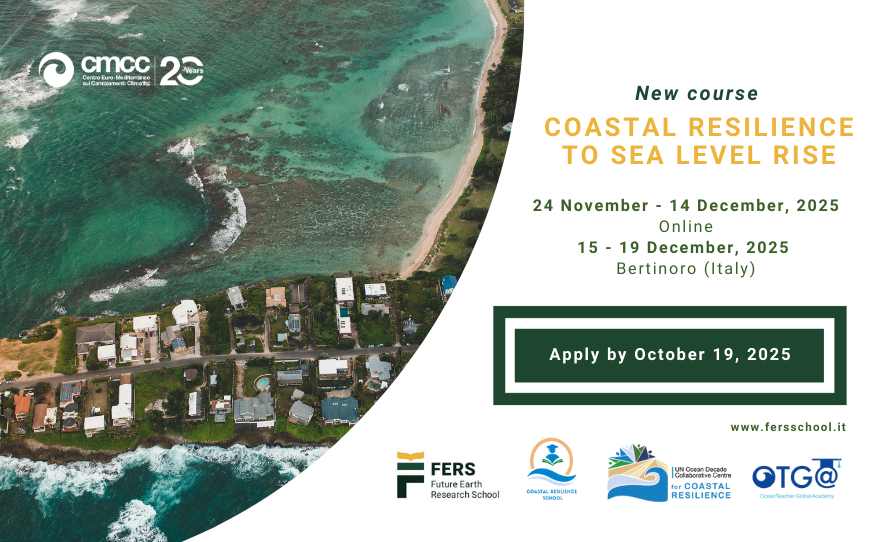
Coastal Resilience to Sea Level Rise
course summary
rise is one of the most pressing challenges facing coastal communities, ecosystems, and infrastructure around the world. Understanding the risks, causes, and impacts of rising sea levels and the consequences on coastal regions is pivotal to design effective adaptation strategies and policies to enhance climate resilience.
the driving physical processes—such as ocean thermal expansion, polar ice melt, glacial retreat, and atmospheric dynamics—as well as the human and ecological impacts – such as increased coastal flooding, saltwater intrusion, habitat loss, and displacement of communities.
tools like flood modelling and vulnerability mapping.
Understand of the physical processes driving SLR risks
Asses regional vulnerabilities and coastal risks
(provide EXAMPLES) for planning and decision-making
, industry and high level education institutions
COMPASS-Philippines2025
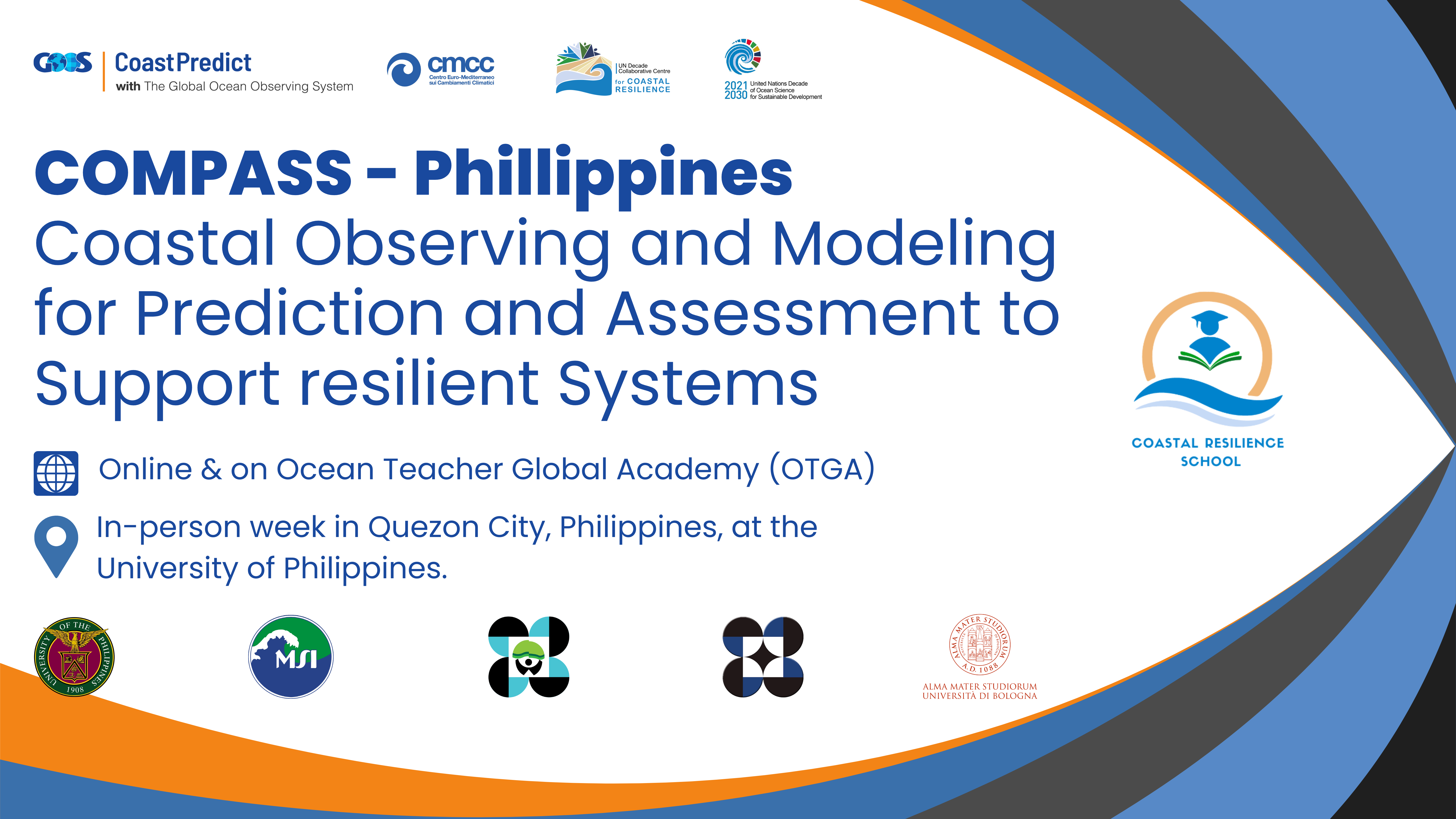
COMPASS Philippines - Coastal Observing and Modeling for Prediction and Assessment to Support resilient Systems
This training course is part of CoastPredict UN Ocean Decade GOOS Programme’s capacity-building efforts and is a collaboration with the SUSTAIN project (UN endorsed project affiliated to CoastPredict). The training focuses on advancing skills in coastal ocean, wave, and biogeochemical modeling, and introduces innovations in observation and remote sensing, to strengthen coastal resilience in the Philippines. The course is organized by CoastPredict in collaboration with the Decade Collaborative Centre for Coastal Resilience (DCC-CR) ‘Coastal Resilience School’ and CMCC Foundation - Euro-Mediterranean Center on Climate Change, Italy, with the support of OceanTeacher Global Academy (OTGA).
Details: https://oceanexpert.org/event/4643
Course objective
The course is designed to provide participants with a comprehensive understanding of numerical ocean modeling, machine learning techniques, and remote sensing applications to simulate and analyze the dynamic and biodiverse marine environments of the Philippines.
A key feature of the course is hands-on training using the SURF ocean modeling platform, enabling participants to simulate real-world scenarios through detailed tutorials and case studies centered on the Philippine coastal region. The program emphasizes integrating physical, biological, and chemical processes in marine systems to support the protection and sustainable management of natural resources. Through this initiative, the course aims to enhance capacity for implementing data-driven solutions and strategies for resilience that can serve as a replicable model for other regions facing similar challenges.
Venue
The course will be subdivided into two phases:
An online phase will take place through OTGA e-learning platform.
An in-person phase which will be held in Quezon City, Philippines, at the University of Philippines.
Learning outcomes
By the end of the course the participants should be able to:
- Understand the fundamentals of ocean circulation, wave dynamics, and biogeochemical modeling.
- Set up and execute downscaling experiments using the SURF platform.
- Apply advanced AI modeling techniques to predict and analyze coastal chlorophyll concentrations.
- Understand key concepts in satellite data processing and remote sensing for oceanographic monitoring
- Understand how decision-support systems can assist in marine hazard management, oil spill forecasting, and ship route optimization
- Gain practical knowledge of coastal observations and hands-on experience in implementing and operating low-cost sea-level monitoring systems.
Target audience
The course is targeted particularly towards mid-career scientists and professionals from environmental protection agencies, governmental officers and postgraduate students (with basic knowledge of oceanography and modeling).
Technological requirements/computer skills
- Python, Jupyter notebook
Course content and agenda
- Module 1 Lessons (online through BigBlueButton on OTGA platform)
24 Feb 2025: 8.00 CET / 15:00 GMT+8 (3 hours)
- Lesson 1: Overview of the Relocatable Ocean Modeling platform SURF
- Lesson 2: Overview of coastal wave modelling
- Lesson 3: Introduction to biogeochemical 1-D modelling
- Lesson 4: Introduction to Cineca’s cloud computing system
- Lesson 5: Practical application of SURF
- Assignment of exercises: Instructions and overview (for downscaling and wave modeling).
- Q&A Live session- 1 hour - 26 Feb 2025: 8.00 CET/15:00 GMT+8 - (BigBlueButton on OTGA platform)
3 March 2025 - 9:00 - 16:00 (GMT +8)
- Welcome and recap of preparatory sessions
- Regional physical oceanography
- Remote sensing applications in the Philippines
- Observation and modeling in the Philippines
- Applications of SURF ocean model in the Philippines
- Numerical modeling of marine ecosystems
4 March 2025 - 9:00 - 16:00 (GMT +8)
- Numerical ocean circulation, dynamical downscaling, and the NEMO model: Advanced techniques and applications
- Practical session 1: Review of exercises completed after online lectures, and case study simulations - instructions on what is needed at the end of week for evaluated presentations.
- Practical session 2: Downscaling experiment using the SURF platform
- Decision support system applications for Oil spills
- Ship voyage optimisation with VISIR-2
5 March 2025 - 9:00 - 16:30 (GMT +8)
- Practical session 3: Wave modelling
- Practical session 4: Biogeochemical models - 1D
- Machine-learning model for chlorophyll
- Practical session 5: Machine learning model implementation
6 March 2025 - 9:00 - 16:00 (GMT +8)
- Coastal observations and citizen science
- Practical Session 6: Finalizing the case study simulation
- Presentation preparations
7 March 2025 - 9:00 - 12:30 (GMT +8)
- Final Presentations and Applications
- Group Presentations
- Discussion and Q&A
- Closing Remarks and Certificates
8 March 2025 - 9:00 - 12:00 (GMT +8)
- Field Trip - installation of low-cost sea level sensors
Language of instruction: English
Course instructors
- Aiko Love B. del Rosario - Marine Science Institute - University of the Philippines
- Aletta T. Yñiguez - Marine Science Institute - University of the Philippines Diliman
- Cesar L. Villanoy - Marine Science Institute - University of the Philippines
- Federica Benassi - CMCC Foundation - Euro-Mediterranean Center on Climate Change, Italy
- Francesco Trotta - CMCC Foundation - Euro-Mediterranean Center on Climate Change, Italy
- Gianandrea Mannarini - CMCC Foundation - Euro-Mediterranean Center on Climate Change, Italy
- Igor Atake - CMCC Foundation - Euro-Mediterranean Center on Climate Change, Italy
- Laura T. David - Marine Science Institute - University of the Philippines
- Lorenzo Mentaschi - University of Bologna
- Luca Giunti - CMCC Foundation - Euro-Mediterranean Center on Climate Change, Italy
- Marco Zavatarelli - University of Bologna
- Samantha Siedlecki - Department of Marine Sciences - University of Connecticut
- Viviana Piermattei - CMCC Foundation - Euro-Mediterranean Center on Climate Change, Italy
Organizers
- Marine Science Institute, University of the Philippines Diliman (Philippines)
- CMCC Foundation - Euro-Mediterranean Center on Climate Change, Italy.
- CoastPredict
- University of Bologna
- Coastal Resilience School - DCC-CR - Decade Collaborative Centre for Coastal Resilience
- Department of Science and Technology Philippine Council for Agriculture, Aquatic and Natural Resources Research and Development DOST PCAARRD
Course Duration
The course has a total of approx 46.5 hours, according to the following structure:
- 24 Feb - 8:00 CET/15:00 Philippines time (GMT+8) - 3.5 hours (synchronous, online)
- 26 Feb - 8:00 CET/15:.00 Philippines time (GMT+8) 1 hour (synchronous, online)
- Assignments ~ 8 hours (asynchronous, online)
- 5 days (3-7 March)- 9:00-16:00 (GMT+8) ~ 6 hours /day ( ~ 30 hours) (synchronous, face-to-face)
Certificate
OTGA Certificate will be awarded to the participants upon successful completion of assignments online and delivery of a group presentation according to the course planning.
Notes
Application process
This course is by invitation only, with a limited number of seats (10-15) participants.
Selection criteria
UNESCO is committed to promoting equal access principles. Applications from minority or underrepresented groups are strongly encouraged.
A minimum of a Master's degree in relevant fields such as environmental science, marine science, meteorology, fisheries, coastal engineering, or urban planning, or with equivalent relevant experience, from the Philippines and surrounding regions.
Costs
Free of charge. There are no tuition fees.
The course is offered free of charge to the participants. The participants would have to cover their own costs of their travel and stay in Quezon city. Instructors are self-funded.
Contacts
For any questions, please contact OTGA Secretariat (ioc.training@unesco.org), always using the name of the course as e-mail subject.
Cancellation policy
In the event of cancellation of the course by the OTGA or its affiliates, we will provide notification of cancellation at least 7 days prior to the course date. In the event of cancellation by the attendee, we should receive notification of cancellation at least 7 days prior to the course date.
OBIS2026EN
Contributing and publishing datasets to OBIS (self-paced)
The Ocean Biodiversity Information System (OBIS) is the most comprehensive gateway to the world’s ocean biodiversity and biogeographic data and information. OBIS provides open access to this quality-controlled data that adhere to biodiversity standards (Darwin Core, EML). This course is a continuation of the Contributing and publishing datasets to OBIS (self-paced), which remained open only for staff and collaborators of OBIS Nodes (under invitation of OBIS Secretariat).
The aim of this course is to teach the step-by-step basics for how to format and publish datasets according to these standards to contribute to OBIS, and adopt best practices in the management of marine life data. This training course is self-guided and designed to teach learners how to structure datasets to contribute to OBIS. The course will guide users step-by-step through the OBIS data life cycle, including: identifying an appropriate data structure, applying Darwin Core Archive formatting, conducting quality control steps, publishing data, and accessing data from OBIS.
This course is an updated version - 2025/2026.
Participation in this course is restricted to staff and collaborators in OBIS Nodes, invited by OBIS Secretariat, open initially from 15 December 2025 to 15 December 2026.
https://oceanexpert.org/event/4930
Watch the video below for a brief overview and introduction by the course instructor, Elizabeth Lawrence.
Learning goals
- Describe the OBIS data life cycle
- Restructure a flat dataset into a Darwin Core-Archive format, following OBIS best practices
- Identify appropriate Biodiversity Information Standards (TDWG) vocabulary for your dataset
- Interpret and resolve quality control flags
- Publish data and metadata on an IPT
- Obtain OBIS data from the Mapper tool, R, API
Target audience
Participation in this course is restricted to staff and collaborators in OBIS Nodes, invited by OBIS Secretariat, open initially from 15 December 2025 to 15 December 2026.
Course content
The course is divided into the following Modules:
Module 1. Introduction to data publishing and Darwin Core
Module 2. Introduction to data formatting
Module 3. Formatting data tables
Module 4. DNA Derived Data
Module 5. Controlled Vocabulary
Module 6. Conducting Quality Control
Module 7. Publishing your Data
Module 8. Accessing Data from OBIS
These modules will cover:
- Darwin Core standards (Relational databases, Core and Extension tables)
- Formatting data to publish in OBIS (Creating Event, Occurrence, and ExtendedMeasurementOrFact tables; Mapping standardized vocabulary; Using World Register of Marine Species (WoRMS) Taxon Match tool; Understand how to compile genetic, acoustic, habitat, imaging, and/or tracking data for OBIS)
- Conducting quality control (Dealing with uncertain data fields e.g. temporal, spatial, taxonomic; Troubleshooting difficult data types or missing data)
- Publishing data (Filling metadata; Using, publishing, and updating datasets on IPT)
- Accessing and downloading data from OBIS (Full data exports, R, API; Using Mapper tool to subset data)
Duration
This is a 32-hour self-paced online course (asynchronously), open continuously from 15 December 2025 to 31 December 2026.
Lead Instructor
- Dr. Elizabeth Lawrence (OBIS training officer)
Other course contributors
- Carolina Peralta Brichtova
- Ruben Perez Perez
- Pieter Provoost
- Saara Suominen
- Leen Vandepitte
- Marcos Zárate
- Mr. Ward Appeltans (OBIS project manager)
Language
English
Learner assessment
This is a self-taught course that includes quizzes designed to help learners assess their own learning at regular intervals. In order to successfully complete the course and be awarded a Certificate at the end, the following is mandatory:
- complete all lessons in each Module of the course;
- complete all quizzes (80% minimum score);
- submit the assignments and receive a minimum grade of 80% or 'satisfactory' according to the exercise type.
Note: Filling in the course feedback survey is mandatory to obtain the course certificate, as well as a pre and post assessment.
Pre-requisites:
- be a staff or collaborator in an OBIS Node
- a working knowledge of English
- background knowledge in biological and marine sciences
- basic computer skills (either Windows or Mac systems)
- the ability to be self-directed in learning new technology skills (e.g. following a step-by-step tutorial, online video help, or access to support to learn necessary skills)
Technology requirements
To complete this course, participants should have access to:
- Latest version of either Chrome, Edge, Firefox, or Safari web browsers
- JavaScript and cookies enabled
- Broadband internet access (minimum bandwidth of 0.5 Mbps (Receive and Send)
- Speakers or headphones, Microphone
How to enrol
If you are a member of an OBIS node, please contact OBIS secretariat (helpdesk@obis.org) for instructions on how to enroll.
For any questions please contact the OTGA Secretariat (ioc.training@unesco.org) or the OBIS secretariat (helpdesk@obis.org) always using the name of the course as email subject.
UNESCO is committed to promote equal access principles. Participation from minority or underrepresented groups are strongly encouraged.
Costs
There are no tuition fees.
This training course has been developed with financial support from NORAD and LifeWatch ERIC.
Feedback survey
At the end of the course, you will be asked to fill out a feedback survey. This information will be used to improve future courses.
Cancellation policy:
In the event of cancellation of the course by the OTGA or its affiliates, we will provide notification of cancellation at least 7 days prior to the course date.
In the event of cancellation by the attendee, we should receive notification of cancellation at least 7 days prior to the course date.
Python2024-LAC
Data Analysis with Python Programming for Early Career Ocean Professionals (ECOPs)
Given the development of new tools in studying the ocean in more detail and on larger scales, early-career ocean professionals, students and other oceanographers need programming skills for effective data management and analysis. This course serves as an introduction to the Python programming language and software environment, enabling participants to process, analyze and visualize data more robustly. It is specially designed for early career ocean professionals who are beginners in Python programming, and who aim to explore different ocean datasets in their research. The training will utilize relevant oceanographic datasets, including physical, chemical and biological data, as well as fisheries datasets. This approach makes it easier to relate to, understand and apply concepts covered in the course.
Details: https://oceanexpert.org/event/4054

DCO-QA/QC
Data quality assurance (QA) and quality control (QC) in the Ocean Decade
Summary
Be able to describe QA and QC processes their ocean data have been through in metadata shared with global data ocean data systems
Understand issues in QC of ocean data from a range of thematic areas and be able to perform basic QC of these data
Actions
advised
Learning will be measured through short assessments and quizzes
Evaluation/Certificate:
Certificate will be issued, the criteria is to complete all lessons in each Module of the course and complete all quizzes (70% minimum score for each quiz)
Complete final course feedback survey
Technology requirements:
● Computer with Windows or Mac operating system
Pre-requisites: advisable: take the Ocean Data Management course (see www.oceanteacher.org) - available till 31st October 2025
Application process:
Please apply through this LINK. Apply before 15 September 2025 (23:59 CEST)
number of participants admitted: 40 people
costs: no cost
For any questions please contact the OTGA Secretariat (ioc.training@unesco.org) always using the name of the course as email subject.
There are no tuition fees.
UNESCO is committed to promote equal access principles. Applications from minority or underrepresented groups are strongly encouraged.
Feedback survey
At the end of the course, you will be asked to fill out a feedback survey. This information will be used to improve future courses.
FishMan_2022
Earth Observation data and techniques for fisheries management
Fishing vessel traffic data derived from Automatic Identification System (AIS) has become an essential component for building fisheries intelligence. Enforce and related fisheries management strategies rely on such information to curb illegal fishing, plan and implement policies for the sustainability of marine living resources.
Fisheries managers and enforcers require specialized skills to processes the large volume of positional, navigational and voyage related information embedded in AIS data. Open-source programming software such as Python has lots of third-party modules for building packages and functions. This makes Python an asset for the creation of customized data processing, analyses and visualization to support in making informed decisions in the management of natural resources.
This training course will provide participants an understanding of the movement of fishing vessels and skills in processing AIS data.
EOFish-2025
Earth Observation for Enhanced Fisheries Monitoring, Control, and Surveillance
: Data manipulation and analysis
- Overview of the Automatic Identification System (AIS)
- Key attributes of AIS data
- Importance of AIS data for monitoring, control, and surveillance
- Sources of AIS data and formats
- Reading AIS data files using Pandas
- Cleaning and preparing AIS data for analysis
- Handling missing or erroneous data in AIS datasets
- Visualising vessel tracks using Python libraries
- Calculating vessel speeds and identifying anomalies
- Detecting potential IUU fishing activities based on AIS patterns
- Integrating AIS data into fisheries management systems
- Case studies: Detecting transshipment using AIS data
Target audience and prerequisites
This course is designed for researchers, fisheries officers, students, and Early Career Ocean Professionals (ECOPs) actively engaged in fisheries management, maritime security, and coastal conservation in Africa.
Language: English
Instructors
Dr. Kwame Adu Agyekum (Department of Marine and Fisheries Sciences, University of Ghana)
Mr. Ignatius Kweku Williams (GMES and Africa project, University of Ghana)
Mr. Daniel Quarshie (GMES and Africa project, University of Ghana)
Course format and duration
This course will be held online and includes synchronous sessions, for which attendance is mandatory. These sessions are scheduled for: 9 – 13 July 2025 11:00 -13:00 UTC / GMT Daily.
The estimated duration of this course is 20 hours (10 hours of synchronous classes and 10 hours of asynchronous activities).
Organizers
RTC Ghana
MarCNoWA: GMES & Africa Project
IOCAFRICA - Intergovernmental Oceanographic Commission of UNESCO Sub-Commission for Africa and the Adjacent Island States
Learner assessment
Assignments (e.g, written and data exercises) and multiple-choice quizzes.
Certificate
OTGA Certificate will be awarded to the participants upon completion of assignments (pass mark: 70%) and 60% attendance at the synchronous sessions.
Technology requirements, computer skills, and pre-requisites
- Computer with Windows or Mac OS
- Latest version of either Chrome, Edge, Firefox or Safari web browsers
- JavaScript and cookies enabled
- Broadband internet access (minimum bandwidth of 0.5 Mbps (Receive and Send)
- Speakers or headphones, and microphone
You should be proficient in the following:
- basic computer skills
- finding resources through search engines
- the ability to be self-directed in learning new technology skills (e.g. following a step-by-step tutorial, online video help, or access to support to learn necessary skills).
Application and selection of participants.
A limited number of seats (approximately 25) are available. Please fill out the online application form available in this LINK:
The applications start on 10 June 2025. The deadline to submit the application is 25 June 2025 (23:59 CET: Central European Time).
Participants will be selected based on the fit to the target audience, motivation statement, and professional background/qualification.
Costs: This is an online course with no tuition fees.
Contacts
For any questions, please contact OTGA Secretariat (ioc.training@unesco.org) or the course coordinator Ignatius Kweku Williams (kwilliams@ugedugh.onmicrosoft.com) always using the name of the course as e-mail subject.
Feedback survey
At the end of the course, you will be asked to fill out a feedback survey. This information will be used to improve future courses.
Cancellation policy
In the event of cancellation of the course by the OTGA or its affiliates, we will provide notification of cancellation at least 7 days prior to the course date. In the event of cancellation by the attendee, we should receive notification of cancellation at least 7 days prior to the course date.
eDNA_Africa_2025
Environmental DNA (eDNA) Training for Africa and the Adjacent Island States
Environmental DNA (eDNA) sampling and analysis have become an increasingly popular tool for studying biodiversity and monitoring ecosystems. It provides a relatively easy, non-invasive method to scan environments; estimate number of species, assess biodiversity, and monitor changes in a community without having to collect organism samples. Additionally, eDNA has the potential to inform on the movements and habitat associations of endangered/rare species, migratory species, water quality, detecting and tracking invasive species, harmful algal blooms, pathogens, and parasites. eDNA uses traces of genetic materials that organisms leave behind in water, soil, or air. Regardless of its wide application, knowledge of this technique is still underused in several parts of the world, such as in Africa. Marine ecosystems of Africa and the adjacent island states are teeming with biodiversity, including 439 key marine biodiversity areas. These ecosystems are facing significant threats from climate change, overexploitation, invasive species, urbanization, and other factors, as such, impact on biodiversity. Therefore, there is an urgent need to accelerate the understanding of African biodiversity patterns and monitor ecosystems more efficiently. Implementing eDNA techniques in biodiversity assessment in African countries is a promising opportunity to maximize the conservation and management of marine life.
In this context, this blended training aims to provide participants with a comprehensive theoretical understanding of environmental DNA (eDNA) and its applications in environmental sciences. It will cover all relevant aspects from eDNA sampling, laboratory and bioinformatic analysis, data analysis of results and possible application. The participants will learn about the origins of eDNA, how it enters the environment, and its significance in measuring biodiversity. The training will give an overview of eDNA, including its definition and different ecosystems where it can be studied with a specific focus on marine ecosystems.
Venue
University of Ghana
General Learning Goals
By the end of the course, the participants are expected to have:
- Increased understanding of the eDNA technology and its practical application.
- Enhanced skills in the collection and preservation of eDNA samples.
- Practical knowledge and skills in the extraction of eDNA samples.
- Insights on the analysis of eDNA data, and use of bioinformatics tools.
- Knowledge of utilization of eDNA technique in assessing marine biodiversity and monitoring ecosystems.
This course includes an online preparation component where participants will learn how to:
- Explain what eDNA is, its sources, and its ecological significance.
- Describe workflows for eDNA sampling, preservation, laboratory analysis, and bioinformatics.
- Identify key challenges, limitations, and good practices in eDNA studies.
- Understand quality control (QC), data stewardship, and ethical considerations in eDNA research.
- Recognise how eDNA data can inform policy, conservation, and ecosystem monitoring in Africa’s marine environments.
Target audience
The training is focused on ocean practitioners from West and North African countries, including Early Ocean Career Professionals (ECOPs) and mid-career ocean scientists interested in and needing to use eDNA in their scientific or technical work.
Pre-requisites
Participants must:
-
Have prior knowledge of marine biodiversity sampling and monitoring.
-
Bring their laptop.
-
A working knowledge of English.
-
Applicants must be from West or North Africa.
Course content
Module 1: Foundations of Environmental DNA (eDNA) Science
Module 2: eDNA-Omics and Their Applications
Module 3: eDNA Workflows and Practical Considerations
Module 4: eDNA Bioinformatics Analysis
Module 5: Data Interpretation, Bias, and Policy Relevance
All these theoretical modules will be complemented by targeted hands-on activities for 1 week, face-to-face training in Ghana.
Language of instruction: English
Course Duration, Synchronous Sessions, and Format
The course will take place face-to-face between 3 to 7 November, 2025, with a duration of approximately 40 hours.
The course has an online learning component to be completed before the onsite classes of approximately 12h.
Participants will be required to:
- Complete online self-paced learning activities before the onsite classes.
- Familiarize themselves with the documentation and methods shared by the group previously.
Instructors
Organizers
Application process and selection criteria
OTGA online application form. Before starting the online application process, applicants must: (a) create a profile in OceanExpert (www.oceanexpert.org); (b) prepare a Curriculum Vitae; and (c) prepare a motivational statement highlighting the relevance of this course for the candidate's career (maximum 300 words).
A limited number of seats are available (20 seats). Please complete the online application form available on this LINK [https://otga.wufoo.com/forms/m164fy0026gyzv/]. The applications start on 5 August 2025. The deadline to submit the application is Sunday 24 August 2025.
UNESCO is committed to promoting equal access principles. Applications from minority or underrepresented groups are strongly encouraged.
Assessment & Certificate
Participants will be required to complete a preparation phase online before the course, attend all sessions of the face-to-face training in Ghana, and successfully complete the course activities and assessments. A certificate of completion will be issued for those who complete these requisites.
Contacts
- Course Coordinators: Ibukun Adewumi i.adewumi@unesco.org; Edwin Mwashinga e.mwashinga@unesco.org;
- RTC Ghana Coordinator: Benjamin Botwe
- OTGA Secretariat: ioc.training@unesco.org
Costs
Free of charge. There are no tuition fees.
For the selected participants, course organizers will cover the costs of travel, accommodation, local transport, and food. Eligibility for support requires meeting the pre-requisites and target audience.
The instructors will give the course voluntarily.
Cancellation policy
In the event of cancellation of the course by the OTGA or its affiliates, we will provide notification of cancellation at least 7 days prior to the course date. In the event of cancellation by the attendee, we should receive notification of cancellation at least 7 days prior to the course date.
MDExc-2025EN
From Observation to Action: Empowering communities towards excellence in marine data
This course aims to equip ocean data leaders in regions across the globe with the knowledge and tools to grow their own communities of practice, thereby developing professional expertise and data literacy for ocean data producers, curators, and users as identified in the Ocean Decade’s Data Strategy Implementation Plan.
General learning outcomes
Upon successful completion of this training, participants will be able to:
- Support community buy-in and develop learning opportunities to train others within their own countries and regions about ocean data
- Seed and lead their own local or regional ocean data Communities of Practice
- Play leading roles in the Decade Coordination Office for Ocean Data Sharing’s global Community of Practice
- Lead cross-border cooperation on specific data sharing topics of interest
Course content & planning
Four modules of three topics delivered on-online with targeted, in-person follow-up.
Each topic will consist of:
- One one-hour lecture - pre-recorded to allow learners to watch at their own pace
- Follow-up discussion time - online, in groups
- Activities to re-inforce the learning
Module 1 (November 2025)
1.1 Setting the scene: Why ocean data management, incentives to sharing data, and the global ocean data landscape
-
- Aim: To provide an introduction and overview to the course; to describe some of the impacts, benefits and motivations in sharing well-managed ocean data; to give an overview of the global and regional ocean data sharing networks and initiatives.
- Outcome: Learners will be able to explain to others why it is important to manage and share ocean data and what options are available to make this happen at a global scale
1.2 Understanding roles: The IODE Quality Framework, Steps, Roles of Individuals
-
- Aim: To give an introduction to the Quality Framework that IODE uses to manage and share ocean data across its network; to outline the various roles that exist within the framework and how these relate to an ocean data community of practice
- Outcome: Learners will be able to describe the key roles that are needed in an ocean data community of practice and the quality framework that activity sits within
1.3 Identifying your ocean data community: Who will you engage with, support, and train?
-
- Aim: To help learners consider who their ocean data community is and what the focus of learning/training needs in that community is
- Outcome: Learners will be able to identify the purpose of their community of practice, and to identify and invite potential members
Module 2 (December 2025)
2.1 Planning: making your marine projects and programmes “data first”
-
- Aim: To explain to learners the Data Management Planning process and how it helps in making a project or programme “data first’
- Outcome: Learners will be able to lead in Data Management Planning in their organisation or community of practice
2.2 Quality data matters
-
- Aim: To introduce learners to a range of thematic data quality issues, which may be beyond their normal area of expertise and to the impacts of data quality on the re-use of data in a range of ocean applications
- Outcome: Learners will have an overview of the importance of ocean data quality which they can bring to their communities of practice and be informed of key resources which they can point their communities of practice
2.3 Building your ocean data community:
-
- Aim: To equip learners with skills in building a community of practice in ocean data management and sharing
- Outcome: Learners will be confident in their ability to grow a community of practice from the potential members identified in Block 1.
Module 3 (January 2025)
3.1 Putting data to work - sharing ocean data to enable insight and action
-
- Aim: To enable communities of practice to understand how to prepare data for sharing, where to share and some tools that can be used to share data which can then be used in creating insights
- Outcome: Learners will be able to encourage data sharing in their communities of practice, and advise on best practices, technology choices, etc
3.2 How do I get credit for sharing my data? Moving from data sharing to data publication
-
- Aim: To help learners to understand the difference between sharing data and formal data publication, the benefits of data publication, how to get started, and how to use digital object identifiers for datasets
- Outcome: Learners will be able to describe data publication to their communities of practice and be aware of options to allow for formal citation of datasets created by their communities of practice
3.3 Creating learning spaces in your ocean data community
-
- Aim: A key activity of communities of practice is sharing knowledge and helping members to learn from each other. This session will focus on the key aspects of a healthy peer-based learning environment, and will be followed in block 4 by a session on designing effective learning sessions
- Outcome: Learners will be able to foster healthy environments in their communities of practice to allow the growth and development of members
Module 4 (February 2026)
4.1 What is the IODE network and who is involved
-
- Aim: The IODE network is the key ocean data sharing network globally and consists of a number of components. This session will introduce learners to the makeup of IODE’s network and its scope of work
- Outcome: Learners will be able to introduce the IODE network to their communities of practice and to align activities of the community to IODE activity, including working alongside National Oceanographic Data Centres and Associated Data Units
4.2 Getting organisational support and buy-in
-
- Aim: As data communities of practice are often engaged in organisational change, getting buy-in or support for their activities is key. This session will equip learners with tools to help with raising the profile of and engagement with their communities of practice leading to greater impact.
- Outcome: Learners will be equipped with skills and knowledge to effectively communicate the work of their communities of practice to a range of stakeholders and to get buy-in from decision makers
4.3 Designing learning
-
- Aim: Communities of Practice support their members by giving them focussed learning opportunities. This session will introduce the concepts in designing effective learning opportunities
- Outcomes: Learners will be able to plan effective and targeted training sessions to develop skills within their communities of practice
In-person Follow-up (2026)
- Aims: To provide in-person spaces to follow-up on the train-the-trainer course content and to develop individual roadmaps to action, implementation of which will be followed up online
- Outcomes: Learners will have developed personal action plans to put into practice the skills they have acquired throughout the course and have organised the first follow-up session with the course leaders
Information about these sessions will be updated [HERE] once confirmed.
Target audience & pre-requisites
This course was prepared for ocean practitioners and institutions interested in becoming focal points to collaborate with the Decade Coordination Office for Ocean Data Sharing in building a network of recommended practices around good data management and sharing.
Participation will require:
- Good working knowledge of English (*the course will be delivered in multiple languages, but external resources may be in English)
- Basic computer skills
- Knowledge of ocean data management is advised (completed the OTGA course)
- Knowledge of ocean data
Language of instruction
English and Spanish
Instructors and Organizers
Content for this course was provided by:
- Adam Leadbetter
- Rob Thomas
- Jan-Bart Calewaert
- Ana Carolina Mazzuco
- Taco de Bruin
- Peter Burger
- Margarita López-Velosa
- Other instructors from each region (to be confirmed)
This training is organized by the Decade Coordination Office for Ocean Data Sharing in collaboration with the the Ocean Decade Coordination Unit and the UNESCO IOC OceanTeacher Global Academy (Programme Component of IODE).
Assessments and Certificate
This course contain a set of online multiple-question automated assessments to evaluate your learning, and a final action plan to be developed and implemented individually. Participants will be required to complete a pre and post self-assessment related to the course content, and be requested to fill out a feedback survey at the end of the course to reflect on your learning experience and identify areas for improvement. This will also provide valuable feedback for course teachers and organisers to enhance future training sessions.
To receive a Certificate of Completion, learners must:
- Achieve a minimum score of 80% on all quizzes;
- Complete every lesson, activity, and assessment;
- Complete the mandatory pre-test and post-test;
- Develop and implement an action plan;
- Participate in online live sessions (75% attendance);
- Submit the required feedback form, which is mandatory for all OTGA courses.
After completion of the course, participants will be invited to join follow ups and monthly meetings with the DCO for Ocean Data Sharing to continue the network building and future training of other participants.
Technology requirements
To complete this course, participants should have access to:
- Computer with a modern operating system (Windows, macOS, or Linux)
- Latest version of either Chrome, Edge, Firefox or Safari web browsers
- JavaScript and cookies enabled
- Broadband internet access (minimum bandwidth of 0.5 Mbps (Receive and Send)
- Speakers or headphones, Microphone
Course duration and format
This course will be conducted in a blended format, through a combination of online self-paced activities, instructor led sessions and assessments, and hands-on work. The duration of the course (Blocks 1, 2, 3, and 4 and related activities) is a total of 25 hours.
Live sessions schedule:
18 November 2025
16 December 2025
5 February 2026
5 March 2026
Note that the training course may be complemented by face-to-face in-person follow-up module - to be scheduled in 2026 - dates and venue to be confirmed by region.
Cost: This course has no tuition fees.
How to participate
Participation in this training is invitation only, coordinated in collaboration with the National Committees, Coordination Offices and Centres of the Ocean Decade.
Contacts
- DCO Ocean Data Sharing: oceandatasharing@unesco.org
- OTGA Secretariat: ioc.training@unesco.org
For any questions please contact the OTGA Secretariat always using the name of the course as the email subject.
Cancellation policy
In the event of cancellation of the course by the OTGA or its affiliates, we will provide notification of cancellation at least 7 days prior to the course date. In the event of cancellation by the attendee, we should receive notification of cancellation at least 7 days prior to the course date.
OceanExpert announcement: https://oceanexpert.org/event/4867
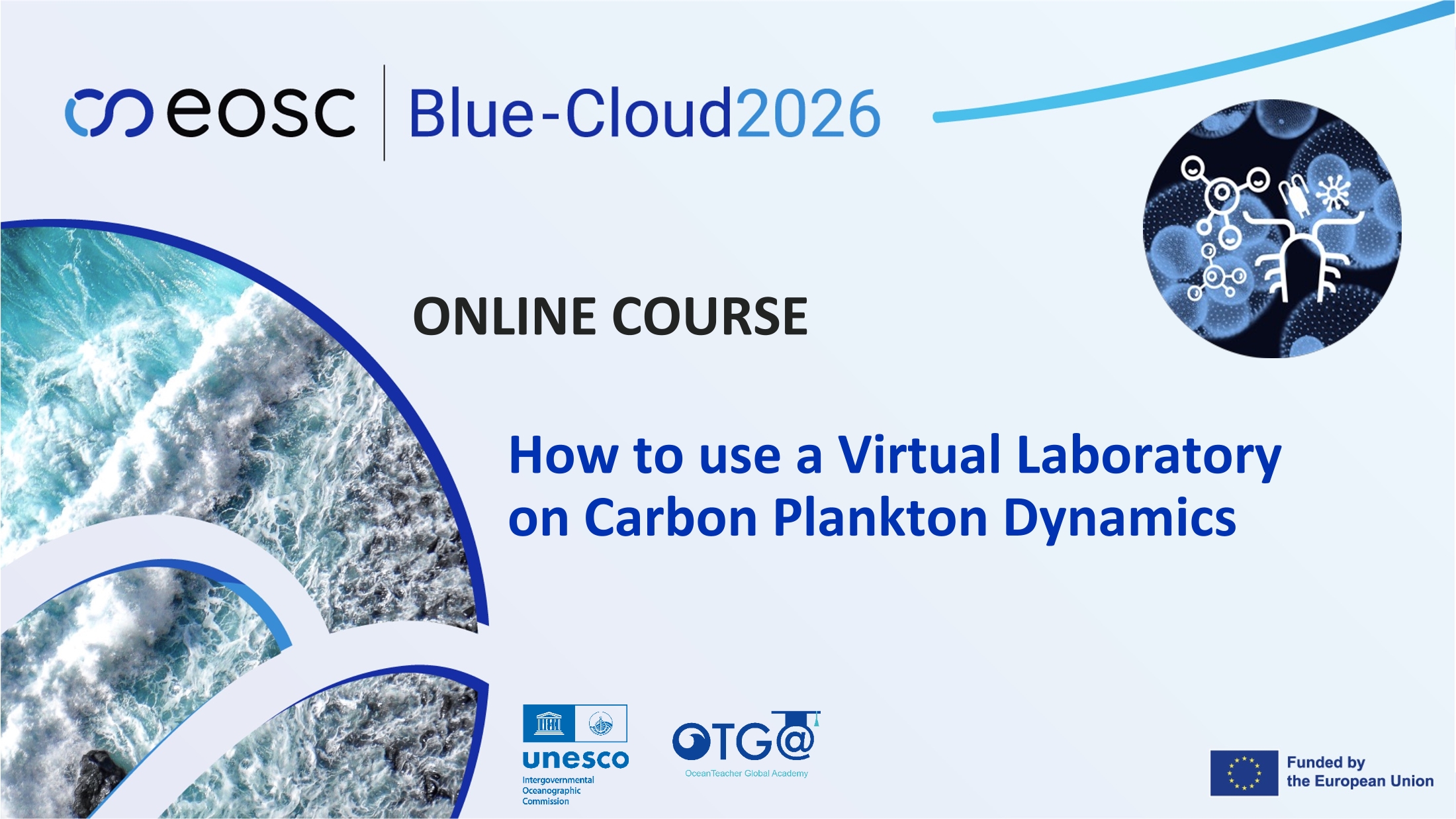
BC-VLab3*2025
How to use a Virtual Laboratory on Carbon Plankton Dynamics
This 4-hour course is designed to empower ocean scientists by providing a comprehensive understanding and practical skills in using a Carbon Plankton Dynamics Virtual Laboratory (VLab), running in Blue-Cloud Virtual Research Environment (VRE). Participants will learn how to explore carbon plankton data, patterns, and processes relevant to marine ecology using a virtual environment. Knowing that the carbon pump in marine ecosystems operates as a key mechanism for carbon dynamics, learning how to use a virtual carbon plankton model can provide support to enhance knowledge in marine life dynamics, as well as perform science-based decision-making. This course uses datasets and scenarios of the Belgian Part of the North Sea and the Gulf of Trieste to demonstrate the capabilities of the models, which can be applied and adapted for other regions and conditions.
The course aims to empower ocean scientists with a comprehensive understanding and practical skills in using a Virtual Laboratory (Vlab) on Carbon Plankton Dynamics within the Blue-Cloud VRE. By accessing various digital tools, you will be able to utilize models to study carbon plankton and apply them to make decisions related to the carbon pump mechanism based on data products and modelling outputs.
Learning outcomes
Upon successful completion of this training, participants will be able to:
- Identify key data collection processes and partners involved in research within the Belgian Part of the North Sea and the Gulf of Trieste and the development of the Carbon Plankton Dynamics Virtual Laboratory.
- Explain the importance of carbon plankton dynamics for scientific research, modeling, and oceanography.
- Define the purpose and functionalities, and the services provided by the Virtual Laboratory.
- Identify and utilize near-real-time data within the Virtual Laboratory for use in Nutrient–Phytoplankton–Zooplankton–Detritus (NPZD)-type models.
- Access relevant data from Blue-Cloud Data Discovery and Access service (DD&AS)
- Format data files for use in the Virtual Laboratory
- Operate the Virtual Laboratory (VLab) on Carbon Plankton Dynamics to simulate and analyze phytoplankton dynamics in the specified regions.
- Analyze model results related to the contributions of bottom-up and top-down drivers by the RShiny App within the Virtual Laboratory.
- Quantify the relative contributions of bottom-up and top-down drivers in phytoplankton dynamics using the NPZD-type model within the Virtual Laboratory.
- Interpret marine ecosystem management decisions based on model outputs from the Virtual Laboratory (VLab).
Course content
-
Module 1: Introduction to the Virtual Laboratory - This module introduces the Virtual Laboratory on Carbon Plankton Dynamics, its services, the relevance of carbon plankton dynamics, and key partners, focusing on their roles in data collection and modeling within the Belgian Part of the North Sea and Gulf of Trieste as a use case.
-
Module 2: Data Collection - This module guides on the types of data needed for the Virtual Laboratory on Carbon Plankton Dynamics, methods to access data (DD&AS), and the process of building and formatting data files, focusing on data from the Belgian Part of the North Sea and Gulf of Trieste.
-
Module 3: Discovering the Model - This module provides hands-on experience in operating the Virtual Laboratory on Carbon Plankton Dynamics using the handbook, focusing on how to use near-real-time data to run an NPZD-type model.
-
Module 4: RShiny App - This module teaches participants how to use the RShiny App in the Virtual Laboratory on Carbon Plankton Dynamics, focusing on visualizing and interpreting data related to phytoplankton dynamics in the Belgian Part of the North Sea and Gulf of Trieste.
Target audience
- Graduate students and postdoctoral researchers in marine and environmental sciences;
- IT professionals supporting research activities in scientific institutions; and
- Project managers and coordinators involved in research projects that utilise Virtual Research Environments (VREs).
Proficient in the following is required:
- The ability to be self-directed in learning new technology skills (e.g. following a step-by-step tutorial, online video help, or access to support to learn necessary skills)
- Basic computer skills
- Finding resources through search engines
Language of instruction
English
Instructors and Organizers
Content for this course was provided by:
This training is organized by the EU BlueCloud2026 project in collaboration with the UNESCO IOC OceanTeacher Global Academy, RTC Belgium, and contributions from project partners' experts (Flanders Marine Institute VLIZ, National Institute of Oceanography and Applied Geophysics (OGS) of Italy).
Blue-Cloud 2026 aims at a further evolution of this pilot ecosystem into a Federated European Ecosystem to deliver FAIR & Open data and analytical services, instrumental for deepening research of oceans, EU seas, coastal & inland waters. It develops a thematic marine extension to EOSC for open web-based science, serving the needs of the EU Blue Economy, Marine Environment and Marine Knowledge agendas.
Assessments and Certificate
This course contain a set of multiple-question automated assessments to evaluate your learning. Participants will be required to complete a pre and post self-assessment related to the course content, and be requested to fill out a feedback survey at the end of the course to reflect on your learning experience and identify areas for improvement. This will also provide valuable feedback for course teachers and organisers to enhance future training sessions.
To receive a Certificate of Completion, learners must:
- Achieve a minimum score of 70% on all quizzes.
- Complete every lesson, activity, and assessment.
- Complete the mandatory pre-test and post-test.
- Submit the required feedback form, which is mandatory for all OTGA courses.
Technology requirements
To complete this course, participants should have access to:
- Computer with a modern operating system (Windows, macOS, or Linux)
- Latest version of either Chrome, Edge, Firefox or Safari web browsers
- JavaScript and cookies enabled
- Broadband internet access (minimum bandwidth of 0.5 Mbps (Receive and Send)
- Speakers or headphones, Microphone
Course duration and format
For this first round, the course will be available online between 17 September 2025 and 31 July 2026. The estimated time to complete the self-paced course is approximately 4 hours.
Cost: This course has no tuition fees.
The training course is Funded by the European Union, with additional support from UNESCO IOC.
How to enrol
Please register on the OceanExpert website (www.oceanexpert.org). Once your OceanExpert account is approved (this is not done immediately), you can self-enrol in the course. If you already have an OceanExpert account, you can self-enrol in the course using your OceanExpert username and password.
First log-in OceanTeacher, then access the course page and click on self-enrolment. The enrolment key for all courses is VLab3*2025EN1
Contacts
- OTGA Secretariat: ioc.training@unesco.org
For any questions please contact the OTGA Secretariat always using the name of the course as the email subject.
Cancellation policy
In the event of cancellation of the course by the OTGA or its affiliates, we will provide notification of cancellation at least 7 days prior to the course date. In the event of cancellation by the attendee, we should receive notification of cancellation at least 7 days prior to the course date.
OceanExpert announcement: https://oceanexpert.org/event/4858

ECOPOceanTech-2024
Introduction to Oceanographic Survey Techniques and Data Management
Summary
Global change requires studying the ocean in more detail and at longer and larger scales. Capacity development and training on standard survey techniques and the use of simple sensors has been identified as a tool to enhance ocean observation. This course serves as an introduction to oceanographic survey techniques and data processing. It is designed for Early Career Ocean Professionals (ECOPs), students, and other oceanographers who intend to pursue oceanography and marine sciences. Relevant oceanographic (physical, chemical, and biological) datasets will collected and used during the training, making it easy to relate, understand, and apply the course concept.
Venue: AquaBioTech Group, Mosta, Malta
Learning outcomes
By the end of the course, the learners are expected to:
- Be familiar with oceanographic survey techniques.
- Understand how to use simple data collection tools and sensors.
- Be familiar with measurement of temperature, salinity, turbidity, depth oxygen and chlorophyll.
- Produce meaningful descriptive statistics and informative graphs from raw data.
- Results interpretation and discussion for scientific communication and writing.
Course contents
The course will be divided into 4 modules:
Module 1: Field sampling techniques for basic coastal oceanographic parameters
- Introduction to oceanographic parameters temperature, salinity, turbidity, depth oxygen and chlorophyll.
- Preparing a field work checklist,
- Safety measures during field work
- Calibration, and deploying of sensors and equipment
- Field surveys
Module 2: Data visualization and management
- Data retrieval
- Data entry
- Data visualization in R software using ggplot package
- Simple analysis using R
- Data management: storage, sharing and repository
Module 3: Basics of scientific writing
- Language and structure
- Graphics and visuals
- Citation and referencing
- Plagiarism
Module 4: Basics of science communication and outreach
- Language and sentence structure in science communication
- PowerPoint Presentation
- Visuals for infographics
- Policy briefs
Target audience
ECOPs who are enrolled in a Bachelor’s or Master’s degree, or have completed their Masters Degree and intend to use this knowledge in their academic or research related work. No prior R knowledge will be required, but knowledge on basics of oceanography is desired. The current course is specifically targeting ECOPs from and/or based in the Mediterranean region (from Southern Europe, Northern Africa and Western Middle East).
Language of instruction: English
Moderators and Instructors
Ines Boujmil – Aqua Biotech Group
Dr. Anabel von Jackwoski - Stockholm University
Mr. Gabriel Akoko Juma – Alfred Wegener Institute, Germany
Organizers
This course is being organized with the support of the Early Career Ocean Professionals Programme, Alfred Wegener Institute, Helmholtz Centre for Polar and Marine Research, Stockholm University, Aqua Biotech Group, International Ocean Institute, Jean Monnet Centre of Excellence on Sustainable Blue Economy and UNESCO-IOC Ocean Teacher Global Academy.
Details: https://oceanexpert.org/event/4367

MEDIN_APR2021
Marine Data Management, Governance and the MEDIN toolset (Apr 2021)
NOTE: The first edition of the course (19-23 April 2021) is full.
MEDIN_Aug2022
Marine Data Management, Governance and the MEDIN toolset (Aug 2022)
This free training course is suitable for anyone responsible for collecting or managing marine environmental data in the public sector, industry or for education or research. Familiarity with different marine data types, and how data is acquired and used, would be helpful but not essential. Prior knowledge or practical experience of data management is not required. The course can be taken as a whole, or attendees can select modules according to two streams: Governance; Practical MEDIN.

MEDIN_Feb2022