
IPI2019
IPI2019
MSR2019BE
Conduct of Marine Scientific Research (MSR) under the United Nations Convention on the Law of the Sea (UNCLOS)
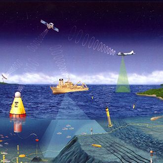
Marine scientific research (MSR) plays a critical role in sustainable development as consistently recognized by the UN General Assembly in its annual resolutions on oceans and the law of the sea. Research, and the tools required to conduct it, are essential for the sustainable development of the oceans and the seas and their resources, including by supporting informed decisions on the conservation and sustainable use of the marine environment and its resources, and by helping to understand, predict and respond to natural disasters and climate change. Increased MSR through capacity--development strengthening the capacity of States, in particular Small Island Developing States (SIDS), to implement the relevant MSR provisions of the United Nations Convention on the Law of the Sea (UNCLOS) as well as similar provisions in other instruments, is essential for increasing the MSR being conducted in the world’s oceans. This course will provide an overview of the legal, technical and scientific aspects of the MSR regime, particularly with respect to consent procedures, so as to reinforce the participants’ knowledge of the rights and obligations of coastal and researching States. It will also touch upon matters relating to the development and transfer of marine technology under the United Nations Convention on the Law of the Sea.

RSCR2019IR