
OceanConnectXL
OceanConnectXL - Alumni event
For 40 years, the master’s programmes in marine and freshwater sciences in Flanders have been building a strong, international community of scientists and professionals. On 16 November 2026, the OceanConnectXL Alumni Event will bring this community back together at VUB aan Zee in Ostend. Alumni from different generations will meet for a day of inspiration, exchange, and networking focused on ocean (and freshwater) research and management.
The event is primarily aimed at alumni of marine and freshwater master’s programmes in Flanders (Oceans & Lakes, IMBRSea, TROPIMUNDO and earlier programmes). Alumni from other master’s programmes with a strong link to marine or freshwater science (such as MSc Biology or Human Ecology) are also welcome.
OT2026
UNESCO IOC Ocean Traineeship 2026
The UNESCO-IOC Ocean Traineeship aims to provide opportunities for hands-on learning and upskilling through a temporary assignment at host institutions with expertise in subject areas relevant to the IOC mandate.
TP2026 Indonesia
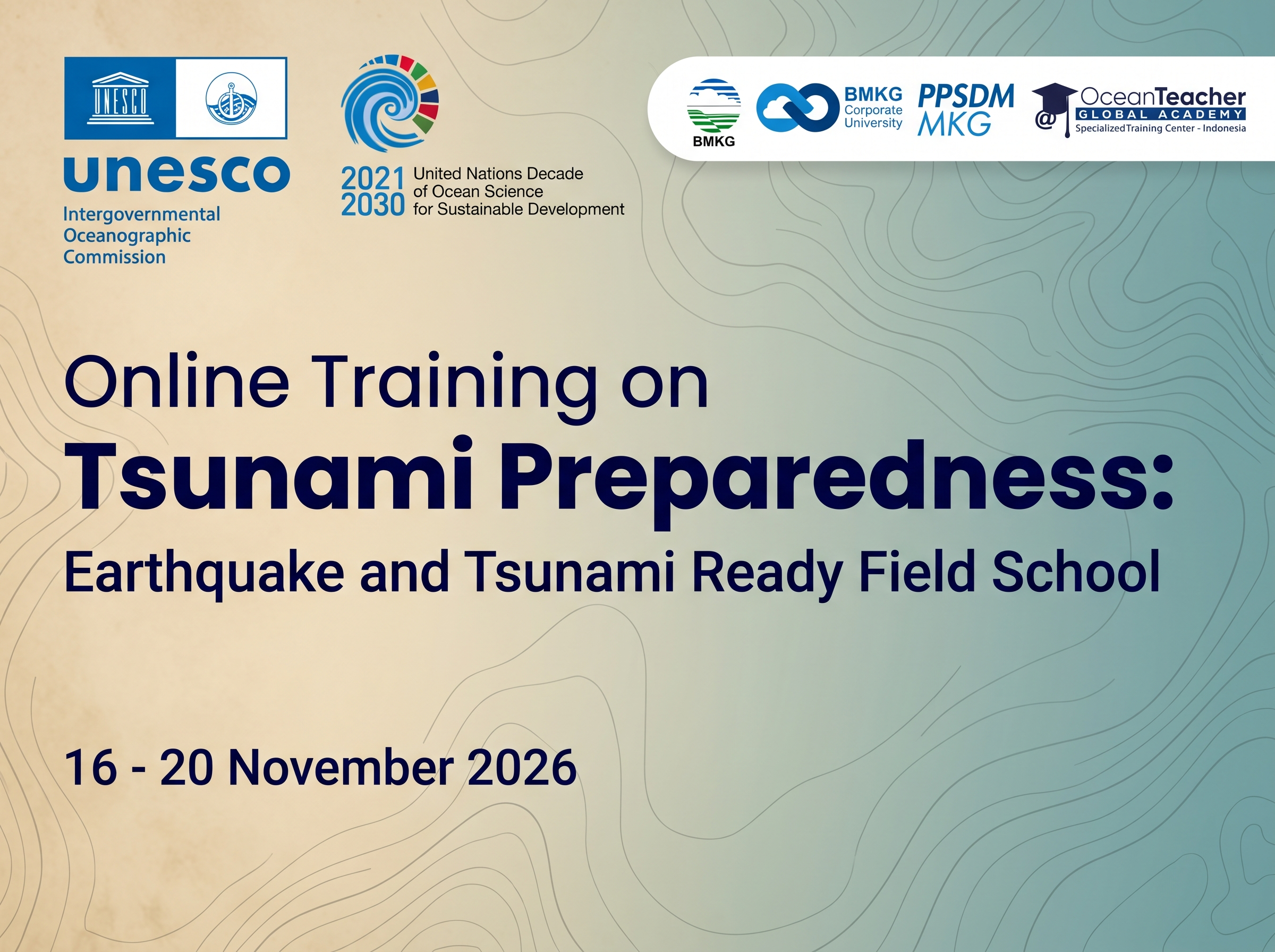
Online Training on Tsunami Preparedness: Earthquake and Tsunami Ready Field School
This five-day training course, Earthquake and Tsunami Ready Field School, equips participants with the knowledge and practical skills needed to strengthen community-level tsunami preparedness in line with the UNESCO-IOC Tsunami Ready Recognition Programme (TRRP). The course builds on and complements Indonesia's national Sekolah Lapang Gempa (SLG)/Earthquake Field School initiative developed by the Indonesia Agency for Meteorology, Climatology, and Geophysics (BMKG), which trains communities to understand earthquake hazards and strengthen local seismic risk literacy. By extending the field-school approach from earthquake awareness into full tsunami readiness, this course bridges BMKG's national capacity-building efforts with the international Tsunami Ready framework, reinforcing a coherent hazard-to-response chain from earthquake detection to community tsunami action. The training is structured around the 12 Tsunami Ready Indicators, which together define the requirements a community must fulfill to achieve Tsunami Ready recognition. This course is delivered by BMKG in its capacity as an IOC Ocean Teacher Global Academy (OTGA) Specialised Training Centre (STC), as part of BMKG's broader role within the Intergovernmental Coordination Group for the Indian Ocean Tsunami Warning and Mitigation System (ICG/IOTWMS) for tsunami warning provision and mitigation and as host of the Indian Ocean Tsunami Information Center (IOTIC) as well as the ASEAN Earthquake Information Centre (AEIC), reflecting its position at the intersection of national, regional, and international earthquake and tsunami risk reduction efforts.
The course combines conceptual grounding with applied, scenario-based learning. Participants begin with a baseline knowledge assessment and an introduction to tsunami hazard potential and basic preparedness measures, before progressing through the three core categories of the Tsunami Ready framework using information products, case studies, and group exercises to build familiarity with what each category requires in practice. The training culminates in a Table-Top Exercise (TTX) simulating a real earthquake-tsunami event, giving participants the opportunity to apply their learning in a coordinated, time-pressured scenario, followed by a post-test and closing session to consolidate key takeaways. The course is intended to build a working understanding of the Tsunami Ready indicators and process, so that participants are better equipped to support, contribute to, and advocate for their communities' progress toward Tsunami Ready recognition.
Needs and priority
Coastal communities in tsunami-prone regions continue to face significant gaps between the existence of early warning systems and actual "last mile" readiness to receive, understand, and act on warnings. Closing this gap depends on having a well-trained cadre of government disaster management staff, technical facilitators, and researchers who can assess, guide, and support communities toward meeting recognized preparedness standards. This course builds that capacity by training government officials and researchers working on tsunami risk reduction to understand and apply the IOC-UNESCO Tsunami Ready Recognition Programme indicators, and is delivered by BMKG in its capacity as an Indian Ocean Tsunami Service Provider and active participant in regional and international earthquake-tsunami coordination mechanisms.
Links to IOC Programmes or Capacity Development Strategy:
- Supports the IOC Tsunami Programme, with BMKG contributing directly as a member of the ICG/IOTWMS, which promotes Tsunami Ready as the standard mechanism for community-level preparedness verification across the Indian Ocean basin.
- Reflects BMKG's operational role as a Tsunami Service Provider under IOC-UNESCO, responsible for issuing tsunami threat notifications to ICG/IOTWMS Member States
- Contributes to the goals of the UN Decade of Ocean Science for Sustainable Development (2021–2030), particularly the "Safe Ocean" outcome.
- Aligns with the Sendai Framework for Disaster Risk Reduction (2015–2030), Priority 4 (enhancing disaster preparedness for effective response).
- Addresses the Strategy's core pillars of institutional strengthening, human capacity building, and knowledge transfer by combining theoretical instruction with an applied, scenario-based Table-Top Exercise
Format and Duration
This is a instructor led ONLINE course, comprising various learning resources, activities and assessments, with a total of 36 hours estimated for completion.
There will be synchronous sessions every day. It will be from 02.00 - 06.45 UTC. The attendance is mandatory for participants.
32 Synchronous Learning Hours
4 Asynchronous Learning Hours
Language of instruction: English
Learning outcomes
After successfully completing this course, learners will:
- Explain the scientific basis of earthquake-generated tsunamis
- Describe the structure of the UNESCO-IOC Tsunami Ready Recognition Programme
- Apply Tsunami Ready Assessment and Preparedness indicators to interpret hazard information products and community-level materials
- Analyze institutional Response arrangements to identify gaps against Tsunami Ready requirements
- Evaluate the effectiveness of a simulated coordinated response during a Table-Top Exercise (TTX)
- Outline preliminary recommendations for a local government or community's next steps toward Tsunami Ready recognition
Course content
- Earthquake and Tsunami Science
- Regional and National Tsunami Risk Context
- UNESCO-IOC Tsunami Ready Recognition Programme
- 12 Tsunami Ready Indicators
- Assessment
- Preparedness
- Response
- Table-top Exercise (TTX)
Target audience
Target: National authorities involved in tsunami preparedness, such as National Meteorological and Geophysical Services, Local/Regional Disaster Management Officers, coastal city planners, port authorities, and emergency first responders.
Prerequisites: Professional involvement in disaster risk reduction or emergency management. Basic knowledge of geography is helpful.
Number of participants: max 40 participants.
Organizers
This course was developed by the Indonesia Specialized Training Center of Center for Human Resources Capacity Development of Meteorology, Climatology, and Geophysics of BMKG Indonesia in collaboration with the support of the Intergovernmental Oceanographic Commission of UNESCO (IOC) OceanTeacher Global Academy (OTGA).
Facilitators
This training was developed with the assistance of
- Dimas Salomo Januarianto Sianipar, Ph.D
- Dr. Pepen Supendi
- Indra Gunawan M.Phil
- Arif Nurokhim, S.SI, M.Si
- Dr. Januar Arifin
- Dr. Bayu Pranata
- Suci Dewi Anugerah, M.Si
- Kian Purna Sinki, S.ST., M.Sc.
- Muhammad Harvan, S.T.
Registration, costs, and technological requirements
This course is offered with no tuition fees.
UNESCO is committed to promoting equal access principles. Registration from minority or underrepresented groups is strongly encouraged.
Applications to this course are open from 19 to 31 October 2026 EXTENDED DEADLINE 08 November 2026 , through this form: https://otga.wufoo.com/forms/mizjdmo0pimwcv/
Selection criteria
- Currently employed as a National Meteorological and Geophysical Services, disaster management officer, coastal planner, or emergency first responder.
- Applicants must provide a Letter of Nomination from their institution.
- Priority will be given to applicants from Tsunami-prone Member States.
- Consideration will be made to ensure gender equity among selected participants.
- Sufficient command of English (written and spoken) to actively participate in classroom and technical discussions.
To follow this course, participants shall have the following technology/computer skills required:
- IT Skills: Basic computer literacy (MS Office, email, and web browsing). Familiarity with video conferencing tools (e.g., Zoom, MS Teams).
- Mapping Skills: Basic understanding of Google Earth or similar web-based mapping tools is highly recommended.
- Equipment: Participants must have access to a personal laptop with a working camera and microphone for the duration of the course (both online and onsite)
Assessment & Certificate
This course contains hands-on and self-paced automated online knowledge checks and assessments.
- Initial assessment will be done through the pre-test before the class starts.
- For formative evaluation, assignments and discussions will be used during synchronous sessions and/or a OTGA Learning Management System or other interactive learning tools.
- For the summative assessment, at the end of the course, participants will have a post-test and have to write an action plan on how they will implement the knowledge they gained during the training and a report following a timeline of the proposed action plan.
In order to successfully complete the course and be awarded a certificate, the following are mandatory:
-
100% attendance in all synchronous sessions
-
Complete all modules and lessons.
-
Complete all quizzes (70% pass mark, 3 attempts) and other assessments
-
Complete the pre and post-assessment questionaries.
-
Submit the feedback survey.
Contacts
For any questions, please contact OTGA Secretariat (ioc.training@unesco.org) always using the name of the course as e-mail subject.
Cancellation policy
In the event of cancellation of the course by the OTGA or its affiliates, we will provide notification of cancellation at least 7 days prior to the course date. In the event of cancellation by the attendee, we should receive notification of cancellation at least 7 days prior to the course date.
DCO-QA/QC 2026
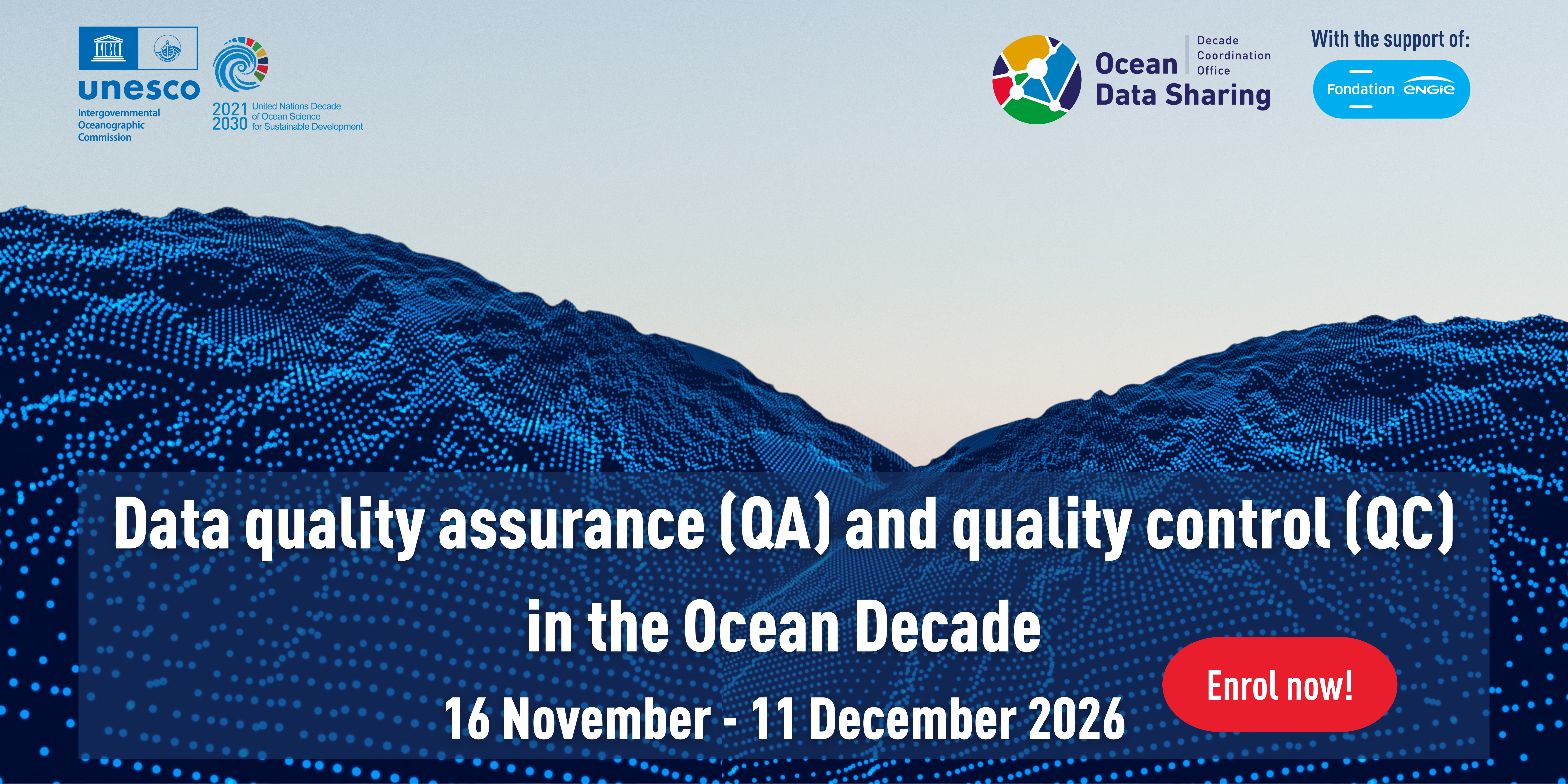
Data quality assurance (QA) and quality control (QC) in the Ocean Decade
This course will give an introductory view of data quality assurance and control (QA/QC), and focus on several quality control in a number of thematic areas relevant to the UN Ocean Decade.
Learning outcomes
Participants will:
- Understand the importance of QA/QC in ocean data.
- Describe QA and QC processes their ocean data have been through in metadata shared with global data ocean data systems.
- Understand issues in QC of ocean data from a range of thematic areas and be able to perform basic QC of these data
Course content
1.Introduction to data quality assurance and quality control (QA/QC)
- Why does QA/QC matter?
- Data lifecycle
- Issues/Challenges of poor QA/QC (examples)
- Recommended QA/QC standards
2. QA/QC process
- Metadata and data quality descriptions
- Rules
3. Data quality in different areas
- Biodiversity
- Forecasting
- Bathymetry
- Microplastics
- Metocean
- Marine megafauna
- Citizen science (biodiversity data)
- Citizen science (physical oceanography data)
Target audience and prerequisites
This course is open enrollments and no application/selection process included.
When enrolling, consider that the course was prepared for:
- Early career ocean professionals (ECOPs) that want to work or are working in data, data management or research
- Ocean Decade Actions
Pre-requisites:
-
Good working knowledge of English
-
Basic computer skills
-
Basic knowledge in data management is advised
-
Some knowledge of ocean data is required
-
Complete the pre- and post-assessment
Language of instruction: English
Instructors
Adam Leadbetter, DCO Ocean Data Sharing
Margarita López, DCO Ocean Data Sharing
Contributors:
- Ocean Biodiversity and Information System
- Enrique Álvarez (DCC Ocean Prediction)
- Vicki Ferrini (Seabed 2030)
- Steve Hall (Seabed 2030)
- Parsa Kian (Kyusyu University)
- Samantha Blakeman (British Oceanographic Data Centre)
- Kamila Walicka (British Oceanographic Data Centre)
- Antonio Novellino (EMODnet physics)
- Jaume Piera
- Stephanie Barnicoat
Synchronous sessions
There will be 2 live sessions on 1 hour, at the beginning and during the course to solve any issues or questions participants might have and to build connections
Potential dates:
-
24 November
-
10 December
Participation in these sessions are not mandatory.
Estimated course duration: 20 hours
Organizers:
This course is organized by the Decade Coordination Office for Ocean Data Sharing with the support of the Intergovernmental Oceanographic Commission (IOC) of UNESCO through the OceanTeacher Global Academy, in collaboration with different experts.
Learner assessment: Learning will be measured through short automated assessments and quizzes.
Evaluation/Certificate:
Certificate will be issued, the criteria is to complete all lessons in each Module of the course and complete all quizzes (70% minimum score for each quiz)
Complete final course feedback survey
Complete pre and post assessment
Technology requirements:
To follow this course, participants shall have:
-
Access to a computer or mobile device with Windows, Android, or Mac OS.
-
Latest version of either Chrome, Edge, Firefox or Safari web browsers, with JavaScript and cookies enabled
-
Broadband internet access (minimum bandwidth of 0.5 Mbps (Receive and Send)
-
Audio speakers or headphones
-
Basic computer skills, such as finding resources through search engines and the ability to be self-directed in learning new technology skills (e.g. following a step-by-step tutorial, online video help, or access to support to learn necessary skills)
Pre-requisites: advisable: take the Ocean Data Management course (see www.oceanteacher.org) - available till 31st December 2026.
Registration/Enrollment
Self-enrollment will be open from 1 November to 4 December 2026, up to 100 participants, until all places are reserved.
To access this course, you must register on the OceanExpert (www.oceanexpert.org) and have an individual account approved (this is not done immediately). Once your OceanExpert account is activated, you must:
- Log in OTGA e-Learning Platform, using your OceanExpert username and password;
- Access the COURSE PAGE; and
- Register with the enrolment key: Qa/Qc2026Decade
For any questions please contact the OTGA Secretariat (ioc.training@unesco.org) always using the name of the course as email subject.
Costs: There are no tuition fees.
UNESCO is committed to promote equal access principles. Applications from minority or underrepresented groups are strongly encouraged.
Feedback survey
At the end of the course, you will be asked to fill out a feedback survey. This information will be used to improve future courses.
BICS-MSP2026pt
Curso MSPglobal sobre Planeamento do Espaço Marinho/Marítimo (PEM) Inclusivo da Biodiversidade e Climaticamente Inteligente.
Descrição do curso
Em todo o mundo, espera-se cada vez mais que o PEM responda à perda de biodiversidade, às alterações climáticas, aos usos marítimos concorrentes e às expectativas de governança em constante evolução. Esta formação foi concebida para ajudar decisores políticos, planeadores, profissionais, investigadores e estudantes a compreender como o PEM pode integrar, de forma efetiva, a conservação da biodiversidade e a resiliência climática nos processos de planeamento.
O MSPglobal é uma iniciativa conjunta da Comissão Oceanográfica Intergovernamental (COI) da UNESCO e da Direção-Geral dos Assuntos Marítimos e das Pescas (DG MARE) da Comissão Europeia, com o objetivo de promover a implementação do PEM a nível global.
Resultados de aprendizagem
Após a conclusão bem-sucedida do curso, será capaz de:
- Explicar os fundamentos do PEM e da abordagem ecossistémica (EBA), e descrever como estes contribuem para a sustentabilidade, a conservação da biodiversidade e a resiliência climática.
- Explicar as interligações entre a biodiversidade marinha, os sistemas climáticos e o bem-estar humano, e identificar exemplos de soluções baseadas na natureza que contribuem para a adaptação e a mitigação.
- Reconhecer os principais marcos globais e regionais em matéria de biodiversidade e clima (tais como a CDB, o MGB, a CQNUAC e os ODS) e explicar como o PEM pode apoiar a implementação nacional destes compromissos globais.
- Relacionar recomendações inclusivas da biodiversidade e climaticamente inteligentes com as diferentes fases do processo de PEM e descrever abordagens práticas para a sua implementação, incluindo princípios de governança equitativa.
- Sintetizar as mensagens-chave sobre a integração de considerações relativas à biodiversidade e às alterações climáticas no PEM e explicar a sua relevância para uma governança inclusiva e o envolvimento das partes interessadas.
Público-alvo
Oferecido como um curso online autoinstrucional com inscrições abertas, este treinamento é voltado para profissionais que atuam na área oceânica, tais como: planejadores marinhos e marítimos, formuladores de políticas, autoridades governamentais, especialistas técnicos, profissionais envolvidos na governança dos oceanos, representantes da sociedade civil, cientistas e estudantes de pós-graduação.
Conteúdo do curso
O curso está organizado em 7 módulos:
- Módulo 1 — Fundamentos e necessidades em evolução do PEM
- Módulo 2 — Compreensão dos ecossistemas, das pressões climáticas e das soluções baseadas na natureza
- Módulo 3 — Marcos globais e regionais
- Módulo 4 — A abordagem ecossistémica como base comum
- Módulo 5 — Elementos-chave de um PEM inclusivo da biodiversidade e climaticamente inteligente
- Módulo 6 — Integração da biodiversidade e do clima no processo de PEM (ciclo de PEM)
- Módulo 7 — Governança inclusiva e comunicação
As atividades de aprendizagem incluem aulas curtas, materiais de leitura, vídeos, verificações de conhecimento interativas, perguntas baseadas em cenários e reflexões guiadas de autoavaliação.
Avaliações
O progresso do aluno é avaliado por meio de métodos de avaliação formativa, incluindo questionários de verificação de conhecimento com avaliação automática (para testar a compreensão de conceitos e conexões importantes), perguntas baseadas em cenários e atividades de reflexão de autoavaliação não avaliadas (tarefas de reflexão que convidam os alunos a relacionar o conteúdo do curso ao seu contexto de trabalho). As verificações de conhecimento no final do módulo combinam recordação factual e raciocínio aplicado e confirmam a prontidão para o progresso.
Um questionário final de revisão de conhecimento é usado para confirmar a conclusão do curso.
Certificado
Um certificado de conclusão será emitido aos alunos que atenderem aos critérios de conclusão do curso, em conformidade com os procedimentos de certificação da OTGA. Isso significa que os participantes precisam concluir todas as lições, atividades e avaliações, além de obter uma pontuação mínima de 70% no questionário final de revisão de conhecimentos.
O preenchimento da pesquisa de avaliação do curso é obrigatório para a obtenção do certificado.
Pré-requisitos
Não são exigidos pré-requisitos formais. O curso foi elaborado para participantes com diferentes níveis de conhecimento prévio, e os conceitos são apresentados de forma progressiva.
Idioma
Português
Tecnologia e requisitos
- Acesso a um computador, noções básicas de informática, conexão estável com a internet.
- Não é necessário nenhum software especializado.
- Computador com sistema operacional Windows ou Mac OS.
- Versão mais recente de um dos seguintes navegadores: Chrome, Edge, Firefox ou Safari.
- JavaScript e cookies habilitados.
- Acesso à internet banda larga (largura de banda mínima de 0,5 Mbps para download e upload).
- Alto-falantes ou fones de ouvido, microfone.
Instrutores
- Catarina Fonseca [OE profile] - Consultora do COI, Especialista em Conservação da MSPglobal & Climate Change
- Niccolò Bassan [OE profile] - Oficial Associado, MSPglobal - COI
Duração
20 horas
Como se inscrever: faça o seu cadastro no site OceanExpert (www.oceanexpert.org). Assim que sua conta no OceanExpert for aprovada (o que não ocorre de imediato), você poderá realizar sua inscrição no curso. Se você já possui uma conta no OceanExpert, pode se inscrever no curso utilizando seu nome de usuário e senha da plataforma. As inscrições permanecem abertas até as 23h59 (horário da Europa Central - CET) do dia 30 de dezembro de 2026.
Primeiro, faça login no OceanTeacher; em seguida, acesse a página do curso e clique na opção de auto-inscrição.
Link do curso: https://classroom.oceanteacher.org/course/view.php?id=1339
A chave de inscrição para o curso é: BiodiversityMSP_PT2026
Em caso de dúvidas, entre em contato com a Secretaria do OTGA (ioc.training@unesco.org), utilizando sempre o nome do curso como assunto do e-mail.
Não há taxas de inscrição.
Pesquisa de avaliação: Ao final do curso, solicitaremos que você preencha uma pesquisa de avaliação. Essas informações serão utilizadas para aprimorar cursos futuros.
Política de cancelamento:
Caso o curso seja cancelado pelo OTGA ou por suas entidades afiliadas, enviaremos um aviso de cancelamento com, pelo menos, 7 dias de antecedência da data do curso. Caso o participante deseje cancelar sua inscrição, deverá nos notificar com, pelo menos, 7 dias de antecedência da data do curso.
Co-Growth 2026 China
Ocean Governance & Sustainable Coastal Growth and Resilience Course (Co-Growth 2nd Edition)
This comprehensive course provides an in-depth exploration of coastal resilience concepts that are key in supporting sustainable business practices and protecting communities against natural hazards and climate change-related impacts. Through immersive and hands on onsite activities, participants will learn and implement the principles, technologies, and strategies needed to understand, assess, and bolster resilience within coastal regions, while emphasizing business responsibility and proactive risk management tailored to Asia-Pacific context.
Building on the success of previous editions, this two-week program will run from 5 to 18 September, with sessions held successively across three Chinese coastal cities: Sanya, Hangzhou and Qingdao. Jointly guided by the Ministry of Natural Resources (MNR) of China, the Intergovernmental Oceanographic Commission (IOC) of UNESCO and the International Ocean Institute (IOI), the training is co-organized by National Marine Data and Information Service (NMDIS), the Second Institute of Oceanography (SIO), MR and the Hainan Provincial Oceanic Administration. It serves as a key regional capacity-building activity targeting marine administrators and technical specialists from developing nations across the Western Pacific. The course is also supported by the Decade Collaborative Centre for Coastal Resilience and its Partner Alliance Network, with contributions to the in-person training from Hereon and the University of Bologna.
The baseline Co-Growth learning framework was conceptualized by the Decade Collaborative Centre for Coastal Resilience (DCC-CR), with the support of the IOC’s Decade Capacity Development Facility (CDF) and OceanTeacher Global Academy (OTGA).
Place and venue
-
Sanya: Yazhou Bay Science and Technology City Innovation Research Valley
-
Hangzhou: Second Institute of Oceanography
-
Qingdao: Ocean University of China (West Coast Campus), Wanda Vista Hotel Qingdao Oriental Movie Metropolis.
Needs and priority analysis
This training contributes to IOC action on enhancing the capacity of its Member States to access technology, physical infrastructure, data and information through promoting human resources development at individual and institutional levels (output 1 and 2 of IOC Capacity Development Strategy, 2023-2030); and to the UN Ocean Decade by addressing capacity development needs of partners involved in current and future Ocean Decade Actions.
It also contributes to the implementation of IOC Medium-term Strategy (2022-2029) and IOC WESTPAC Call to action SGOs Tokyo Statement, by facilitating initiatives to improve Resilience to climate change and contribution to its mitigation.
Learning outcomes
After completing this course, participants will be able to:
-
Explain the fundamentals and applications of blue carbon ecosystems, including basic and advanced theory, carbon sequestration mechanisms, and practical case studies drawn from Chinese coastal management experience.
-
Apply remote sensing and machine learning techniques to oceanographic problems, including coastal water monitoring, high-resolution 3D ocean field reconstruction, neural network fundamentals, and AI-driven analysis of extreme sea-level events.
-
Evaluate the impacts of climate change on coastal and marine systems, including sea level rise, statistical modelling of extreme events, storm surge dynamics, and associated adaptation strategies.
-
Assess frameworks for sustainable ocean governance and environmental protection, covering ocean economy and governance principles, management of areas beyond national jurisdiction, coral reef monitoring, and hands-on observation through field site visits and emerging sensor technologies.
Course content
See the final version of the programme HERE.
Target audience and prerequisites
This course is designed for early-career scientists and professionals as part of their professional development and continuing education. It is especially intended for early-career scientists, young professionals working in coastal consulting firms, coastal managers and operators, and staff from environmental protection and civil protection agencies. Priority will be given to researchers and technical staff (such as managers and operators) from national and international institutions involved in ocean science, marine services, and ocean management in the Asia-Pacific region.
Language of instruction: English
Instructors
Course Coordinators
Contributing to the lectures:
Peng Zhao
Ballin Cong
Marco Marani
Lingling Li
Junxiao Zhang
Yuan Bing
Weili Wang
Bing Yuan
Xianqiang He
Wei Chen
Other contributors:
Course format
This is a face-to-face training with live sessions will run daily from 9:00-17:00 approximately. The total course duration is approximately 112 hours.
Learner assessment
This course contains one final report as core assessment. Other non-graded assessments may be included in the hands-on activities.
Evaluation/Certificate
A certificate will be awarded to the participants upon successful completion of:
-
All sessions face-to-face;
-
Final report (passmark: 70%);
-
Completion of a pre and post-test; and
-
Completion of a feedback survey.
Technology requirements/computer skills
-
Basic computer skills and experience in working in a digital learning environment.
-
Notions on QGIS and Python programming (Jupyter notebooks environment).
Application process
Managed externally by the Ministry of Foreign Affairs of China.
Number of participants
Approximately 35.
Costs
This course is offered with no tuition fees.
Participants were granted support for lodging, transportation, and subsistence during the course from the organizers.
Contacts
For additional questions, please contact OTGA Secretariat (ioc.training@unesco.org) always using the name of the course as e-mail subject.
Cancellation policy
In the event of cancellation of the course by the OTGA or its affiliates, we will provide notification of cancellation at least 7 days prior to the course date. In the event of cancellation by the attendee, we should receive notification of cancellation at least 7 days prior to the course date.
Resiliência_2026-Mozambique
Resiliência costeira e segurança comunitária
Descrição do curso
Impacto das alterações climáticas nos sistemas costeiros; Avaliação dos riscos costeiros; Técnicas de monitorização; Adaptação costeira baseada nos ecossistemas; Resiliência da infraestrutura costeira; Planeamento e desenvolvimento das zonas urbano-costeiras; Resposta e preparação para catástrofes; Tendências emergentes na resiliência climática costeira.
No final deste curso, será capaz de:
- Avaliar os riscos de uma zona costeira em relação aos impactos climáticos;
- Desenvolver métodos para a monitorização dos processos costeiros;
- Criar e aplicar métodos para a conservação dos ecossistemas costeiros.
Conteúdo do curso:
Como é que um sistema responde à mudança
- Elementos resilientes
- Redução de riscos baseada na comunidade
- Medidas de redução de riscos
- Ciclo de gestão de catástrofes (resposta, recuperação e prevenção; enfrentamento de múltiplos riscos; relacionamento com múltiplos stakeholders; e integração das atividades de redução de riscos de catástrofes nos planos de desenvolvimento de um país)
Público-alvo:
- Estudantes de ciências do ambiente (Oceanografia, Física, Biologia, Geografia, Geologia);
- Profissionais da área ambiental em início de carreira;
- Gestores costeiros; Líderes comunitários;
pré-requisitos:
no
Língua de instrução: português
Instructores:
- António Hoguane- School of Coastal and Marine Sciences –Eduardo Mondlane University
- Noca Furaca - School of Coastal and Marine Sciences –Eduardo Mondlane University
- Nélio Sitoe - School of Coastal and Marine Sciences –Eduardo Mondlane University
- Clousa Maueua- ITRANSMAR
organizadores: CePTMAR
Datas do curso (online): 9 a 27 de novembro de 2026 (3 semanas)- 120 horas
Avaliação do aluno:
Este curso oferece tarefas que precisa de completar com uma nota mínima de 80% para obter o certificado. O questionário de avaliação do curso é também um requisito para a obtenção do certificado.
Critérios de seleção
- Ser estudante ou profissional na área da gestão costeira
- Ser estudante ou profissional em gestão de catástrofes
- Trabalhar com a gestão de ecossistemas
- Ser estudante de ciências ambientais
Processo de candidatura
O número de lugares disponíveis é limitado (30 vagas). As candidaturas terão início a partir de 28 de setembro de 2026 até 18 de outubro (23: 59 CEST)
Preencha o formulário de inscrição on-line disponível neste LINK.
inquérito de satisfação: Ao final do curso, você será solicitado a preencher uma pesquisa de feedback. Essas informações serão usadas para melhorar cursos futuros
Política de cancelamento: Em caso de cancelamento do curso por parte da OTGA ou das suas afiliadas, notificaremos o participante com pelo menos 7 dias de antecedência da data do curso. Em caso de cancelamento por parte do participante, a notificação deverá ser feita com uma antecedência mínima de 7 dias em relação à data do curso.
EOFish-2026
Earth Observation Techniques for Fisheries Management - 2nd Edition
Summary
GeoPandas and MovingPandas.
~5–8 hours — fully asynchronous.
Application and selection of participants:
A limited number of seats (approximately 30) are available. Please fill out the online application form available in this Link
Applications open 18 september 2026 . The deadline to submit the application is 27 September 2026 (23:59 CEST: Central European Summer Time). When selected you will be notified immediately to start the week after.
Participants will be selected based on the fit to the target audience, motivation statement, and professional background/qualification.
Costs: This is an online course with no tuition fees.
Contacts:
For any questions, please contact OTGA Secretariat (ioc.training@unesco.org) or the course coordinator Daniel Quarshie (danielquarshie02@gmail.com). always using the name of the course as e-mail subject.
Feedback survey:
At the end of the course, you will be asked to fill out a feedback survey. This information will be used to improve future courses.
In the event of cancellation of the course by the OTGA or its affiliates, we will provide notification of cancellation at least 7 days prior to the course date. In the event of cancellation by the attendee, we should receive notification of cancellation at least 7 days prior to the course date.
ROAEM2026-2
Recursos online para análise de ecossistemas marinhos 2026 (2º turma)
Neste curso online, os participantes aprenderão a aceder a dados oceanográficos in situ e remotos disponíveis gratuitamente online e a explorar software gratuitos para desenvolver dados e análises básicas de ecossistemas marinhos e costeiros de meso a larga escala. Trata-se de uma formação de nível introdutório, ideal para quem está dando os primeiros passos na utilização de dados oceanográficos.
Objetivos
Como resultado deste curso, os participantes irão adquirir conhecimentos básicos para apoiar uma análise inicial, de meso a grande escala, de ecossistemas marinhos e costeiros. Estes incluem:
- Obtenção de variáveis auxiliares (e.g., limites administrativos, batimetria) e oceanográficas (e.g., temperatura da superfície do mar, concentração de clorofila-a)
- Funções básicas em Sistemas de Informação Geográfica (SIG) em software geral (QGIS) e específicos à oceanografia (Ocean Data Viewer)
- Visualização e o desenvolvimento de produtos online e em ambiente SIG.
Resultados de aprendizagem
No final deste curso, os participantes deverão ser capazes de:
- Capacidade demonstrada de acessar, extrair e gerenciar conjuntos de dados oceanográficos de acesso livre, provenientes tanto de fontes in situ quanto remotas, aplicando-os no apoio à análise de ecossistemas marinhos e costeiros.
- Aplicou ferramentas de visualização e geoespaciais de código aberto, incluindo Ocean Data View (ODV) e QGIS, para processar, realizar o controle de qualidade e interpretar Variáveis Oceânicas Essenciais e outros conjuntos de dados ambientais relevantes.
- Desenvolveu e apresentou produtos de dados marinhos integrados para áreas de interesse definidas, demonstrando competência na organização de processos analíticos, na produção de mapas e figuras e na condução de avaliações preliminares de ecossistemas.
Conteúdo
Módulo 1: Introdução a Observação do Oceano
- Importância da oceanografia observacional e do Sistema Global de Observação do Oceano (GOOS)
- Plataformas de observação e amostragem
Módulo 2: Definição de Área de Interesse (AoI) e estrutura de pastas
- Seleção e delimitação da área de interesse.
- Organização da estrutura de pastas e nomes de arquivos
Módulo 3: Ocean Data View & World Ocean Data database
- World Ocean Database (WOD), selecionar e baixar dados WOD
- Ocean Data View (ODV), baixar e instalar ODV
- Criar coleção de dados no ODV
- Importar e analisar dados WOD no ODV
- Controle de qualidade no ODV
- Preparar e exportar produtos no ODV
Módulo 4: Introdução a Sistemas de Informação Geográfica (SIG) & QGIS
- Sistema de Informação Geográfica e formatos básicos de arquivos SIG
- QGIS, baixar e instalar, interface do usuário
Módulo 5: Criar um projeto SIG com dados auxiliares e dados marinhos simples
- Fontes de dados marinhos simples e auxiliares para SIG
- Importar dados de formato vetorial (shape) e matriz (raster) no SIG
- Recorte de camadas vetoriais (shape) e matriciais (raster)
- Preparar e exportar figura cartográfica
Módulo 6: Importar Variáveis Essenciais do Oceano (EOVs)
- Obter EOVs a partir de diversos portais
- Ferramentas de SIG tais como interpolação, recorte com máscaras, extração de isolinhas, cálculos, derivação de vetores de componentes escalares
Módulo 7: Visualização online de produtos oceanográficos
- Familiarização com portais de dados oceanográficos e suas ferramentas básicas para plotagem e consulta de variáveis de interesse
- Exportar produtos (figuras, plots, dados, arquivos de formato SIG)
Público-alvo
Alunos de graduação (bacharelado) e pós-graduação (mestrado e doutorado), e profissionais em início de carreira nas áreas de oceanografia, ciências do mar, biologia marinha e/ou afins.
Idioma: Português
Instrutores/Organizadores
1 Partnership for Observation of the Global Ocean (POGO)
2 Centre of Marine Sciences of the Algarve (CCMAR)
Duração e formato do curso:
O curso terá lugar on-line maioritariamente em modo assíncrono. O curso inclui cerca de 7 horas de trabalho individual assíncrono, por semana, num total de cerca de 30 horas de trabalho, a serem concluídos no período entre 16 de novembro a 16 de dezembro de 2026. Os módulos do curso devem ser concluídos sequencialmente.
Caso os organizadores considerem necessário, poderão organizar-se algumas sessões síncronas para discussão ou esclarecimento de dúvidas. Em todo o caso, haverá assistência assíncrona durante o curso.
Pré-requisitos tecnológicos:
- Computador com sistema operativo Windows
- Versão mais recente dos browsers Chrome (preferencial) e Firefox
- Direitos de administrador no computador/laptop a utilizar durante o curso
- Java Runtime Engine (Java 9 JRE) instalado ou 70 MB de espaço para o instalar
- Processador Intel® Core™ i3 ou similar/superior
- Espaço em disco de 3 GB ou mais
- 2 GB ou mais de RAM
- QGIS versão 3.40 ou a mais recente (estável) disponível no momento do curso
Nota: o curso destina-se a utilizadores de Windows
Avaliação / Certificado
Um certificado de participação será emitido se todos os segmentos dos módulos do curso forem concluídos e um mínimo de 70% for alcançado no total das avaliações (questões de múltiplas respostas, V/F, exercícios).
Processo de candidatura
O número de lugares disponíveis é limitado (Até 30 brasileiros e até 5 de outras nacionalidades de língua portuguesa). Preencha o formulário de inscrição on-line disponível em: https://otga.wufoo.com/forms/m1xrjsel070triv/
O prazo para submissão da candidatura é 10 de outubro, 2026 (23:59 CEST: Central European Time). Critérios de seleção:
- Alunos de graduação (bacharelado) e pós-graduação (mestrado e doutorado), e profissionais em início de carreira nas áreas de oceanografia, ciências do mar, biologia marinha e/ou afins.
- Fluência em Português e conhecimentos práticos de inglês
- Competências informáticas básicas
- Preferência a candidatos brasileiros que não tenham participado em formações anteriores semelhantes no âmbito do OTGA
Custos: Não se aplicam propinas ou taxas de inscrição.
A UNESCO está empenhada em promover os princípios de igualdade de acesso. As inscrições de grupos minoritários ou sub-representados são fortemente encorajadas.
Em caso de dúvidas entre em contato com a Secretaria da OTGA (ioc.training@unesco.org) usando sempre o nome do curso como assunto do e-mail.
Política de cancelamento
Em caso de cancelamento do curso pela OTGA ou afiliados, notificaremos o cancelamento pelo menos 7 dias antes da data do curso. Em caso de cancelamento pelo participante, deveremos receber notificação de cancelamento pelo menos 7 dias antes da data do curso.
IOC Training Course and Identification Qualification in Harmful Marine Microalgae 2026
Since 1993 the IOC has conducted training courses on harmful microalgae. The purpose has been to improve the taxonomic and identification skills of the participants for research purposes and for practical monitoring of harmful algal blooms.
From 2006 the IOC training in HAB identification has been offered within a new framework which gives accreditation. The present course includes now a practical exam at the end of the course with an IOC Certificate of Proficiency in Identification of Harmful Algae issued to participants who pass the exam. We know by experience that many of the more than 500 trainees we have had over the years have wished the courses to give accreditation, and in some countries, the IOC courses have become a reference for laboratories to be approved for carrying out regulatory monitoring for harmful microalgae.
The IOC Science and Communication Centre on Harmful Algae, University of Copenhagen, Denmark is organizing the course.
IOC Training Course and Identification Qualification in Harmful Marine Microalgae 2026
Course description: The course includes 100 hours of teaching and is divided into two parts. 1) The first part of the course is organised online using the elearning platform of IOC/IODE/OceanTeacher Global Academy, giving general introductions to the various groups of harmful algae; this part is mainly for self-study and estimated to 40 hours of reading. 2) The second part is a practical course in species identification (see tentative programme below). Part 2 includes 60 hours of teaching and a microscope will be available to each participant during the entire period, see also link below.
Participants: The course is aimed at participants who have some years of practical experience in identification of microalgae. The number of participants is limited to 16. If there are more applicants than available seats, priority will be given to applicants who have direct research or management responsibilities with regard to the occurrence of harmful algae.
Dates: Part 1 will be offred through the eLearning platform of OTGA’ from October onwards; part 2 takes place onsite from 12-24 October 2026.
Venue on site: IOC Science and Communication Centre on Harmful Algae, Department of Biology, University of Copenhagen, Denmark.
Language: English.
Course lecturers: Dr. Santiago Fraga, Dr. Jacob Larsen, Dr. Nina Lundholm, Professor Øjvind Moestrup.
Enquiries may be sent to Jacob Larsen, jacobl@bio.ku.dk
Costs: The course is organized on a cost-recovery basis. The price of the course is 4500 EUR and it is a package deal, which covers all expenses during the course period, see also link below; thus
- Accommodation, arriving to the course venue on 12 October, check-in from 16.00, and check-out on 24 October at 10.00
- All meals during the course, starting with an evening meal upon arrival on 12 Oct. and finishing with breakfast on 24 Oct.
- Access to the distant learning programme on Ocean Teacher which will be available two- months prior to the practical course
- Teaching material including hard copies or pdf-versions of the following books which will be distributed during the practical part of the course:
- Lassus, P., Chomérat, N., Hess, P. & Nézan, E. 2016. Toxic and Harmful Microalgae of the World Ocean. – Denmark. International Society for the Study of Harmful Algae / Intergovernmental Oceanographic Commission of Unesco. IOC Manuals and Guides 68, 523 pp. (pdf-version)
- Hoppenrath, M., Chomérat, N., Horiguchi, T., Murray, S.A. & Rhodes, L. 2023. Marine benthic dinoflagellates – their relevance for science and society (2nd, revised edition). - Senckenberg Gesellschaft für Naturforschung, Frankfurt am Main, Germany. Senckenberg Buch vol. 88, 376 pp.
- Karlson, B., Cusack, C. & Bresnan, E. (eds). 2010. Microscopic and molecular methods fro quantitative phytoplankton analysis. – IOC Manuals and Guides 55, Paris, Unesco, 110 pp. (pdf-version)
- Larsen, J. & Nguyen, N.L. (eds). 2004. Potentially toxic microalgae of Vietnamese waters. – Opera Bot. 140: 5-216 (pdf-version)
- Reguera, B., Alonso, R., Moreira, A., Méndez, S., Dechraoui-Bottein, M.-Y. (eds). 2016. Guide for designing and implementing a plan to monotor toxin-producing microalge. 2nd ed. – IOC Gudies and Manuals 59, Intergovernmental Oceanographic Commission (IOC) of Unesco and International Atomic Energy Agency (IAEA), Paris and Vienna, 66 pp. (pdf-version)
- Proceedings from various HAB conferences (pdf-versions)
- Copies of all lectures given during the course
- Use of facilities, microscopes, samples, and cultures
- Tuition during the practical part of the course
Species identification
This part of the course will focus on identification of harmful algal species by light microscopy, with particular reference to the ‘IOC Taxonomic Reference List on Toxic Plankton Algae’. The use of electron microscopy will be introduced, but practical exercises are not included. During the course, the following species will be demonstrated either as cultures (*subject to the availability of cultures) or as preserved material.
Haptophyceae*: Chrysochromulina spp. Prymnesium spp.
Raphidophyceae*: Chattonella antiqua, C. ovata, C. subsalsa, Fibrocapsa japonica, Heterosigma akashiwo, Olisthodiscus luteus (Olisthodiscophyceae).
Dictyochophyceae*: Pseudo-chattonella verruculosa
Dinophyceae: Prorocentrum concavum, P. cordatum, P. emarginatum, P. gracile, P. obtusidens, P. hoffmannianum, P. lima, P. micans, P. rhathymum, P. rostratum, P. scutellum, P. triestenum
Dinophysis acuta, D. acuminata, D. caudata, D. fortii, D. miles, Phalacroma mitra, D. norvegica, P. rotundatum, D. tripos
Alexandrium affine, A. minutum*, A. catenella, A. ostenfeldii, A. pacificum*, A. pseudogonyaulax, A. tamarense, A. taylorii
Pyrodinium bahamense, Lingulodinium polyedrum, Protoceratium reticulatum, Gonyaulax polygramma, G. spinifera, Vulcanodinium rugosum, Gambierdiscus spp, Coolia spp., Ostreopsis spp.
Akashiwo sanguinea*, Amphidinium carterae*, Margalefidinium polykrikoides*, Gymnodinium catenatum*, G. impudicum*, Karenia mikimotoi*, K. papilionaceae*, K. selliformis*, Karlodinium armiger*, K. micrum*, Noctiluca scintillans.
Bacillariophyceae: Pseudo-nitzschia australis, P. calliantha*, P. delicatissima, P. fraudulenta, P. multiseries, P. pungens*, P. seriata, Nitzschia navis-varingica.
Cyanobacteria: Anabaena spp, Anabaenopsis spp, Aphanizomenon spp., Cylindro-spermopsis spp., Microcystis spp, Nodularia spumigena, Trichodesmium sp.
Feedback survey
At the end of the course, you will be asked to fill out a feedback survey. This information will be used to improve future courses. Note: submitting the course feedback survey is mandatory to obtain the course certificate
Certificate: A certificate of completion will be awarded to all participants who attended all classes and activities and completed the final test onsite.
Cancellation policy:
In the event of cancellation of the course by the OTGA or its affiliates, we will provide notification of cancellation at least 7 days prior to the course date. In the event of cancellation by the attendee, we should receive notification of cancellation at least 7 days prior to the course date.
ERASMUSMARIS-26
Erasmus Maris 2026: Monitoring microplastic pollution in coastal waters: From sampling and analysis to data
Collaboration and teamwork are central, and the training concludes with a certificate ceremony recognizing participants' achievements.
Who is it for?
The course is designed for approximately 60 upper secondary students and 14 science teachers from participating European Schools. The teachers will follow the trainer pathway, enabling them to implement Erasmus Maris activities with their students after the course. Two facilitators from Wings of the Ocean will also follow the trainer pathway to support future implementation in France.
Venue
Microplastic sampling with a manta net.
This includes:
Approximately 20 hours of synchronous practical training distributed across 14–18 September 2026;
approximately 12 hours of online/asynchronous learning, including lessons and quizzes.
The practical training includes laboratory analysis, field sampling, introduction to the MARIS database, and supervised data-entry activities. The online component includes theoretical lessons and quizzes
Language of Instruction
Spanish.
The online lessons and quizzes are currently in English. If translation is completed before the course, the online materials may also be made available in Spanish.
Instructors
- Kamel Labibes: Chair- Ayam Sailing Europe,ASE)
- Carlos Sanz Lázaro: Professor, Department of Ecology, Faculty of Sciences, University of Alicante; Ramón Margalef Multidisciplinary Institute for Environmental Studies (IMEM), University of Alicante
Internal process. Each of the schools participating in the Erasmus Maris program, spread across EU different countries, have chosen six students to participate in the program. Applicants have expressed a genuine interest in environmental issues. presentation, and performance at school were also taken into account.
UNESCO is committed to promoting equal access principles. Applications from minority or underrepresented groups are strongly encouraged. For any questions please contact the OTGA Secretariat (ioc.training@unesco.org) always using the name of the course as the email subject.
Contacts
- Dr Kamel Labibes: coordination@ayamsailing.eu
- OTGA Secretariat: ioc.training@unesco.org
In case of need for further clarifications please use the contacts above, always using as email subject.
Feedback survey
At the end of the course, you will be asked to fill out a feedback survey. This information will be used to improve future courses.
Cancellation policy
In the event of cancellation of the course by the OTGA or its affiliates, we will provide notification of cancellation at least 7 days prior to the course date. In the event of cancellation by the attendee, we should receive notification of cancellation at least 7 days prior to the course date.
MHW Africa 2026
Regional Training Workshop on Monitoring and Forecasting Marine Heatwaves and Assessing their Impacts in the Mediterranean and Red Sea
All details: https://oceanexpert.org/event/5095
- Build understanding of marine heatwaves, including how they are defined and measured using internationally recognised methods, their physical drivers, and how they are projected to change under climate change.
- Build understanding of how Earth system models and AI methods are used to predict marine heatwaves, including their strengths and limitations.
- Strengthen understanding of how climate change, marine heatwaves and other environmental stressors affect marine and coastal ecosystems and the communities that depend on them, including through harmful algal blooms, and of the measures that protect seafood safety and public health.
- Build skills in accessing, processing and interpreting satellite and in situ ocean data for marine heatwave monitoring.
- Build understanding of how evidence and early warnings of marine heatwaves can inform fisheries and ecosystem management responses.
Venue
National Institute of Oceanography and Fisheries (NIOF), Alexandria, Egypt
Needs and priority
The regional training addresses the growing threat of marine heatwaves (MHWs) in the climate-sensitive Mediterranean and Red Sea basins. By combining satellite remote sensing, in situ observations and an introduction to Earth system modelling and AI-based prediction, it aims to support IOCAFRICA Member States in addressing specific technical capacity gaps. . Through six modules, participants will gain practical skills in satellite and in situ monitoring, including near-real-time detection, and learn how this evidence can inform the protection of fisheries, sensitive habitats and public health from extreme warming events.
This initiative directly supports the IOC Capacity Development Strategy (2023–2030) and the strategic priorities established during the IOCAFRICA-VIII session, which emphasize institutional strengthening and the development of a "critical mass" of trained specialists. The workshop serves as a catalyst for the regional “Science to Action” priority by initiating the information-gathering process needed to inform a collaborative roadmap for a Marine Heatwave Early Warning Mechanism (MHW-EWM).
By fostering partnerships between oceanographers and policymakers, the program aligns with the UN Ocean Decade’s goal of reversing knowledge asymmetries and enhancing climate resilience across African coastal and island states.
Learning outcomes
Upon completion of the workshop, learners will be able to:
- Apply internationally recognised definitions, baselines, thresholds and metrics to identify marine heatwave events and describe their intensity, duration and severity.
- Explain the main physical drivers of marine heatwaves, including atmospheric forcing, ocean processes and water column structure, and recognise how their influence differs across regions.
- Explain how coupled and regional Earth system models are used to predict marine heatwaves, and recognise the strengths and limitations of AI-based forecasting tools, including the checks needed before they are used in a new region.
- Explain how marine heatwaves and interacting stressors affect coral reefs, fish, fisheries, aquaculture and coastal livelihoods, drawing on regional cases such as the 2023 Red Sea events, and contribute to field assessments of coral bleaching and recovery.
- Identify how climate change, marine heatwaves and other drivers can favour harmful algal blooms, link the main algal toxins to their health risks, and contribute to monitoring, risk assessment and response plans that protect seafood safety and public health.
- Inspect satellite and in-situ data and metadata, generate and interpret SST anomaly and MHW products, apply matching quality-control flags, collocate Argo and gridded SST observations, and report results with appropriate limitations.
- Use evidence and early-warning signals of marine heatwaves to outline management responses for fisheries and sensitive habitats, such as temporary closures, reduced local pressures and restoration.
Course content
Module 1. Understanding Marine Heatwaves: Definitions, Metrics and Physical Drivers (Day 1)
- Definition, metrics and classification of marine heatwaves
- Regional drivers and physical processes
Module 2. Introduction to Earth System Modelling and AI-Based Prediction (Days 1 and 2)
- Introduction to coupled ocean and atmosphere models
- Approaches to high-resolution marine heatwave prediction
- Neural network architectures for forecasting, with a hands-on anomaly and event prediction exercise
Module 3. Ecological and Socioeconomic Impacts of Marine Heatwaves (Day 3)
- Field trip hosted by NIOF
- Ecological and socioeconomic impacts of recent environmental changes on marine and coastal ecosystems
- Harmful algal blooms and seafood safety
Module 4. Satellite Monitoring of Marine Heatwaves (Day 4)
- Accessing and processing satellite datasets
- Generating SST anomaly maps
- Near-real-time detection workflows
- Practical exercise
Module 5. In Situ Observations and Data Integration (Day 5)
- Overview of observation platforms
- Data quality control and calibration
- Data Integration and Validation
- Hands-on exercise and exchange
Module 6. From Science to Action: Management Responses and Way Forward (Day 6)
- Marine heatwaves and fisheries: impacts and management responses
- Early-warning responses for sensitive habitats
- Final exam
- Gaps and needs assessment and way forward
Target audience and prerequisites
Mid and top-career scientists from IOCAFRICA member states adjacent to the Mediterranean and Red Sea basins. Applications from other IOCAFRICA member states will be considered on a special basis, and subject to availability of slot.
Language of instruction: English
Instructors
Xiuwen Guo
Format & Duration
This course is face-to-face with synchrounous onsite continuous activities for 6 days, with a total of 36 hours.
Organizers
This course is organized by National Institute of Oceanography and Fisheries, the Intergovernmental Oceanographic Commission (IOC) of UNESCO through the IOC Sub Commission for Africa and the Adjacent Island States (IOCAFRICA) in collaboration with the Decade Capacity Development Facility and the OceanTeacher Global Academy.
Assessment & Certificate
This course has theoretical and practical tests.
To receive a Certificate of Completion, for each part of the training course, participants shall:
- Fully attend to the in-person sessions
- Engage and complete every proposed training activity
- Successfully complete the tests
- Complete the mandatory pre- and post-assessment.
- Submit the required feedback form is mandatory.
Technology requirements/computer skills and pre-requisites
To follow this course, participants shall have:
- Access to a notebook computer/laptop, and should bring it to the course;
- Latest version of either Chrome, Edge, Firefox or Safari web browsers, with JavaScript and cookies enabled;
- Broadband internet access (minimum bandwidth of 0.5 Mbps (Receive and Send)
- Audio speakers or headphones
- Basic computer skills, such as finding resources through search engines and the ability to be self-directed in learning new technology skills (e.g. following a step-by-step tutorial, online video help, or access to support to learn necessary skills)
- Good knowledge of computer use. The satellite and in situ exercises use NASA Panoply, which requires Java 11 or later, with Python notebooks provided as an alternative. Data manipulation using Python, R or MATLAB is desirable.
Application & Selection criteria
Application was managed by IOCAFRICA through their digital platforms, and was open from 19 May to 9 June 2026.
Participants were asked to submit a motivation letter, their resume and recommendation from their employer. This enabled us to assess the relevance and importance of the course to their routine work and institution / country. We also assessed the gender of the applicants, country they are domiciled in, and challenges they wish to address in the short and long term.
Approximately 26 seat were available for participation.
UNESCO is committed to promoting equal access principles. Registration from minority or underrepresented groups is strongly encouraged.
Costs
This course has no tuition fees.
Finantial support is available for the participants.
Contacts
For additional questions, please contact the course coordinators Prof. Suzan M. El-Gharabawy (suzymooo@yahoo.com) and John Ngatia (Jn.ndarathi@unesco.org ), or OTGA Secretariat (ioc.training@unesco.org) always using the name of the course as e-mail subject.
Cancellation policy
In the event of cancellation of the course by the OTGA or its affiliates, we will provide notification of cancellation at least 7 days prior to the course date. In the event of cancellation by the attendee, we should receive notification of cancellation at least 7 days prior to the course date.
Biomonitoring2026PT
Biomonitorização de substâncias e materiais perigosos em ecossistemas costeiros_2026
A monitorização da presença e dos efeitos de substâncias perigosas, e materiais como os microplásticos, é essencial para manter uma boa qualidade dos ecossistemas costeiros. As abordagens de monitorização adequadas necessitam de combinar um conjunto de avaliações químicas e biológicas. Este curso online foca-se em abordagens integradas químico-biológicos para a monitorização de substâncias perigosas, desde o planeamento até à recolha e análise de dados. Abrangerá períodos de aprendizagem assíncronos e síncronos, onde serão abordados conceitos teóricos e discutidos casos de estudo.
Resultados de aprendizagem
Após a conclusão bem-sucedida deste curso, os alunos serão capazes de:
-
Aumentar a compreensão dos princípios básicos subjacentes à biomonitorização
-
Aumentar as competências para planear e seleccionar locais de monitorização e bioindicadores adequados
-
Aumentar a compreensão das vantagens e desvantagens das diferentes medições químicas e biológicas
-
Avaliar os resultados e as desvantagens da abordagem adotada
-
Aumentar a capacidade de interpretar e selecionar boas práticas para a caracterização de base e acompanhamento dos ecossistemas costeiros
Conteúdo do curso
-
Princípios básicos de biomonitorização de substâncias perigosas
-
Planeamento e desenho experimental
-
Análise química e bioacumulação
-
Bioensaios e medições de biomarcadores
-
Avaliação da contaminação por microplásticos
-
Análise integrada de dados
Público alvo
Gestores ambientais que pretendam realizar a monitorização de rotina dos ecossistemas estuarinos e costeiros, investigadores marinhos, investigadores pós-doutoramento, estudantes de doutoramento, docentes de ensino básico e secundário, e outros profissionais interessados. Será dada prioridade a participantes originários de países de língua portuguesa. A UNESCO está empenhada em promover a igualdade de género. Por conseguinte, as candidaturas de mulheres são fortemente encorajadas.
Idioma do curso: Português
Pré-requisitos: Conhecimentos básicos de contaminação ambiental e toxicologia. Este curso terá um pré-teste para que você possa medir o progresso.
Instructores
Duração do curso e formato
O curso será ministrado online entre 12 de outobro e 16 de novembro de 2026.O curso tem carga horária total de 25 horas.
Aulas síncronas
- completar todas as lições de cada Módulo do curso
- completar todos os questionários (pontuação mínima de 50% para cada questionário)
- finalizar o trabalho final prático
- responder ao inquérito de satisfação
O curso será ainda certificado pelo Conselho Científico-Pedagógico de Formação Contínua (Ministério da Educação, Ciência e Inovação de Portugal).
Requisitos tecnológicos
Processo de candidatura
O número de lugares disponíveis é limitado (50 vagas). As candidaturas terão início a partir de 1 de setembro de 2026
Preencha o formulário de inscrição on-line disponível neste LINK . O prazo para submissão da candidatura é até 20 de setembro de 2026 (23:59 CEST: Central European Summer Time).
- Motivação: resumo até 200 palavras sobre a motivação para realizar o curso e como pretendem aplicar os conhecimentos adquiridos.
- País de origem (60% das vagas reservadas a participantes oriundos de países da CPLP).
- Equilíbrio de género dentre os candidatos.
inquérito de satisfação: Ao final do curso, você será solicitado a preencher uma pesquisa de feedback. Essas informações serão usadas para melhorar cursos futuros.
OLSSchool*Milazzo2026
Summer School on Ocean Literacy and Collaboration – Sustainable Blue Tourism in the Mediterranean and Black Seas
-
Gain familiarity with the objectives and activities of the EU4Ocean Coalition and the Youth4Ocean Forum and their contribution to the United Nations Decade of Ocean Science for Sustainable Development;
Explore how ocean literacy can inform tourism planning, destination management, education, and visitor engagement in Mediterranean and Black Sea coastal areas
Develop practical skills for transdisciplinary collaboration in the design and implementation of ocean-related projects;
Learn to integrate diverse knowledge systems, cultural contexts, and local perspectives when working towards a sustainable blue economy;
Strengthen science communication skills through storytelling, public engagement, and policy advocacy
- Francesca Santoro (UNESCO-IOC)
- Ottavia Carlon (UNESCO-IOC)
- Carmelo Isgrò (MuMa – Museo del Mare Milazzo)
- Carolyn Berger (MuMa – Museo del Mare Milazzo)
- Angelo Sciacca (Institute for Sustainable Development and International Relations – IDDRI)
- Ernesto Rollando (Freelance Consultant)
- Elissa Phillips (Incredible Oceans)
- Virginia Di Marco (Assicurazioni Generali)
- Natasa Vaidianu (Ovidius University of Constanța)
- Giovanni Mangano (Capo Milazzo Marine Protected Area)
- Teresa Romeo (Sicily Marine Centre – Stazione Zoologica Anton Dohrn)
- Claudio Berti (Stazione Zoologica Anton Dohrn)
- Gender balance
- Geographical representation
- Age range: up to 35 years old
- Background: all the sectors are encouraged to apply. We will pay attention to create an interdisciplinary group.
- Priority will be given to youth from the Mediterranean Sea and Black Sea, as well as members of the Y4O Forum and ECOPs
CWQAEM SIDS2026
International Training on Coastal Water Quality Assessment and Environmental Monitoring for Small Island Sustainability
This 5-day international ONSITE training equips early career ocean professionals with the practical knowledge and technical competencies required to assess coastal water quality and monitor environmental conditions in small island ecosystems. Building on the IOC-UNESCO frameworks for ocean observing and capacity development, the course bridges standardized coastal monitoring methodologies with field-based environmental assessment in the contrasting ecosystems of Tidung Besar and Tidung Kecil, exploring how integrated physical and chemical water quality observations, laboratory nutrient analysis, and ecosystem-based interpretation are applied using CTD multiparameter sensors, Niskin bottle sampling, UV-Vis spectrophotometry, and nutrient analyzer techniques to support evidence-based coastal management.
Place and venue
Indonesia, Jakarta; KIOTEC, Seribu Island (Tidung Besar and Tidung Kecil Island) and TWA Mangrove
Learning outcomes
Upon completion of this course, participants will be able to:
- Understand major sources of nutrient enrichment, land-based pollution, and anthropogenic activities influencing coastal water quality in small island environments, and explain their impacts on marine ecosystems.
- Design a coastal water quality monitoring plan for small islands, combining in-situ CTD profiling and nutrient analysis, following APHA analytical methods and The Ocean Best Practices System (OBPS)
- Conduct in-situ survey using CTD, Portable water sampler, and nutrient analyses using UV-Vis Spectrophotometry.
- Analyze and interpret coastal water quality data by integrating field observations and laboratory results using internationally recognized assessment approaches, including STORET, Water Quality Index (WQI), TRIX (Trophic Index), and indicators supporting SDG 14 monitoring.
- Visualize and integrate field and laboratory water quality data using QGIS.
- Evaluate the ecological status of small island coastal waters by linking water quality conditions with ecosystem health, anthropogenic pressures, and nutrient dynamics to identify potential environmental issues.
Course content
Day 1: Lecture Class and Collaborative Group Exercise on Small Island Water Quality Assessment (Introduction to Small Island Water Quality; co-Designing Water Quality Monitoring Programmes; Environmental Impact Assessment & ASEAN Coastal Challenges).
Topics Covered: Physical, chemical, and biological characteristics of small islands; land-based pollution sources and drivers of water quality degradation; monitoring program design (spatial/temporal sampling strategies, station selection, parameter selection); quality assurance/control (QA/QC); environmental impact assessment frameworks and international standards (APHA, OBPS).
Activities: Pre-test, Interactive lectures and discussions; group assignment and exercise, and briefing on field preparations
Day 2: Field Training on Coastal Water Quality Assessment (In-situ CTD profiling, seawater sampling using Niskin bottles, and observation of anthropogenic impacts at Tidung Besar & Tidung Kecil Islands).
Topics Covered: Oceanographic field survey protocols; in-situ CTD profiler operations; water sampling techniques; direct field observation of anthropogenic impacts in settlement vs. conservation zones.
Activities: Boat travel to field site by passenger boat; on-site activities using BADA 1 and BADA 2 (training boat) ; hands-on deployment and instrument calibration of CTD profilers; field seawater sampling using Niskin bottles and portable water samplers; field survey observing land-based pollution, tourism impacts, and aquaculture activities.
Day 3: Laboratory Analysis (Nutrient analysis for NO2, NO3, NH3, PO4 using UV-Vis Spectrophotometry) & Introduction to QGIS and Data
Visualization using Phyton.
Topics Covered: Standard analytical methods for nutrient analysis (nitrate, nitrite, ammonia, phosphate); calibration curve evaluation; introduction to geospatial data and coordinate systems.
Activities: Wet lab hands-on reagent and sample preparation; operating UV-Vis Spectrophotometry instruments for nutrient measurement; practical hands-on exercises in QGIS to import GPS coordinates and run spatial interpolation techniques to map ocean parameter distributions.
Day 4: Water Quality Index Calculation (self-learning
and presentation preparation)
Topics Covered: Environmental water quality
indexing (STORET, WQI, TRIX Trophic Index); Data integration (CTD + Spectrophotometry + QGIS spatial maps); evidence-based reporting; translating technical environmental data into actionable management recommendations for small island sustainability.
Activities: Calculating WQI, STORET, and TRIX indices from field/lab data; practical hands-on exercises in QGIS to import GPS coordinates and run spatial interpolation techniques to map ocean parameter distributions;
Day 5: Group Case Study Session (Scientific
interpretation, group presentation, post-test, and
certificate ceremony); Complementary Activity: Mangrove Conservation (Mangrove ecosystem education and hands-on mangrove planting at TWA Angke).
Topics Covered: Ecosystem-based management; nature-based solutions; ecological roles of mangroves as natural coastal buffers (sediment trapping, pollutant filtering, nutrient cycling, habitat provision).
Activities: Group-based project preparation; group scientific presentations to a jury panel followed by Q&A; post-test and participant satisfaction survey; jury deliberation, award ceremony; Field-based mangrove habitat observation; interactive discussions on ecosystem restoration; hands-on mangrove conservation, ; and tree planting (to be confirmed ) .
Target audience and prerequisites
This training is designed early career ocean professionals with up to five (5) years of professional experience who are engaged in or preparing for careers in coastal and marine environmental monitoring, water quality assessment, marine ecosystem management, and related fields. Typical participants include young professionals from government agencies, research and academic institutions, non-governmental organizations (NGOs), and other organizations involved in coastal and marine science and management. The course is particularly suited for professionals seeking to strengthen their practical competencies in standardized coastal water quality monitoring, field and laboratory techniques, and evidence-based environmental assessment for sustainable coastal and small island management.
Prerequisites:
• Basic understanding of coastal and marine ecosystems, environmental science, or water quality principles
Language of instruction
Invited experts from National Research and Innovation Agency (BRIN), IPB University, Jakarta Mangrove Nature Park (Angke Kapuk), Marine Aquaculture and Conservation Center in Tidung Island, Korea Institute of Ocean Science and Technology (KIOST), IOC, and BlueArc Global.
*Note that names and profiles will be available shortly
Format & Duration
This is an onsite face-to-face training from 2 to 6 November 2026, 08:00–17:00 WIB / GMT+7 daily). Attendance is mandatory for all sessions.
The total duration of the course is of approximately 40 hours.
Organizers
Hosted by the the Korea-Indonesia Integrated Ocean Fisheries Technology Training Center (KIOTEC), in co-hosting partnership with BPPSDMKP (Agency for Marine and Fisheries Extension and Human Resources Development, Ministry of Marine Affairs and Fisheries), the Coordinating Ministry of Food Affairs, and BRIN (National Research and Innovation Agency), with the support of IOC OceanTeacher Global Academy.
Learner assessment & Certificate
- Mandatory pre-test and post-test
- Active engagement in training activities
- Group presentation/case study project
Certificate of Completion issued. Criteria: Full attendance at online and onsite sessions, completion of pre/post-assessments, and submission of mandatory feedback form.
Technology requirements/computer skills
- Laptop computer or mobile device with Windows, Android, or Mac OS.
- Basic computer skills, such as finding resources through search engines and the ability to be self-directed in learning new technology skills (e.g., following a step-by-step tutorial, online video help, or access to support to learn necessary skills)
Application & Selection Criteria
UNESCO is committed to promoting equal access principles. Registration from minority or underrepresented groups is strongly encouraged.
This course has a limited number of seats (10 Indonesian, including a designated number of invited participants , and 10 International). Application is open from 17-31 August 2026 (23:59 CEST) and must be submitted through the following application form: https://otga.wufoo.com/forms/m1crdfki0x6f3xq/
Criteria for selection:
1. Academic & Professional Background
Early Career Ocean Professionals with a maximum of five (5) years of work-related experience.
Minimum Education: Holds at least a Bachelor's degree or is a final-semester undergraduate student.
Relevant Academic Field: Degree in Marine Science, Fisheries Science, Oceanography, Environmental Science, Coastal Management, Marine Biology, Aquatic Resource Management, or other closely related disciplines.
2. Institutional Endorsement
Reference/Recommendation Letter: Must be formally nominated or endorsed by their home institution (Government, NGO, research institute, etc.) via a mandatory reference letter.
3. Motivation & Alignment
Motivation Letter: Evaluated based on a clear statement (up to 1,000 words) explaining the applicant's alignment with the course goals, career aspirations, and interest in small island water quality monitoring and sustainability.
List of eligible countries includes: Malaysia, Singapore, Thailand, Myanmar, Cambodia, Timor-Leste, Laos, Philippines, Vietnam, and Brunei.
Costs and Finantial support:
The course has no tuition fee.
Selected participants may be granted travel and accomodation support by the course organizers.
Note: Accident insurance for the field trip will be provided (boat travel coverage), with details shared upon selection; participants may also use or arrange their own insurance.
Note that: VISA support or administrative processing is NOT required, as participants from Southeast Asian (ASEAN/SEA) countries benefit from regional VISA-FREE entry agreements.
Contacts
For additional questions, please contact OTGA Secretariat (ioc.training@unesco.org) always using the name of the course as e-mail subject.
For local matters, please contact the course coordinator Dr. Hansan Park (parkhansan@gmail.com)
Cancellation policy
In the event of cancellation of the course by the OTGA or its affiliates, we will provide notification of cancellation at least 7 days prior to the course date. In the event of cancellation by the attendee, we should receive notification of cancellation at least 7 days prior to the course date.
MSP-ICZM 2026
Planificación espacial marina y gestión marino-costera en Colombia: estrategias para la gobernanza del océano
El curso proporciona conceptos básicos, principios y metodologías sobre Manejo Integrado de Zonas Costeras (MIZC) y Planificación Espacial Marina (PEM), sus aplicaciones en casos prácticos, y en general, herramientas que facilitan el trabajo de los encargados de la gestión y planificación del medio marino y costero. Busca también propiciar un espacio de retroalimentación e intercambio de experiencias por parte de todos los participantes de acuerdo a sus conocimientos y lecciones aprendidas en temas de planificación y manejo de la zona costera en la región.
https://oceanexpert.org/event/5076
Local: Cartagena, Colombia (por confirmar sitio)
Needs and priorities
El curso proporciona los conceptos y metodologías fundamentales del Manejo Integrado de Zonas Costeras (MIZC) y la Planificación Espacial Marina (PEM), así como sus aplicaciones mediante casos prácticos y el uso de herramientas para la gestión y planificación de los espacios costeros y marinos. Además, fortalece las capacidades de comunidades, instituciones y demás actores locales para participar de manera efectiva en procesos de planificación, formulación e implementación de planes de manejo, zonificación, articulación interinstitucional, análisis integrado de información y desarrollo de proyectos. De esta manera, promueve el intercambio de conocimientos y experiencias, contribuyendo al fortalecimiento de una gobernanza marino-costera más participativa, integrada y orientada hacia la sostenibilidad.
Resultados generales de aprendizaje
Al completar con éxito esta capacitación, los participantes podrán:
-
Conceptos fundamentales y contexto del Manejo Integrado de Zonas Costeras (MIZC) y la Planificación Espacial Marina (PEM) en los procesos de planificación de los espacios marinos y costeros.
-
Metodologías del MIZC y la PEM aplicadas como herramientas para la planificación, el ordenamiento y la gestión de los espacios marinos y costeros.
-
Herramientas y enfoques aplicables al MIZC y la PEM, incluyendo temáticas transversales como gobernanza, participación de actores, cambio climático, conservación de la biodiversidad, economía azul y gestión basada en ecosistemas.
-
Estudios de caso nacionales e internacionales que ilustran la aplicación de los enfoques de MIZC y PEM.
Contenido y planificación del curso
El curso está estructurado en tres módulos que integran fundamentos conceptuales, gobernanza y aplicaciones prácticas de la Planificación Espacial Marina (PEM). Los principales temas incluyen: marco internacional de los océanos, conceptos y principios de la PEM, Manejo Integrado de Zonas Costeras (MIZC), gobernanza participativa, marco jurídico colombiano, uso de datos y SIG, experiencias nacionales e internacionales, cambio climático, Economía Azul, conservación y restauración marina, cooperación transfronteriza y ordenamiento territorial marino. Entre las actividades destacan cuestionarios y evaluaciones, análisis de casos, ejercicios de identificación de actores y conflictos, diseño de procesos de PEM, mapeo de condiciones actuales y futuras, paneles de reflexión y la elaboración de un plan integrado de Planificación Espacial Marina aplicado a un territorio específico.
Audiencia: Profesionales, comunidades y funcionarios de entidades a nivel nacional, regional y local, vinculados a pilotos PEM tanto nacionales como locales, y otras pertenecientes a instituciones/autoridades con potencialidad de desarrollar estos instrumentos de planificación.
Prerrequisitos
-
Pertenecer a una institución o autoridad con competencias en la gestión de los espacios marinos y costeros, a nivel nacional, regional o local.
-
Preferentemente, ser funcionario con vínculo laboral vigente en la institución o entidad a la que pertenece.
-
Tener preferentemente menos de 50 años de edad.
-
No haber participado ni aprobado este mismo curso en la convocatoria del año anterior.
Idioma de instrucción
Español
Instructores y organizadores
El contenido de este curso fue proporcionado por:
Gisela Paredes Leguizamón – Parques Nacionales Naturales (Colombia)
Natalia Quintero – Ministerio de Ambiente y Desarrollo Sostenible (Colombia)
Ángela López – Consultor Independiente
Julio César Rodríguez Peláez– Autoridad ambiental local (Corporación Autónoma Regional del Cauca -CRC)
Roberto Enrique Lastra Mier – Universidad del Atlántico (Colombia)
Natalia Solis– MSPglobal COI (Costa Rica)
Milena Hernández-Ortiz– INVEMAR
Anny Paola Zamora – INVEMAR
Esta capacitación está organizada por RTC Colombia (INVEMAR) en colaboración con y la UNESCO IOC OceanTeacher Global Academy, IOCARIBE e MSPglobal.
Evaluaciones y certificados
Asistencia, cumplimiento y participación en trabajos en grupo y quices.
Se expedirá un certificado a los estudiantes que tengan una participación activa en el 100% del curso, participación en trabajos y realización de quices.
Requisitos tecnológicos
Para completar este curso, los participantes deben tener acceso a:
- Computadora con un sistema operativo moderno (Windows, macOS o Linux)
- Última versión de los navegadores web Chrome, Edge, Firefox o Safari
- JavaScript y cookies habilitados
- Acceso a internet de banda ancha (ancho de banda mínimo de 0.5 Mbps (Recepción y Envío))
- Altavoces o auriculares, micrófono
Duración y formato del curso
Este curso se impartirá en formato presencial, 20 horas teórico-prácticas distribuidas en 3 días.
Costo: Este curso no tiene costo de matrícula.
Cómo participar
La participación en esta capacitación es solo por invitación.
Contatos
- OTGA Secretariat: ioc.training@unesco.org
Para cualquier consulta por favor contactar con la Secretaría de OTGA utilizando siempre el nombre del curso como asunto del correo electrónico.
Política de cancelación
En caso de cancelación del curso por parte de la OTGA o sus afiliados, se notificará con al menos 7 días de antelación. En caso de cancelación por parte del asistente, se nos notificará con al menos 7 días de antelación.
Fish-Pc2026
Climate change impacts and adaptation in marine fisheries in the Pacific region
This training course is based on the Fisheries Climate Awareness Workshop (CLAW 2024), designed to enhance knowledge and awareness of climate change impacts on marine ecosystems and industrial fisheries, particularly in the western and central Pacific region.
Learning goal(s)
Participants will gain a foundational understanding of climate science, ocean–atmosphere processes, and projected impacts on fisheries and marine ecosystems. The course integrates scientific concepts, modelling approaches, management strategies, and policy frameworks to support climate-informed decision-making.
Format and Duration
This is a self-paced online course, comprising various learning resources, activities and assessments, with a total of 8 hours estimated for completion.
Language of instruction: English
Learning outcomes
After successfully completing this course, learners will be able to:
- Define key climate change and oceanographic terms.
- Identify major climate drivers affecting marine ecosystems.
- List projected impacts of climate change on fisheries and biodiversity.
- Explain IPCC climate scenarios and their relevance to marine systems.
- Describe how climate variability influences tuna and coastal fisheries.
- Interpret climate and fisheries data using basic analytical tools.
- Apply climate scenarios to fisheries planning exercises.
- Compare climate impacts across different fisheries and ecosystems.
- Assess potential economic and ecological risks under future scenarios.
- Propose climate-informed fisheries management strategies.
- Evaluate adaptation options for fisheries-dependent communities.
Course content
The course is composed of three online modules:
Module 1: Foundations of climate science
This module introduces the basic concepts of climate science, key terminology, and the physical processes driving climate change. Participants will gain a shared understanding of climate variability, greenhouse gases, and global climate scenarios. Content is based on the CLAW terminology, IPCC scenario, and Pacific climate variability presentations.
Module 2: Physical and biological impacts of climate change on marine ecosystems
This module examines how climate change is affecting ocean conditions, marine ecosystems, and fisheries, with a focus on the Pacific region. Participants will explore key physical drivers such as warming, variability, and extreme events.
Module 3: Climate-change planning
This module focuses on how climate information can be applied to fisheries planning and management. Participants will learn how climate risks are assessed, how adaptation strategies are developed, and how climate-informed management approaches can help maintain sustainable fisheries and livelihoods.
Target audience
This course is open to everyone interested in the science of climate change impacts and adaptation in marine fisheries in the Pacific region, and it was designed primarily to support fisheries officers and managers, marine scientists and researchers, government representatives, and technical staff working in fisheries and climate adaptation.
Organizers
This course is jointly organized by the Pacific Community (SPC) in collaboration with the IOC Decade Coordination Unit and OceanTeacher Global Academy.
The learning materials were adapted from the talks given by experts during Fisheries Climate Awareness Workshop (CLAW 2024).
Facilitators
This training was developed with the assistance of Maeva Tesan & Maissa Gharbi. Lectures were adapted from the talks provided/given by: Espen Ronneberg, Moleni Tu’uholoaki, Elisabeth Holland, Steven Hare, Inna Senina, John Morrongiello, Chris Reid, Simon Nicol, Marina Abas
Registration, costs, and technological requirements
This course is offered on a continuous basis, with open registrations as yearly cohorts, with no tuition fees.
UNESCO is committed to promoting equal access principles. Registration from minority or underrepresented groups is strongly encouraged.
- Access to a computer or mobile device with Windows, Android, or Mac OS.
- Latest version of either Chrome, Edge, Firefox or Safari web browsers, with JavaScript and cookies enabled
- Broadband internet access (minimum bandwidth of 0.5 Mbps (Receive and Send)
- Audio speakers or headphones
- Basic computer skills, such as finding resources through search engines and the ability to be self-directed in learning new technology skills (e.g. following a step-by-step tutorial, online video help, or access to support to learn necessary skills)
How to enroll:
Enrolment is available from 13 November 2026, for this cohort.
To access this course, you must register on the OceanExpert (www.oceanexpert.org) and have an individual account approved (this is not done immediately). Once your OceanExpert account is activated, you must:
- Log in OTGA e-Learning Platform, using your OceanExpert username and password; and
- Register with the enrolment key: Fish-Pc2026
Assessment & Certificate
This course contains self-paced automated online knowledge checks and assessments.
In order to successfully complete the course and be awarded a certificate, the following are mandatory:
- Complete all modules and lessons.
- Complete all quizzes (80% pass mark, 2 attempts).
- Complete the pre and post-assessment questionaries.
- Submit the feedback survey.
Contacts
For any questions, please contact OTGA Secretariat (ioc.training@unesco.org) always using the name of the course as e-mail subject.
Cancellation policy
In the event of cancellation of the course by the OTGA or its affiliates, we will provide notification of cancellation at least 7 days prior to the course date. In the event of cancellation by the attendee, we should receive notification of cancellation at least 7 days prior to the course date.
Microplásticos_2026
Microplásticos: Fundamentos científicos para a ciência e a política ambiental
Descrição do curso:
A poluição por plásticos tornou-se um dos desafios ambientais mais urgentes da nossa época, exigindo que cientistas, gestores ambientais e formuladores de políticas compreendam a ciência subjacente aos microplásticos. Este curso oferece uma introdução abrangente à formação, propriedades, destino ambiental, impactos e monitoramento de microplásticos sob a perspectiva da ciência dos polímeros. Os participantes aprenderão os princípios científicos necessários para avaliar criticamente as pesquisas atuais, compreender os dados de monitoramento e participar da tomada de decisões ambientais baseadas em evidências. A dinâmica do curso baseia-se na transmissão de conhecimento consolidado e de ponta sobre o tema e na abertura de espaço para debates entre alunos e professores.
Resultados de aprendizagem:
1. Explicar a origem e as vias de formação dos microplásticos.
2. Compreender como a composição e as propriedades dos polímeros influenciam o comportamento ambiental.
3. Avaliar as metodologias de monitoramento e suas limitações.
4. Compreender os fundamentos das propriedades dos polímeros, especialmente aquelas relevantes para a compreensão do seu potencial impacto ambiental.
5. Discutir o papel dos aditivos, da degradação e do intemperismo nos impactos ambientais.
6. Discutir as iniciativas políticas internacionais atuais utilizando evidências científicas.
Conteúdo do curso
1. Poluição por plástico: história, definições e desafios globais
2. Fundamentos da ciência dos polímeros: transição vítrea, fusão e cristalização; difusão; aditivos, degradação;
3. Formação e fontes de microplásticos: fontes locais e difusas, fontes terrestres e marinhas, microplásticos negligenciados;
4. Transporte e destino ambiental: vias de transporte da terra para o oceano, processos de transporte físico e biológico, fatores físicos que determinam o destino, sumidouros ambientais, microplásticos de legado;
5. Monitoramento e métodos analíticos: amostragem em ambientes terrestres, de água doce e marinhos, separação, caracterização, identificação, contaminação cruzada e garantia e controle de qualidade.
6. Impactos ambientais e biológicos: impactos físicos e químicos, efeitos ecotoxicológicos e vias de exposição humana
7. Políticas ambientais: as iniciativas políticas atuais e em desenvolvimento para o enfrentamento da questão da poluição plástica, incluindo o Tratado Global sobre Plásticos do PNUMA
Público-alvo e pré-requisitos:
Cientistas ambientais, cientistas marinhos, ecólogos, químicos, engenheiros, gestores ambientais, formuladores de políticas, educadores, estudantes de pós-graduação e profissionais de todas as áreas interessados em poluição plástica.
Não é necessário conhecimento prévio em ciência de polímeros. O curso é voltado para participantes com diversas formações científicas e profissionais. Estudantes de todos os níveis de formação acadêmica são bem-vindos.
Idioma e competências tecnológicas requeridas:
-
um bom conhecimento prático de Português
-
conhecimentos básicos de informática
-
a capacidade de encontrar recursos por meio de mecanismos de pesquisa digitais
-
a capacidade de ser autodirigido no aprendizado de novas habilidades tecnológicas (por exemplo, seguindo um tutorial passo a passo, ajuda em vídeo on-line ou acesso a suporte para aprender as habilidades necessárias)
Observação: Todas as aulas são preparadas para alunos sem conhecimento específico em química, física ou biologia. A história dos cursos anteriores no Brasil contou com participação significativa de profissionais das Ciências Humanas e Sociais e de uma ampla gama de setores públicos.
Língua de instrução: Português. Algumas partes do curso podem ser oferecidas em inglês.
Instrutores:
Walter Ruggeri Waldman – Universidade Federal de São Carlos
Maria Fernanda Rosa da Silva – Universidade Federal de São Carlos
Rafael Vinícius de Oliveira – Universidade Federal de São Carlos
Adriana Sheyla Moura Murari – Universidade Federal de São Carlos
Avaliações e Certificado
- completar todas as lições de cada Módulo do curso
- completar todos os questionários (pontuação mínima de 70% para cada questionário)
- responder a pesquisa de satisfação
Requisitos tecnológicos/habilidades em informática Utilização da plataforma OTGA, YouTube e Google Docs. Todas as plataformas são de código aberto.
Pré-requisitos: Nenhum pré-requisito.
Como se inscrever
As inscrições são realizadas online. Siga o passo-a-passo:
Registre-se no site da OceanExpert (www.oceanexpert.org). Assim que sua conta OceanExpert for aprovada (isso não é feito imediatamente), você poderá se inscrever no curso. Se você já possui uma conta OceanExpert, você pode se inscrever no curso usando seu nome de usuário e senha OceanExpert. As inscrições estão disponíveis de 1 de agosto 2026 (12:00, hora de Bruxelas, CEST).Inscrições até 15 de setembro, duas semanas antes do início do curso.
Pesquisa de satisfação
Ao final do curso, você será solicitado a preencher uma pesquisa de feedback. Essas informações serão usadas para melhorar cursos futuros.
Contatos:
- através do email: walter@ufscar.br
- Secretariado da OTGA por e-mail ioc.training@unesco.org (utilizar sempre o nome do curso como assunto de e-mail)
Blue Impact Lab
Blue Impact Lab
Course description
A 1,5 day hands-on science communication learning lab for Early Career Ocean Professionals (ECOPs). Focused on audience concretization, strategy, and practical application rather than generic media training. Participants bring a real project to work on directly. The goal of the Blue Impact lab is to provide participants with a workflow and strategic tools to use at the start of their science communication efforts.
Learning Outcomes
- Understand why and where science communication does not get traction
- Understand the difference between awareness and adoption by an audience
- Map a real target audience for their project, more specific than "the general public"
- Understand communication as a strategic choice, not an output after the fact
- Reframe a message toward what that audience needs to take away
- Read in real time whether a message is working, and adjust it if needed
- Give and receive structured, useful feedback on communication work from peers
- Leave the lab with at least one peer contact they can turn to for feedback on their communication work going forward
Course content
DAY 1: 10 September 2026 (14:00-17:00)
- Goal setting & Agenda
- Science communication with impact
- Writing your core message and who you're actually trying to reach
- Does the message connect (or not)?
- Backcasting and sharing
- Recap and prep for day 2
DAY 2: 11 September 2026 (10:00-17:00)
- The Impact Workflow
- Define your own impact for this case
- Audience concretization
- Audience context and entry points
- Message stress-test
- Backcasting and sharing
- Close and next steps
Target audience and prerequisites
Early Career Ocean Professionals already working (not students only). From a marine-related master programme or from a marine-related sector (governmental, non-governmental, private sector or academia). Primarily Belgian/European context since course will be on-site. Senior/expert practitioners also participate, in an audience role.
Prerequisites:
- Working experience in the marine sector or research
- A real working case to bring, or a credible substitute (e.g. the November Ocean conference, for participants without an active project)
- Working proficiency in English
Language of instruction: English
Instructor(s):
Tom Janssen (creators for Climate) main instructor and facilitator
Angeliki Karampourouni
Course structure: Blended format. Online part: IOC OceanTeacher Global Academy + Onsite part: InnovOceanCampus- VLIZ, Jacobsenstraat 1-8400 Oostende, Belgium
Course duration: +/- 9-10 hours
Learner assessment: Non-scored. Participants submit a copy (photograph) of filled-in digital or physical canvases. Submissions kept private given sensitive case studies may be discussed.
Evaluation/certificate:
Certificate issued via OTGA on completion. Criteria: full attendance across both days plus canvas submission
Technology requirements and pre-requisites: None required to follow the course. May offer an AI tool as a optional extra, not mandatory - non pre-requisites.
Application process: OTGA application form - open till 30 August 2026
max number of people: 25
costs: free of charge
The course is financed by the National Decade Committee for Belgium as a support to capacity development opportunities for ECOPs, local networks in Belgium, and contribution to blue skills and IOC-UNESCO Capacity development strategy (2023-2030).
Lunch and coffee break will be provided for both days of the training
Travel costs are covered by the participants
Feedback survey: At the end of the course, you will be asked to fill out a feedback survey. This information will be used to improve future courses.
Cancellation policy:
In the event of cancellation of the course by the OTGA or its affiliates, we will provide notification of cancellation at least 7 days prior to the course date. In the event of cancellation by the attendee, we should receive notification of cancellation at least 7 days prior to the course date.
MarineGeology
Geología marina, geofísica y procesos oceanográficos asociados.
Descripción del curso
Curso teórico-práctico que aborda los aspectos científicos y técnicos del estudio de los márgenes continentales desde una perspectiva multidisciplinaria, integrando la geología marina con otras disciplinas complementarias como la oceanografía, la geofísica, la geomática y las ciencias ambientales. El curso se divide en módulos que combinan conceptos teóricos, actividades prácticas y debates interactivos.
Resultados del aprendizaje
El curso proporcionará las herramientas necesarias para comprender los conceptos básicos de la geología marina y disciplinas afines desde una perspectiva interdisciplinaria. Al finalizar el curso, los estudiantes habrán adquirido un conocimiento amplio de las investigaciones más recientes que se realizan en el margen continental argentino y habrán desarrollado la capacidad de evaluar los problemas relacionados. Esto les permitirá diseñar, debatir y defender proyectos de investigación a pequeña escala en los que podrán aplicar los conocimientos adquiridos sobre los temas que más les interesen.
Contenido del curso
LUNES
Módulo 1. Introducción a la geología marina
Módulo 2. Introducción a la oceanografía.
Sesión práctica sobre el uso de plataformas de datos oceanográficos de acceso abierto. MARTES
Módulo 3. Conceptos básicos de geofísica marina y sus aplicaciones. Sesión práctica sobre la configuración de pequeños proyectos para compartir en línea mediante un repositorio público de GitHub.
Módulo 4. Introducción a la geomática y el uso de software para crear mapas batimétricos y geomorfológicos. Sesión práctica: Panorama general de las principales bibliotecas públicas y recursos de código abierto para trabajar con datos geofísicos y crear mapas.
MIÉRCOLES
Módulo 5. Geología marina costera y playas: conceptos generales.
Práctica: Identificación de formas del relieve y tipos de costa con Google Earth.
Módulo 6. Geología marina en la plataforma continental y en golfos.
JUEVES
Módulo 7. Procesos sedimentarios en la plataforma continental argentina
Módulo 8. Cañones submarinos y problemáticas ambientales asociadas
VIERNES
Módulo 9. Geología económica y recursos marinos no vivos Se presentarán estudios de caso sobre energías renovables marinas y minería submarina.
Módulo 10. Debate general. Sesión de preguntas y respuestas. Comentarios de los estudiantes (30 min). Breve prueba de opción múltiple (60 min).
Público objetivo y requisitos previos
El curso está dirigido a estudiantes de posgrado, profesionales y científicos que trabajan en el ámbito de las ciencias marinas, así como a responsables de la toma de decisiones. Con sede en Buenos Aires
Estudiantes y profesionales interesados en los temas que abarca el curso.
Idioma de instrucción
español
Instructoras
Albite, Juan Manuel, geólogo, experto en geomorfología.
Arribalzaga, Faustino, geólogo marino, experto en geología marina de alta mar.
Bozzano, Graziella, geóloga marina, experta en geología marina de alta mar.
Canoura, Miguel, Licenciado en Ciencias Ambientales, experto en gestión de residuos marinos.
Fernández, Marcos, geólogo, experto en geología marina costera y de aguas someras;
Nicora, Guillermo, geofísico marino;
Noli, Eva, geóloga, experta en geomática;
Silvestri, Ornella, oceanógrafa física.
Afiliación de todos los instructores: Servicio Hidrográfico Naval, Av. Montes de Oca 2124, Buenos Aires, Argentina.
Formato del curso
Escuela de Ciencias Marinas, Buenos Aires, Argentina
20 horas- in situ
Presencial: lunes, martes, miércoles, jueves y viernes, de 8:30 a 13:00, con una pausa de media hora entre las 10:30 y las 11:00.
60 personas, o sujeto a la capacidad del aula en la Escuela de Ciencias Marinas.
No se proporciona ningún tipo de apoyo financiero.
Evaluación del alumno
El progreso se evaluará mediante preguntas al final de cada módulo, el desempeño en actividades prácticas y la realización de un pequeño proyecto, así como aprobando una breve prueba de opción múltiple que se realizará el último día del curso.
Certificado
El progreso se evaluará mediante preguntas al final de cada módulo, el desempeño en actividades prácticas y la realización de un pequeño proyecto, así como aprobando una breve prueba de opción múltiple que se realizará el último día del curso.
Requisitos tecnológicos/habilidades informáticas
Ordenador con acceso a internet y puerto HDMI; Google Earth y QGIS instalados
Cómo inscribirse
El proceso de solicitud se realizará a través del formulario en línea de OTGA. Complete el formulario disponible en este ENLACE. El plazo de solicitud comienza el 15 de julio de 2026 y finaliza el 7 de agosto de 2026 (23:59 CEST, hora de verano de Europa Central).
Para cualquier consulta, póngase en contacto con la Secretaría de la OTGA (ioc.training@unesco.org) indicando siempre el nombre del curso en el asunto del correo electrónico.
Encuesta de satisfacción
Al finalizar el curso, se le pedirá que complete una encuesta de satisfacción. Esta información se utilizará para mejorar los cursos futuros.
Política de cancelación
En caso de cancelación del curso por parte de la OTGA o sus afiliados, se notificará la cancelación con al menos 7 días de antelación a la fecha del curso. En caso de cancelación por parte del participante, deberá notificarnos la cancelación con al menos 7 días de antelación a la fecha del curso.